


Baltimore, Maryland 50-mile Radius Vicinity Wall Map
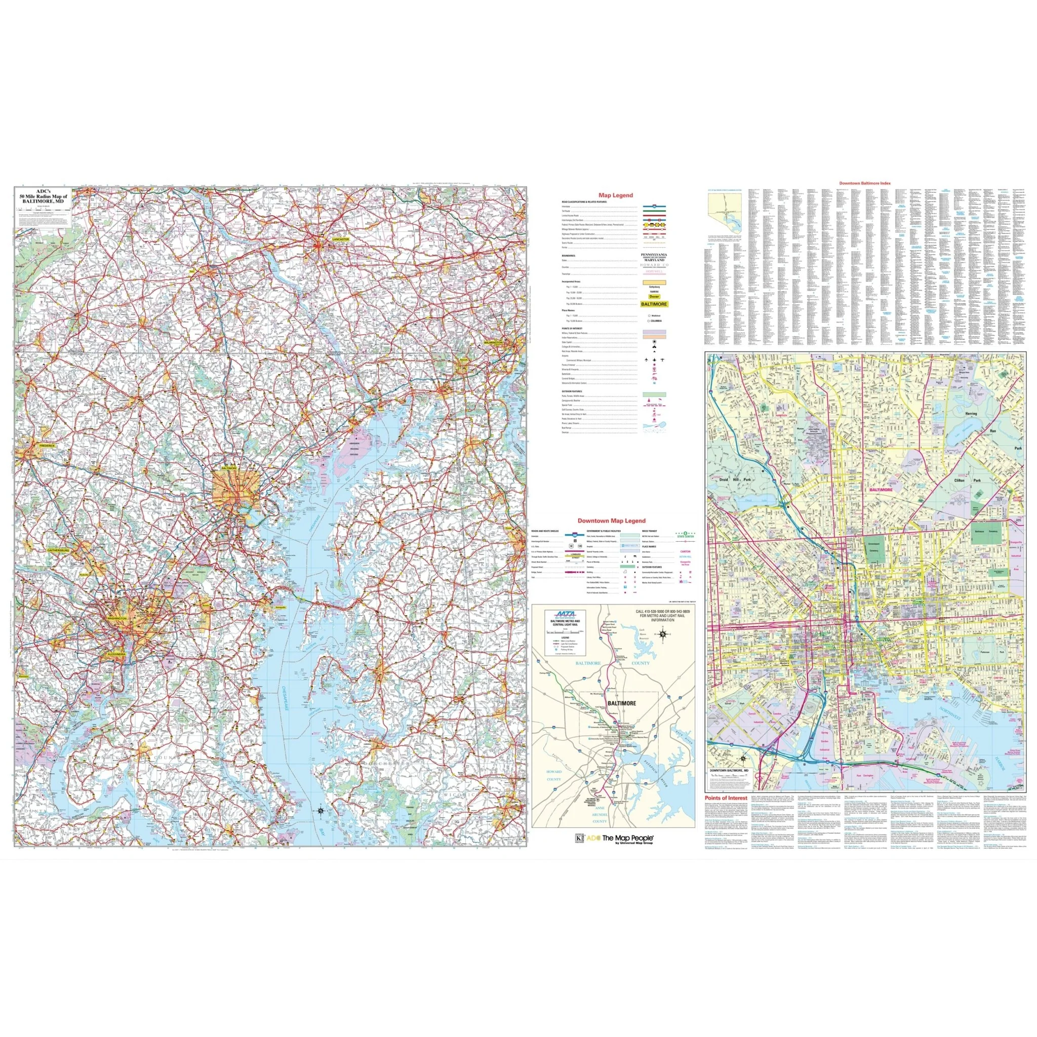
Explore the extensive Baltimore, MD 50 Mile Radius Vicinity Wall Map, brought to you by UniversalMAP. This high-quality map, created by ADC: Alexandria Drafting Company, offers a detailed perspective of the region. It features a scale of 1" = 2.66 miles for precision in navigation, with streets conveniently indexed directly on the map's surface for ease of use.
This map covers the District of Columbia, the counties of Anne Arundel, Baltimore, Cecil, Carroll, Charles, Calvert, Caroline, Harford, Howard, Kent, Montgomery, Prince Georges, Queen Ann, Talbot, and portions of Frederick, St. Mary, Dorchester, and Wicomico in Maryland. It also includes portions of York, Adams, Lancaster, and Chester in Pennsylvania, Arlington, and portions of Fairfax, Prince William, and King George in Virginia, as well as portions of Kent, Sussex, and New Castle in Delaware.
The coverage extends from Lancaster and York, PA in the north, to Leonardtown in St Mary's Co and Salisbury in Wicomico Co, MD in the south. It reaches as far east as Wilmington and Dover, DE, and encompasses Frederick and Gaithersburg, MD in the west.
In addition to the comprehensive coverage, there is an inset map of Downtown Baltimore with a scale of 1" = 1,000 feet. This inset provides complete street details, block numbers, and a list of major points of interest in the area, including Morgan State University to the north, Orangeville Industrial Area to the east, I-95 & Port Covington to the south, and US 1 – Monroe Street to the west.
Embark on a journey through this vast region with the Baltimore, MD 50 Mile Radius Vicinity Wall Map, a valuable tool designed to assist you in exploring and navigating the diverse landscapes and points of interest in this expansive area.
Size: 72.5" x 48"
Published: 2011
Original: $149.99
-70%$149.99
$45.00Product Information
Product Information
Shipping & Returns
Shipping & Returns
Description
Explore the extensive Baltimore, MD 50 Mile Radius Vicinity Wall Map, brought to you by UniversalMAP. This high-quality map, created by ADC: Alexandria Drafting Company, offers a detailed perspective of the region. It features a scale of 1" = 2.66 miles for precision in navigation, with streets conveniently indexed directly on the map's surface for ease of use.
This map covers the District of Columbia, the counties of Anne Arundel, Baltimore, Cecil, Carroll, Charles, Calvert, Caroline, Harford, Howard, Kent, Montgomery, Prince Georges, Queen Ann, Talbot, and portions of Frederick, St. Mary, Dorchester, and Wicomico in Maryland. It also includes portions of York, Adams, Lancaster, and Chester in Pennsylvania, Arlington, and portions of Fairfax, Prince William, and King George in Virginia, as well as portions of Kent, Sussex, and New Castle in Delaware.
The coverage extends from Lancaster and York, PA in the north, to Leonardtown in St Mary's Co and Salisbury in Wicomico Co, MD in the south. It reaches as far east as Wilmington and Dover, DE, and encompasses Frederick and Gaithersburg, MD in the west.
In addition to the comprehensive coverage, there is an inset map of Downtown Baltimore with a scale of 1" = 1,000 feet. This inset provides complete street details, block numbers, and a list of major points of interest in the area, including Morgan State University to the north, Orangeville Industrial Area to the east, I-95 & Port Covington to the south, and US 1 – Monroe Street to the west.
Embark on a journey through this vast region with the Baltimore, MD 50 Mile Radius Vicinity Wall Map, a valuable tool designed to assist you in exploring and navigating the diverse landscapes and points of interest in this expansive area.
Size: 72.5" x 48"
Published: 2011


