


Charleston, WV Wall Map
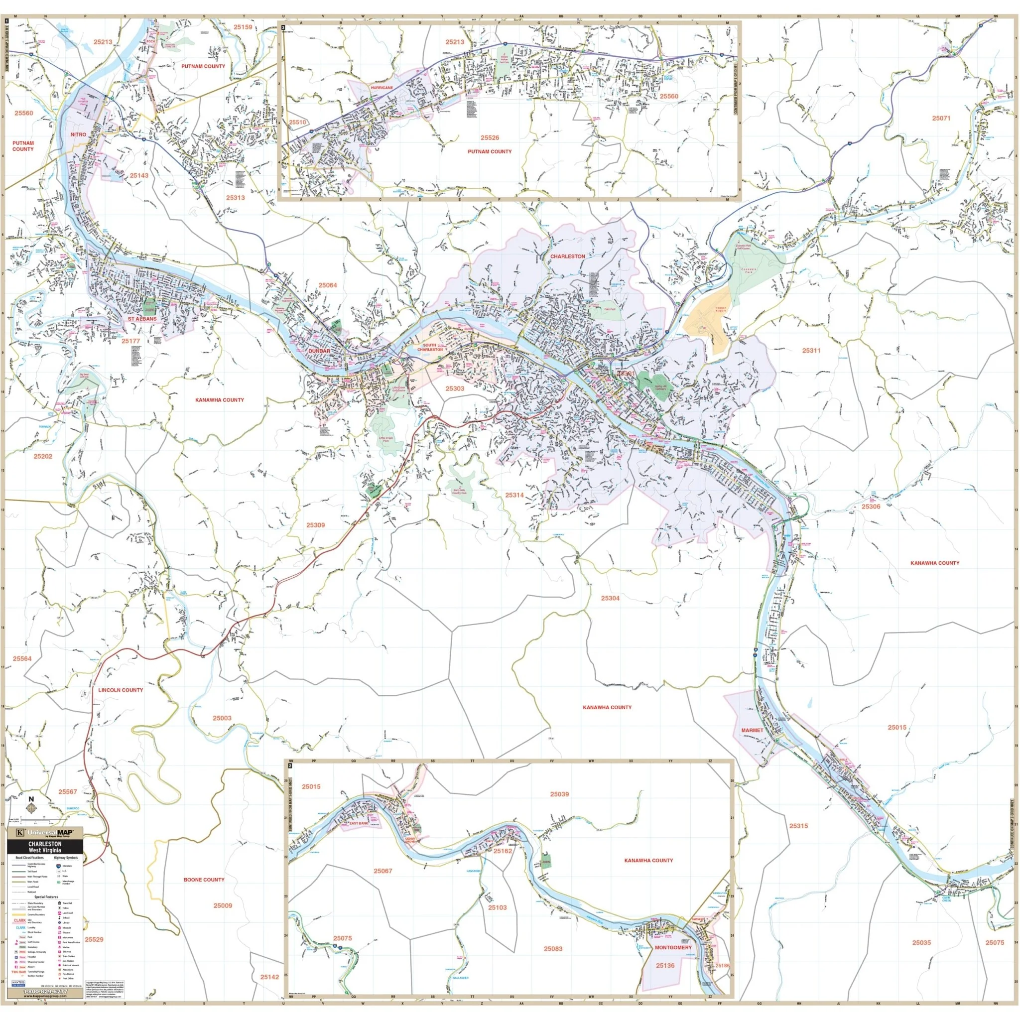
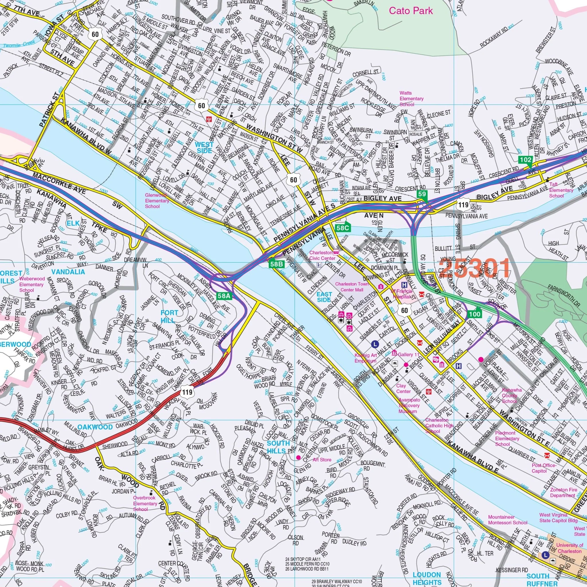
This Wall Map of Charleston, West Virginia with adjacent areas by Kappa Map Group provides complete street detail. The area of coverage includes the following boundaries:
- North: All of the City of Nitro and the Hub Industrial Park
- South: The Community of Cabin Creek
- East: Southeast to include the Community of Cabin Creek and Northeast to include the Crossings Mall
- West: 2.5 miles west of the cities of St. Albans and Nitro
Special features and details of this map include airports, all streets and highways, government buildings, cemeteries, shopping centers, fire and police stations, hospitals, water features, educational institutions, railroads, recreational parks, golf and country clubs, post offices, libraries, ZIP codes and boundaries, points of interest, city limits (color-coded), and block numbers. Insets for this map include the continuation of the Kanawha River to include the City of Smithers to the east and the continuation of I65 to include the City of Hurricane to the west.
Size: 55.25" x 54"
Published: 2014
Original: $139.99
-70%$139.99
$42.00Product Information
Product Information
Shipping & Returns
Shipping & Returns
Description
This Wall Map of Charleston, West Virginia with adjacent areas by Kappa Map Group provides complete street detail. The area of coverage includes the following boundaries:
- North: All of the City of Nitro and the Hub Industrial Park
- South: The Community of Cabin Creek
- East: Southeast to include the Community of Cabin Creek and Northeast to include the Crossings Mall
- West: 2.5 miles west of the cities of St. Albans and Nitro
Special features and details of this map include airports, all streets and highways, government buildings, cemeteries, shopping centers, fire and police stations, hospitals, water features, educational institutions, railroads, recreational parks, golf and country clubs, post offices, libraries, ZIP codes and boundaries, points of interest, city limits (color-coded), and block numbers. Insets for this map include the continuation of the Kanawha River to include the City of Smithers to the east and the continuation of I65 to include the City of Hurricane to the west.
Size: 55.25" x 54"
Published: 2014