


Lincoln, NE Wall Map
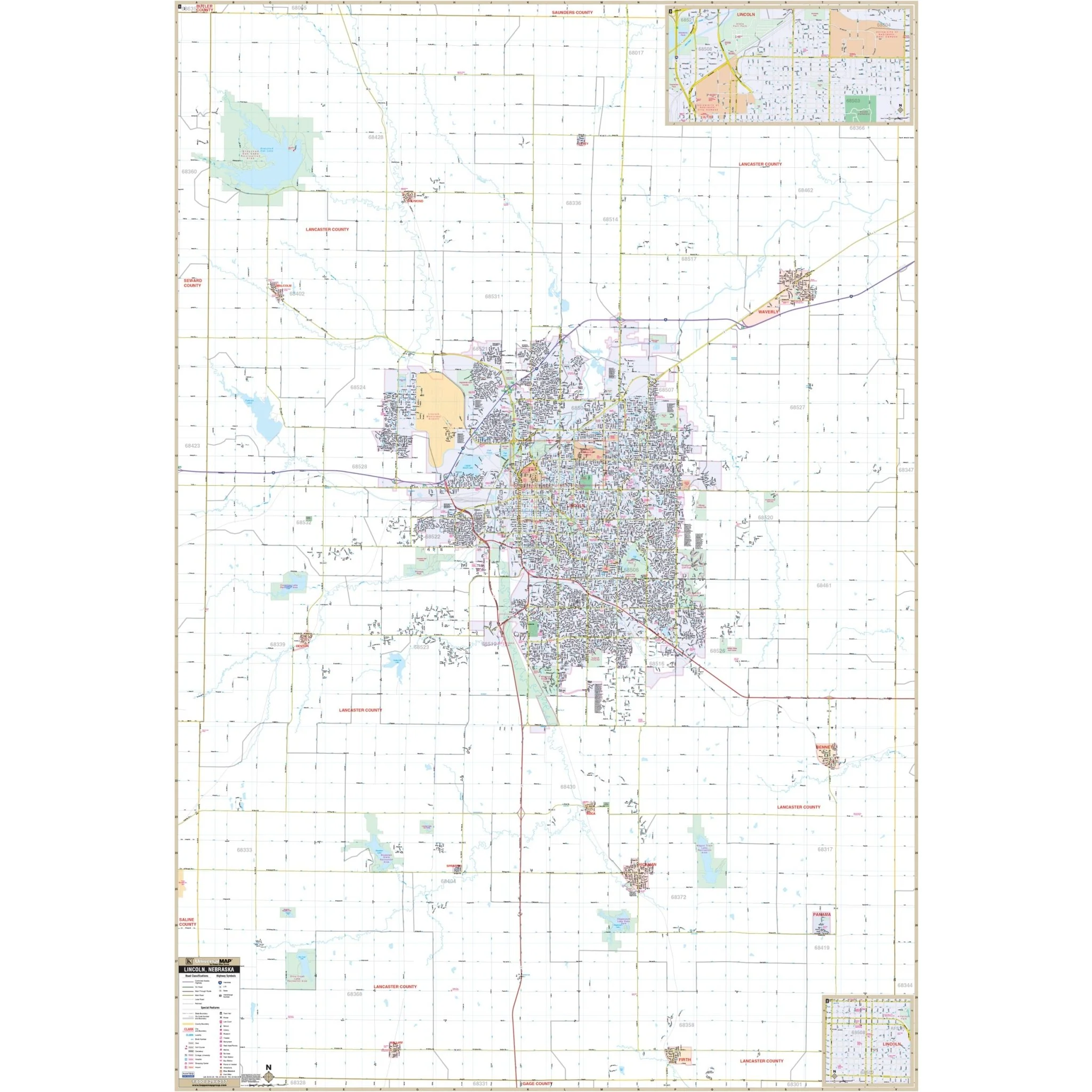
The Lincoln, NE Wall Map provides comprehensive coverage, including most of Lancaster County, with the following boundaries:
- North to Davey
- South to Sprague and Hickman
- East to Bennet and Waverly
- West to Pawnee State Recreation Area
The Lincoln, NE Wall Map also includes inset maps of Downtown Lincoln, University of Nebraska campuses, and State Fair Park.
Details featured on the map encompass all streets, airports, government buildings, post offices, cemeteries, fire & police stations, hospitals, shopping centers, educational institutions, railroads, water features, golf & country clubs, mileage circles, recreational parks, ZIP codes/boundaries, and block numbers.
Size: 54" x 78.5"
Published: 2012
Original: $149.99
-70%$149.99
$45.00Product Information
Product Information
Shipping & Returns
Shipping & Returns
Description
The Lincoln, NE Wall Map provides comprehensive coverage, including most of Lancaster County, with the following boundaries:
- North to Davey
- South to Sprague and Hickman
- East to Bennet and Waverly
- West to Pawnee State Recreation Area
The Lincoln, NE Wall Map also includes inset maps of Downtown Lincoln, University of Nebraska campuses, and State Fair Park.
Details featured on the map encompass all streets, airports, government buildings, post offices, cemeteries, fire & police stations, hospitals, shopping centers, educational institutions, railroads, water features, golf & country clubs, mileage circles, recreational parks, ZIP codes/boundaries, and block numbers.
Size: 54" x 78.5"
Published: 2012


