


New Jersey Intermediate Thematic State Wall Map
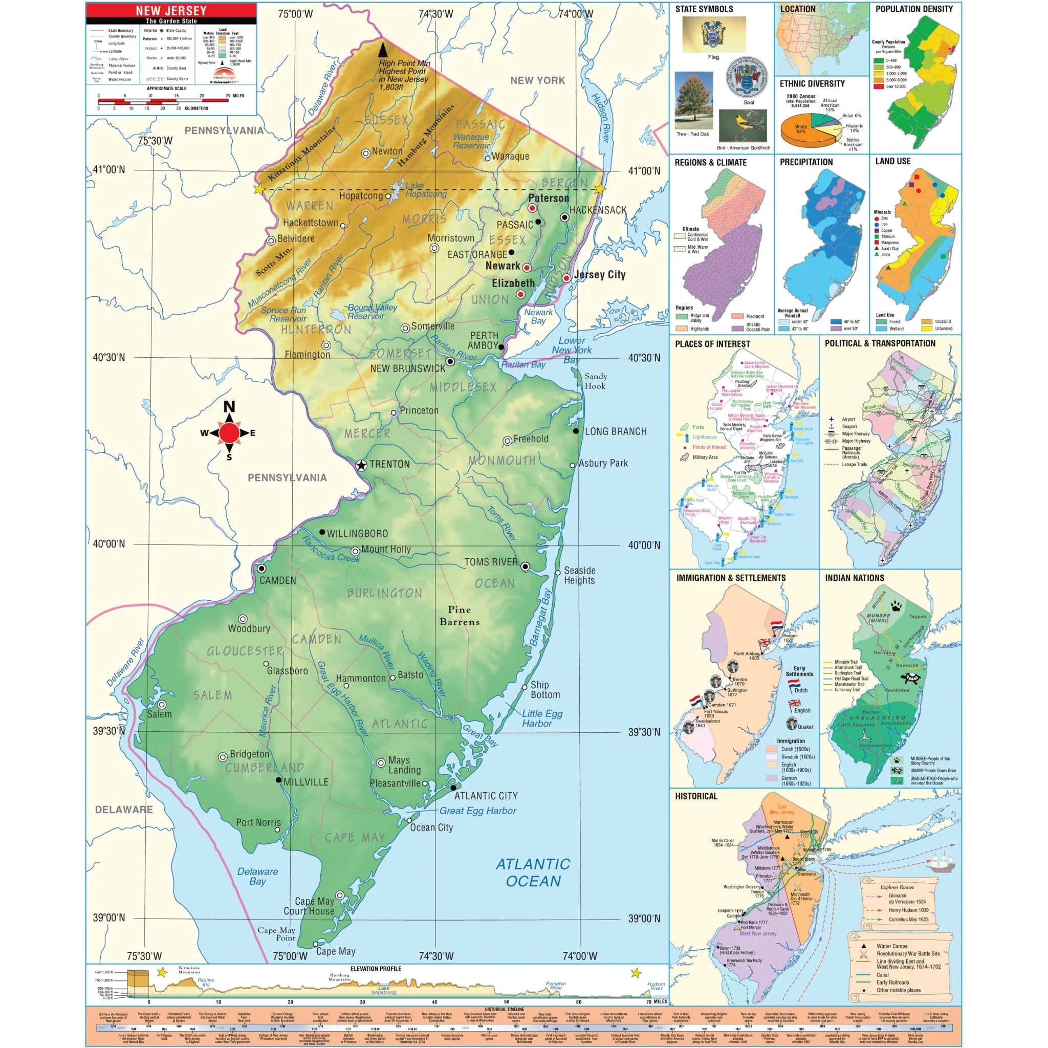
The New Jersey State Intermediate Thematic Wall Map is the perfect teaching aid for state studies and related subjects. Political/physical maps with hypsometric colorations; shows county boundaries, interstate highways, county seats, cities and towns and state regions. Maps correlate with state standards and curriculum guidelines. 
Intermediate Thematic Wall Maps feature a historical timeline and elevation profile, plus insets of land use, ethnic diversity and population, average precipitation, and more. Corresponds with the Thematic Deskpad Maps. This product is ideal for public, private, parochial, and home schools.
Size: 54" x 64"
Published: 2006
Original: $139.99
-70%$139.99
$42.00Product Information
Product Information
Shipping & Returns
Shipping & Returns
Description
The New Jersey State Intermediate Thematic Wall Map is the perfect teaching aid for state studies and related subjects. Political/physical maps with hypsometric colorations; shows county boundaries, interstate highways, county seats, cities and towns and state regions. Maps correlate with state standards and curriculum guidelines. 
Intermediate Thematic Wall Maps feature a historical timeline and elevation profile, plus insets of land use, ethnic diversity and population, average precipitation, and more. Corresponds with the Thematic Deskpad Maps. This product is ideal for public, private, parochial, and home schools.
Size: 54" x 64"
Published: 2006


