


North America Advanced Physical Wall Map
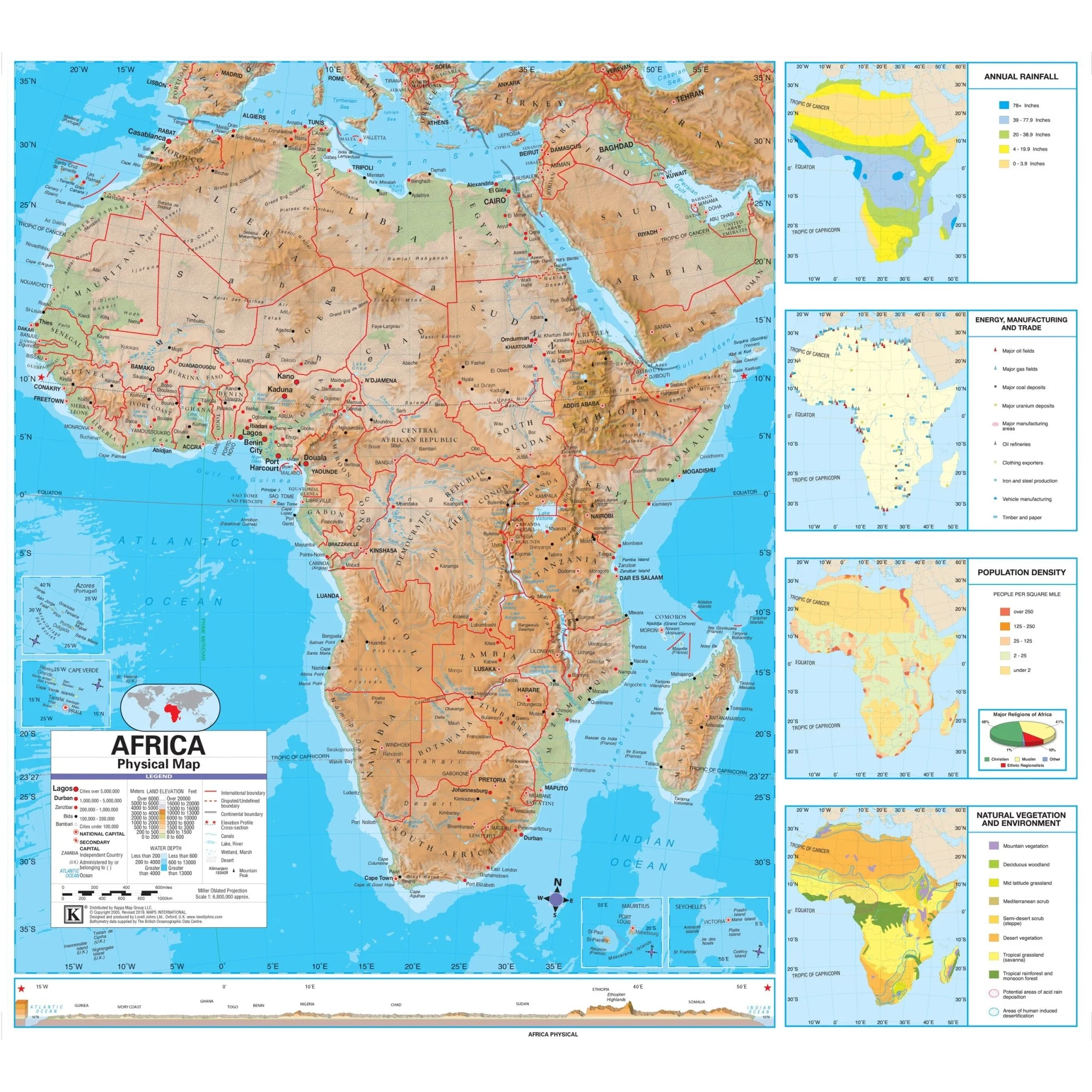
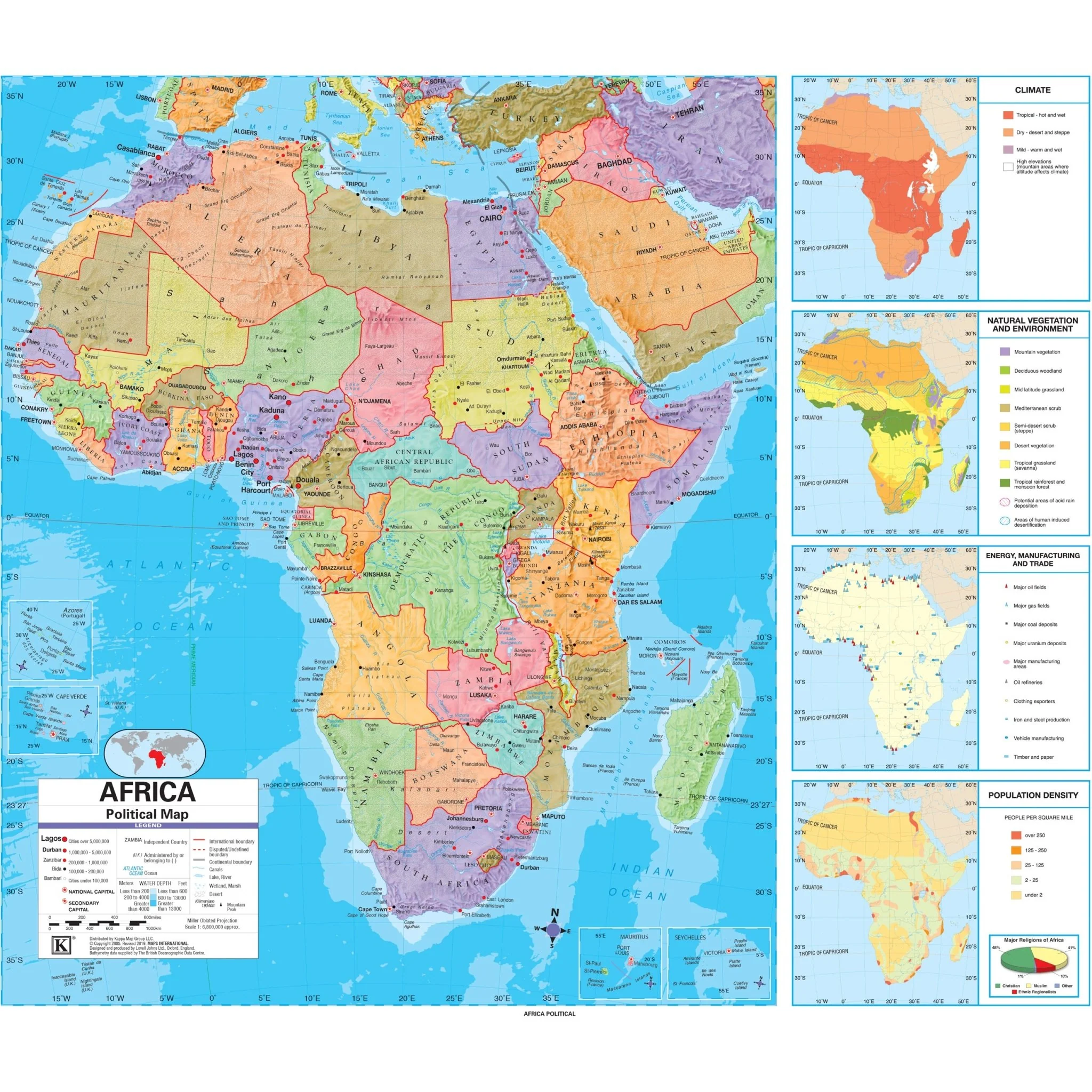
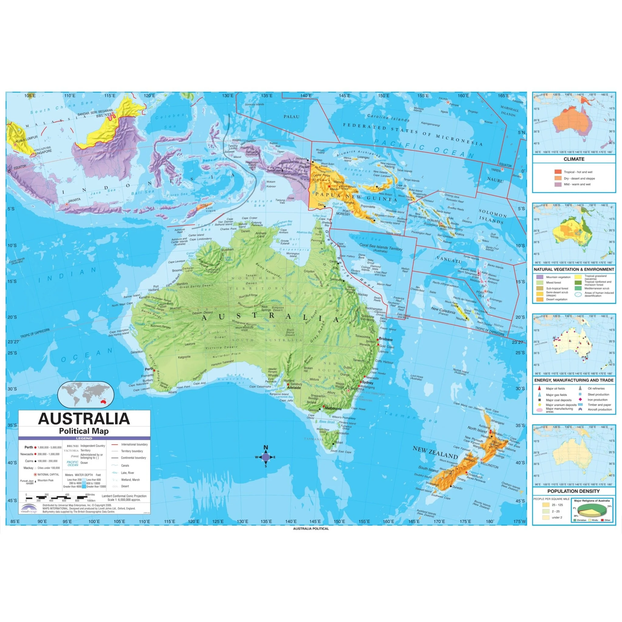
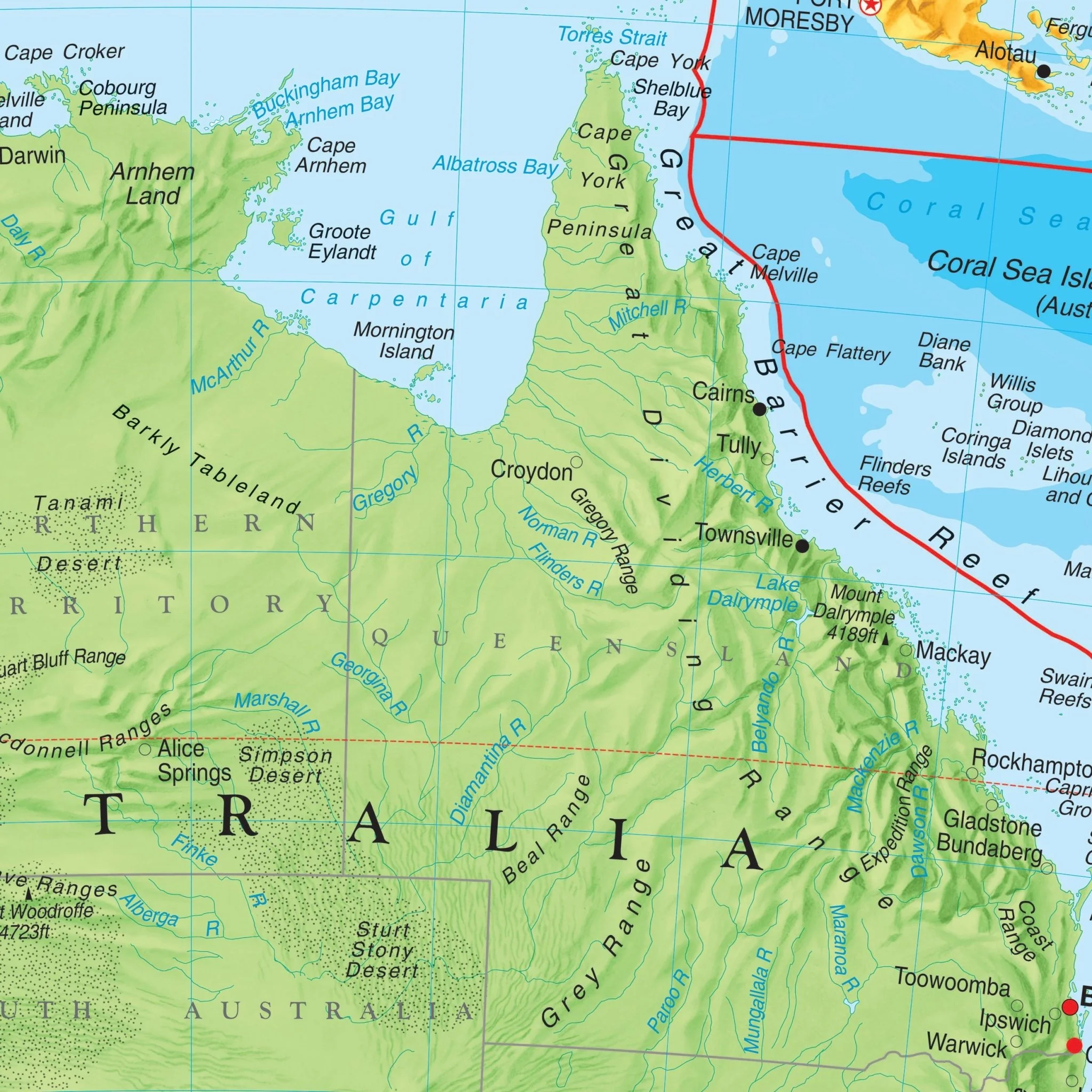
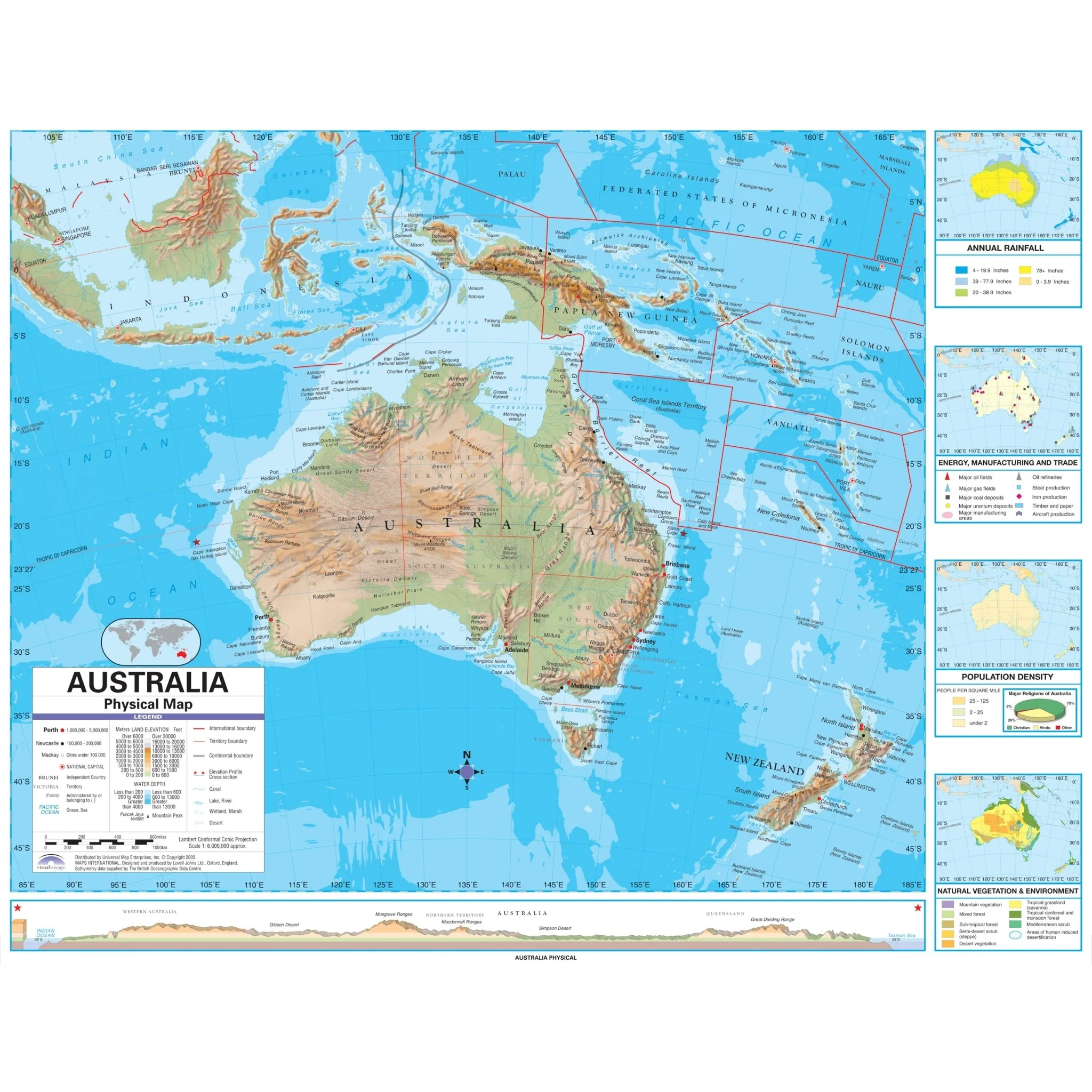
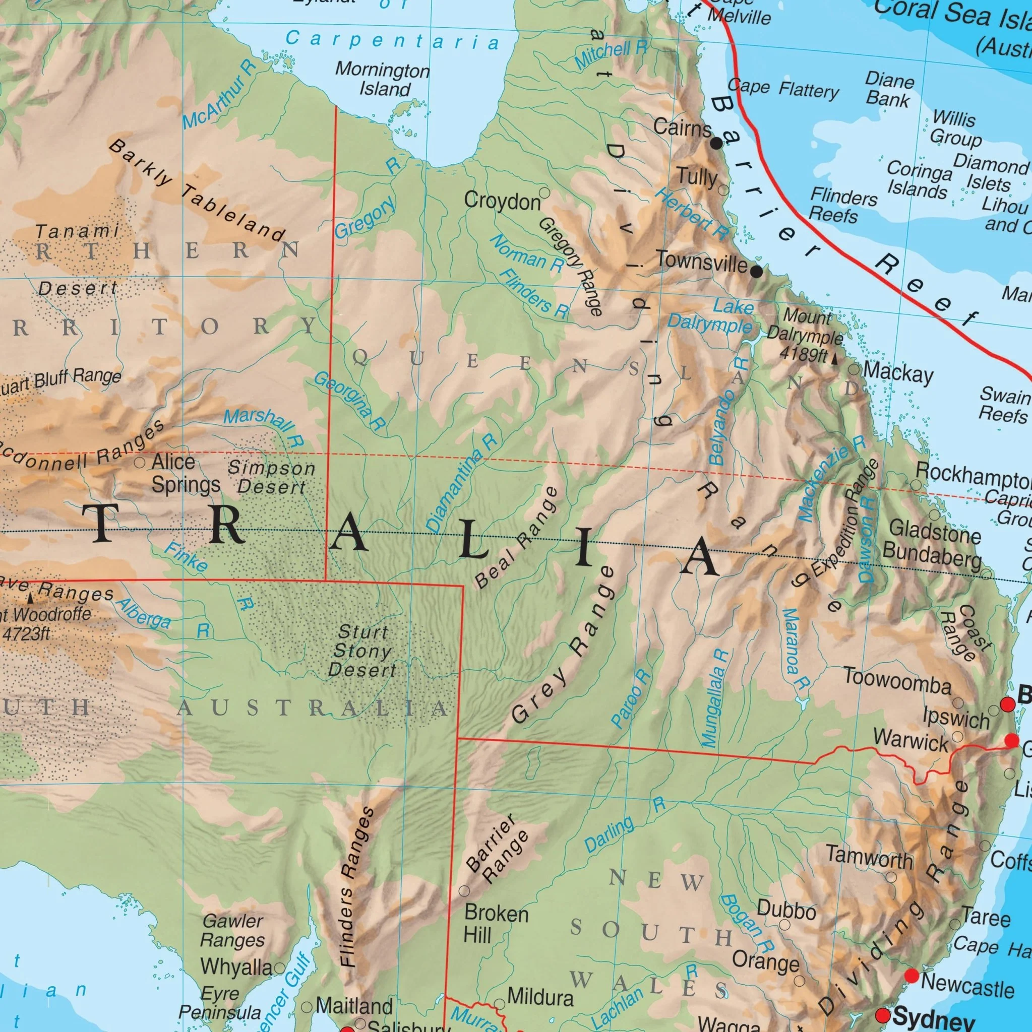
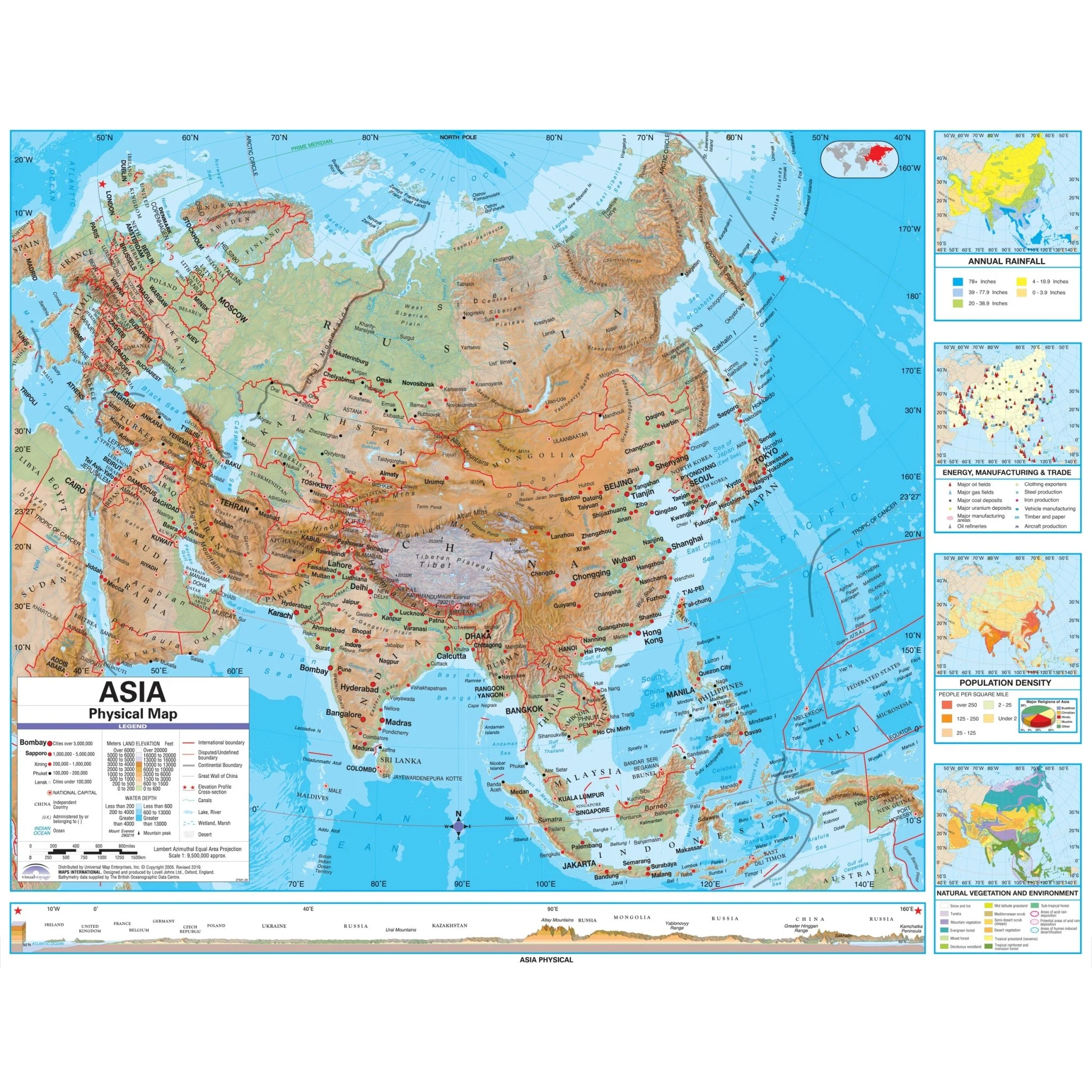
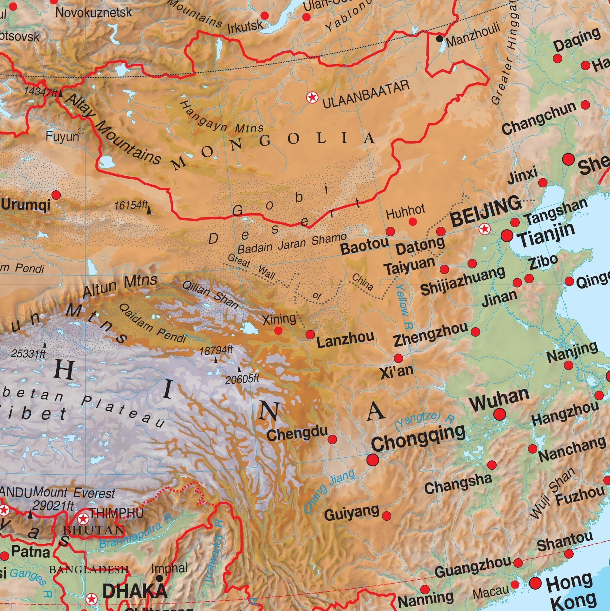
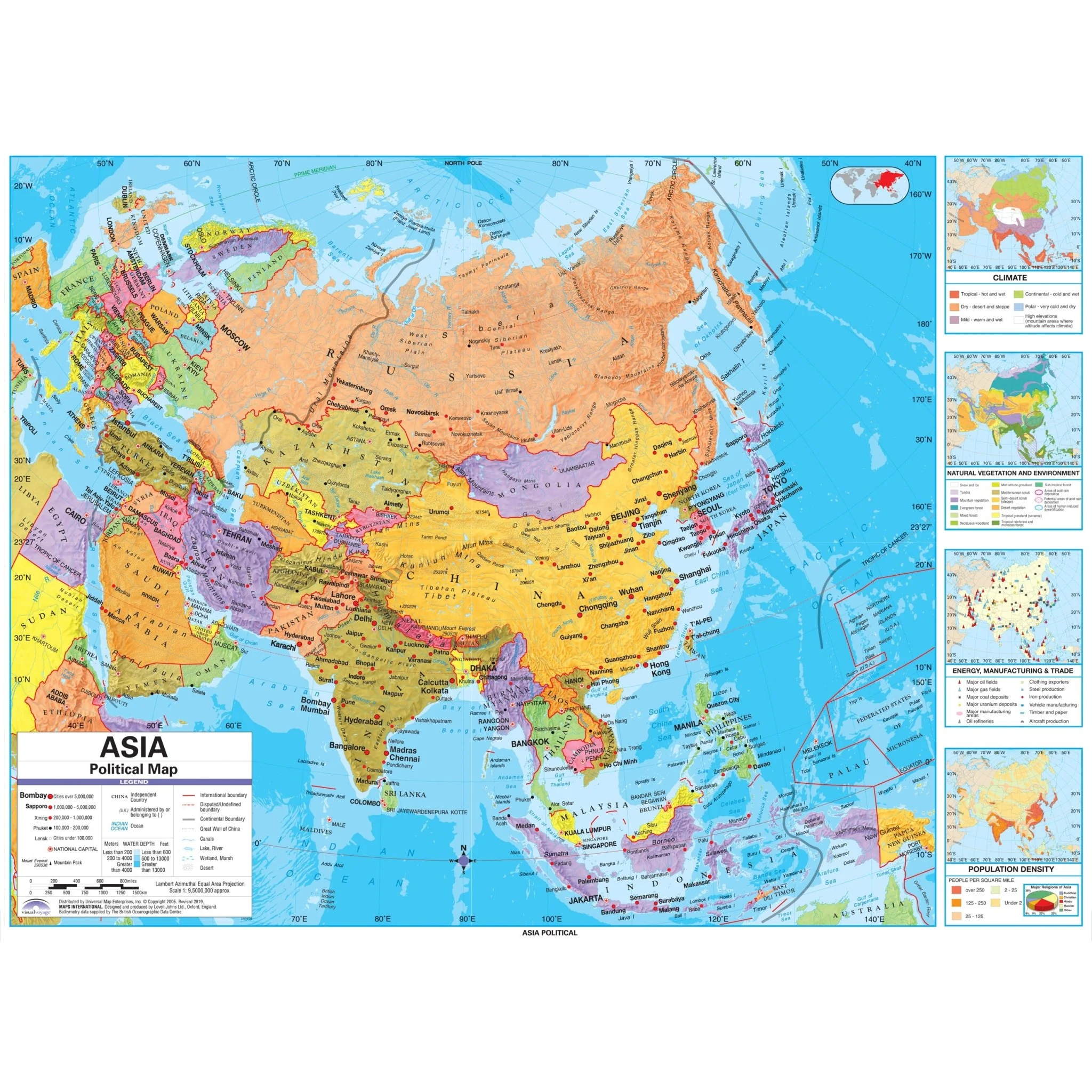
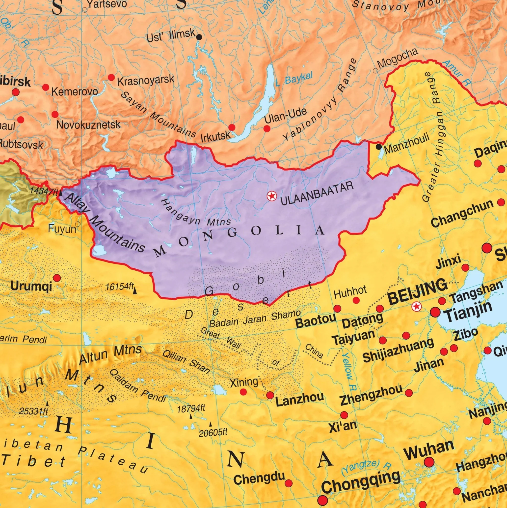
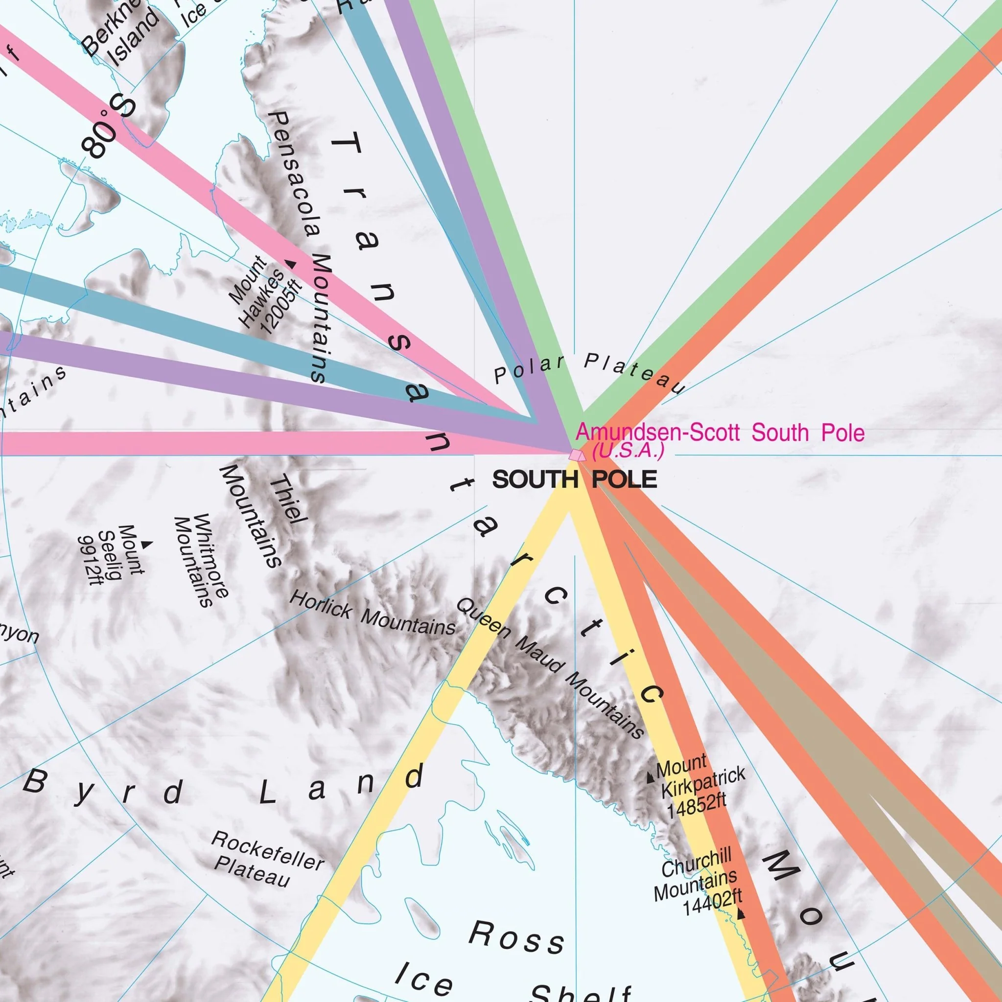
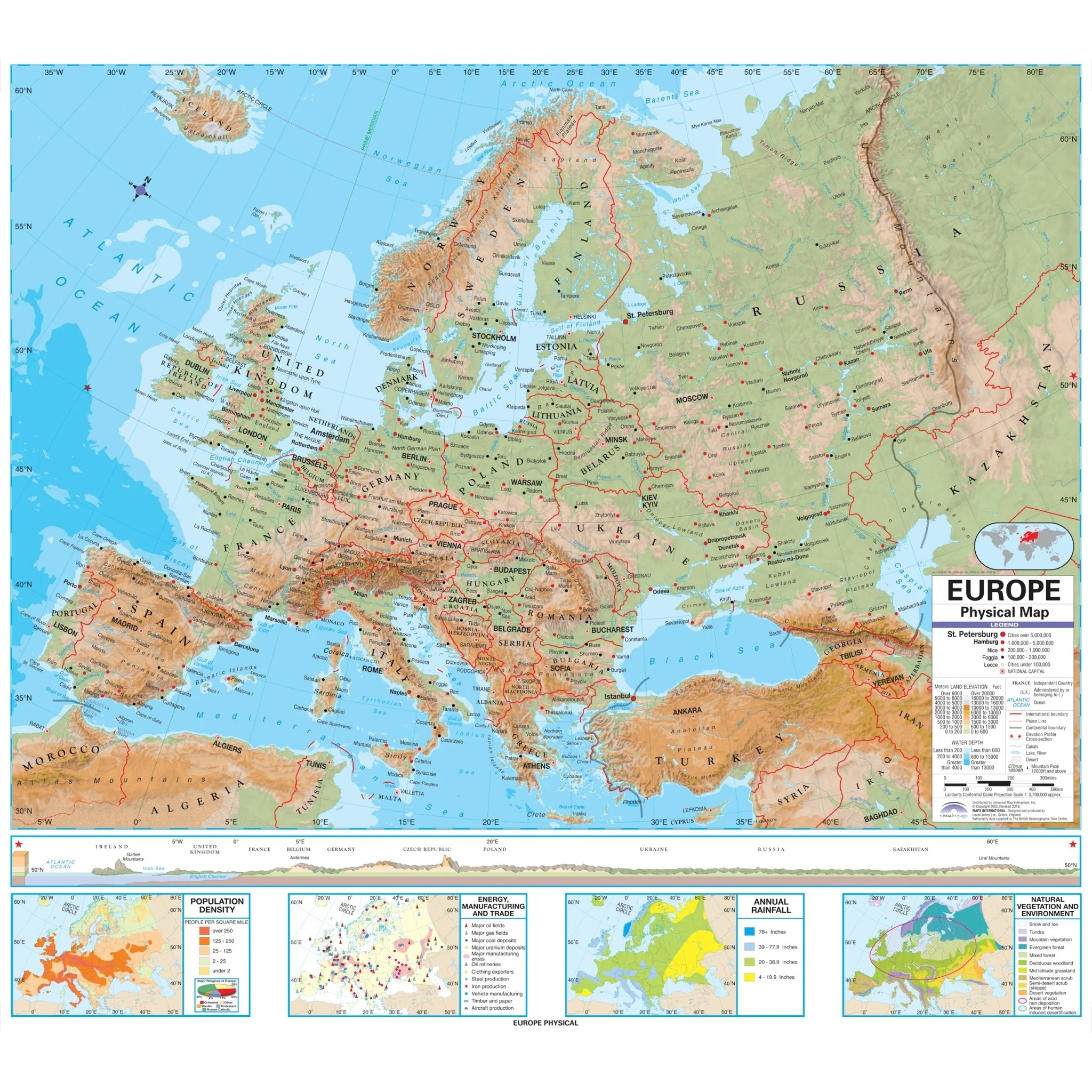
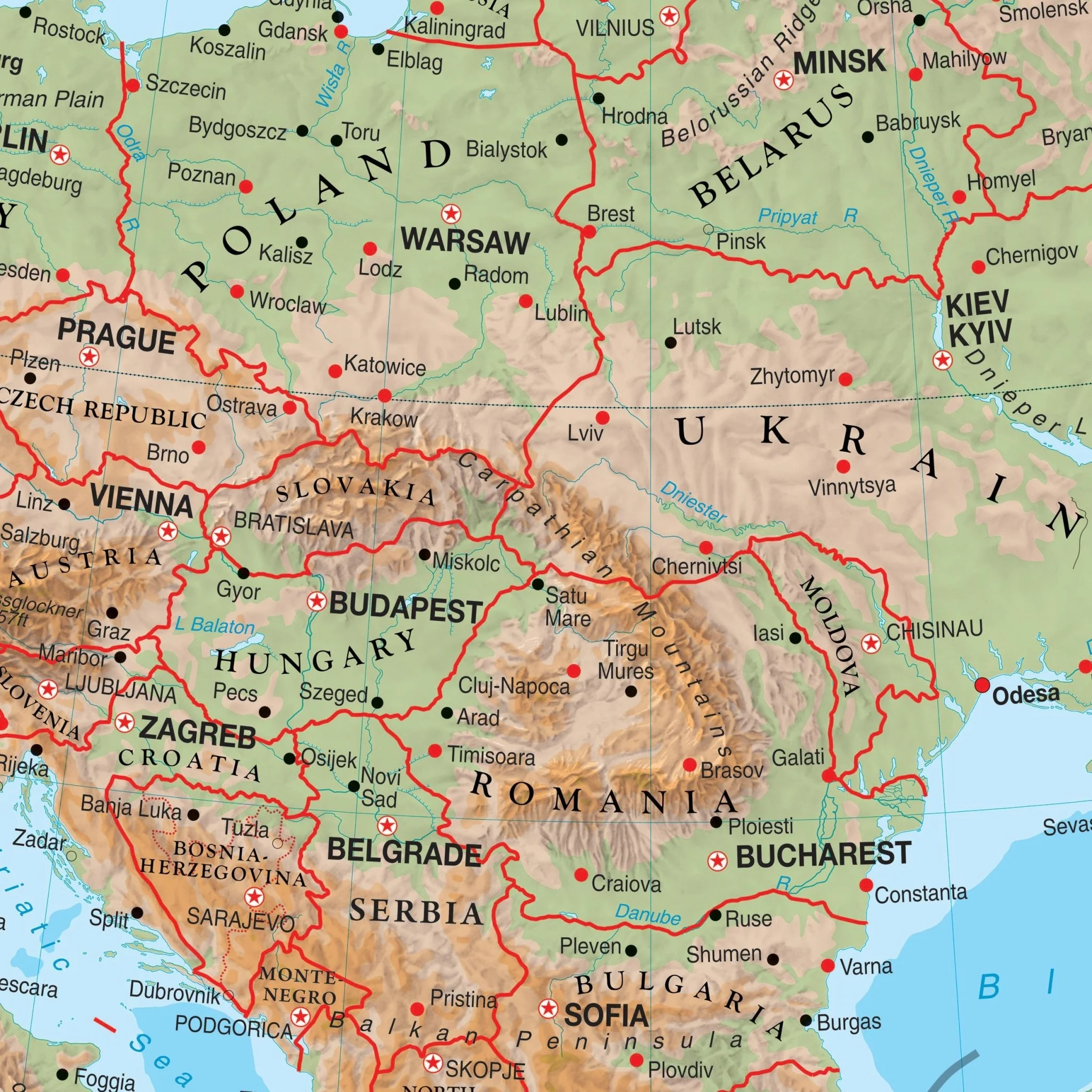
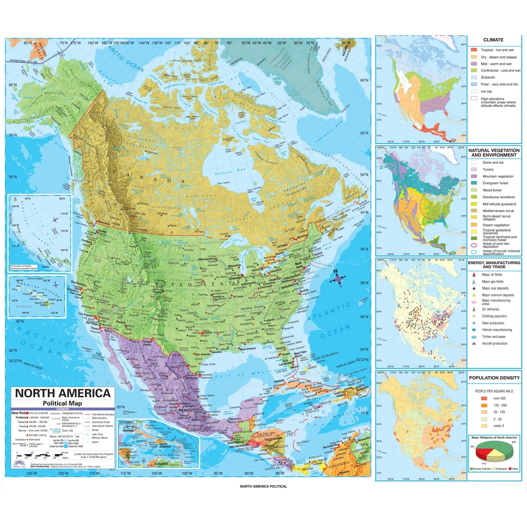
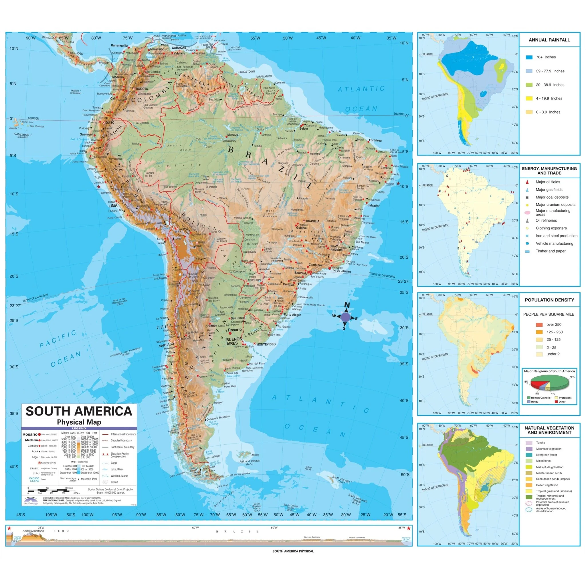
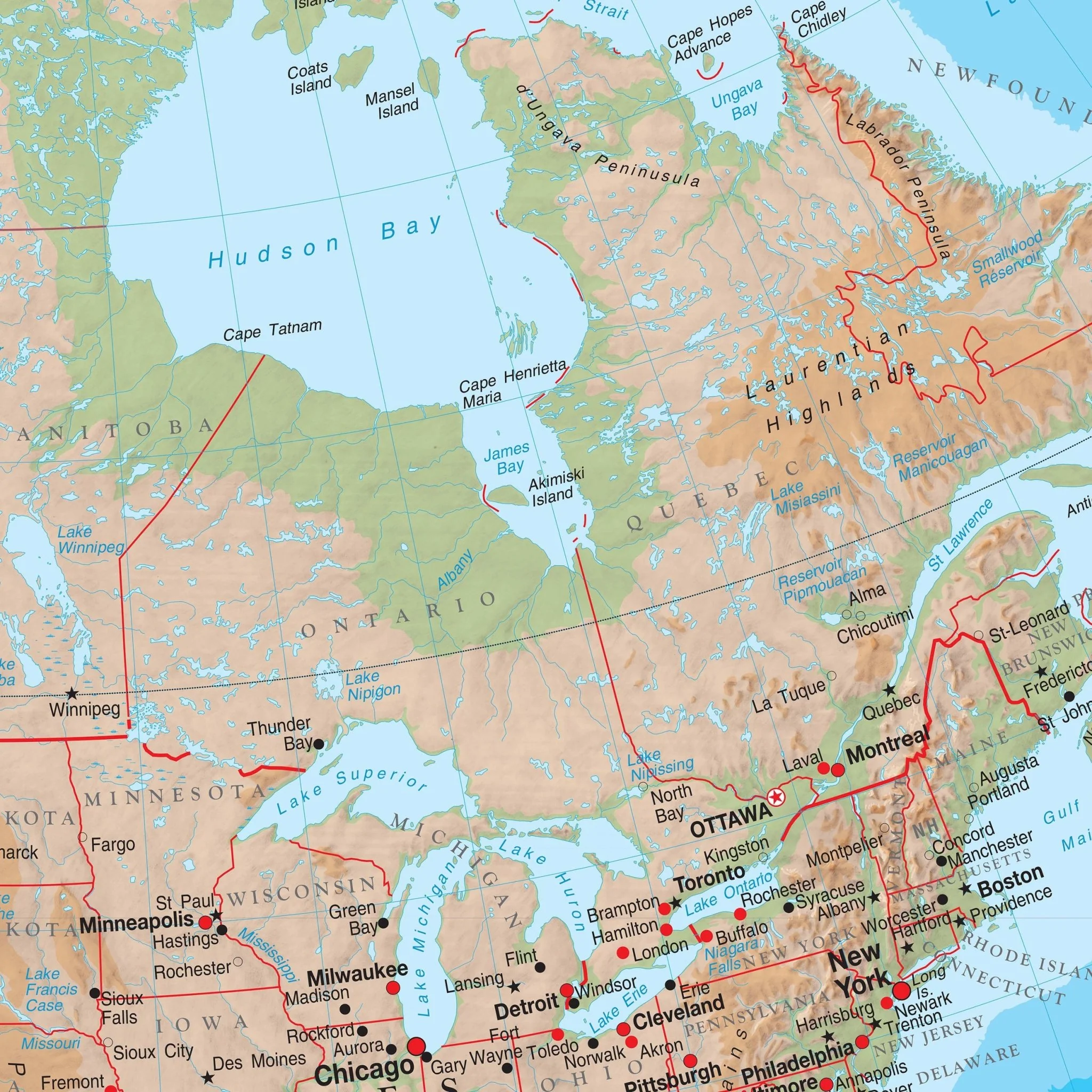
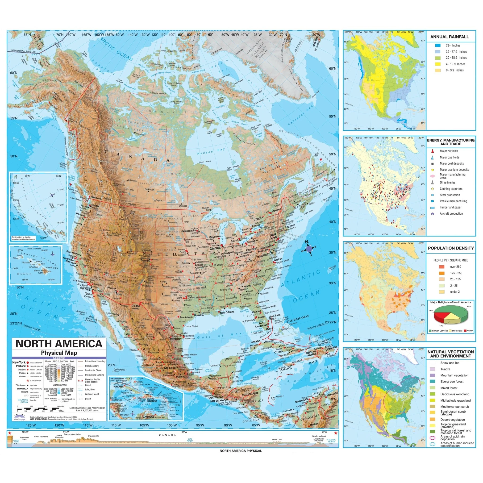
The Advanced Physical Wall Map series by Kappa Map Group offers an immersive and detailed exploration of the world's geography, making it an ideal resource for grades 9-12. These maps are a testament to precision and visual clarity, featuring shaded relief that brings to life the intricate contours of the planet's landscapes. The inclusion of a color ramp depicting elevation changes adds depth to the terrain, while an elevation profile provides an in-depth look at the topographical variations. This comprehensive collection of maps enriches the educational experience, providing students and educators with valuable insights into the physical geography of the world.
The US map includes four informative insets further enrich the maps, covering:
- Population Density
- Annual Rainfall
- Energy, Manufacturing, and Trade
- Natural Vegetation and Environment
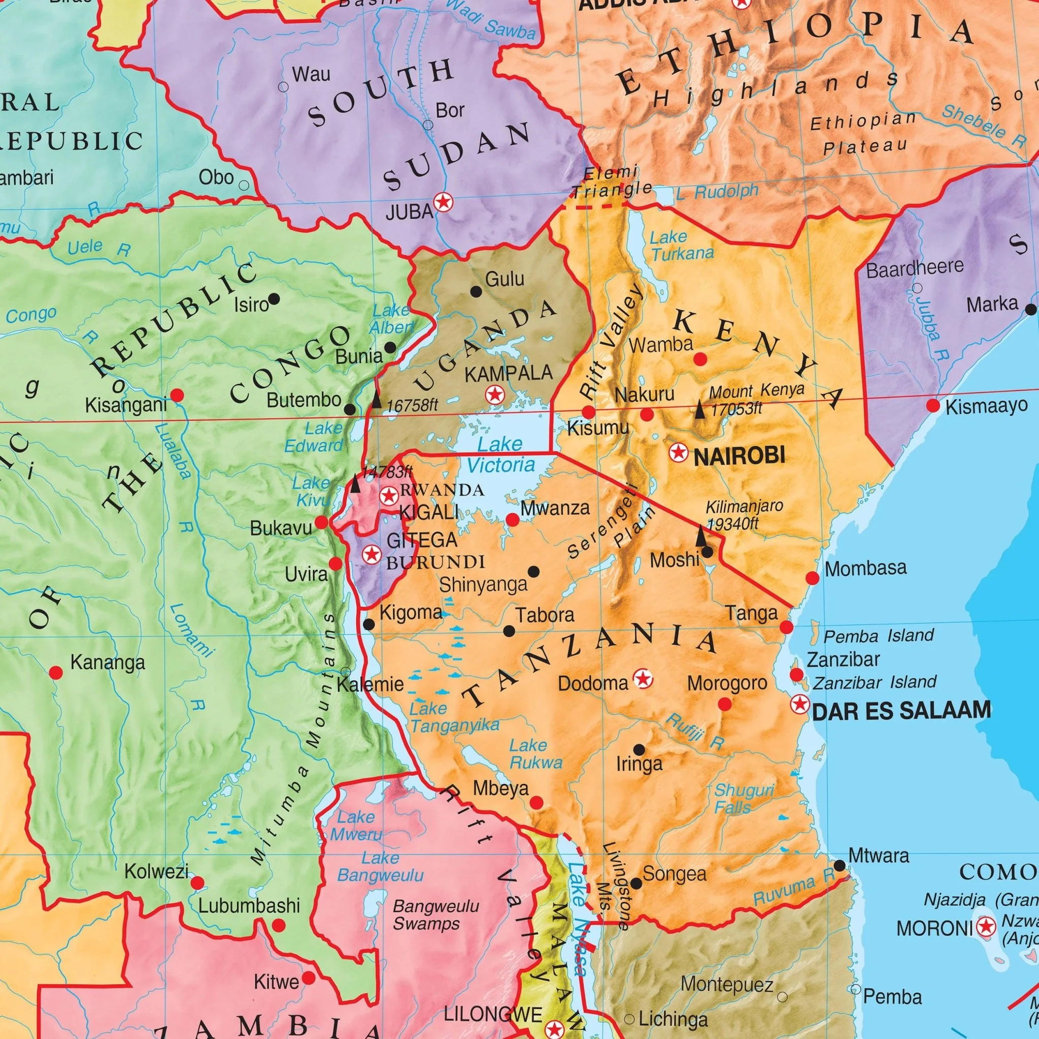
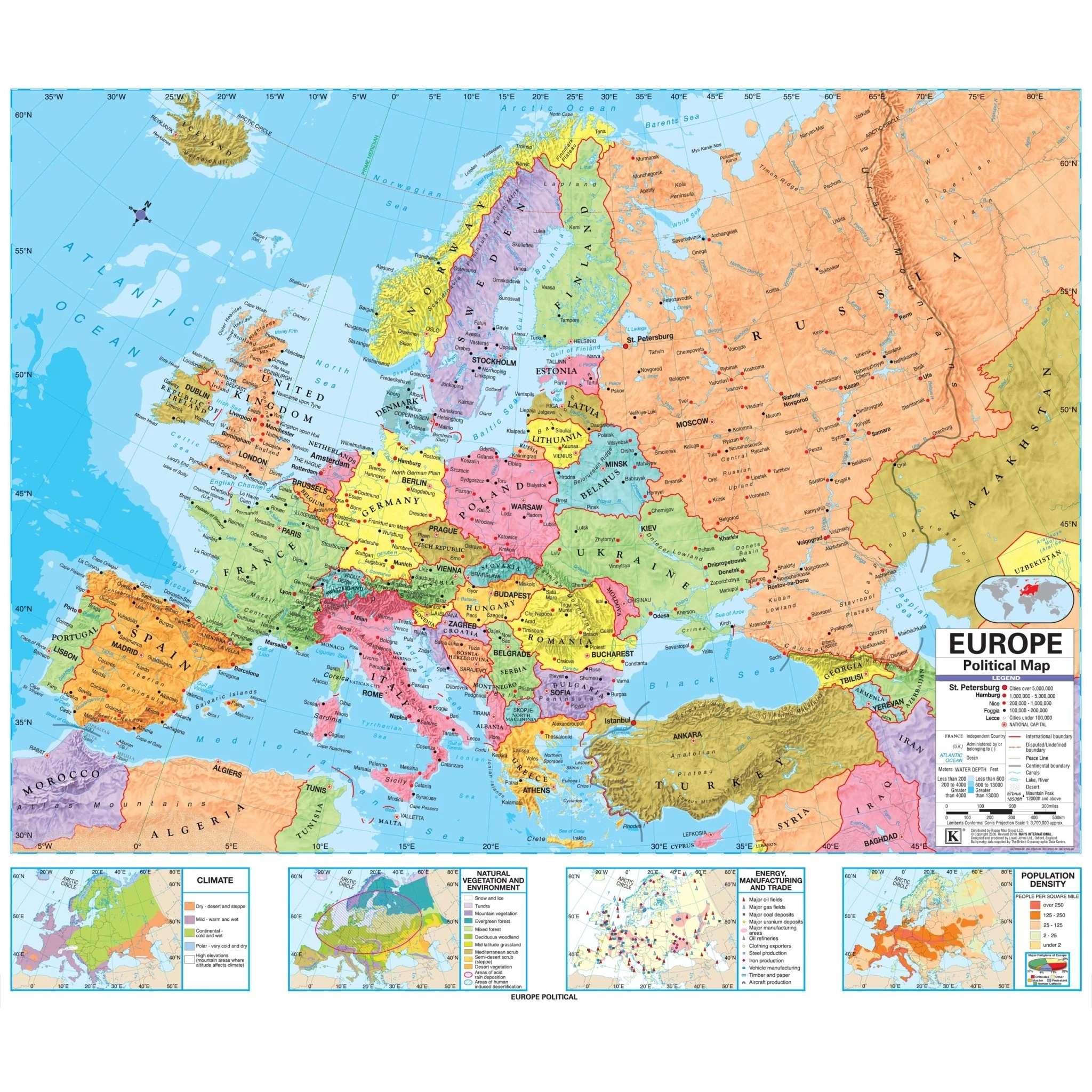
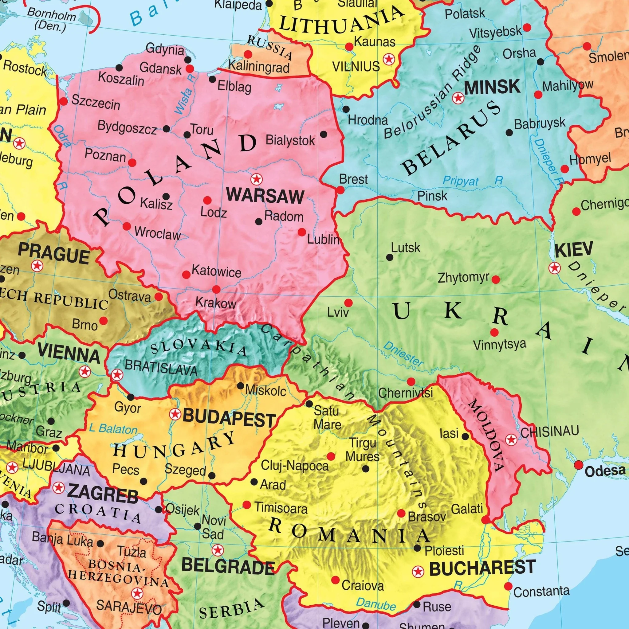
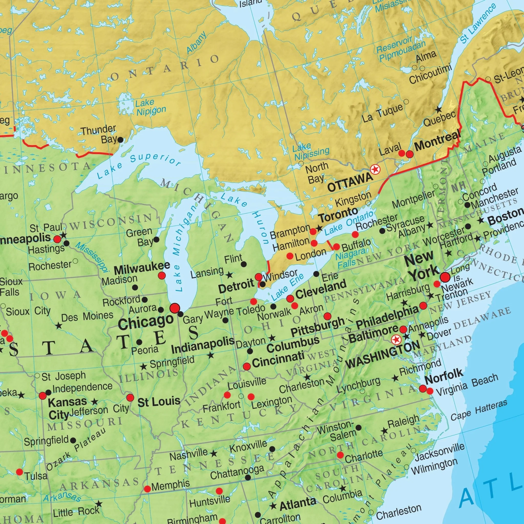
Within these maps, one can easily discern:
- Country boundaries
- National capitals
- Major cities
- Latitude & Longtiude lines, emphasizing the major latitudes
- Various physical features
This combination of features makes these maps invaluable resources for anyone seeking to delve into the intricacies of the world's physical geography.
Target Grade Range: 9 through 12
Sizes: 63" x 54" | 46.5" x 42"
Published: 2000
Original: $79.99
-70%$79.99
$24.00Product Information
Product Information
Shipping & Returns
Shipping & Returns
Description
The Advanced Physical Wall Map series by Kappa Map Group offers an immersive and detailed exploration of the world's geography, making it an ideal resource for grades 9-12. These maps are a testament to precision and visual clarity, featuring shaded relief that brings to life the intricate contours of the planet's landscapes. The inclusion of a color ramp depicting elevation changes adds depth to the terrain, while an elevation profile provides an in-depth look at the topographical variations. This comprehensive collection of maps enriches the educational experience, providing students and educators with valuable insights into the physical geography of the world.
The US map includes four informative insets further enrich the maps, covering:
- Population Density
- Annual Rainfall
- Energy, Manufacturing, and Trade
- Natural Vegetation and Environment
Within these maps, one can easily discern:
- Country boundaries
- National capitals
- Major cities
- Latitude & Longtiude lines, emphasizing the major latitudes
- Various physical features
This combination of features makes these maps invaluable resources for anyone seeking to delve into the intricacies of the world's physical geography.
Target Grade Range: 9 through 12
Sizes: 63" x 54" | 46.5" x 42"
Published: 2000