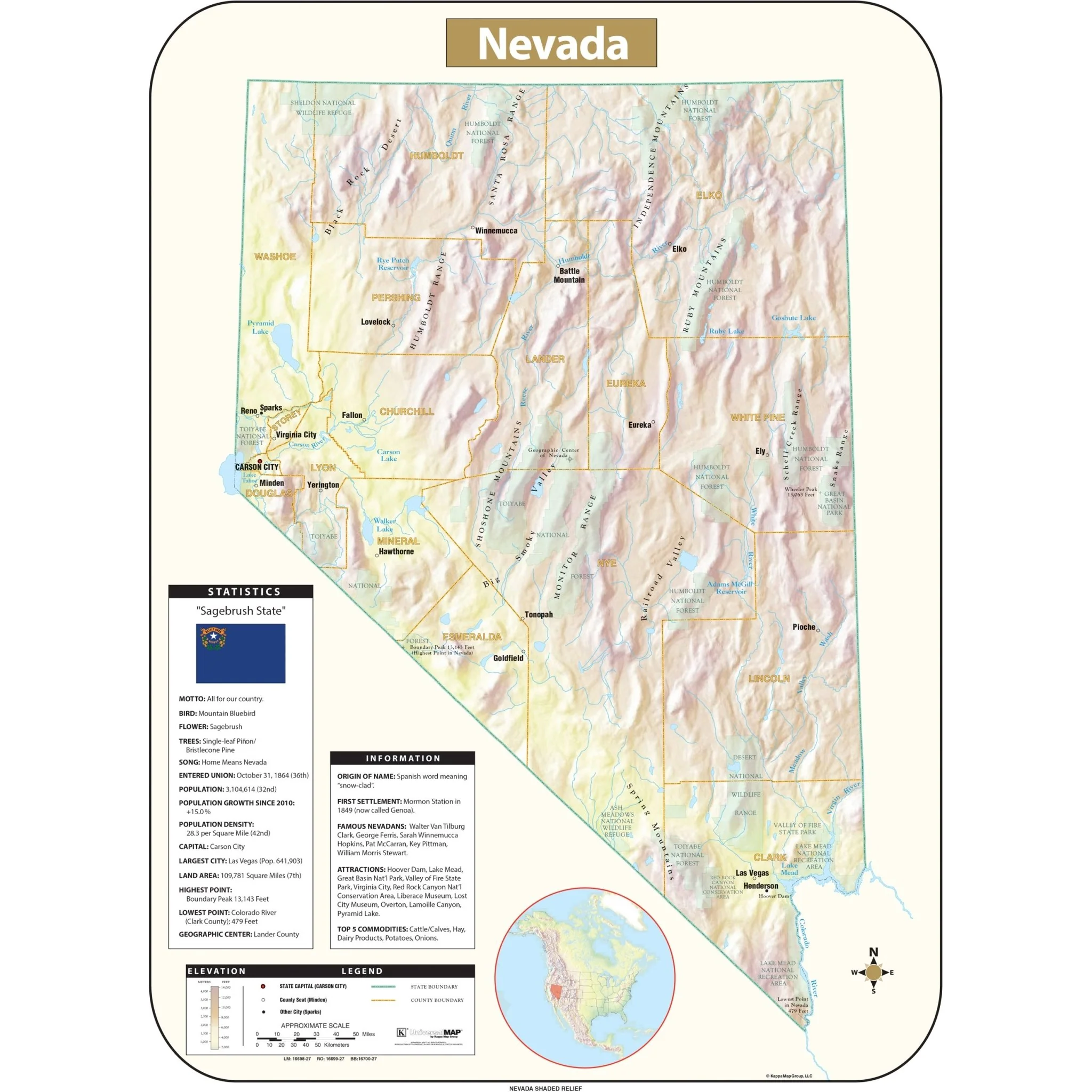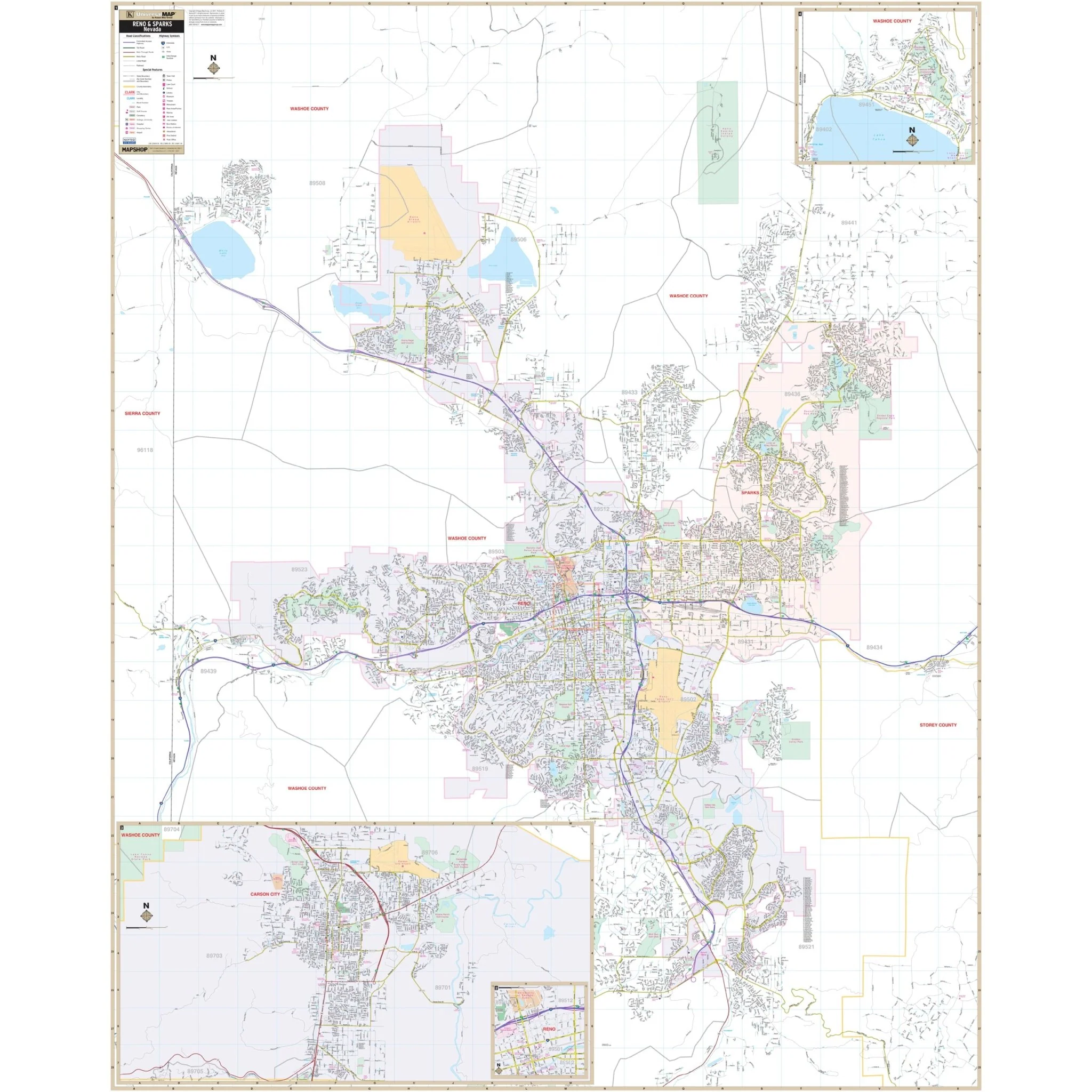
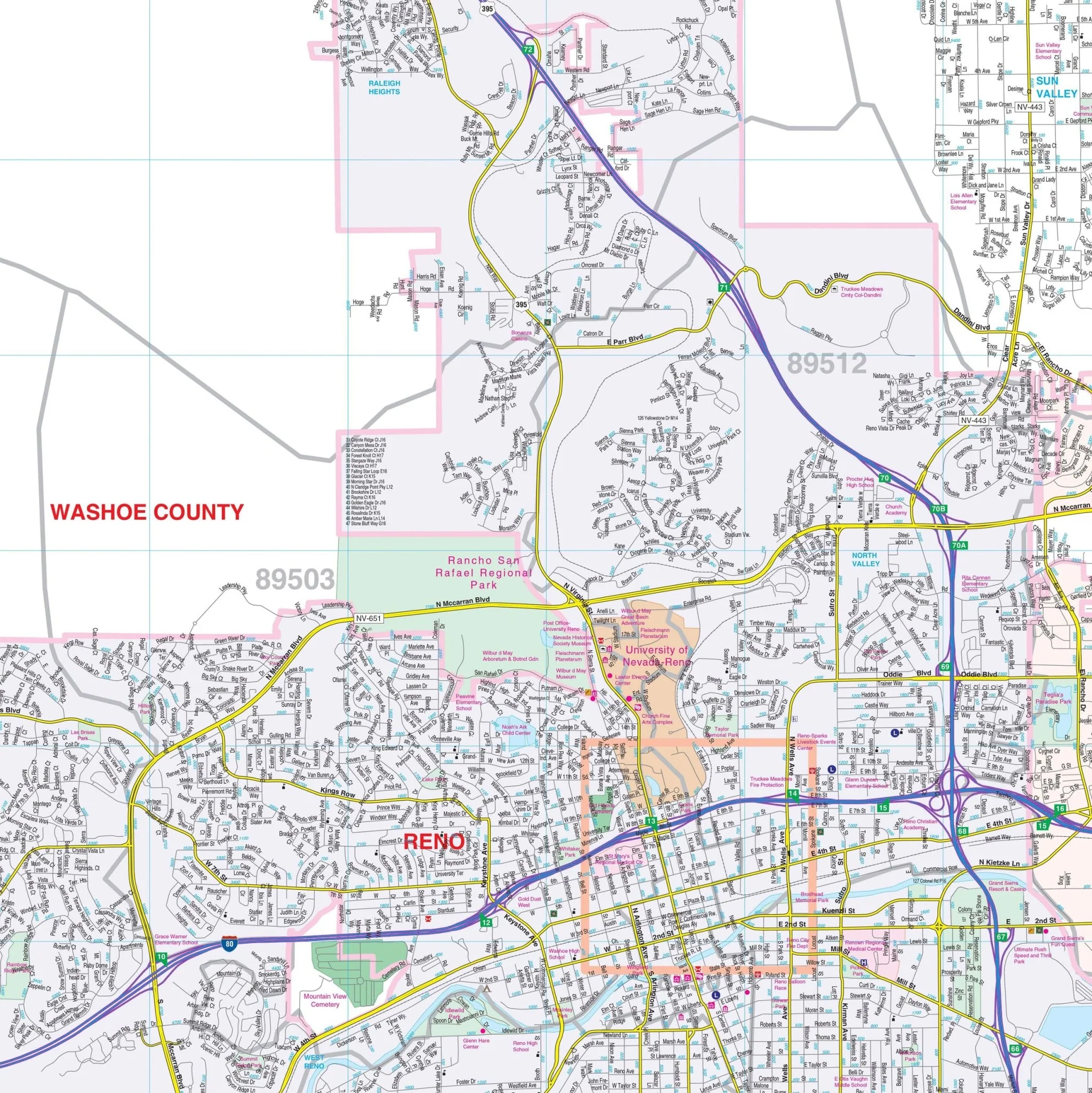


Reno, NV Wall Map
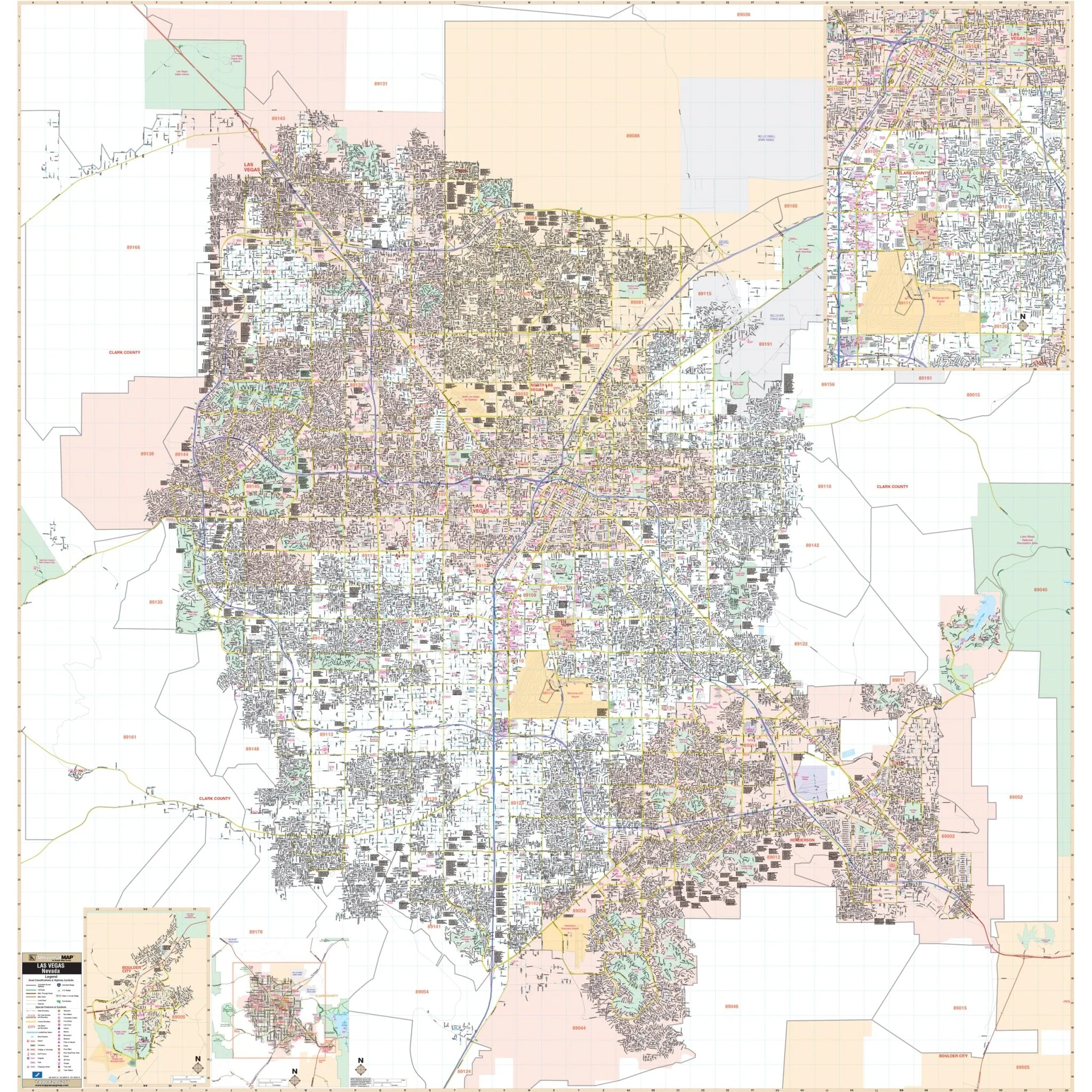
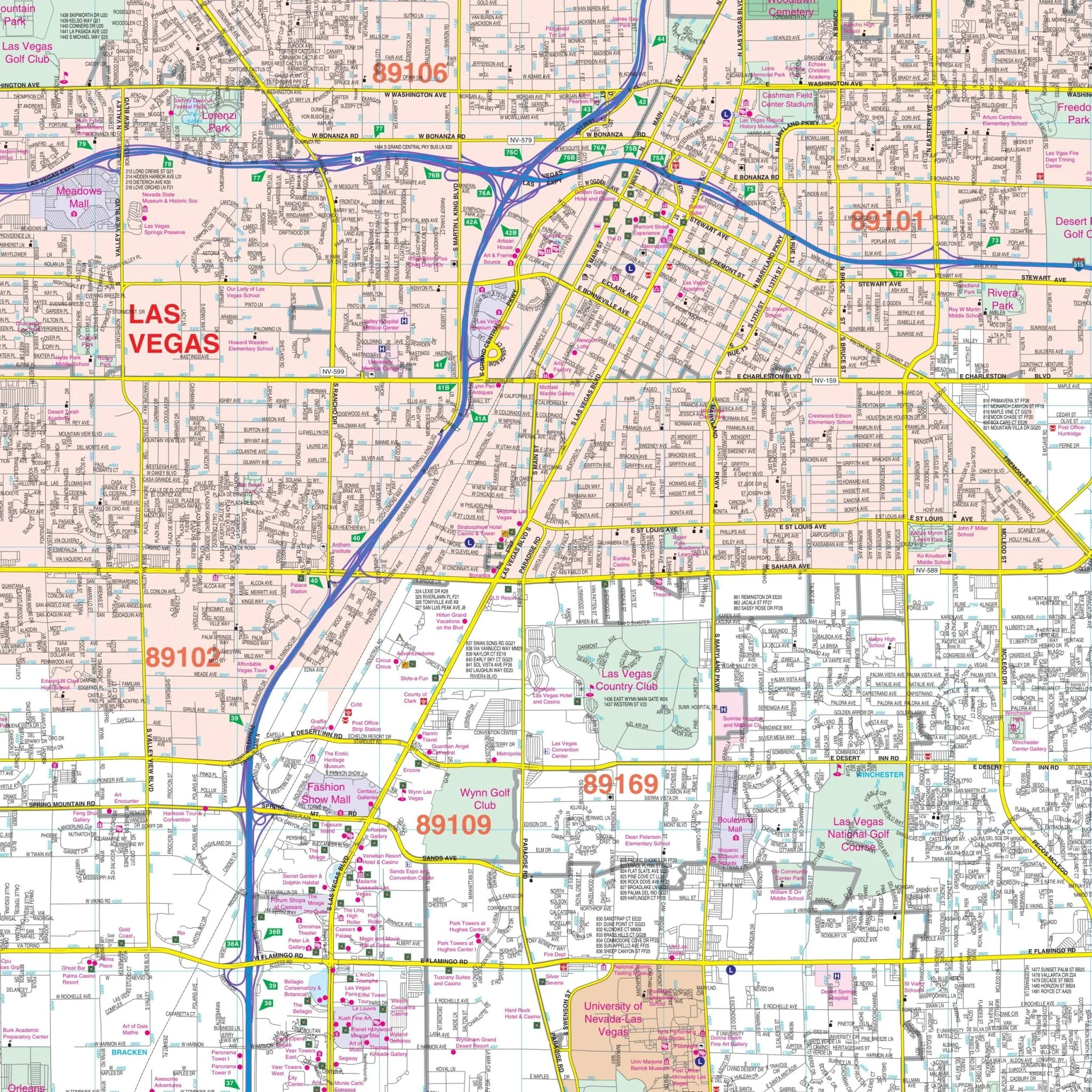
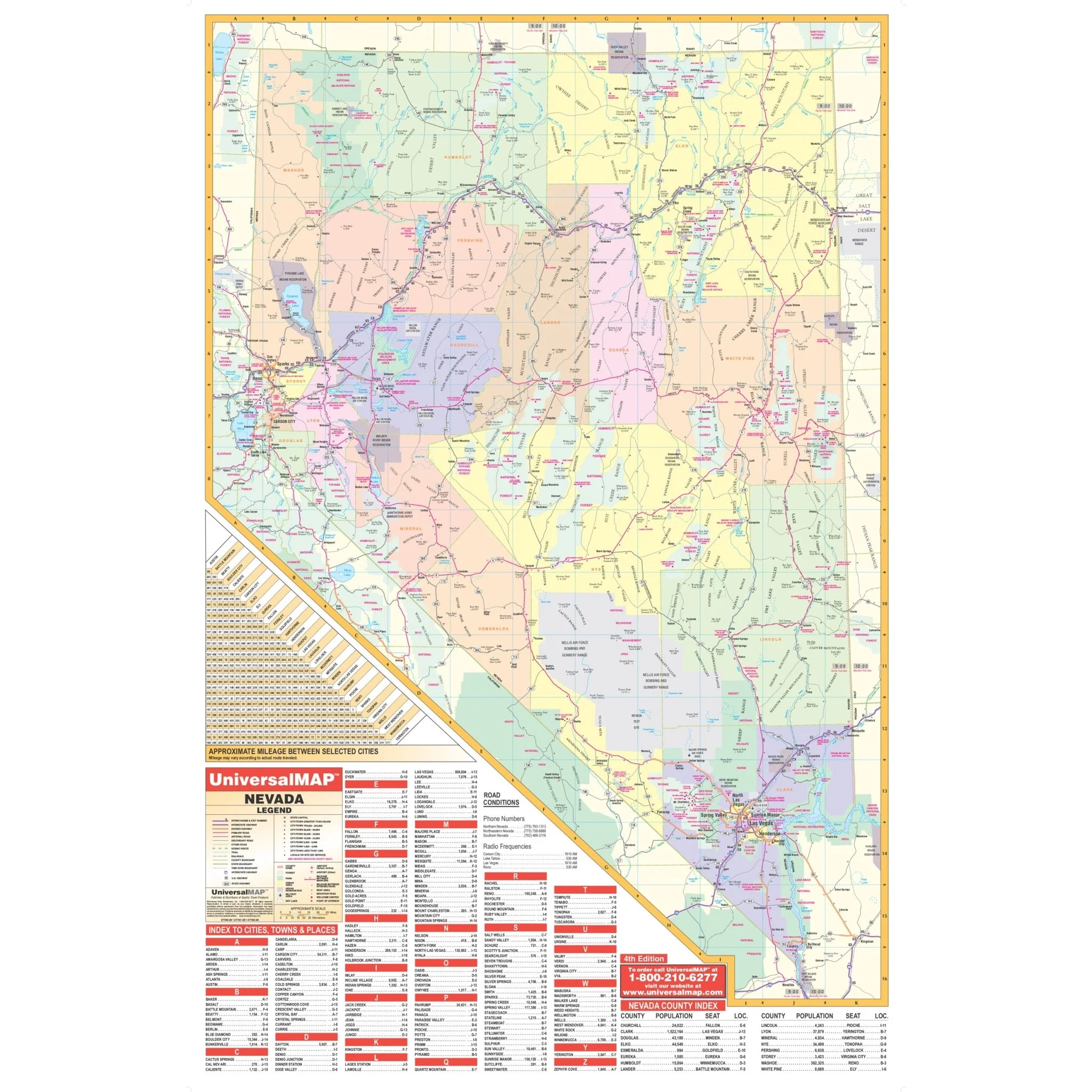
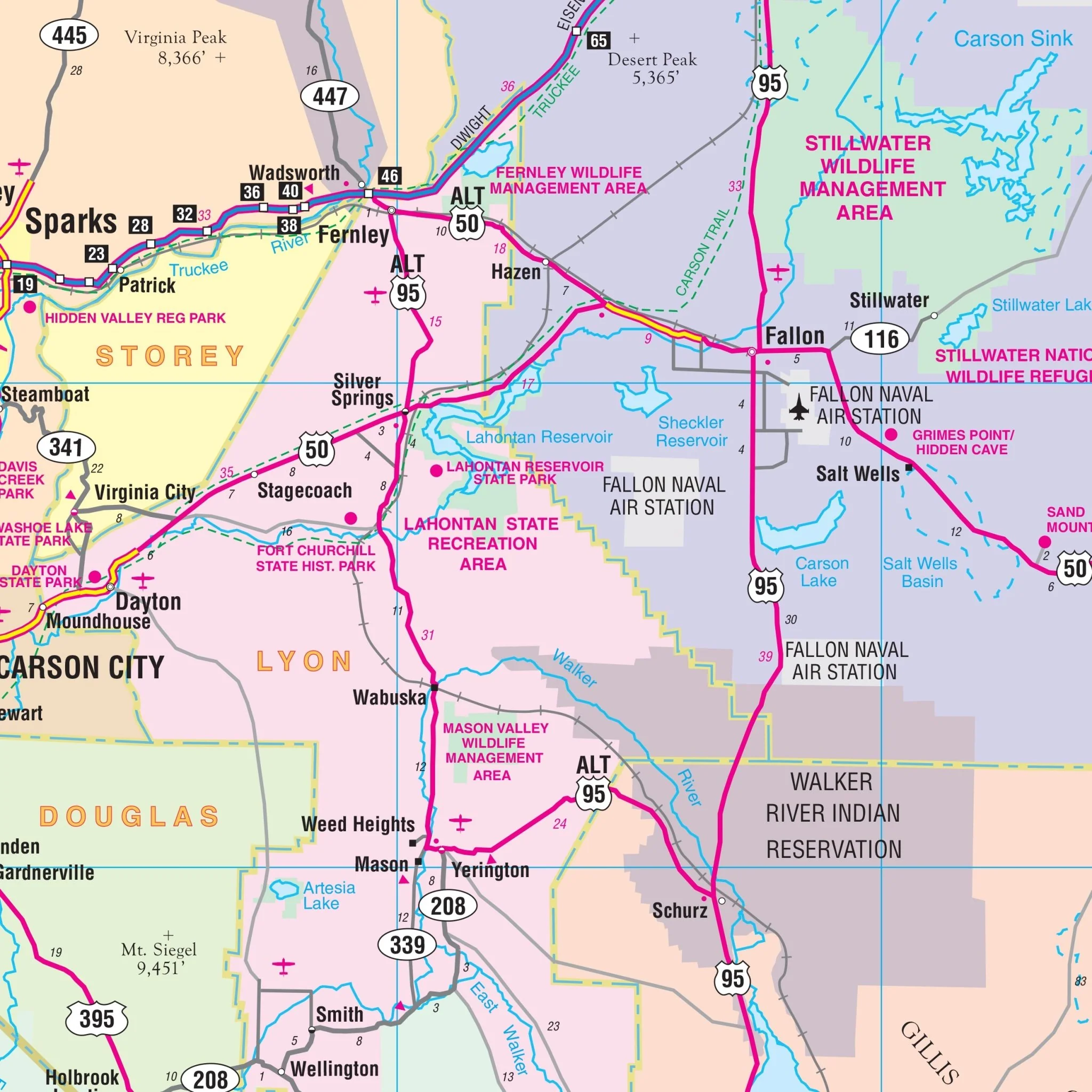
The Reno, NV Wall Map, with adjacent areas, provides complete street detail and covers the following boundaries:
- North to Reno/Stead Airport and Reno-Sparks Indian Colony
- South to Steamboat
- East to Lockwood and Hafed
- West to Verdi Sierra Pines, CA
The Reno, NV Wall Map also includes insets of Incline Village, Carson City, and an enlarged Downtown Reno. Details and features on the map include airports, block numbers, cemeteries, city limits, educational institutions, fire & police stations, golf & country clubs, government buildings, hospitals, longitude & latitude coordinates, points of interest, post offices, railroads, recreational parks, shopping centers, streets & highways, water features, and ZIP code boundaries.
Size: 57" x 71"
Published: 2012
Original: $149.99
-70%$149.99
$45.00Product Information
Product Information
Shipping & Returns
Shipping & Returns
Description
The Reno, NV Wall Map, with adjacent areas, provides complete street detail and covers the following boundaries:
- North to Reno/Stead Airport and Reno-Sparks Indian Colony
- South to Steamboat
- East to Lockwood and Hafed
- West to Verdi Sierra Pines, CA
The Reno, NV Wall Map also includes insets of Incline Village, Carson City, and an enlarged Downtown Reno. Details and features on the map include airports, block numbers, cemeteries, city limits, educational institutions, fire & police stations, golf & country clubs, government buildings, hospitals, longitude & latitude coordinates, points of interest, post offices, railroads, recreational parks, shopping centers, streets & highways, water features, and ZIP code boundaries.
Size: 57" x 71"
Published: 2012