


Africa Shaded Relief Wall Map
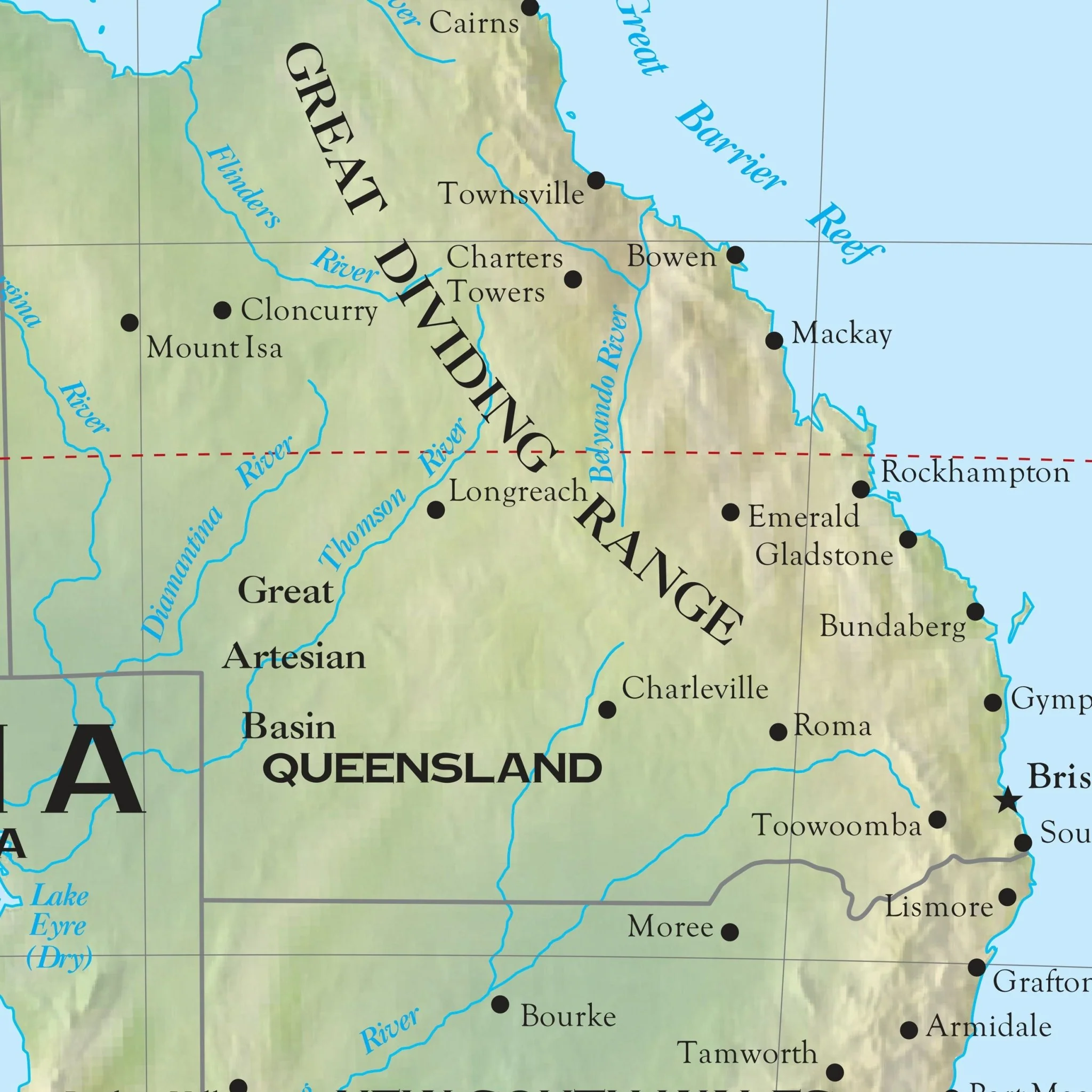
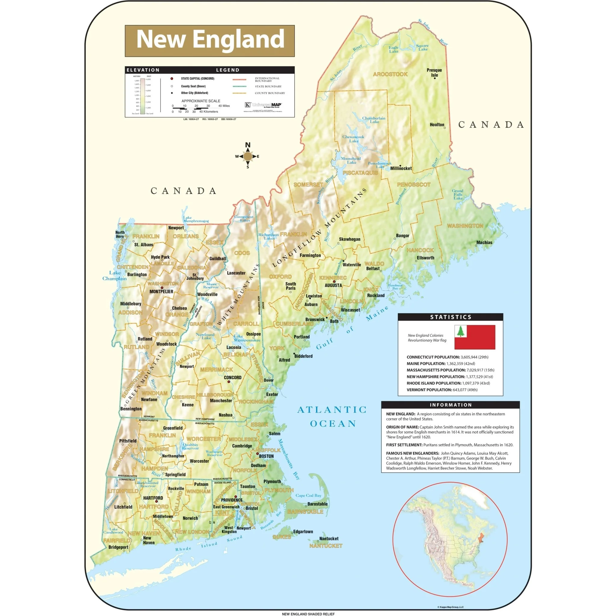
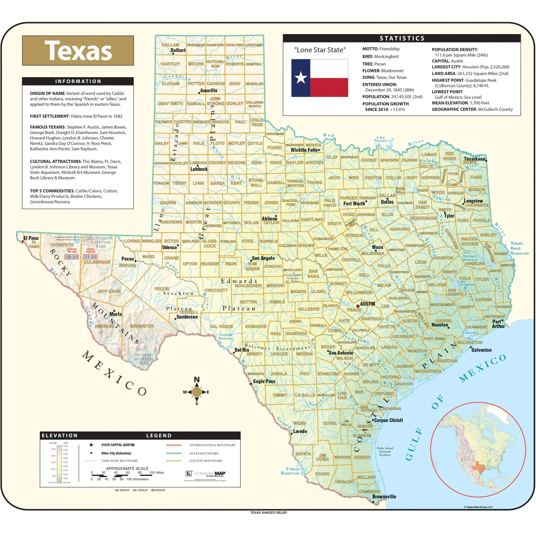
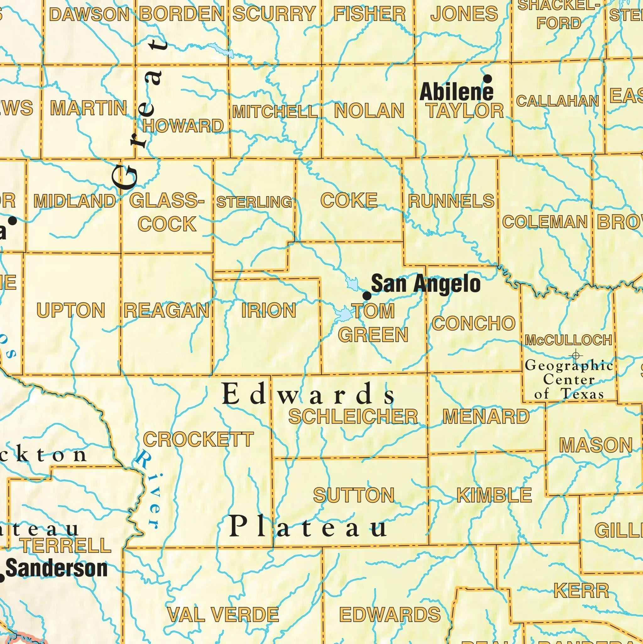
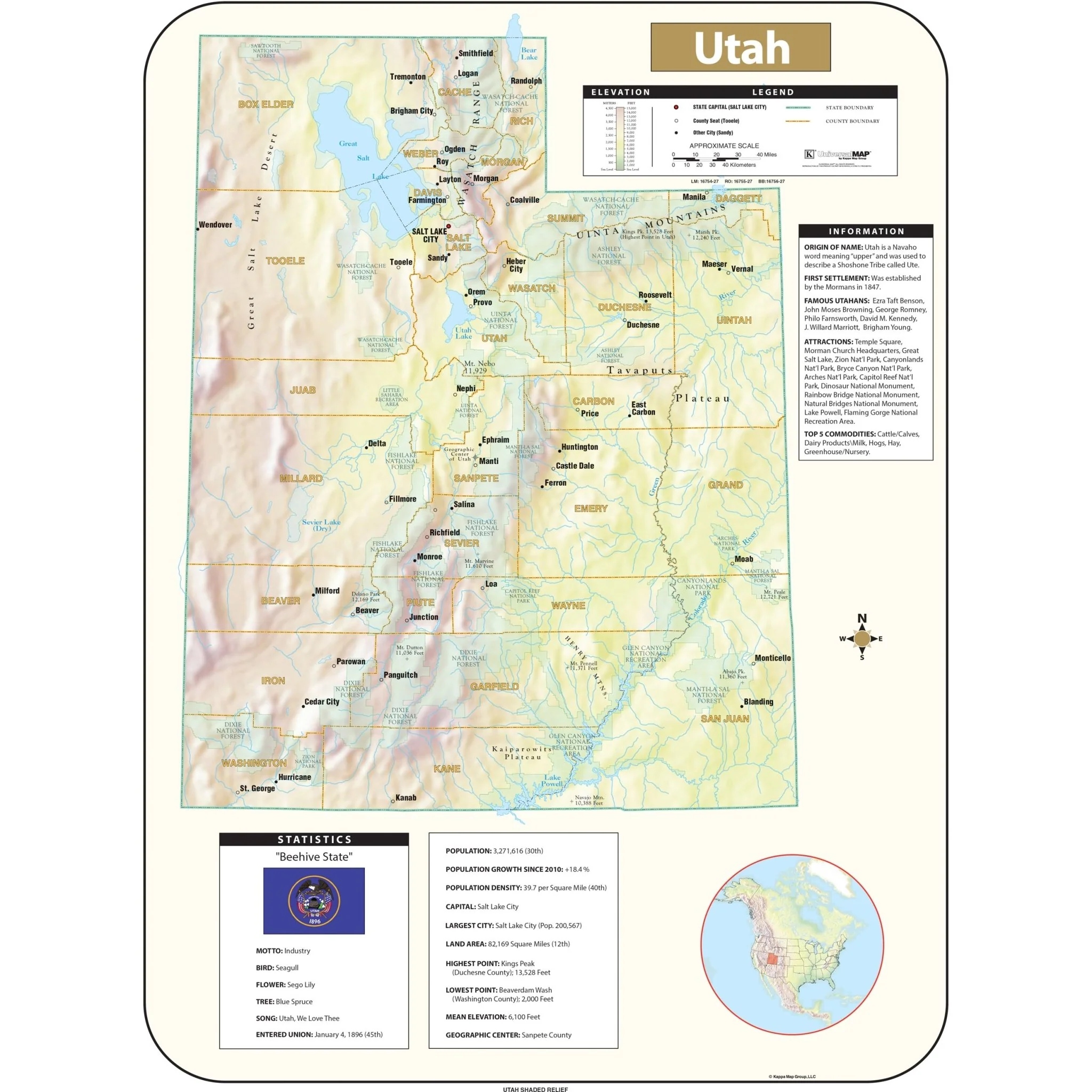
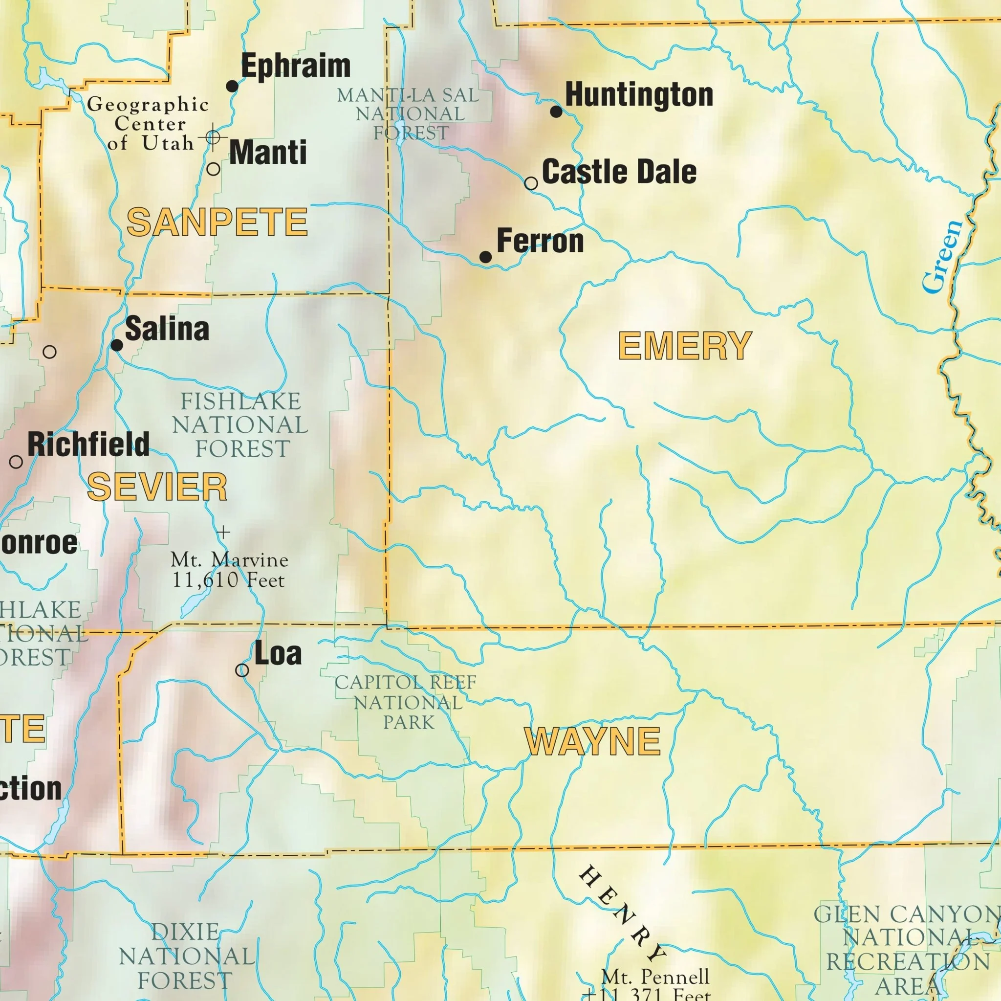
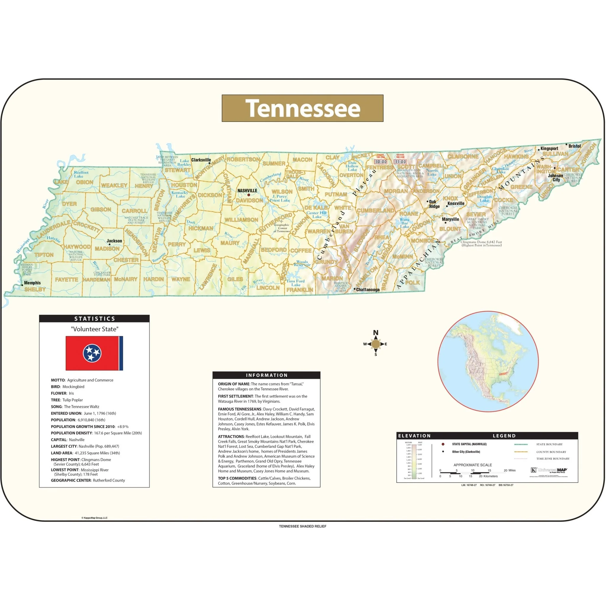
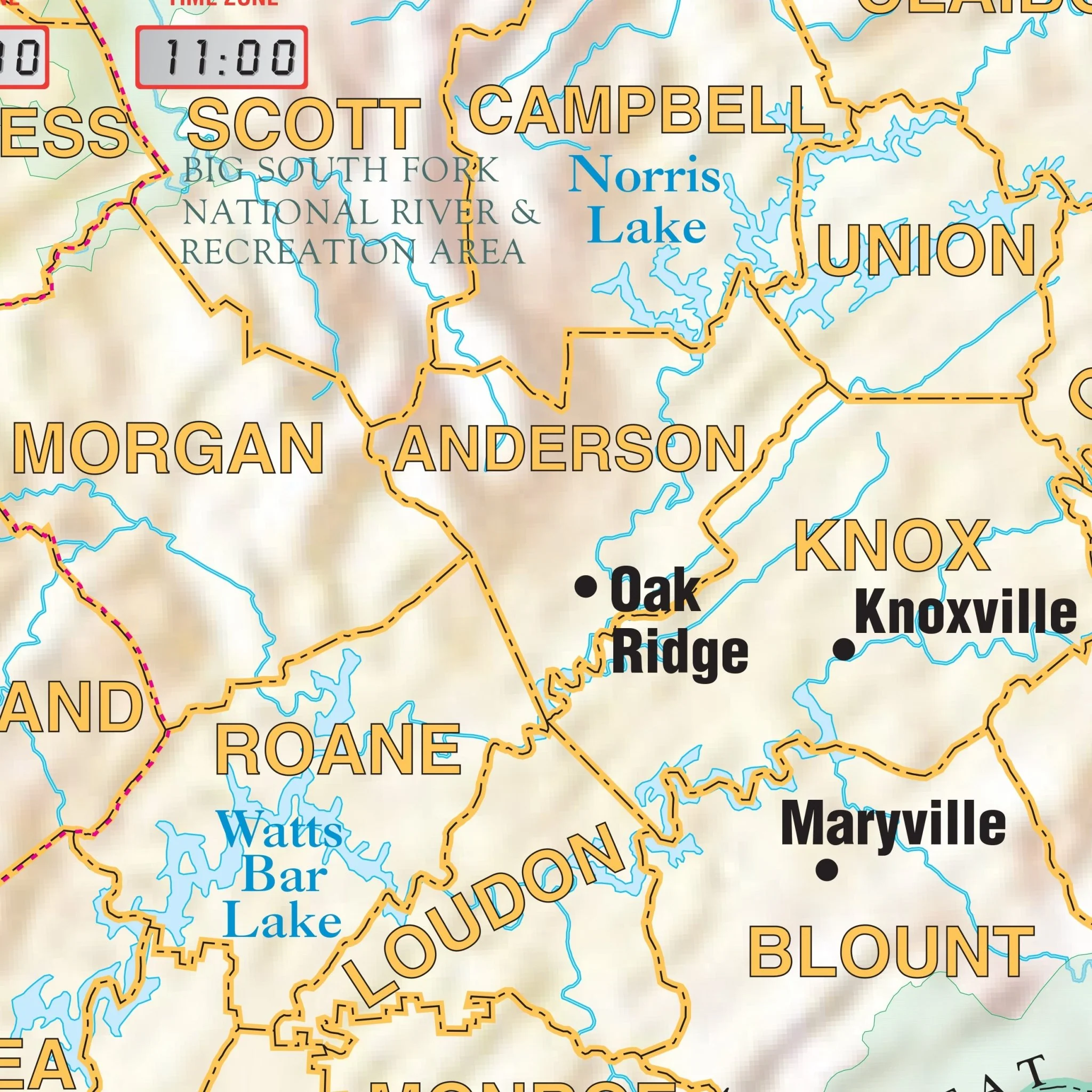
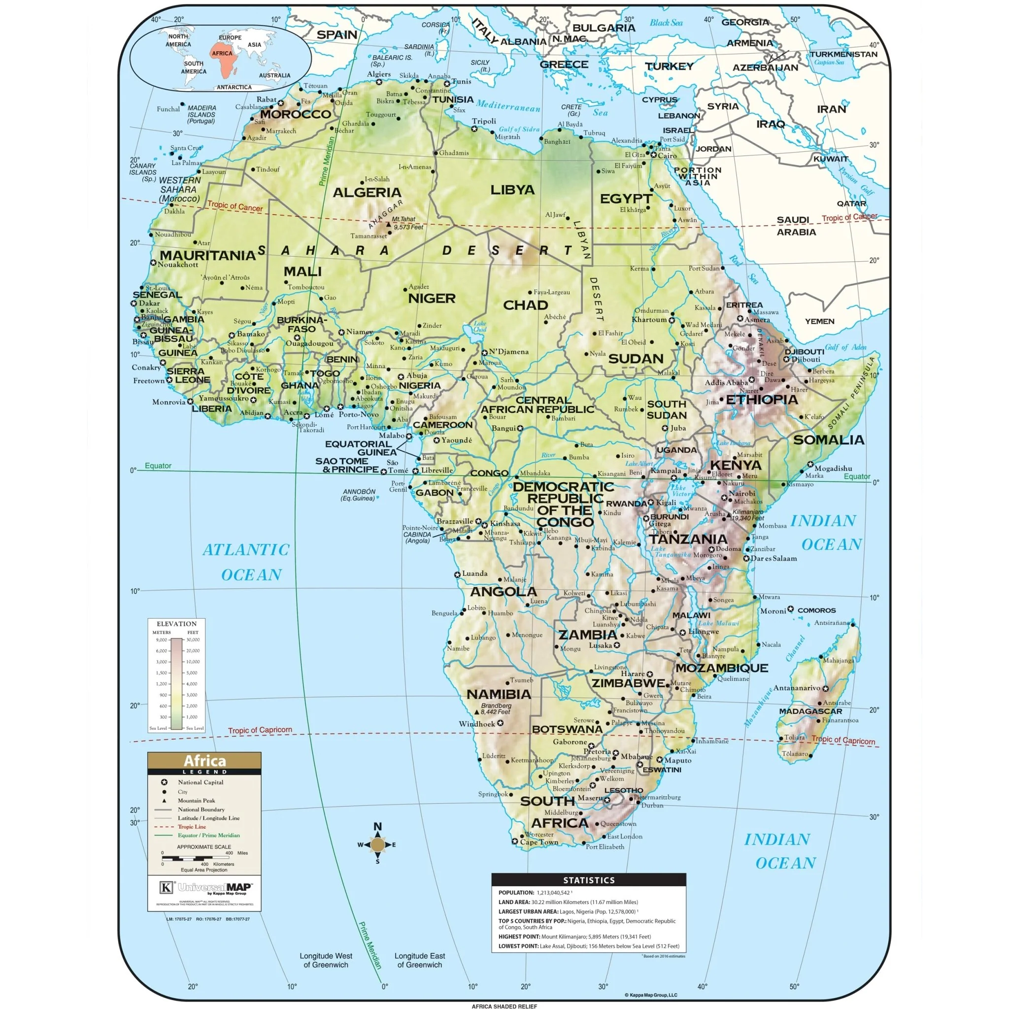
The Shaded Relief series by Kappa Map Group showcases varying elevations using color gradation to indicate different altitudes, with lighter colors representing higher elevations. The map is comprehensive and includes a multitude of geographical and political details.
List of Features:
- Elevation table in both meters and feet
- National boundaries
- National capitals
- Major cities
- Mountain peaks & other physical features
- Longitude & latitude lines, emphasizing major reference lines
- Dual-scale distance scale in miles and kilometers.
Sizes: 54" x 69" | 42" x 54" | 29.5" x 38"
Published: 2016
Select Map Size
Select Map Finish
From $27.00
Original: $89.99
-70%Africa Shaded Relief Wall Map—
$89.99
$27.00Product Information
Product Information
Shipping & Returns
Shipping & Returns
Description
The Shaded Relief series by Kappa Map Group showcases varying elevations using color gradation to indicate different altitudes, with lighter colors representing higher elevations. The map is comprehensive and includes a multitude of geographical and political details.
List of Features:
- Elevation table in both meters and feet
- National boundaries
- National capitals
- Major cities
- Mountain peaks & other physical features
- Longitude & latitude lines, emphasizing major reference lines
- Dual-scale distance scale in miles and kilometers.
Sizes: 54" x 69" | 42" x 54" | 29.5" x 38"
Published: 2016