


Boston, MA Wall Map
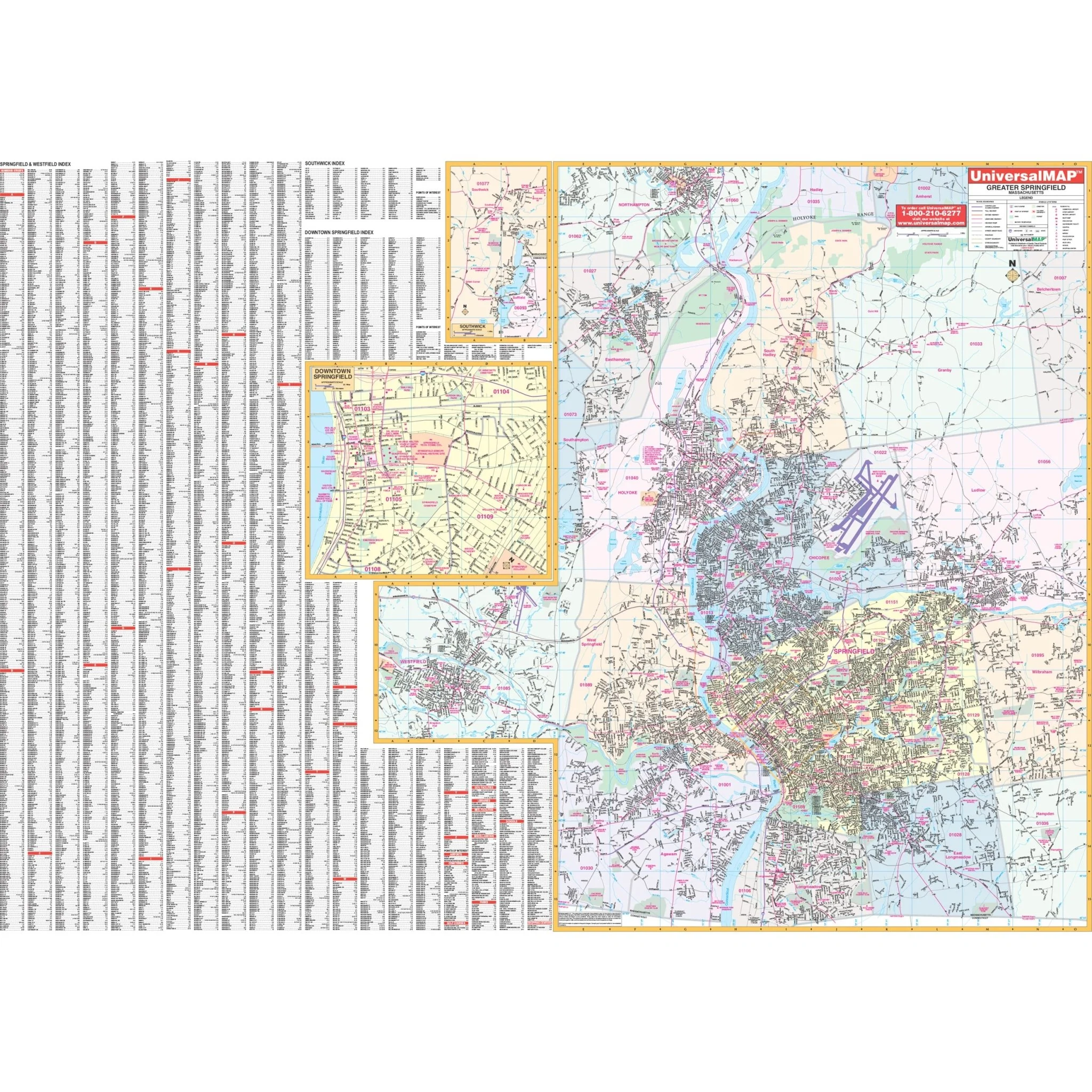
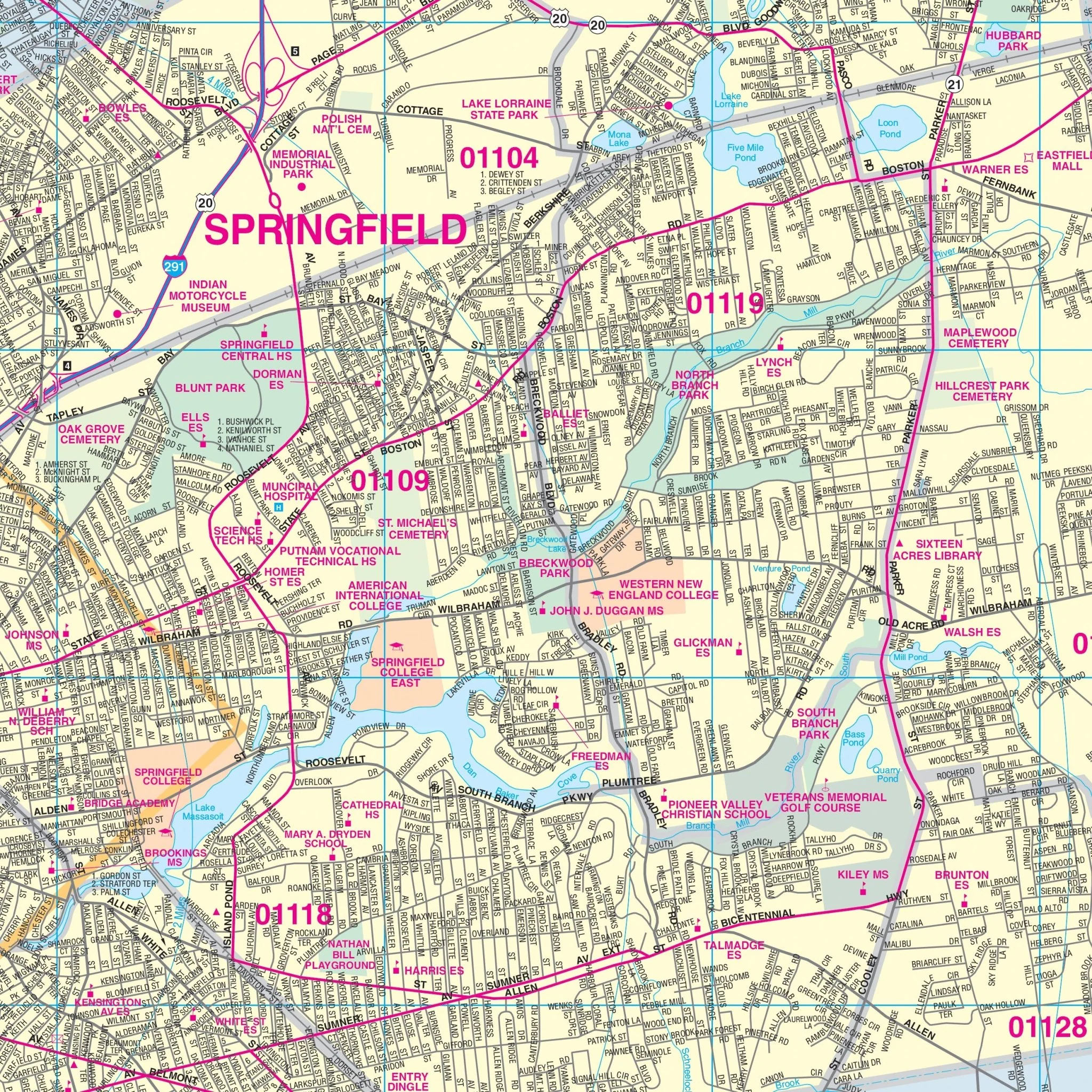
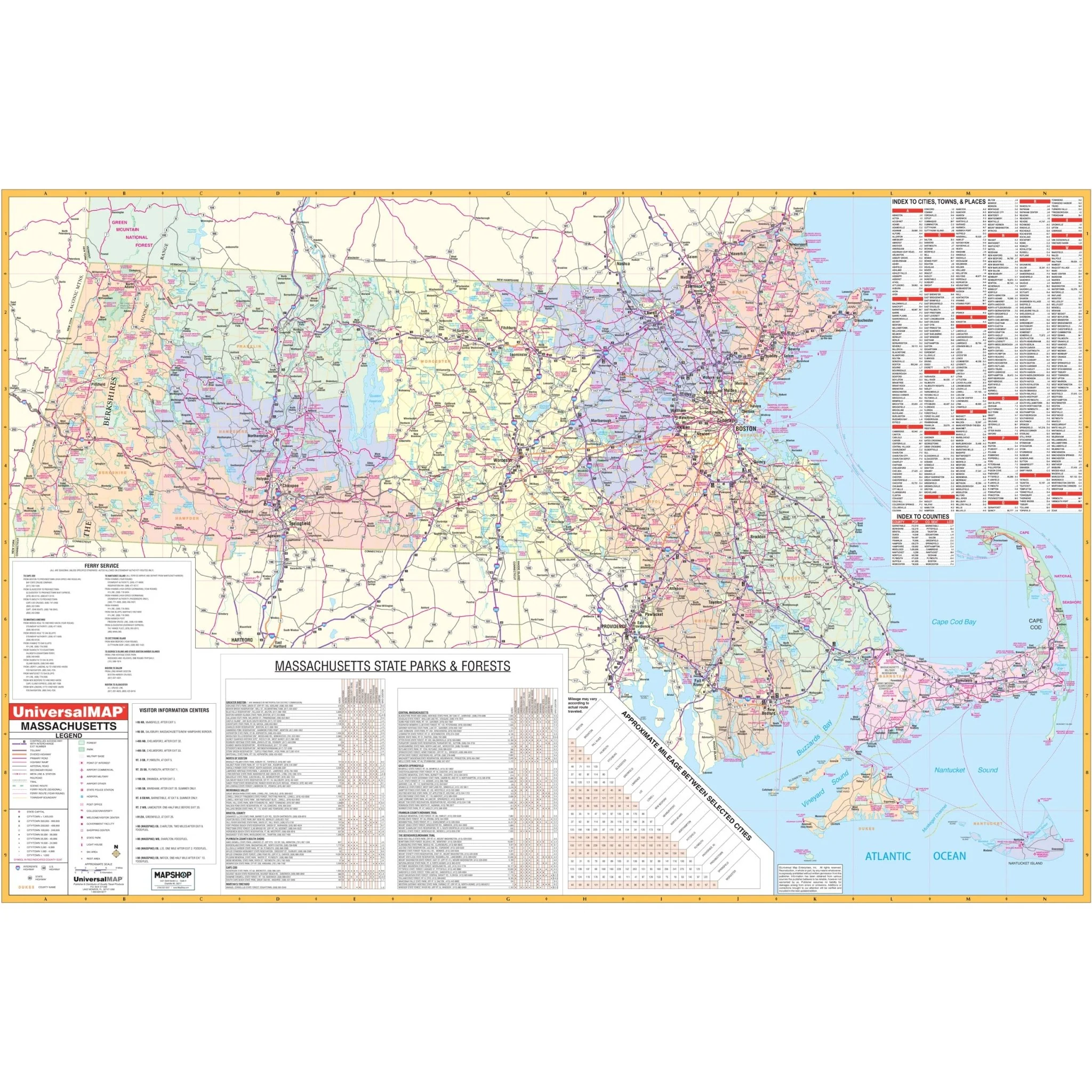
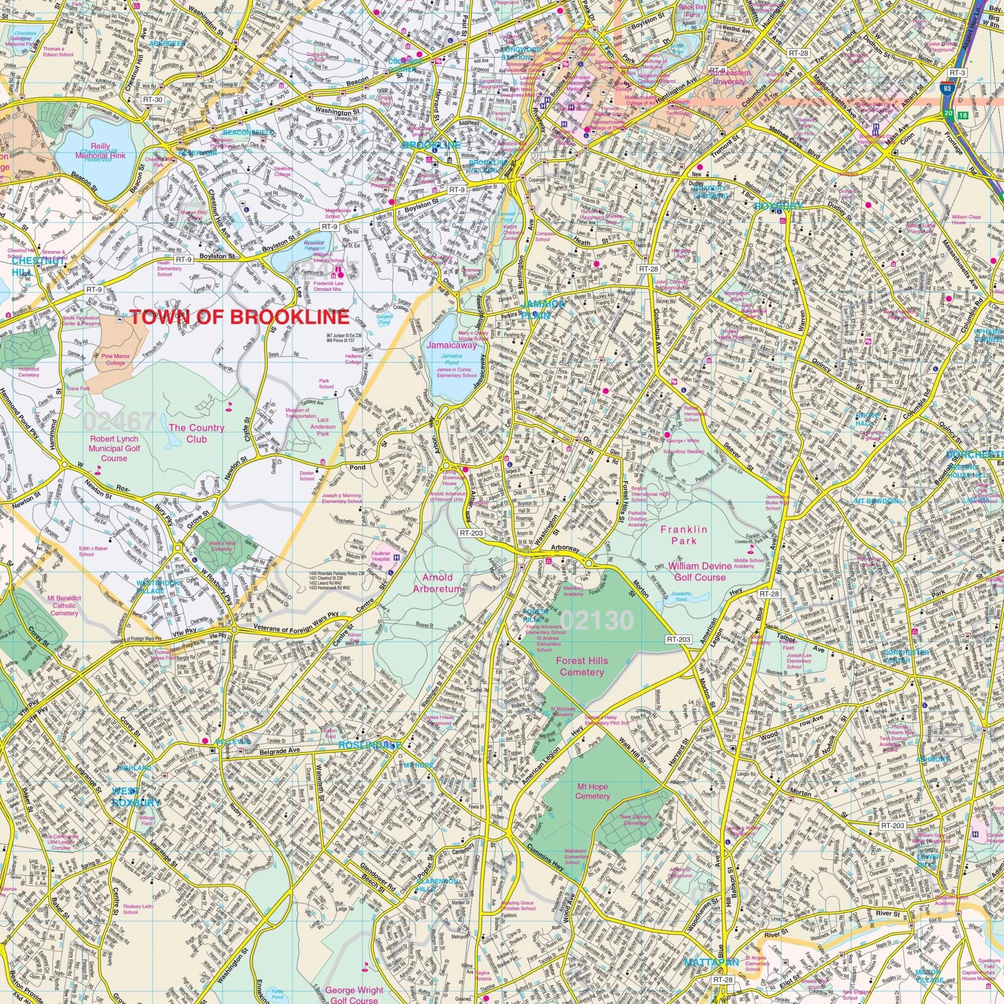
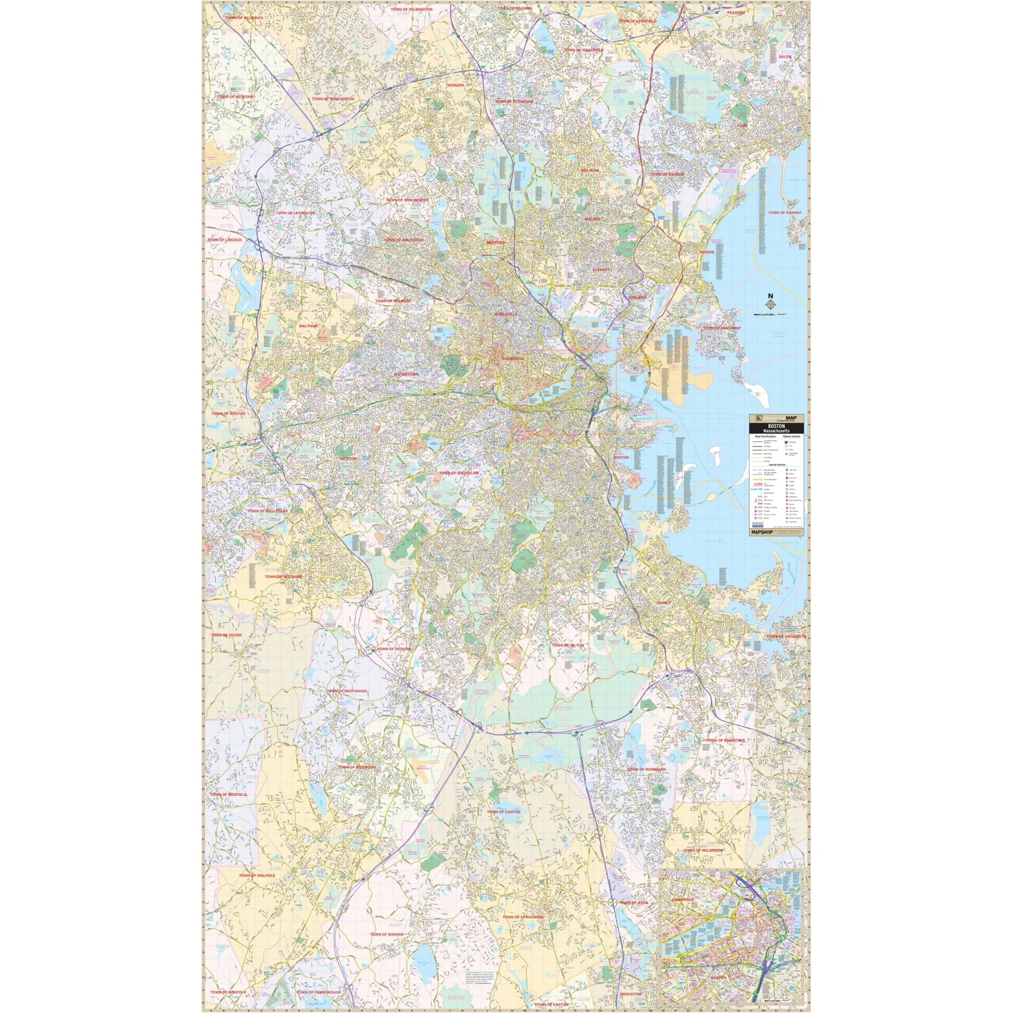
Discover the intricacies of Boston, MA, and its surrounding areas with this comprehensive Wall Map. This map provides complete street detail and covers the entirety of Boston, extending north to the Town of Wakefield and the City of Woburn, south to Gillette Stadium and the Town of Foxborough, east to the City of Lynn and Quincy, and west to the City of Waltham and the Town of Needham. Additionally, it features an inset map of Downtown Boston for your convenience.
Within this map, you'll find a wealth of essential details, including streets, airports, government buildings, post offices, cemeteries, fire and police stations, hospitals, shopping centers, educational institutions, railroads, water features, golf and country clubs, mileage circles, recreational parks, ZIP codes and boundaries, and block numbers.
Embark on your journey through Boston, MA, armed with this comprehensive map that will assist you in navigating the region's diverse landscapes and points of interest.
Size: 48" x 79"
Published: 2011
Original: $149.99
-70%$149.99
$45.00Product Information
Product Information
Shipping & Returns
Shipping & Returns
Description
Discover the intricacies of Boston, MA, and its surrounding areas with this comprehensive Wall Map. This map provides complete street detail and covers the entirety of Boston, extending north to the Town of Wakefield and the City of Woburn, south to Gillette Stadium and the Town of Foxborough, east to the City of Lynn and Quincy, and west to the City of Waltham and the Town of Needham. Additionally, it features an inset map of Downtown Boston for your convenience.
Within this map, you'll find a wealth of essential details, including streets, airports, government buildings, post offices, cemeteries, fire and police stations, hospitals, shopping centers, educational institutions, railroads, water features, golf and country clubs, mileage circles, recreational parks, ZIP codes and boundaries, and block numbers.
Embark on your journey through Boston, MA, armed with this comprehensive map that will assist you in navigating the region's diverse landscapes and points of interest.
Size: 48" x 79"
Published: 2011