


Springfield, MA Wall Map
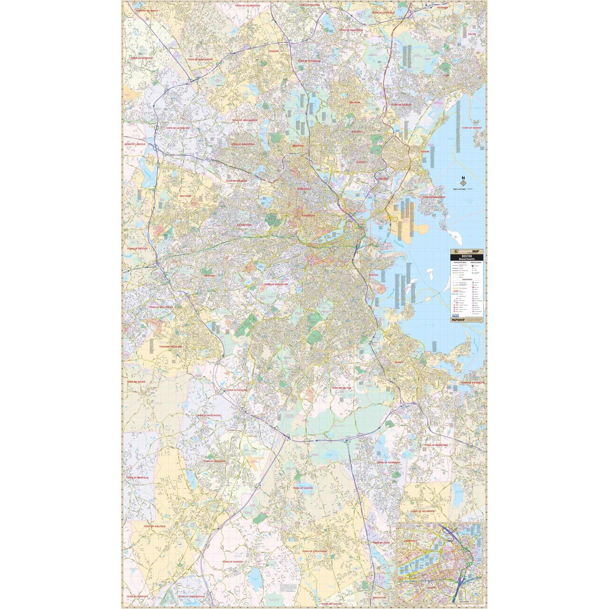
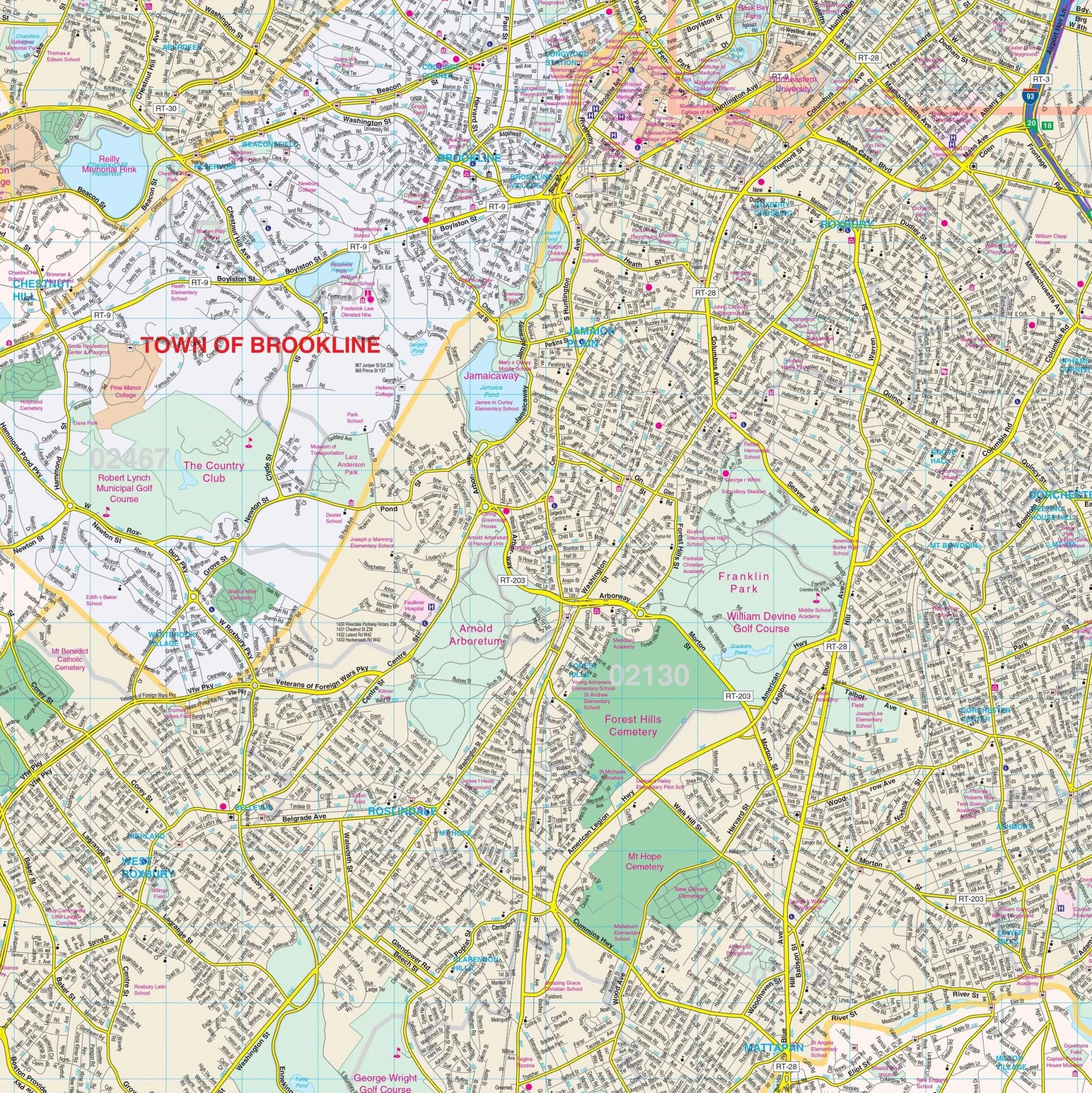
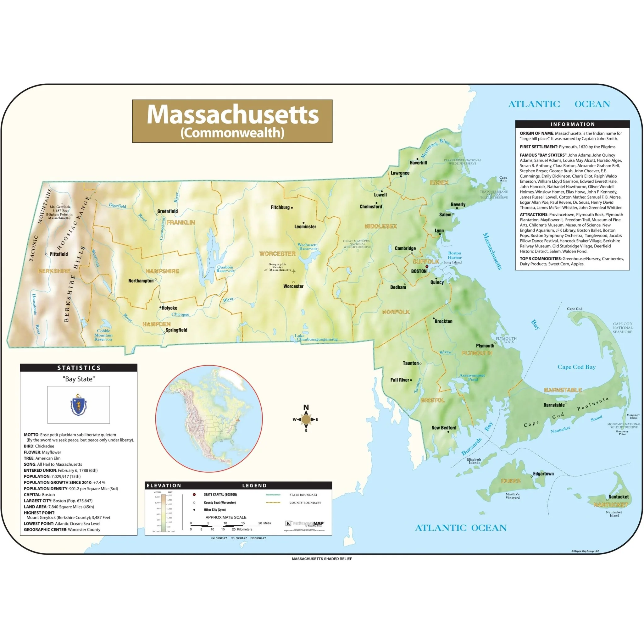
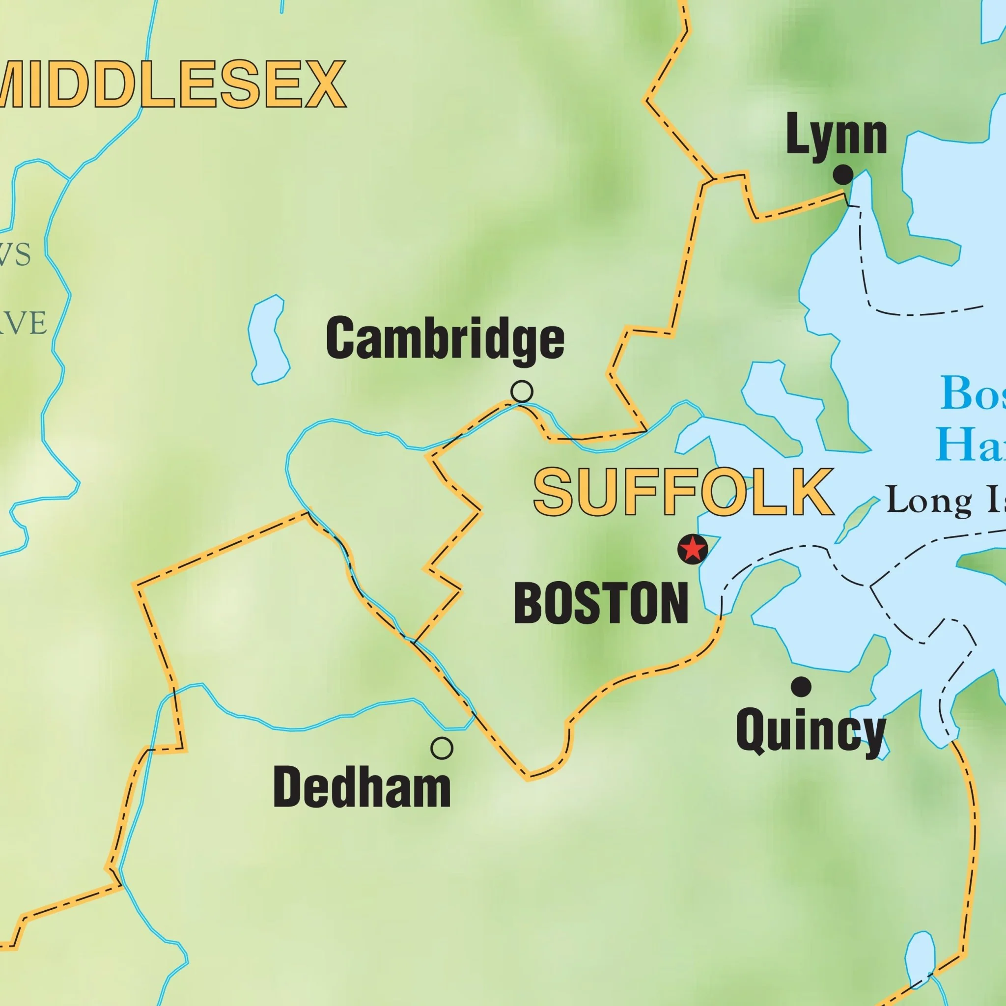
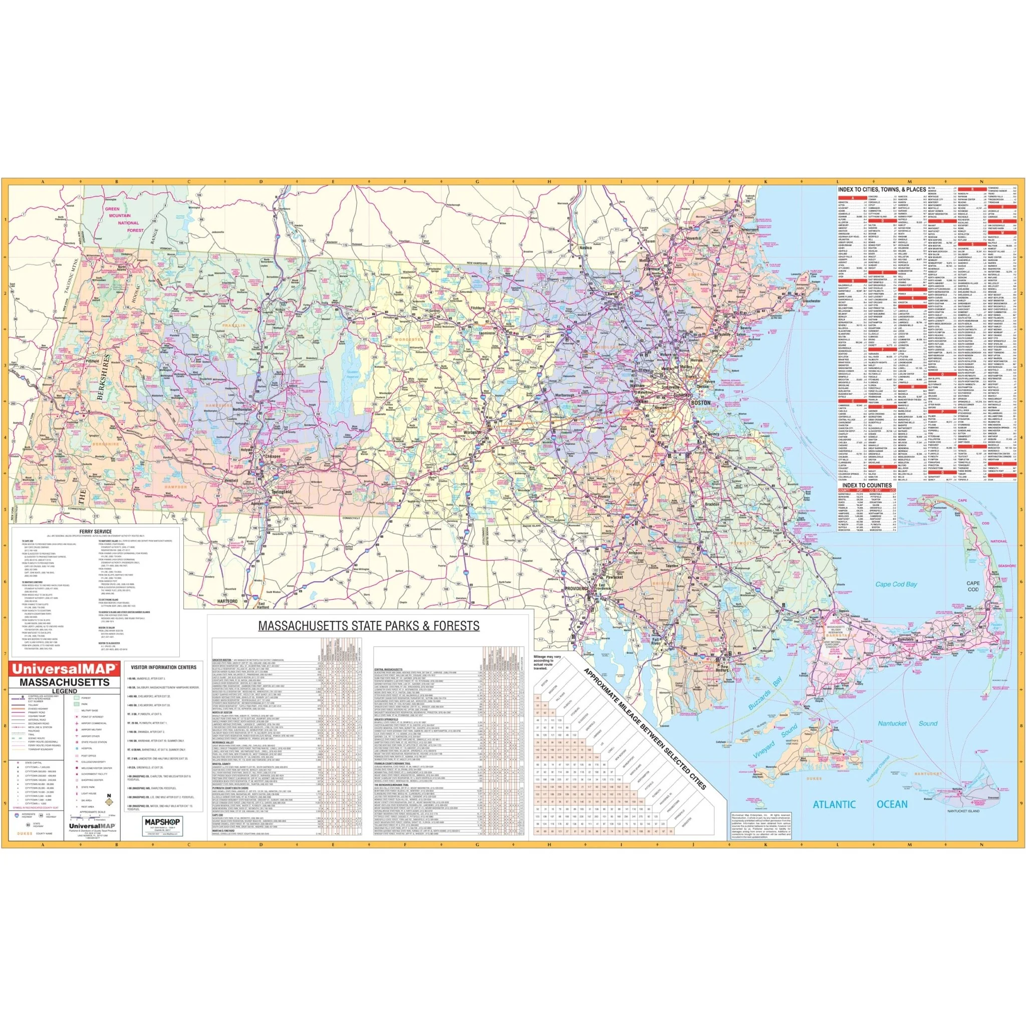
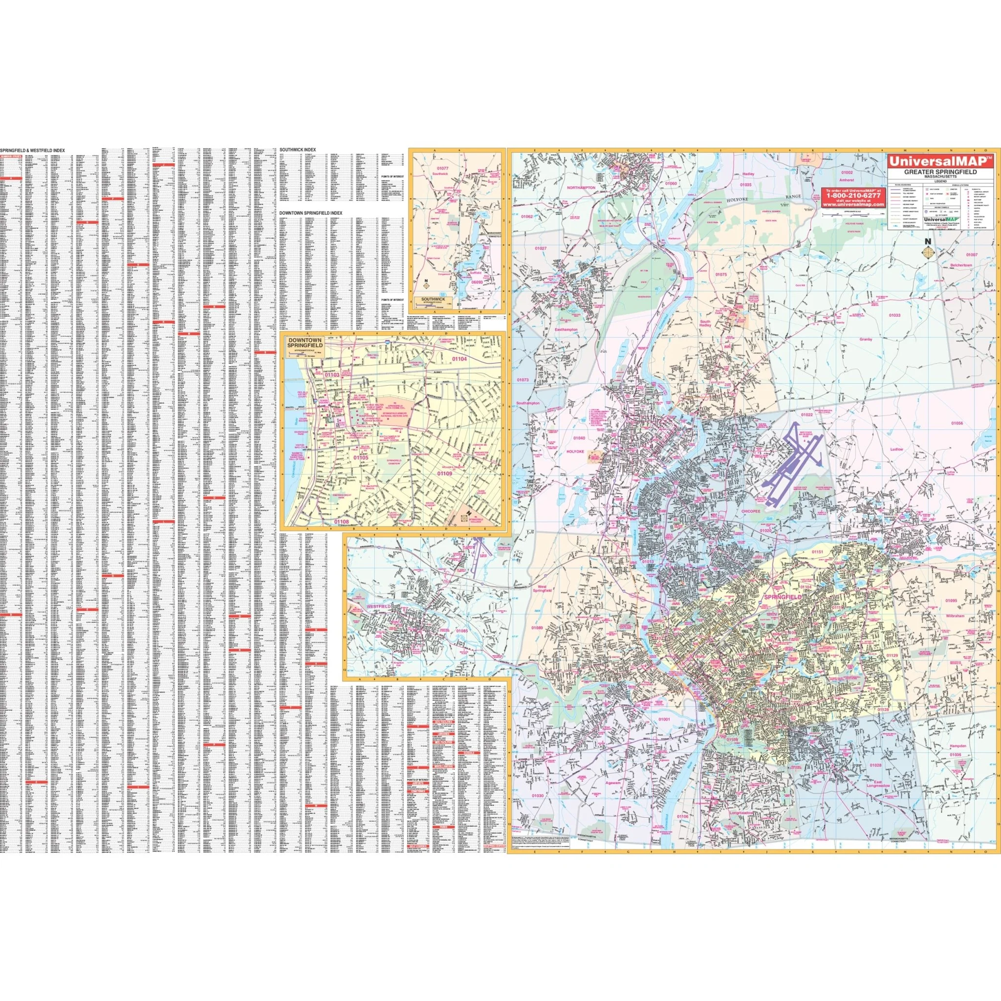
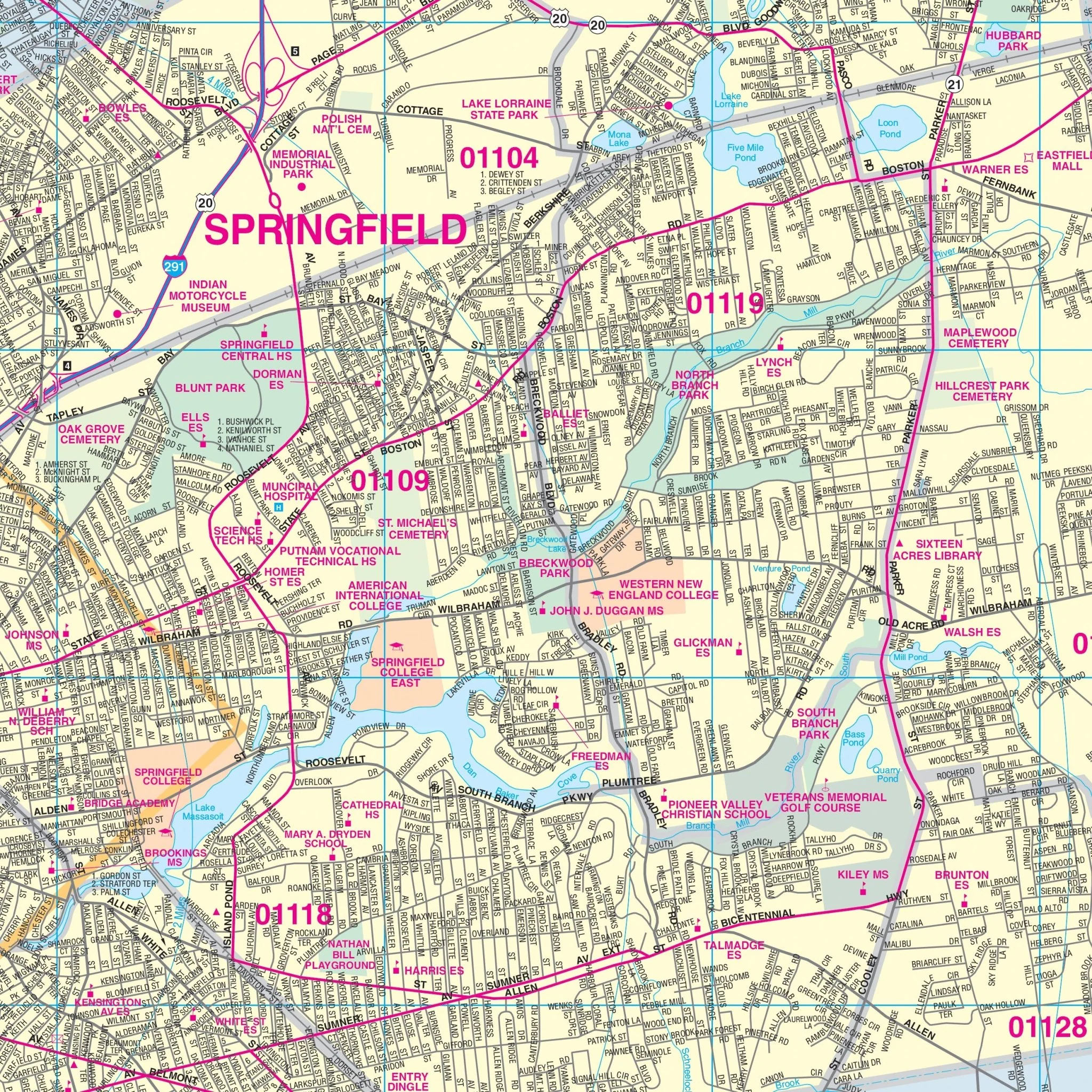
Explore the Springfield, Massachusetts Wall Map, proudly published by Kappa Map Group, to uncover a wealth of information about this vibrant city. This map provides complete street detail, with streets conveniently indexed on the face of the map. The coverage area extends from Smith College in Northampton to the Massachusetts-Connecticut line in the south, from Springfield Reservoir in Ludlow to Westfield State College in Westfield to the west, and includes insets for Downtown Springfield and Southwick.
Details and features abound on this map, making it an indispensable resource for navigating Springfield and its surroundings. You'll find information on all streets, post offices, hospitals, railroads, longitude and latitude coordinates, airports, cemeteries, shopping centers, water features, recreational parks, city limits and annexations, government buildings, fire and police stations, educational facilities, golf and country clubs, ZIP codes and boundaries, as well as points of interest.
With the Springfield, Massachusetts Wall Map, you'll have a comprehensive guide at your disposal to help you explore and navigate the diverse landscapes and attractions of this dynamic city and its neighboring areas.
Size: 68" x 50"
Published: 2000
Original: $139.99
-70%$139.99
$42.00Product Information
Product Information
Shipping & Returns
Shipping & Returns
Description
Explore the Springfield, Massachusetts Wall Map, proudly published by Kappa Map Group, to uncover a wealth of information about this vibrant city. This map provides complete street detail, with streets conveniently indexed on the face of the map. The coverage area extends from Smith College in Northampton to the Massachusetts-Connecticut line in the south, from Springfield Reservoir in Ludlow to Westfield State College in Westfield to the west, and includes insets for Downtown Springfield and Southwick.
Details and features abound on this map, making it an indispensable resource for navigating Springfield and its surroundings. You'll find information on all streets, post offices, hospitals, railroads, longitude and latitude coordinates, airports, cemeteries, shopping centers, water features, recreational parks, city limits and annexations, government buildings, fire and police stations, educational facilities, golf and country clubs, ZIP codes and boundaries, as well as points of interest.
With the Springfield, Massachusetts Wall Map, you'll have a comprehensive guide at your disposal to help you explore and navigate the diverse landscapes and attractions of this dynamic city and its neighboring areas.
Size: 68" x 50"
Published: 2000