Lexington & Fayette County, KY Wall Map
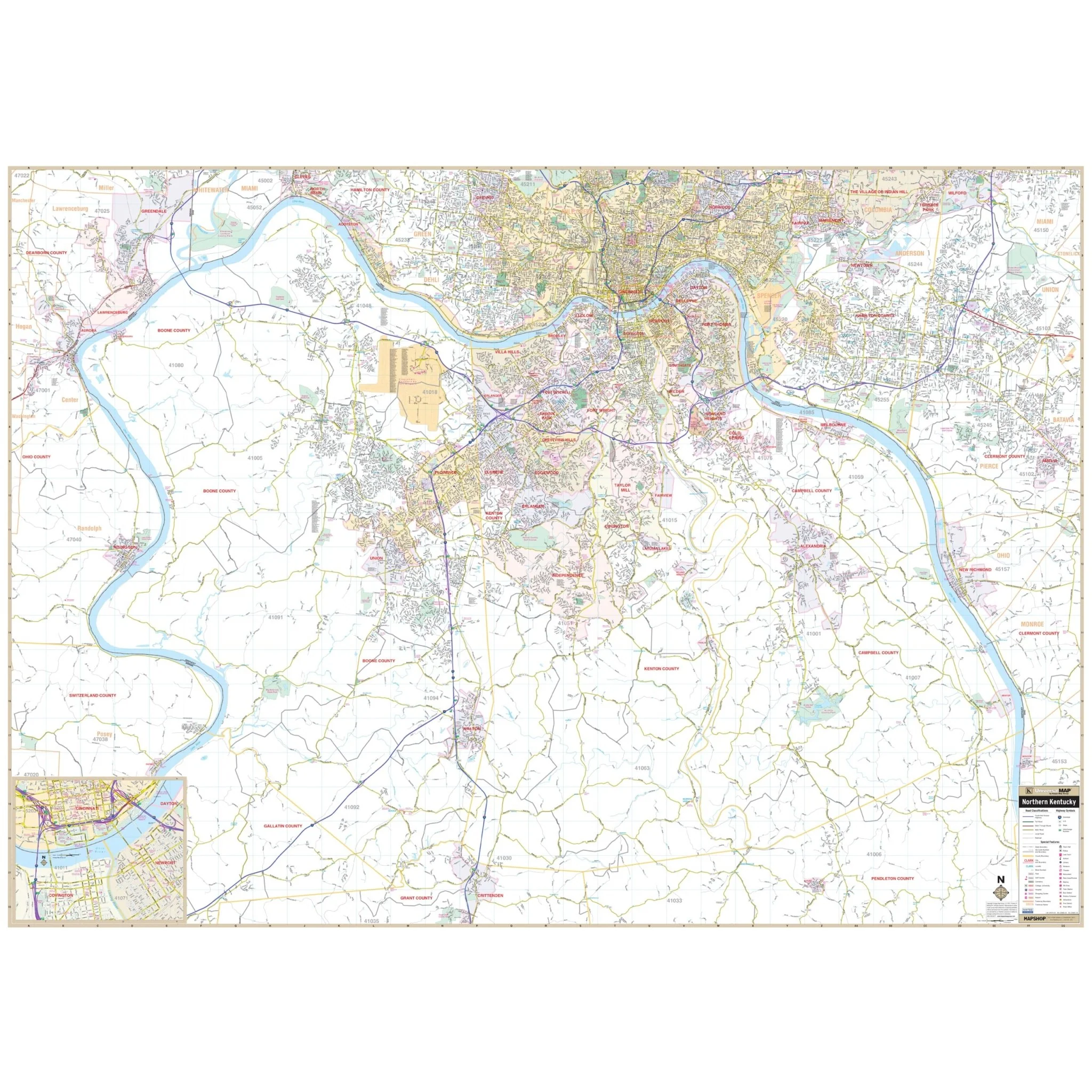
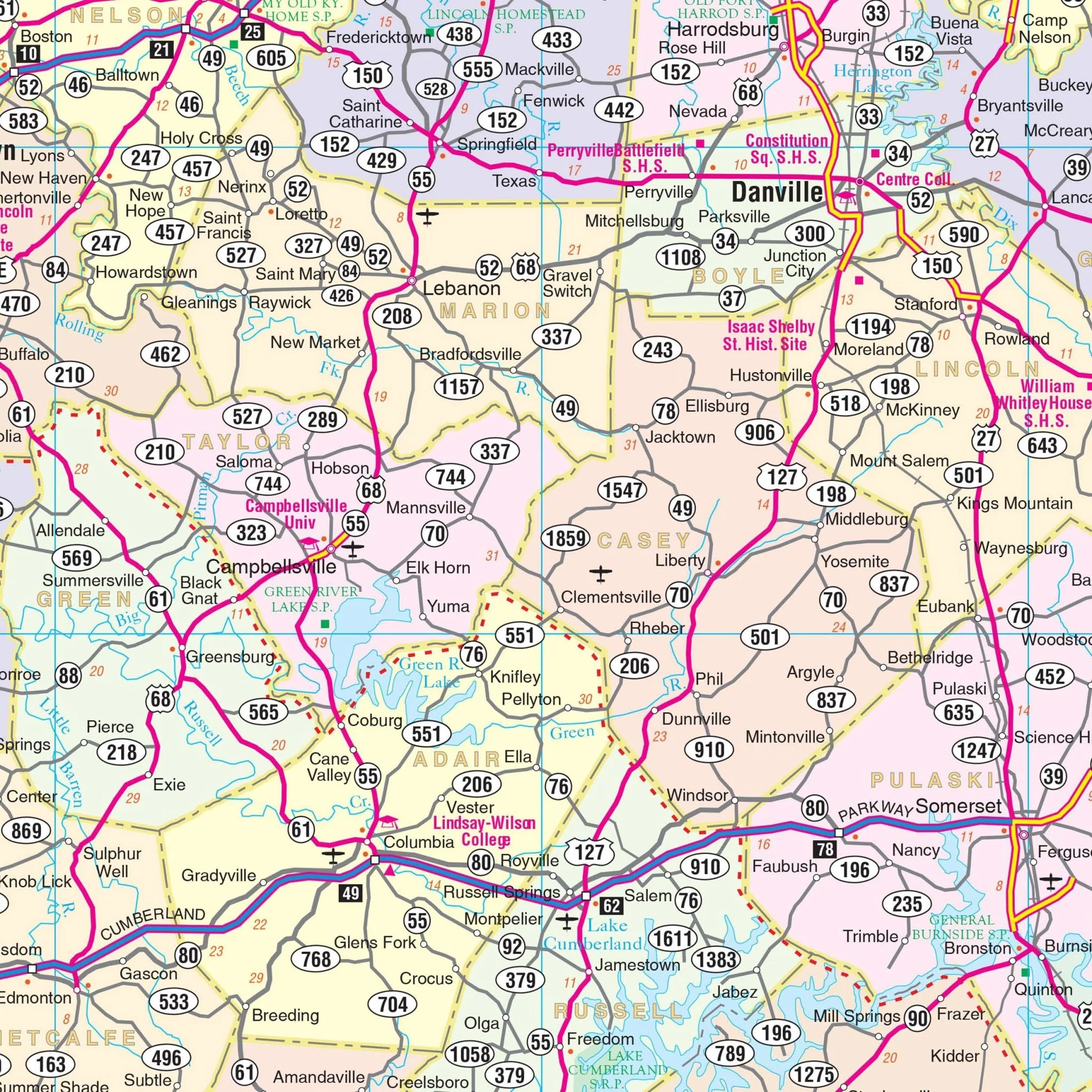
Discover the Lexington and Fayette County, KY Wall Map, meticulously crafted to provide comprehensive street-level detail for the region. This map, spanning an area of Fayette County, offers valuable geographic insights.
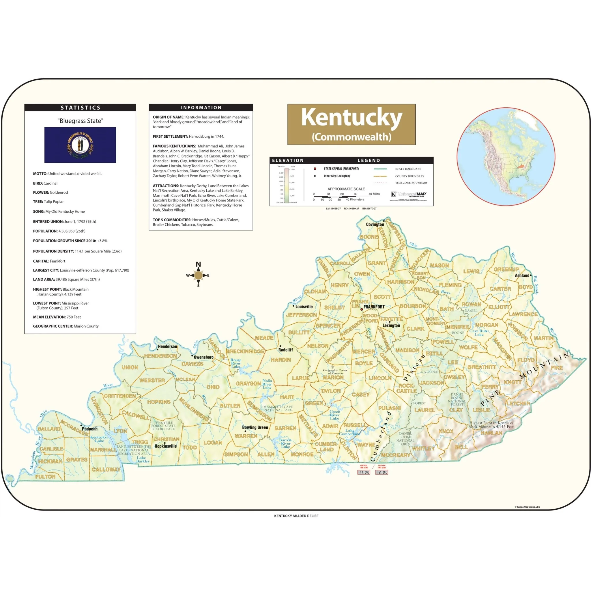
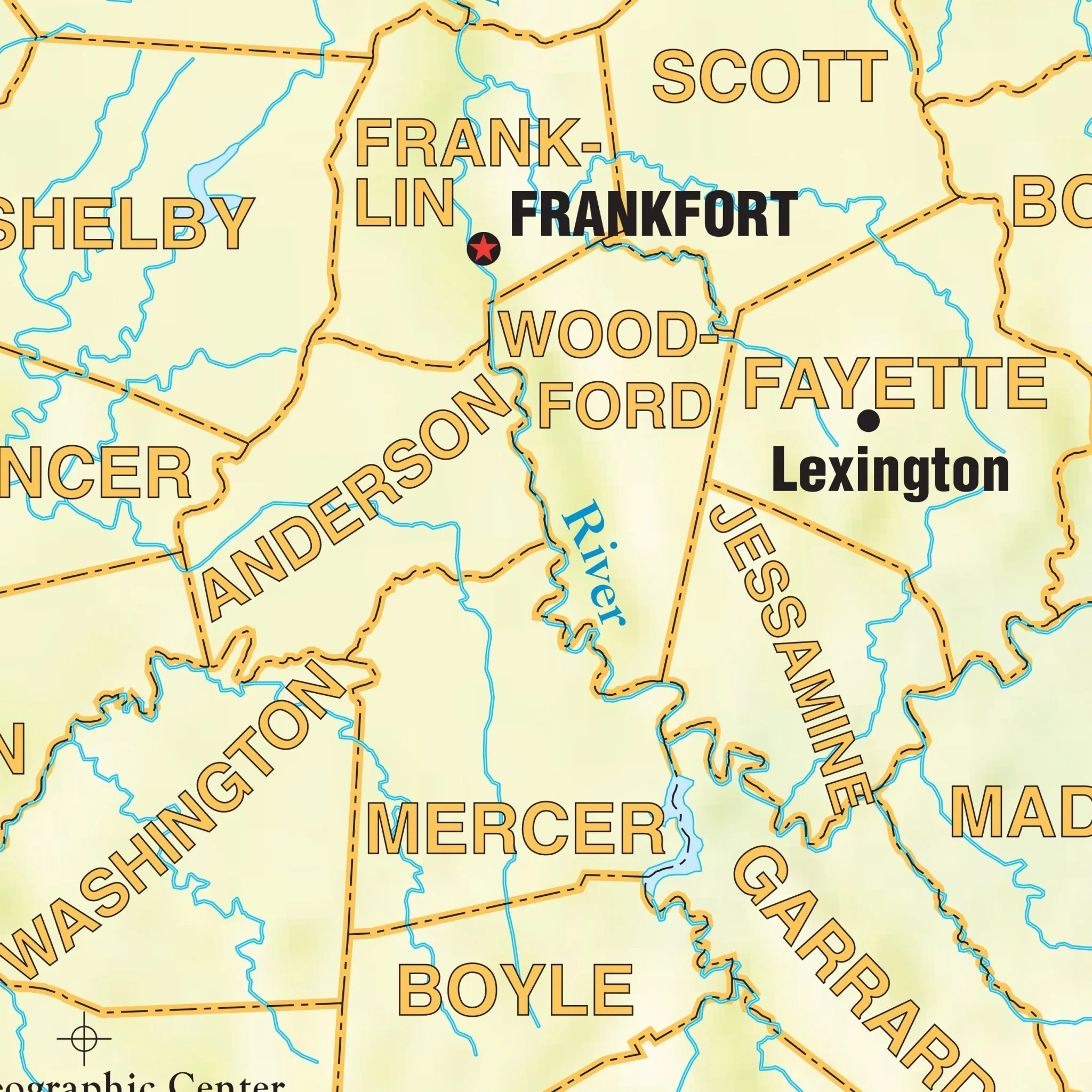
Geographically, the coverage extends from Georgetown and the Bourbon/Fayette/Scott County line in the north to Nicholasville and the Madison County line in the south. To the east, it reaches Winchester, while to the west, it encompasses Wilmore and Midway. This extensive coverage ensures you have access to essential information for this area.
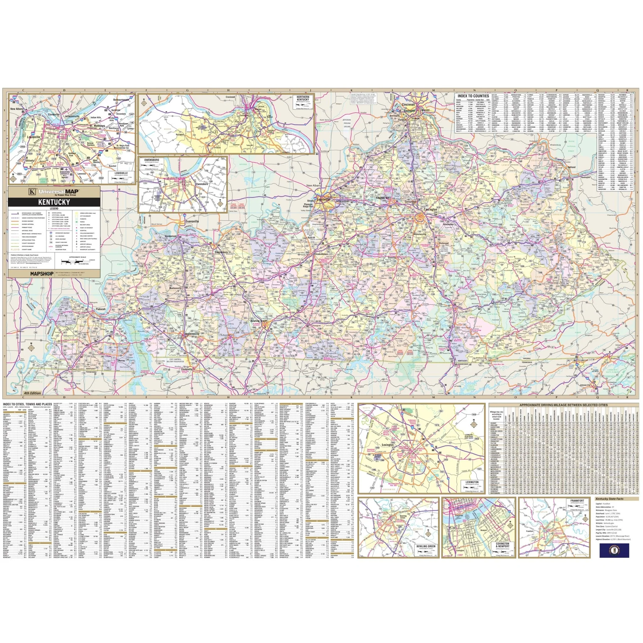
Within the map, you'll find a wealth of details, including streets, airports, government buildings, post offices, cemeteries, fire and police stations, hospitals, shopping centers, educational institutions, railroads, water features, golf and country clubs, mileage circles, recreational parks, ZIP codes and boundaries, as well as block numbers. Additionally, an inset of Lexington and the surrounding county areas with cities, major and secondary roads, and community details is included for your reference.
Size: 54" x 60"
Published: 2015
Original: $139.99
-70%$139.99
$42.00Product Information
Product Information
Shipping & Returns
Shipping & Returns
Description
Discover the Lexington and Fayette County, KY Wall Map, meticulously crafted to provide comprehensive street-level detail for the region. This map, spanning an area of Fayette County, offers valuable geographic insights.
Geographically, the coverage extends from Georgetown and the Bourbon/Fayette/Scott County line in the north to Nicholasville and the Madison County line in the south. To the east, it reaches Winchester, while to the west, it encompasses Wilmore and Midway. This extensive coverage ensures you have access to essential information for this area.
Within the map, you'll find a wealth of details, including streets, airports, government buildings, post offices, cemeteries, fire and police stations, hospitals, shopping centers, educational institutions, railroads, water features, golf and country clubs, mileage circles, recreational parks, ZIP codes and boundaries, as well as block numbers. Additionally, an inset of Lexington and the surrounding county areas with cities, major and secondary roads, and community details is included for your reference.
Size: 54" x 60"
Published: 2015