


Philadelphia, PA Metro Wall Map
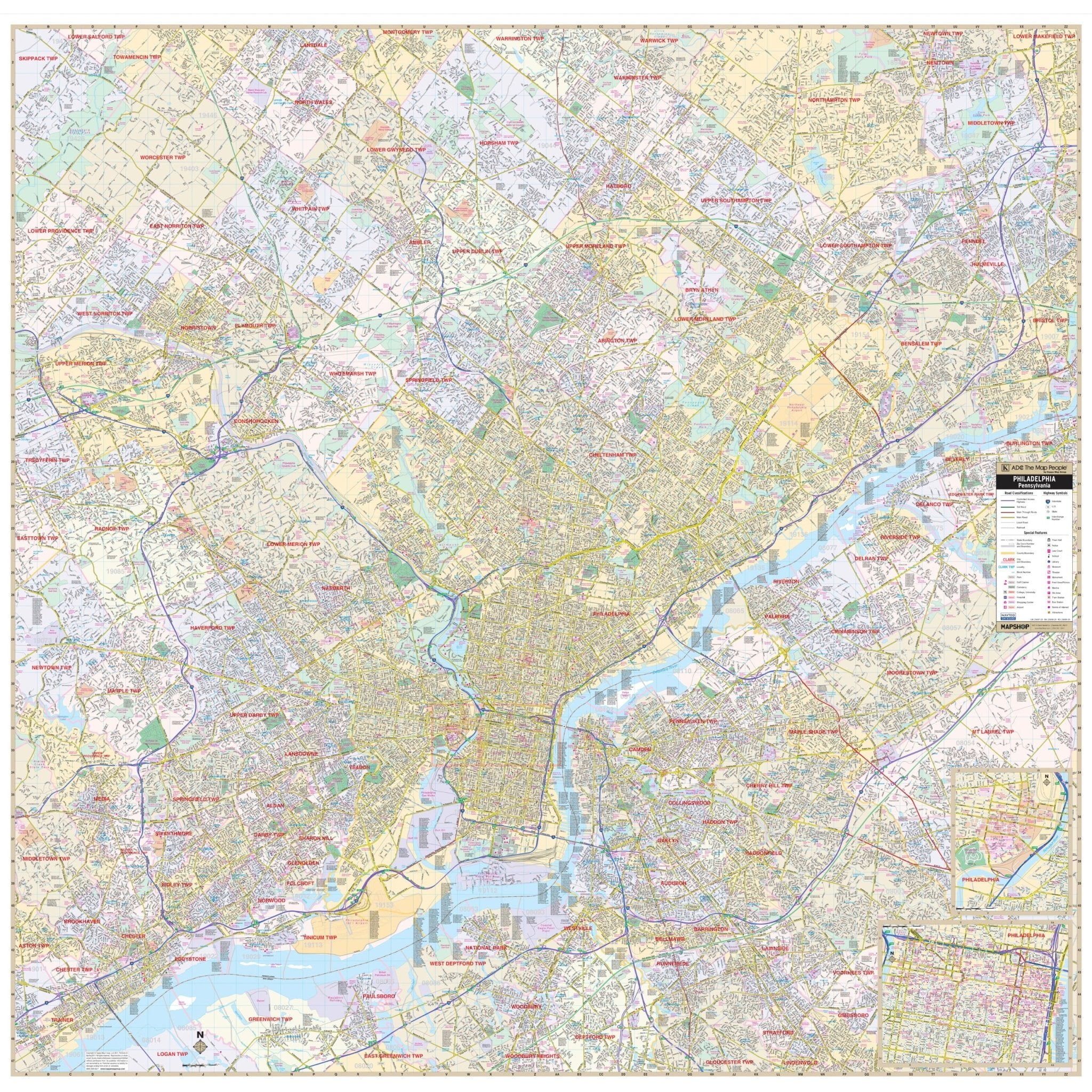
The Philadelphia, PA Metro Wall Map, with adjacent areas, covers all of Metro Philadelphia, with the following boundaries:
- North: Horsham Township, in Montgomery County; and Newtown Borough, in Bucks County
- South: Paulsboro and Stratford, New Jersey
- East: Middleton Township
- West: Upper Merion, in Montgomery County; and Upper Providence, in Delaware County
Details include all streets, airports, government buildings, post offices, cemeteries, fire & police stations, hospitals, shopping centers, educational institutions, railroads, water features, golf & country clubs, mileage circles, recreational parks, ZIP codes/boundaries, and block numbers.
Size: 58" x 57"
Published: 2011
Original: $139.99
-70%$139.99
$42.00Product Information
Product Information
Shipping & Returns
Shipping & Returns
Description
The Philadelphia, PA Metro Wall Map, with adjacent areas, covers all of Metro Philadelphia, with the following boundaries:
- North: Horsham Township, in Montgomery County; and Newtown Borough, in Bucks County
- South: Paulsboro and Stratford, New Jersey
- East: Middleton Township
- West: Upper Merion, in Montgomery County; and Upper Providence, in Delaware County
Details include all streets, airports, government buildings, post offices, cemeteries, fire & police stations, hospitals, shopping centers, educational institutions, railroads, water features, golf & country clubs, mileage circles, recreational parks, ZIP codes/boundaries, and block numbers.
Size: 58" x 57"
Published: 2011