Arkansas State Wall Map
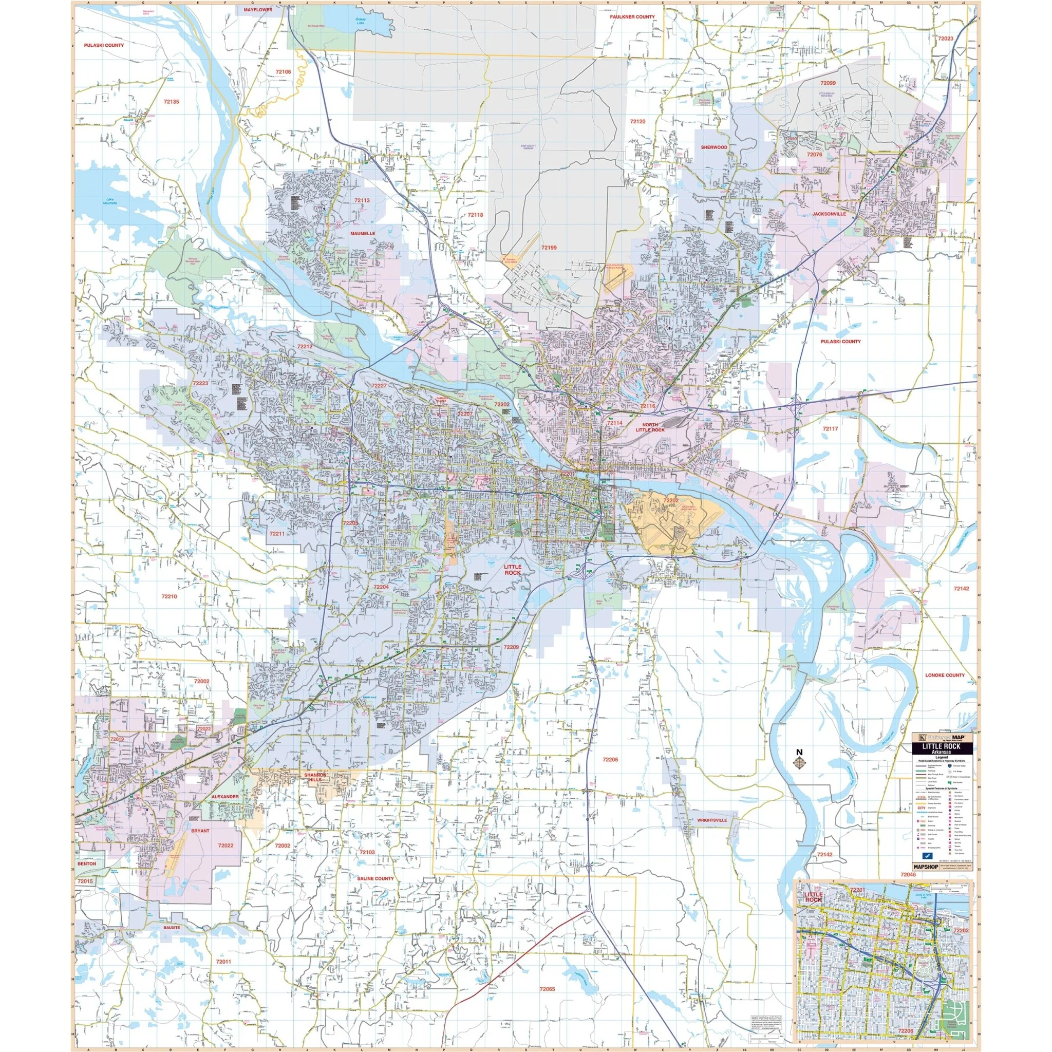
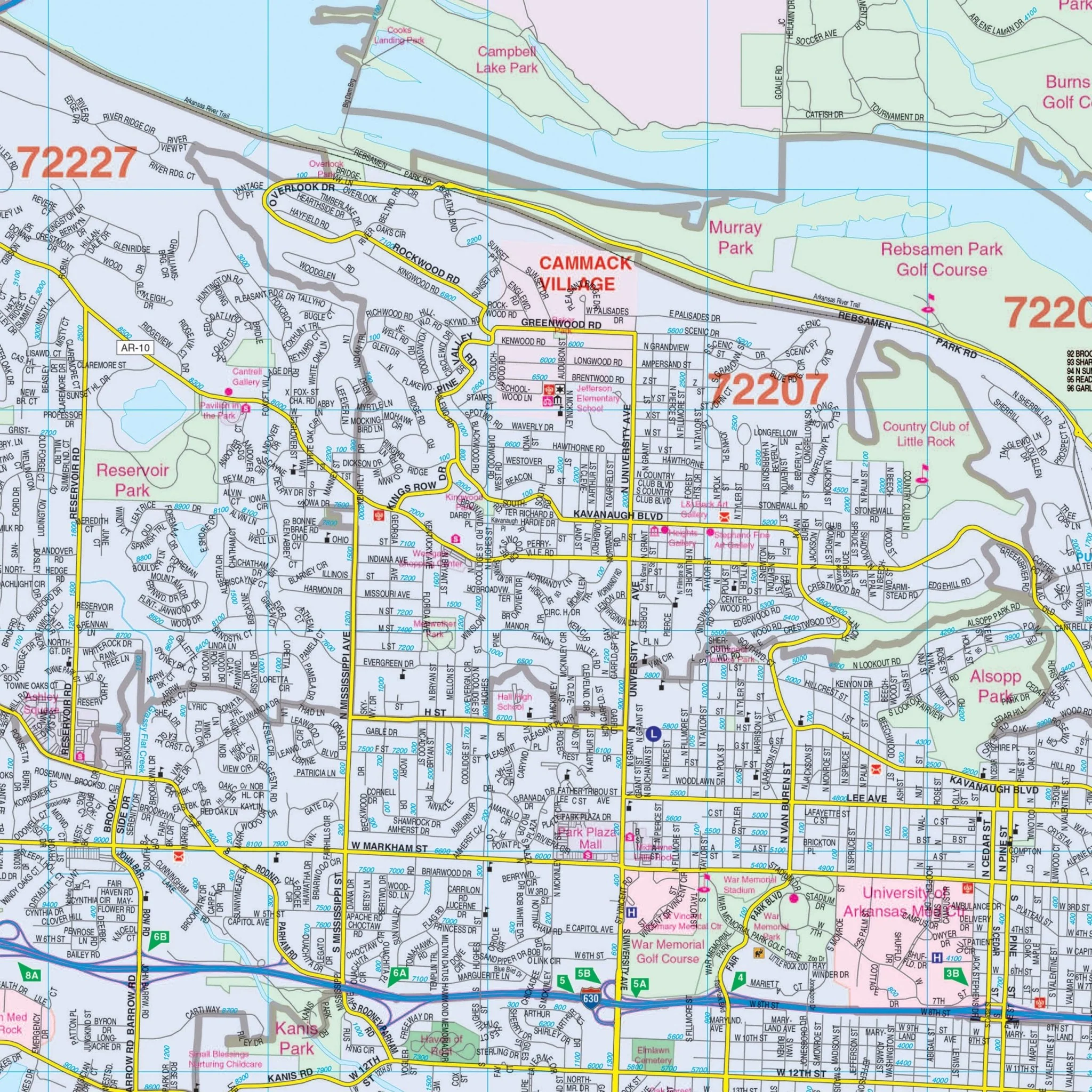
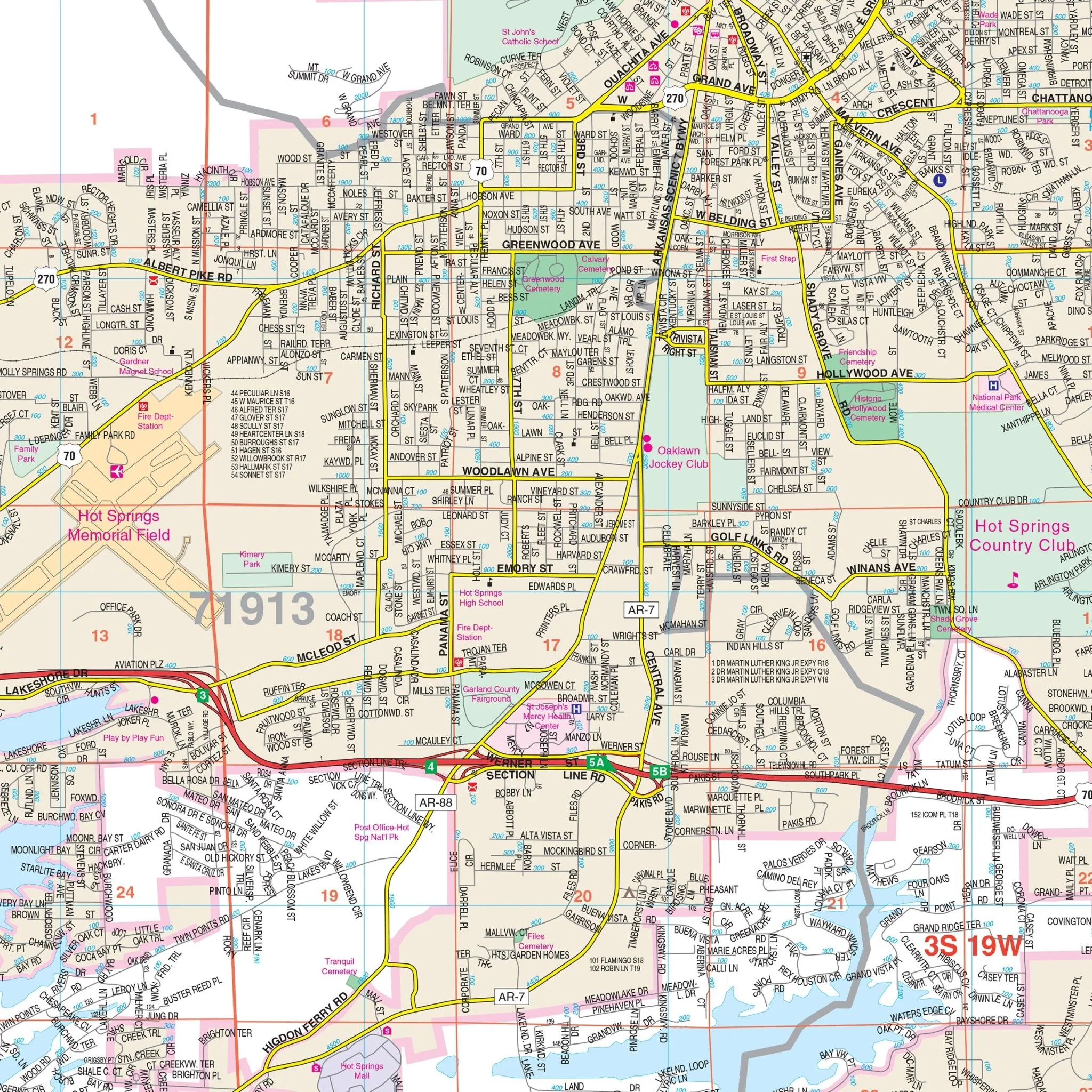
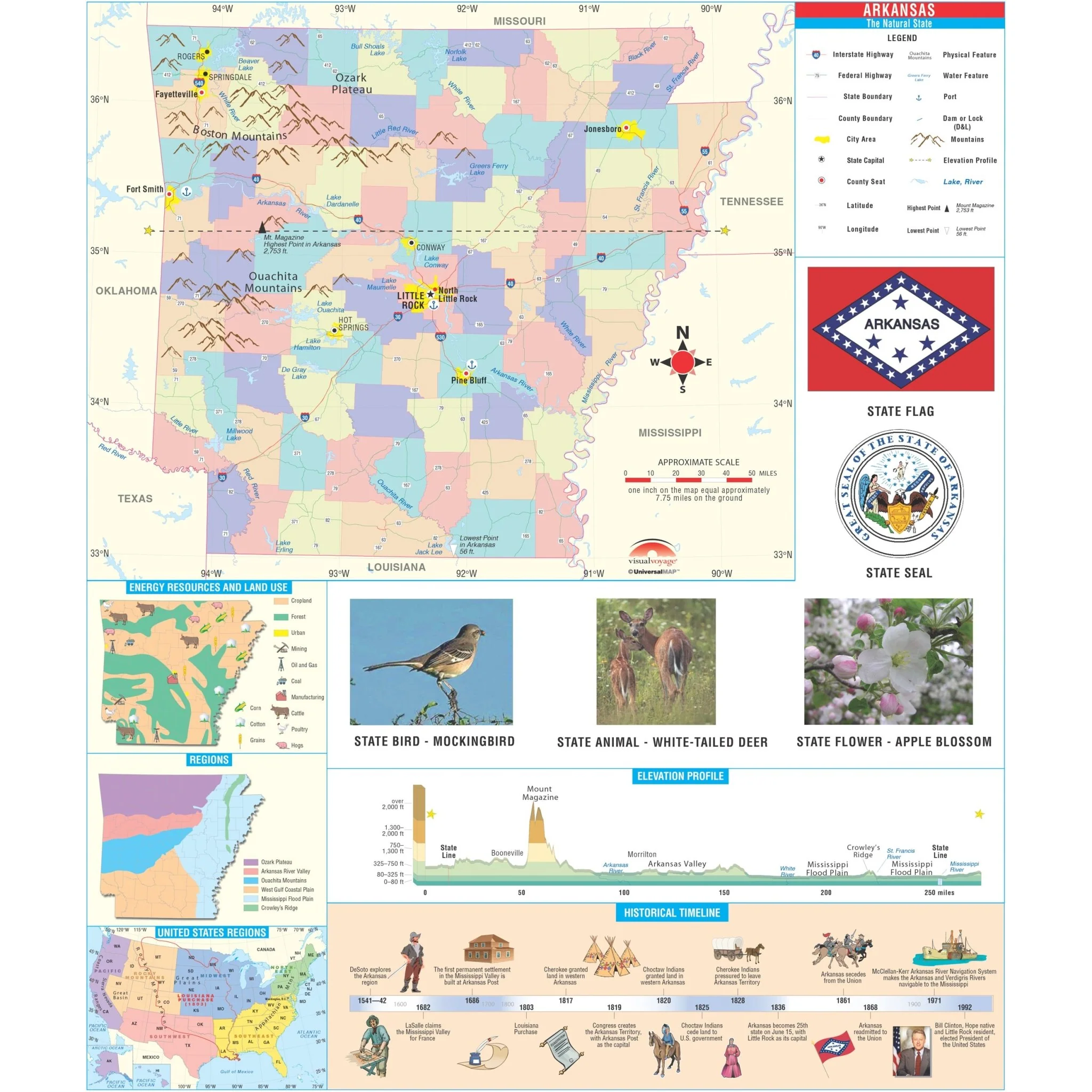
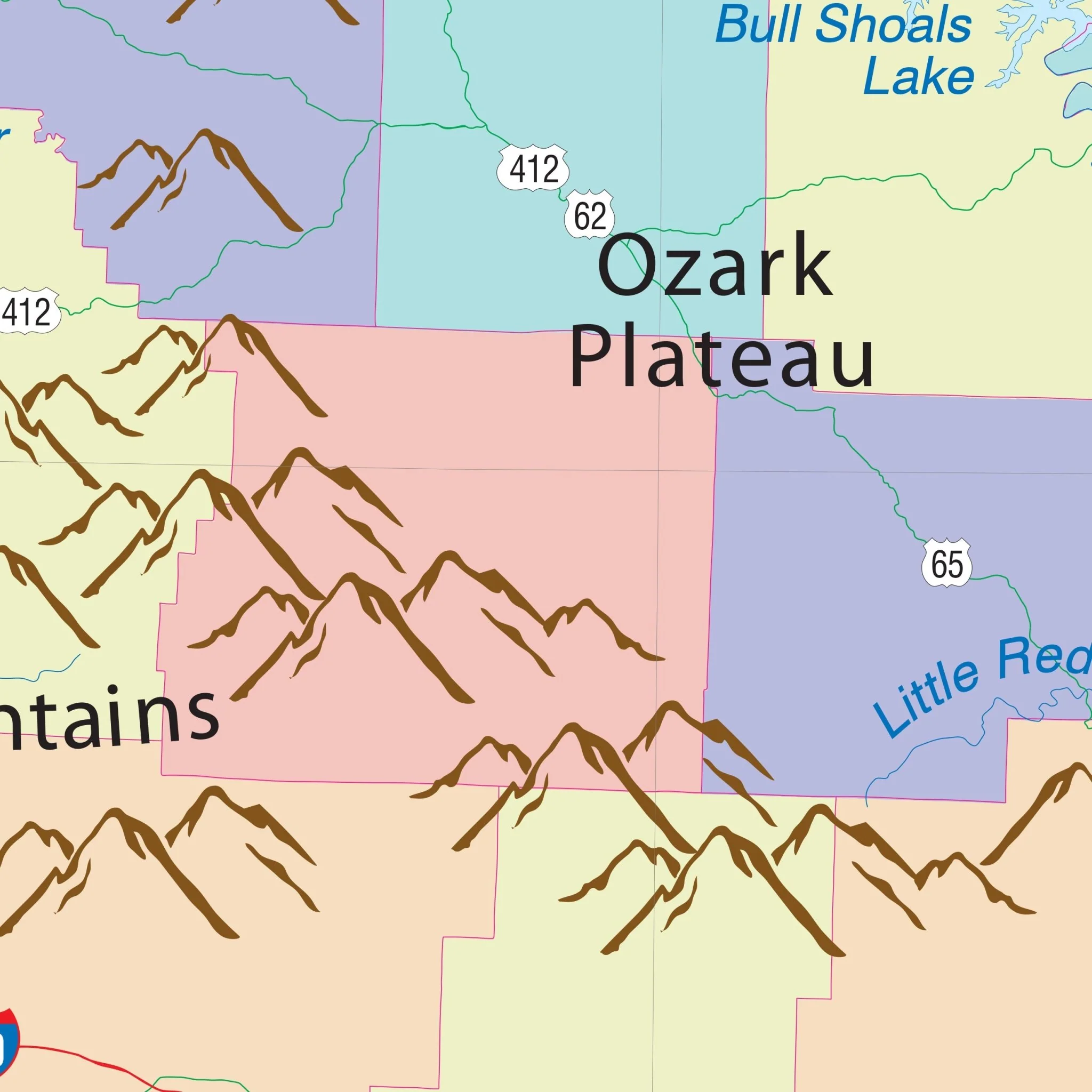
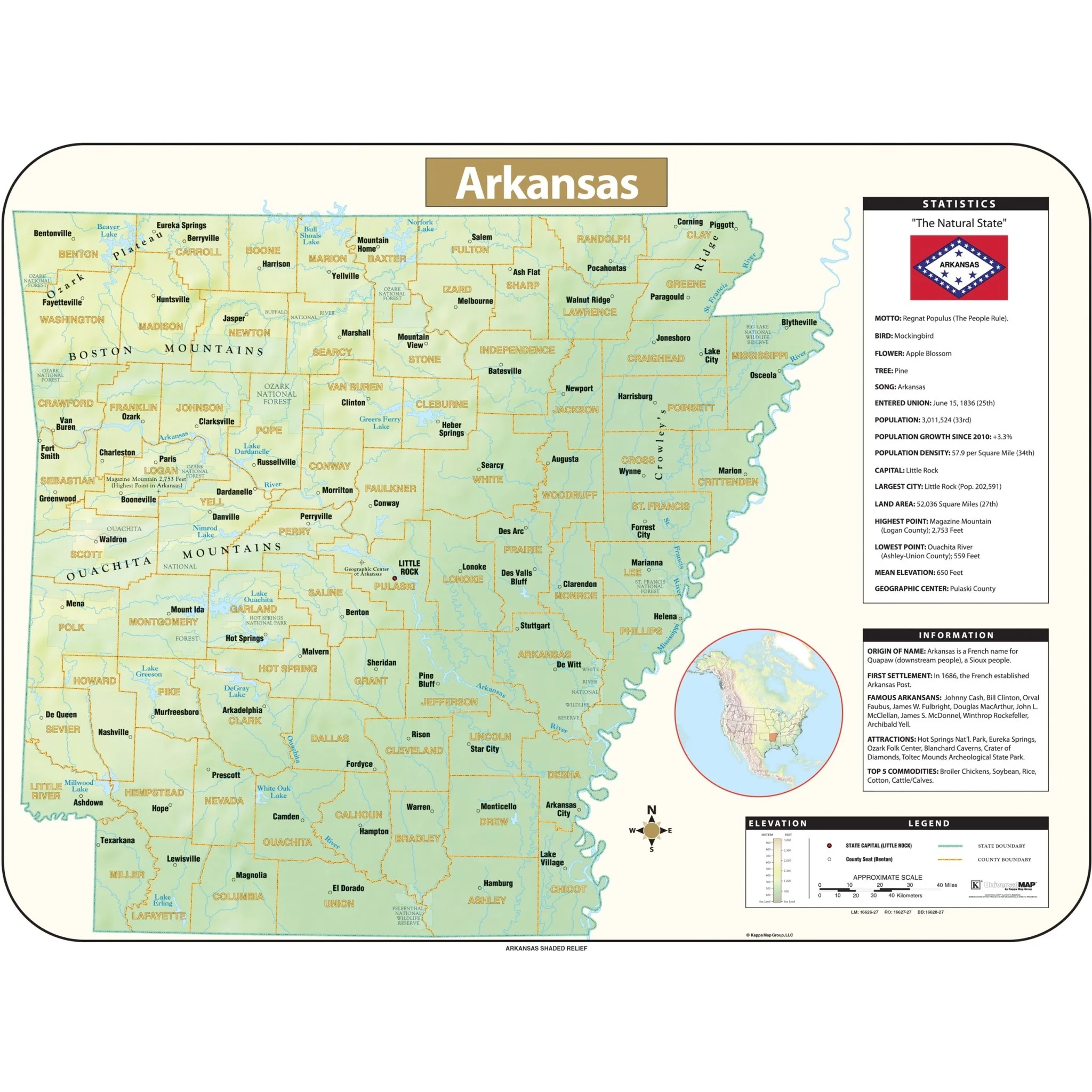
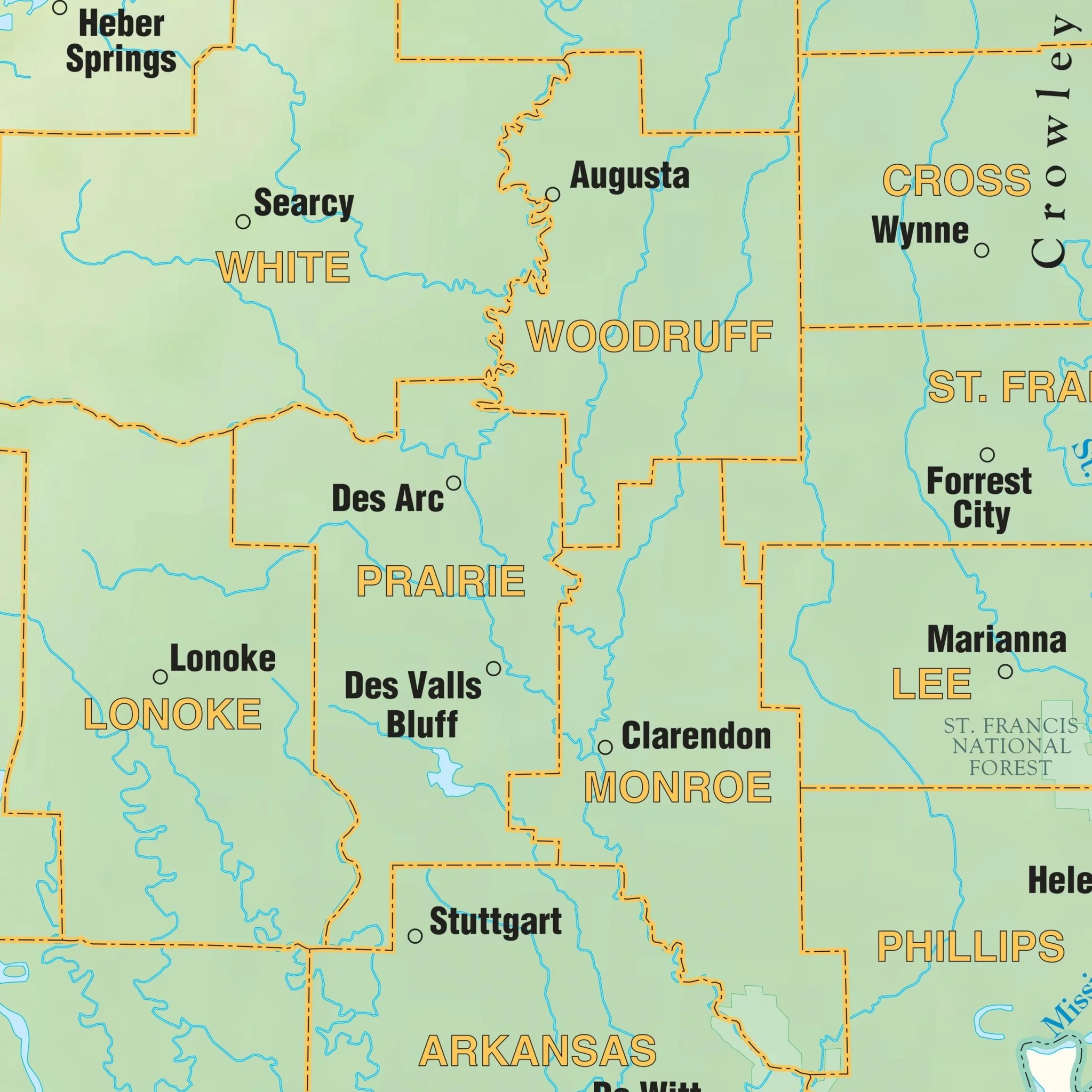
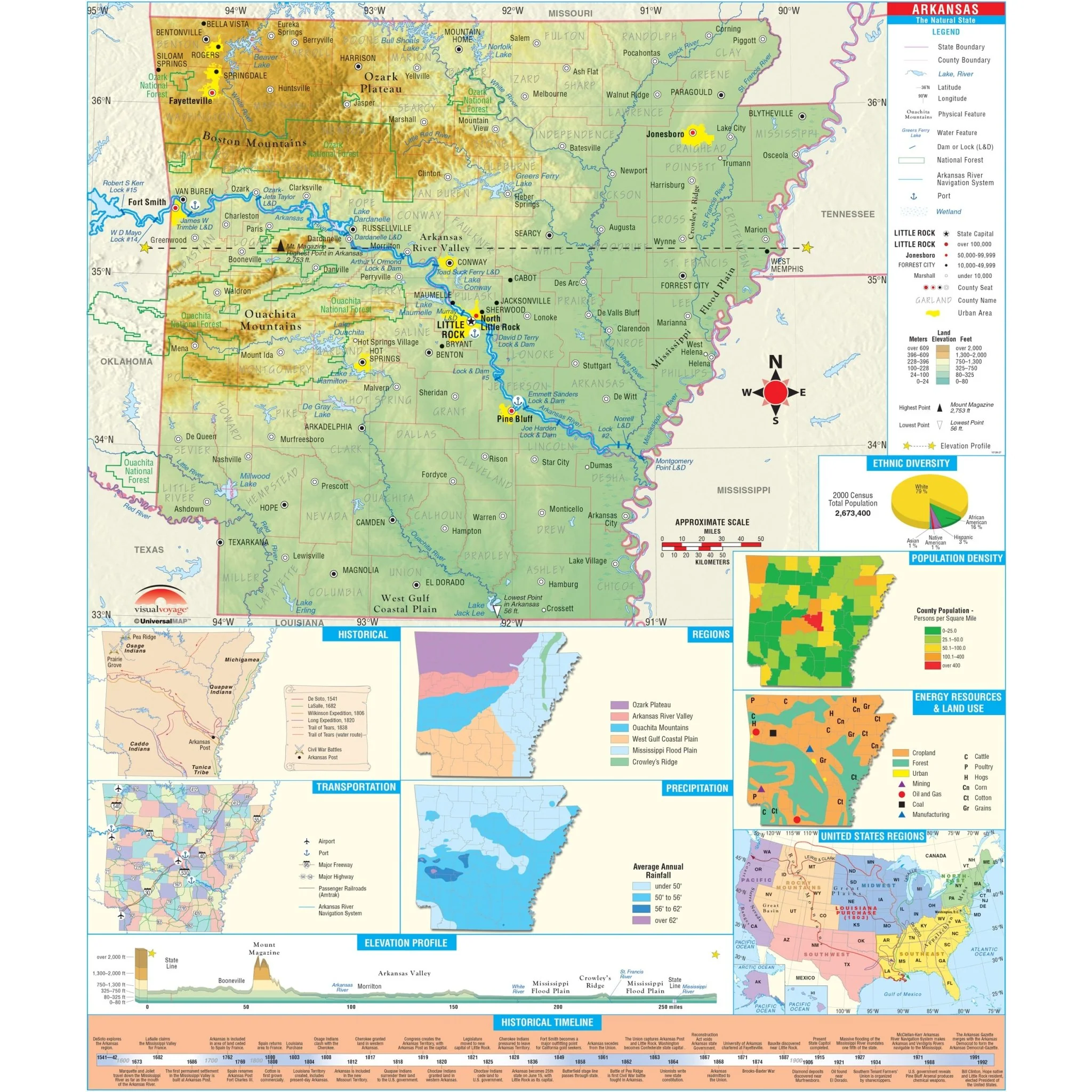
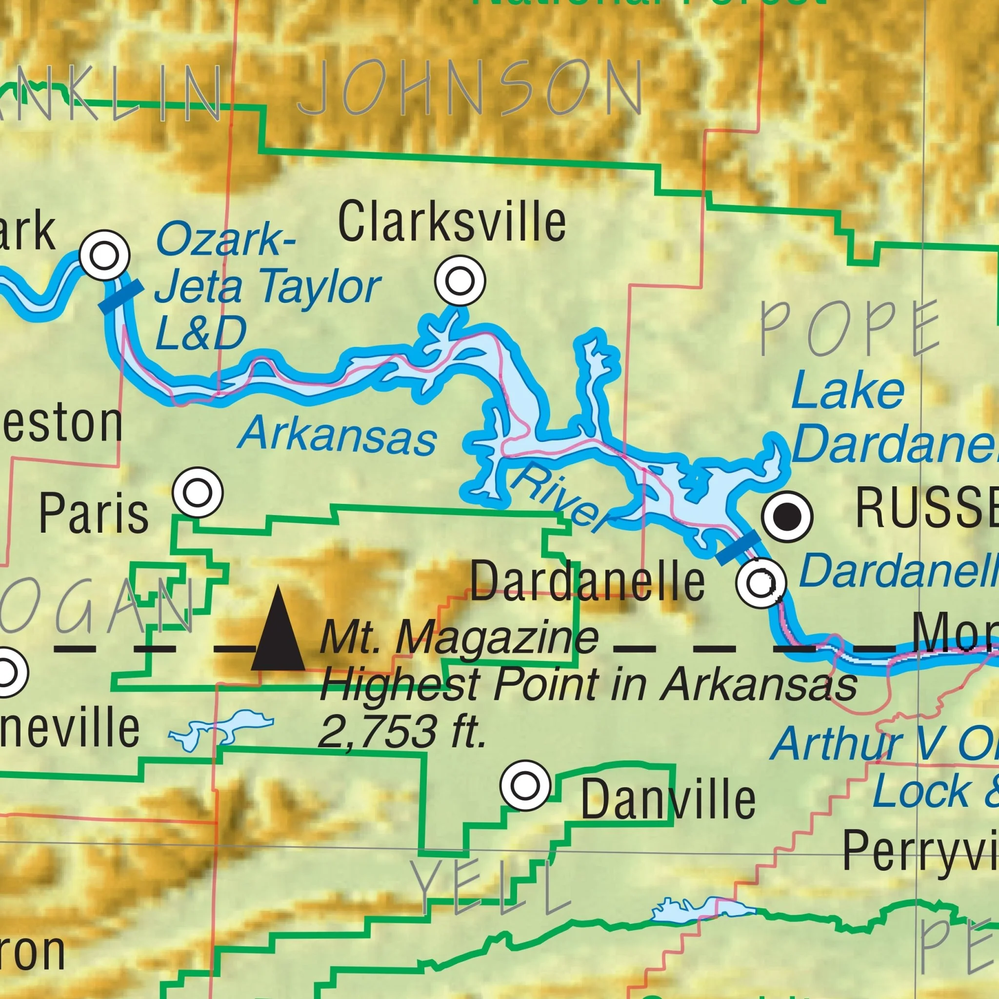
The Arkansas State Wall Map by Kappa Map Group is a comprehensive resource detailed with color-coded counties, city insets, and a mileage chart. It includes highways, waterways, educational and military facilities, airports, hospitals, parks, attractions, urban centers, wildlife regions, and rest stops, annotated for easy reference.
Size: 74" x 52"
Published: 2000
Original: $149.99
-70%$149.99
$45.00Product Information
Product Information
Shipping & Returns
Shipping & Returns
Description
The Arkansas State Wall Map by Kappa Map Group is a comprehensive resource detailed with color-coded counties, city insets, and a mileage chart. It includes highways, waterways, educational and military facilities, airports, hospitals, parks, attractions, urban centers, wildlife regions, and rest stops, annotated for easy reference.
Size: 74" x 52"
Published: 2000