


Florence & Muscle Shoals, AL Wall Map
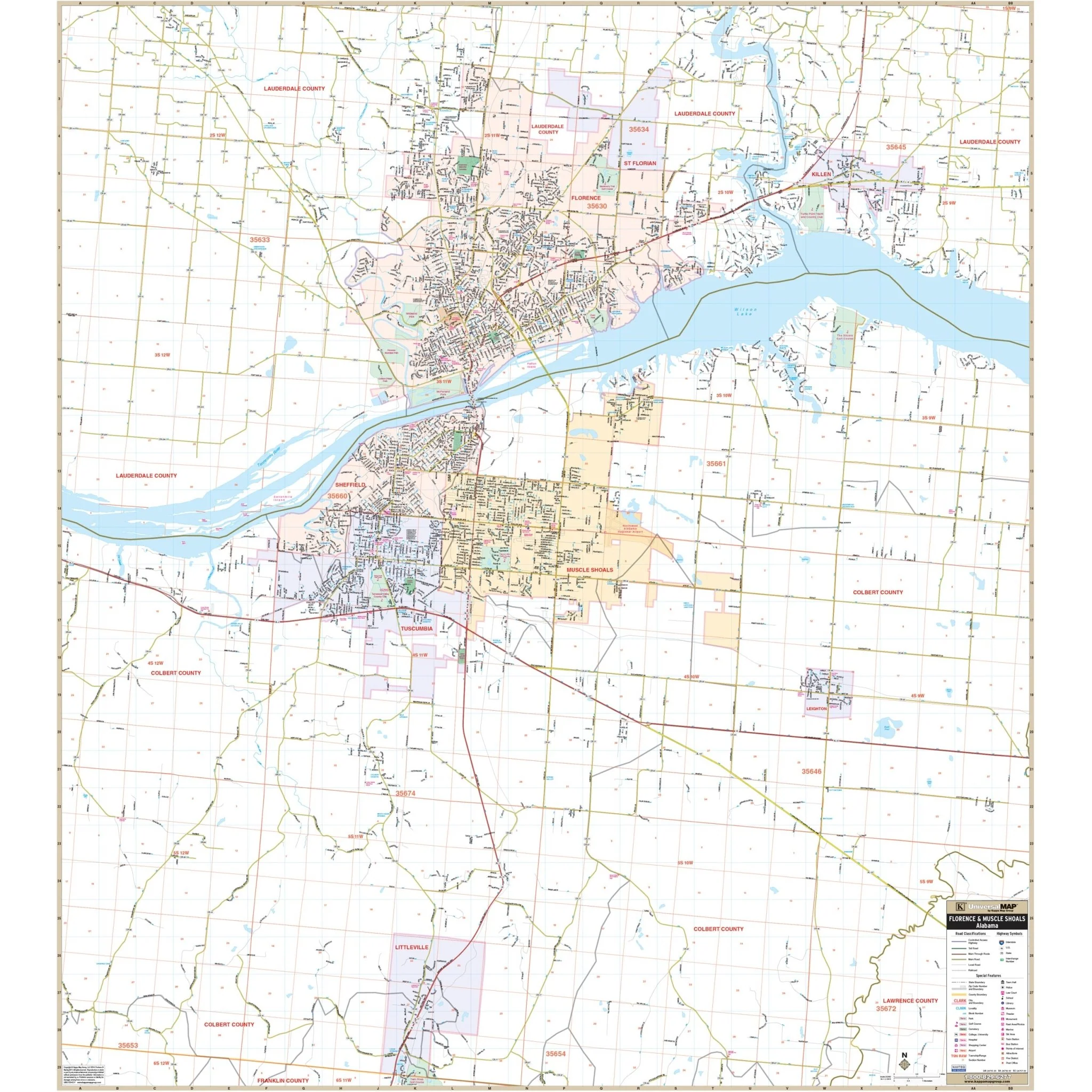
- To the North, it spans 2 miles beyond the Florence city limits. - To the South, it includes the region up to the Colbert/Franklin County line and the Town of Littleville. - In the East, it stretches to Pinedale Acres in Lauderdale County and the junction of CR-22 with AL-20 in Colbert County. - To the West, it reaches Smallwood Mountain Rd in Colbert County and slightly west of CR-81 in Lauderdale County.
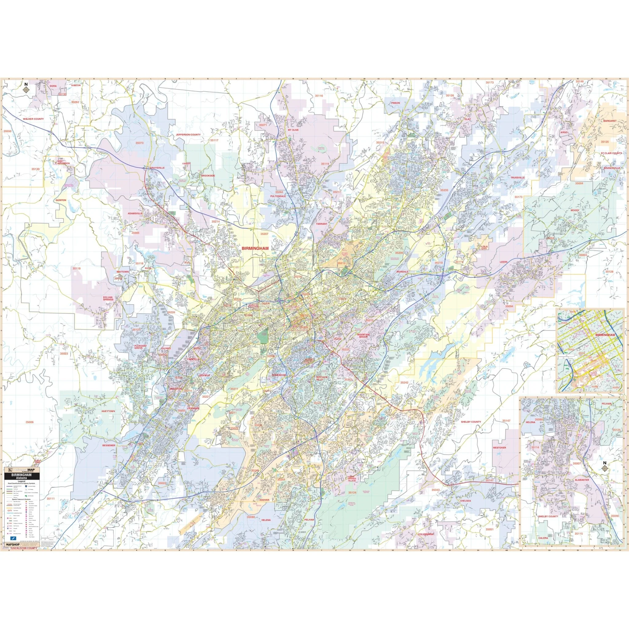
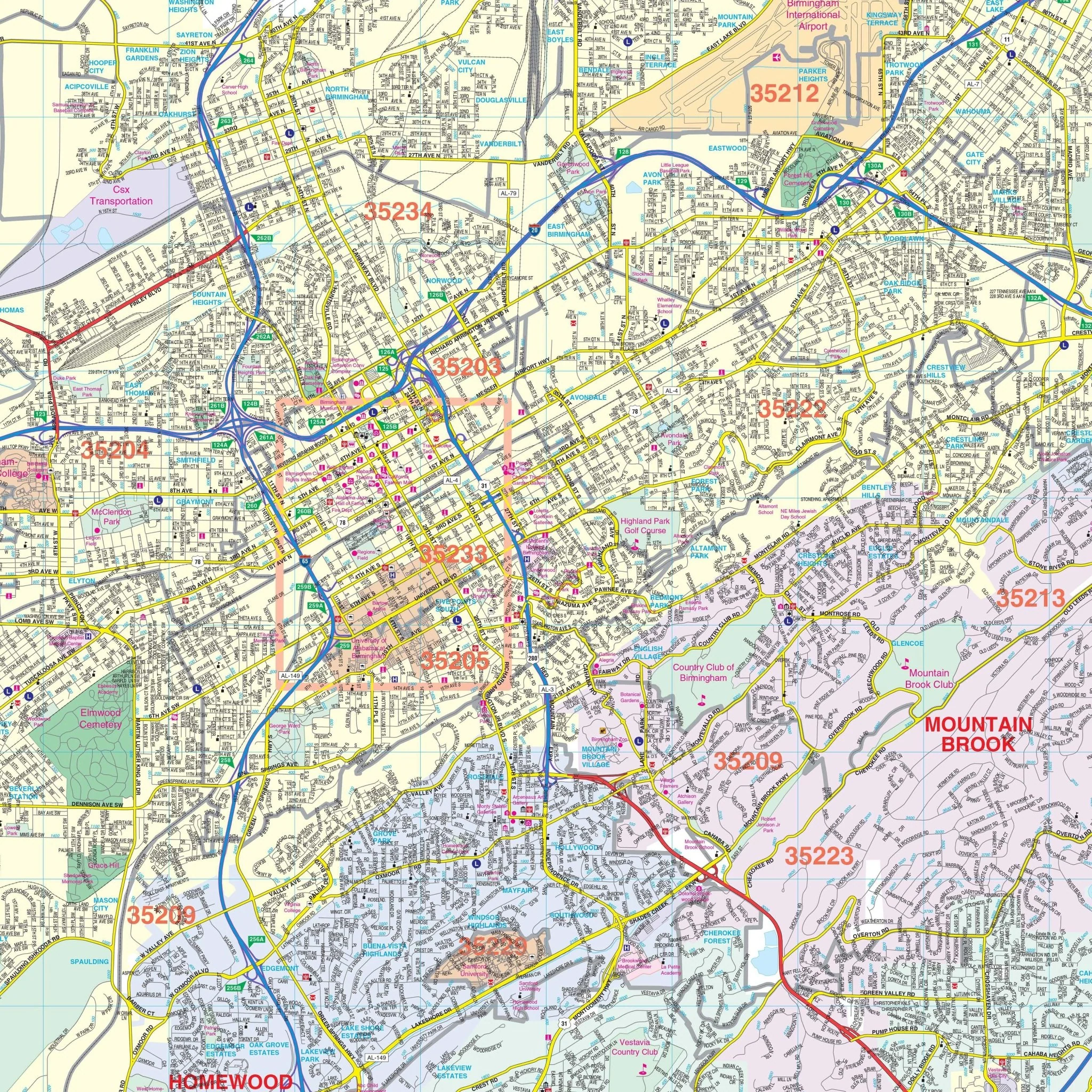
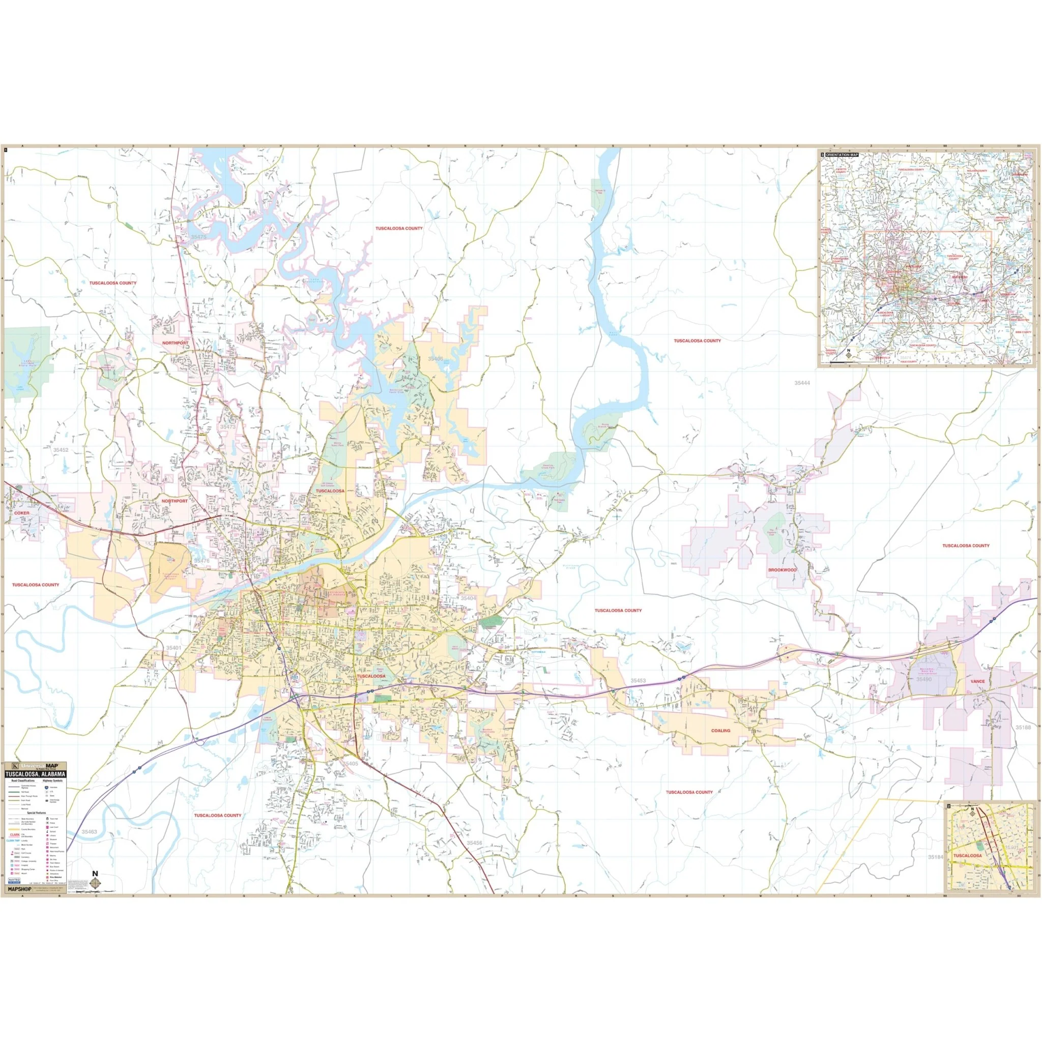
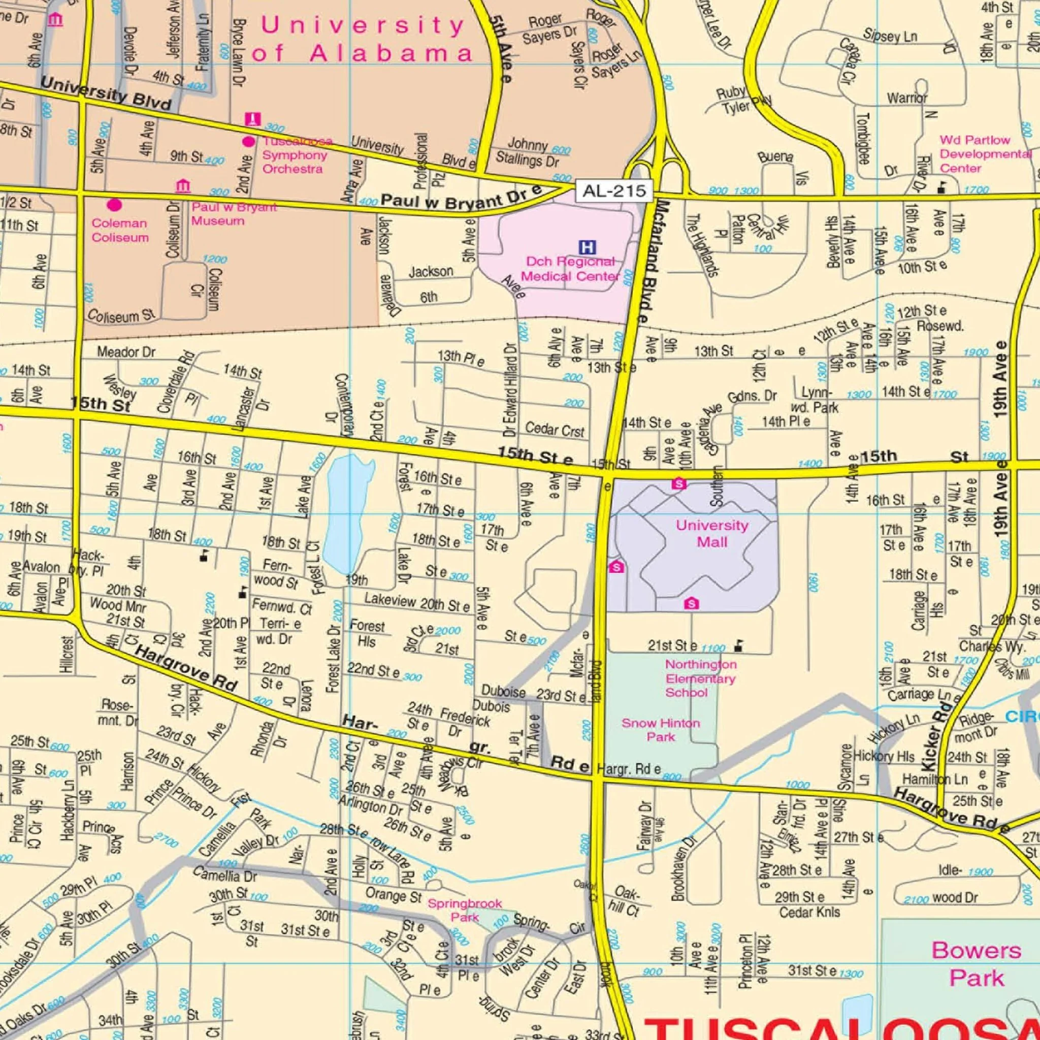
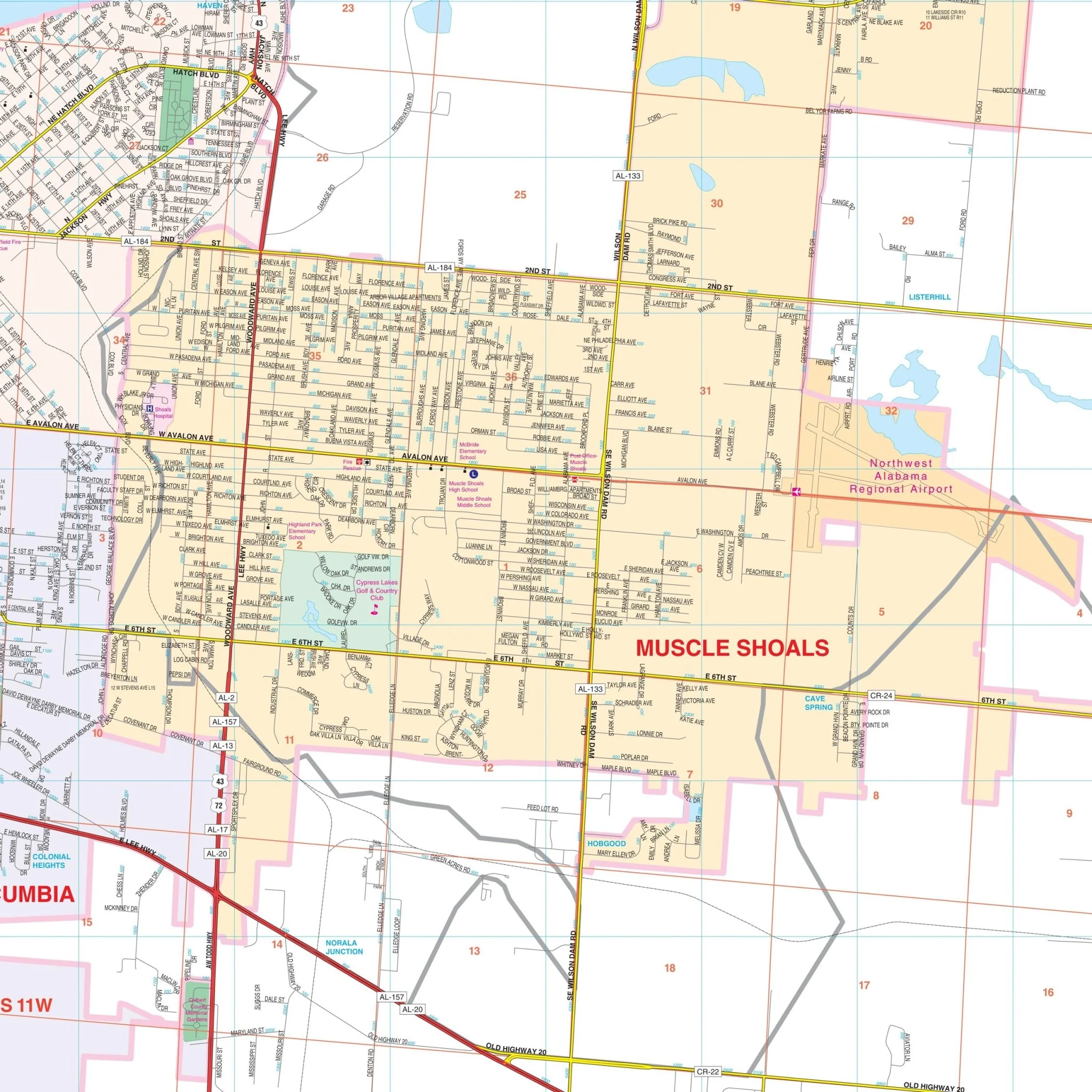
This map provides a wealth of details and features, including but not limited to airports, all streets and highways, government buildings, cemeteries, zip codes and their boundaries, fire and police stations, hospitals, water features, educational institutions, railroads, recreational parks, golf and country clubs, post offices, points of interest, city limits and annexations, block numbers, libraries, as well as section/township/range lines and numbers.
Size: 52.5" x 58.5"
Published: 2011
Product Information
Product Information
Shipping & Returns
Shipping & Returns
Description
- To the North, it spans 2 miles beyond the Florence city limits. - To the South, it includes the region up to the Colbert/Franklin County line and the Town of Littleville. - In the East, it stretches to Pinedale Acres in Lauderdale County and the junction of CR-22 with AL-20 in Colbert County. - To the West, it reaches Smallwood Mountain Rd in Colbert County and slightly west of CR-81 in Lauderdale County.
This map provides a wealth of details and features, including but not limited to airports, all streets and highways, government buildings, cemeteries, zip codes and their boundaries, fire and police stations, hospitals, water features, educational institutions, railroads, recreational parks, golf and country clubs, post offices, points of interest, city limits and annexations, block numbers, libraries, as well as section/township/range lines and numbers.
Size: 52.5" x 58.5"
Published: 2011