


North Carolina State Wall Map
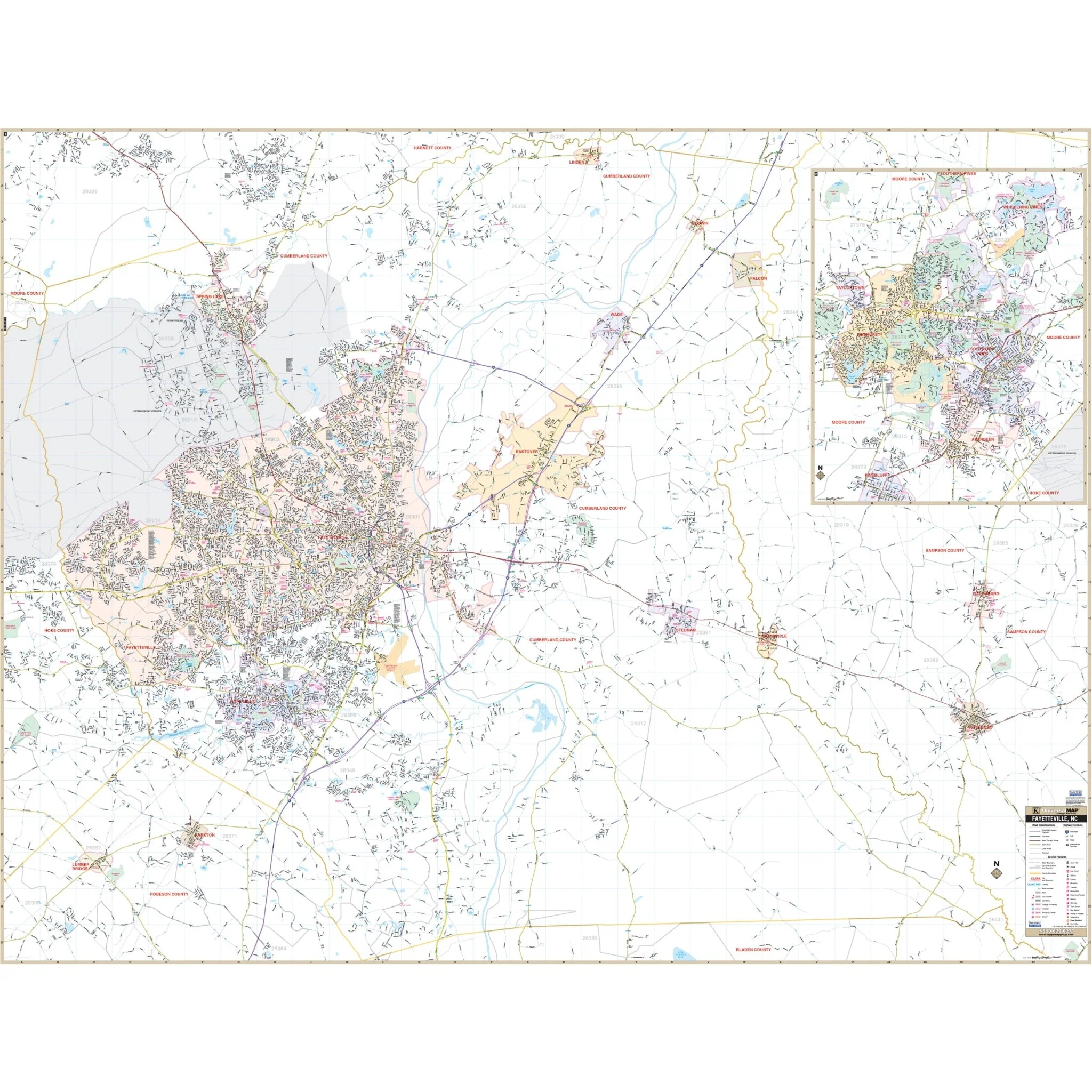
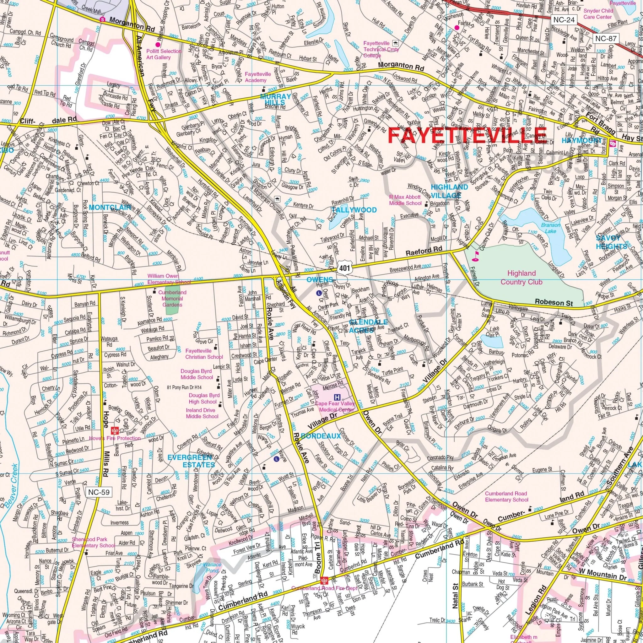
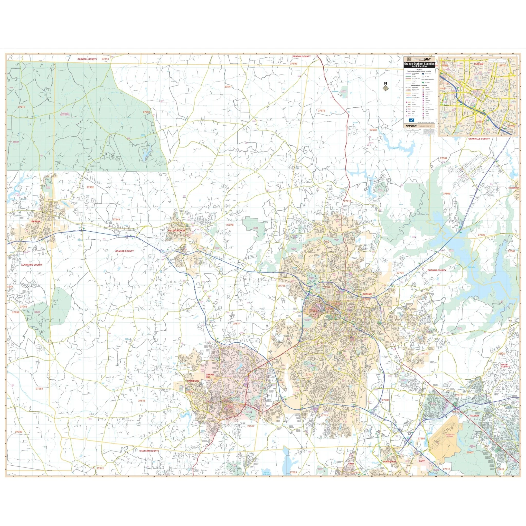
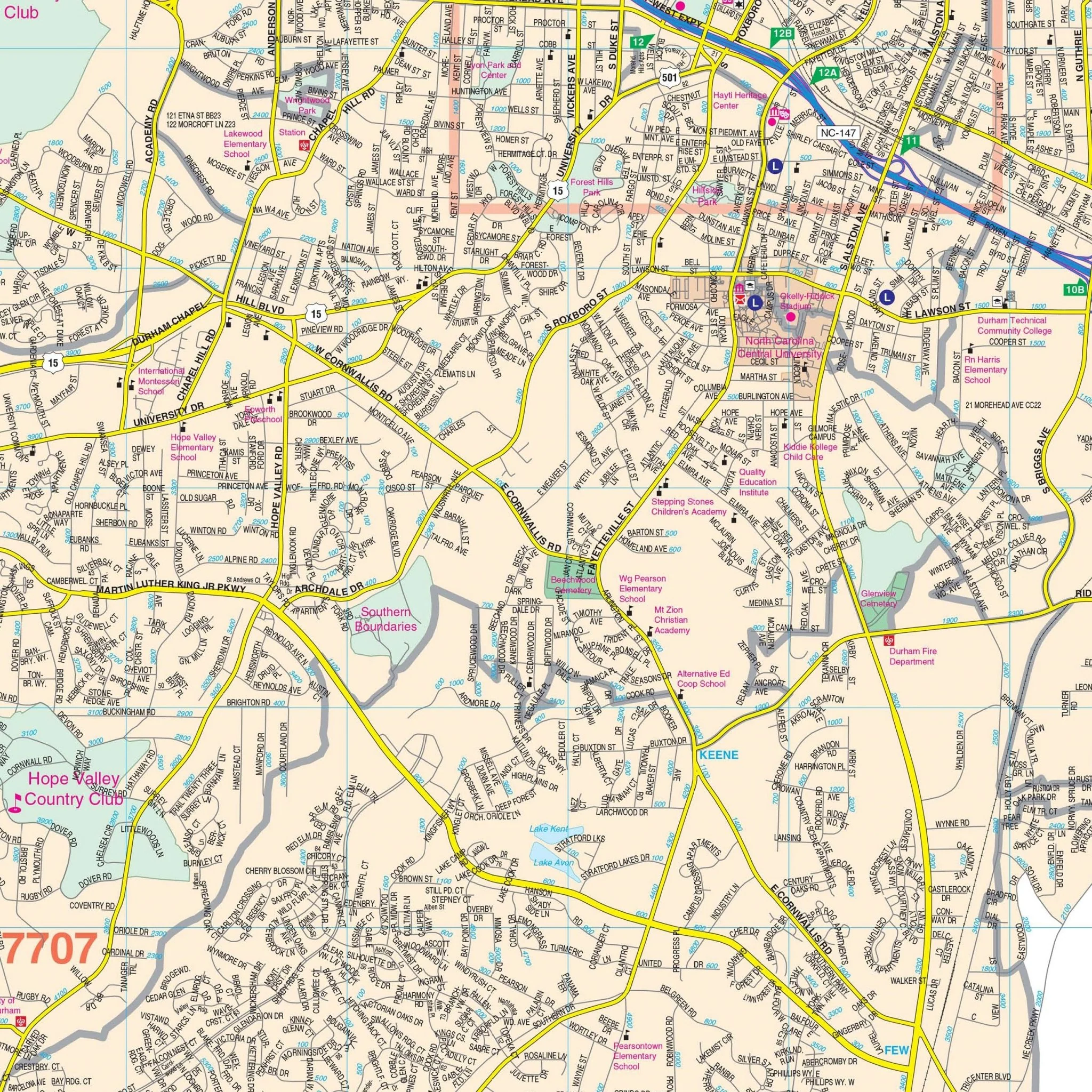
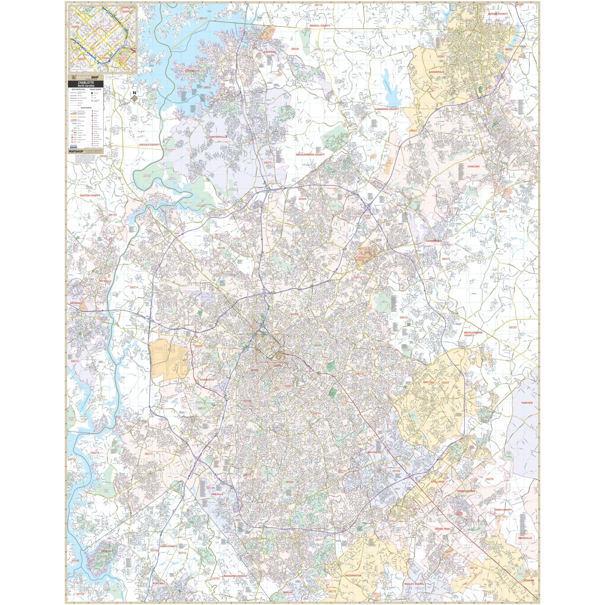
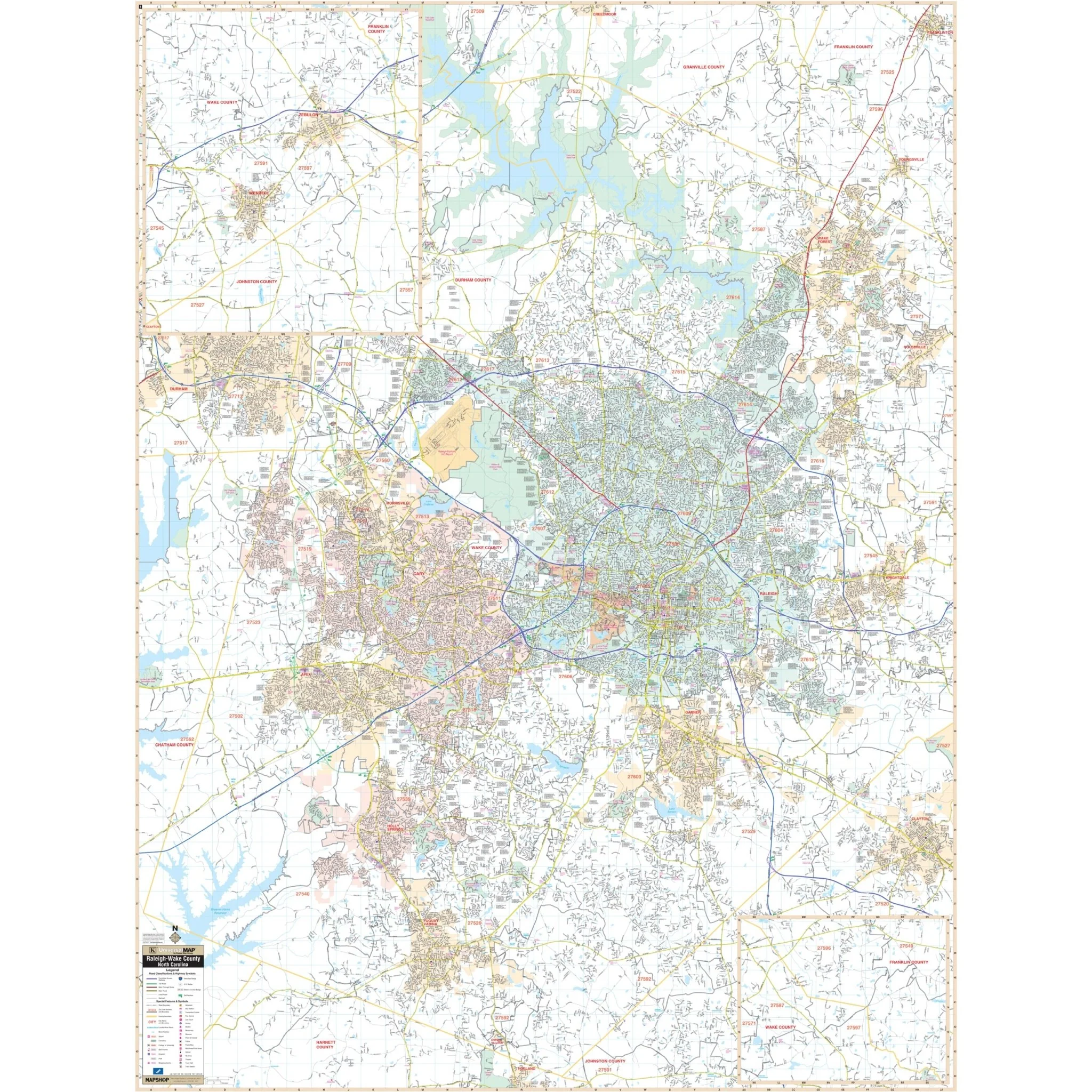
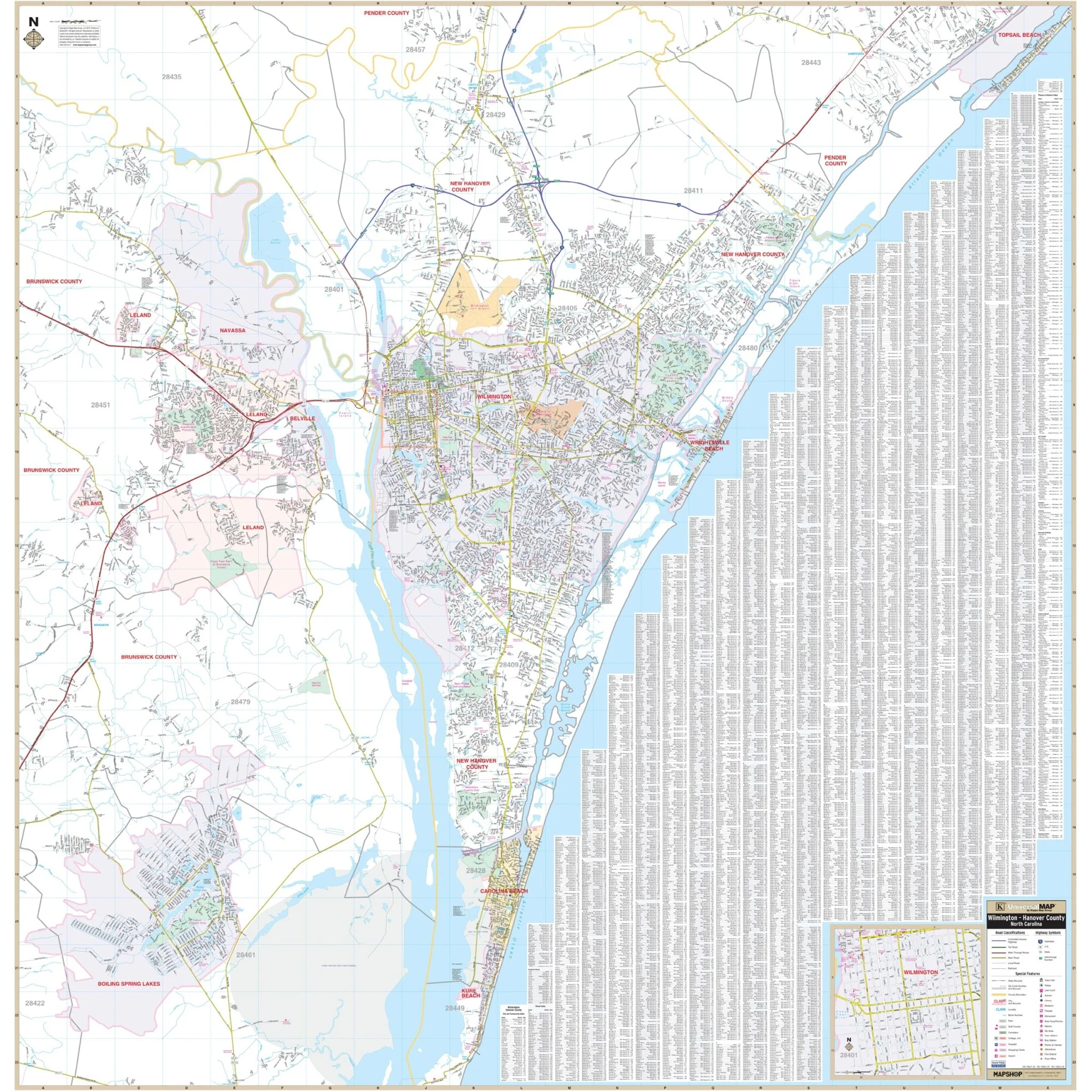
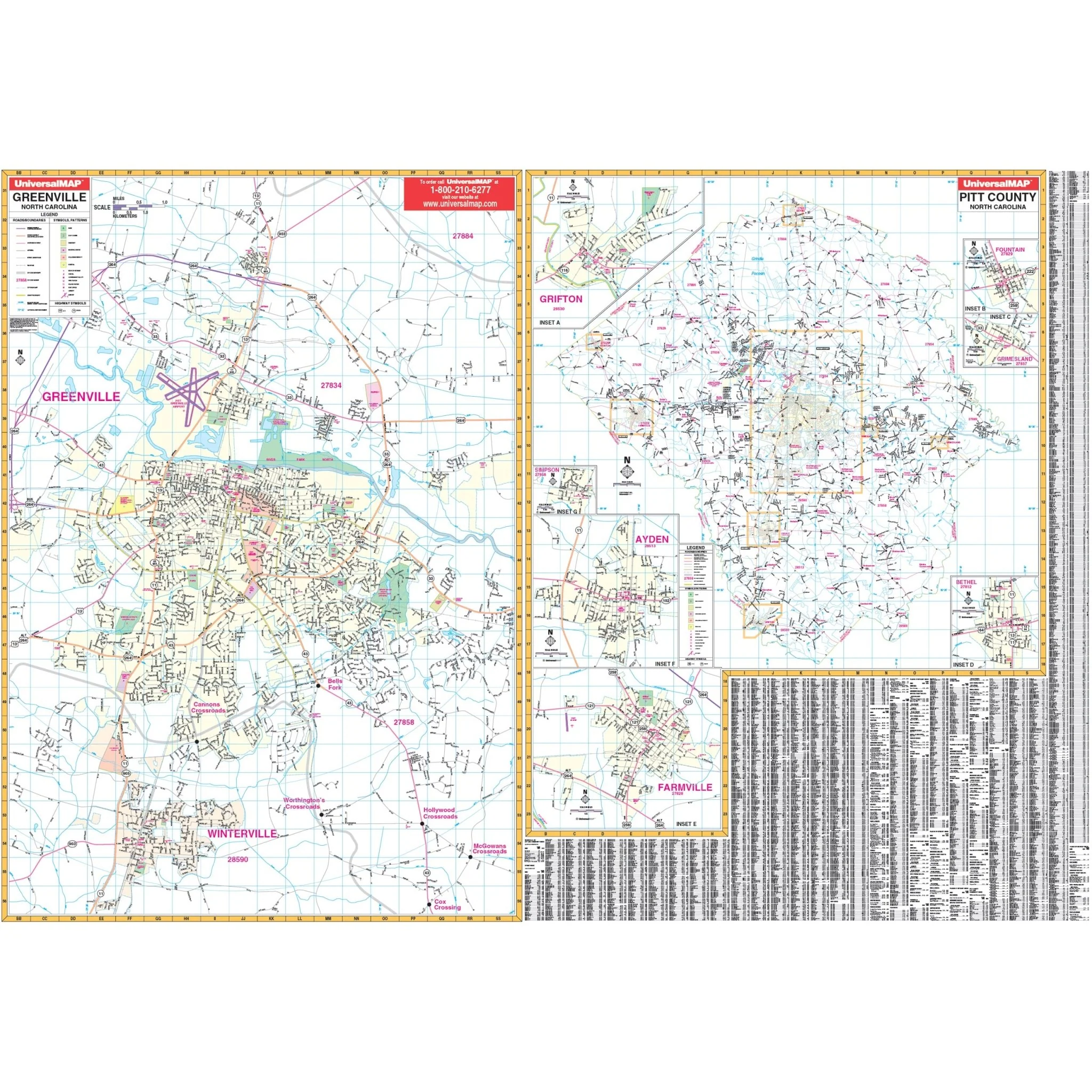
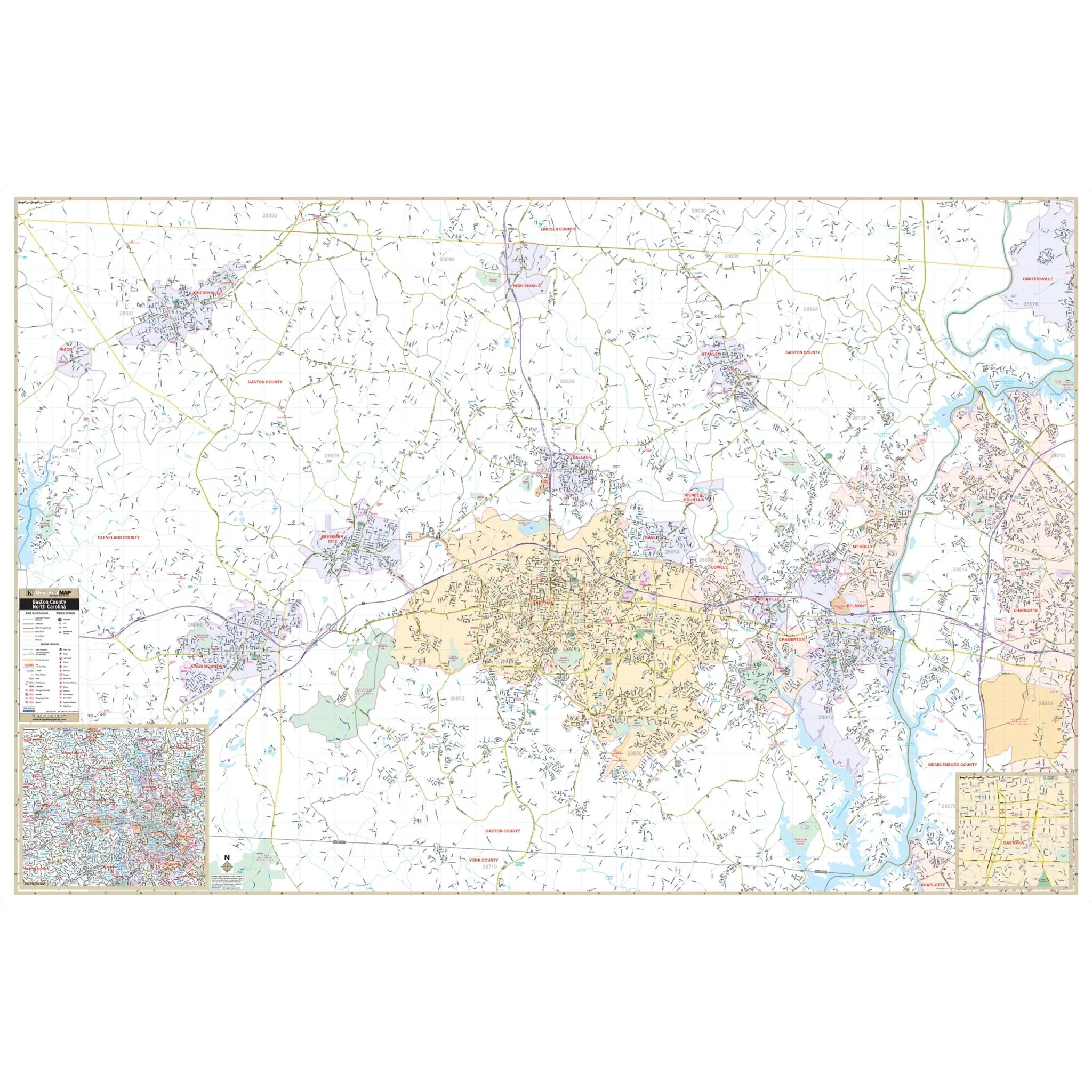
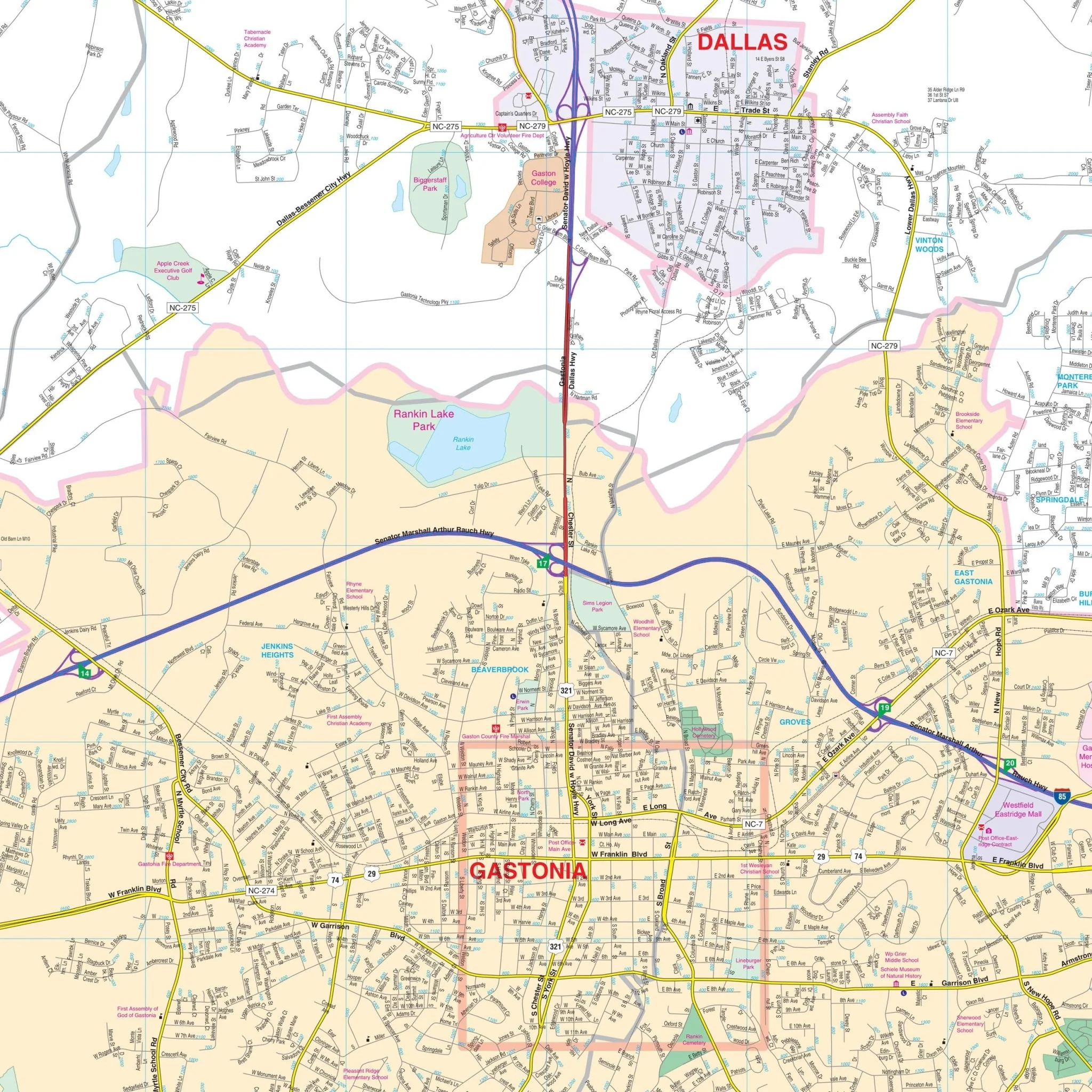
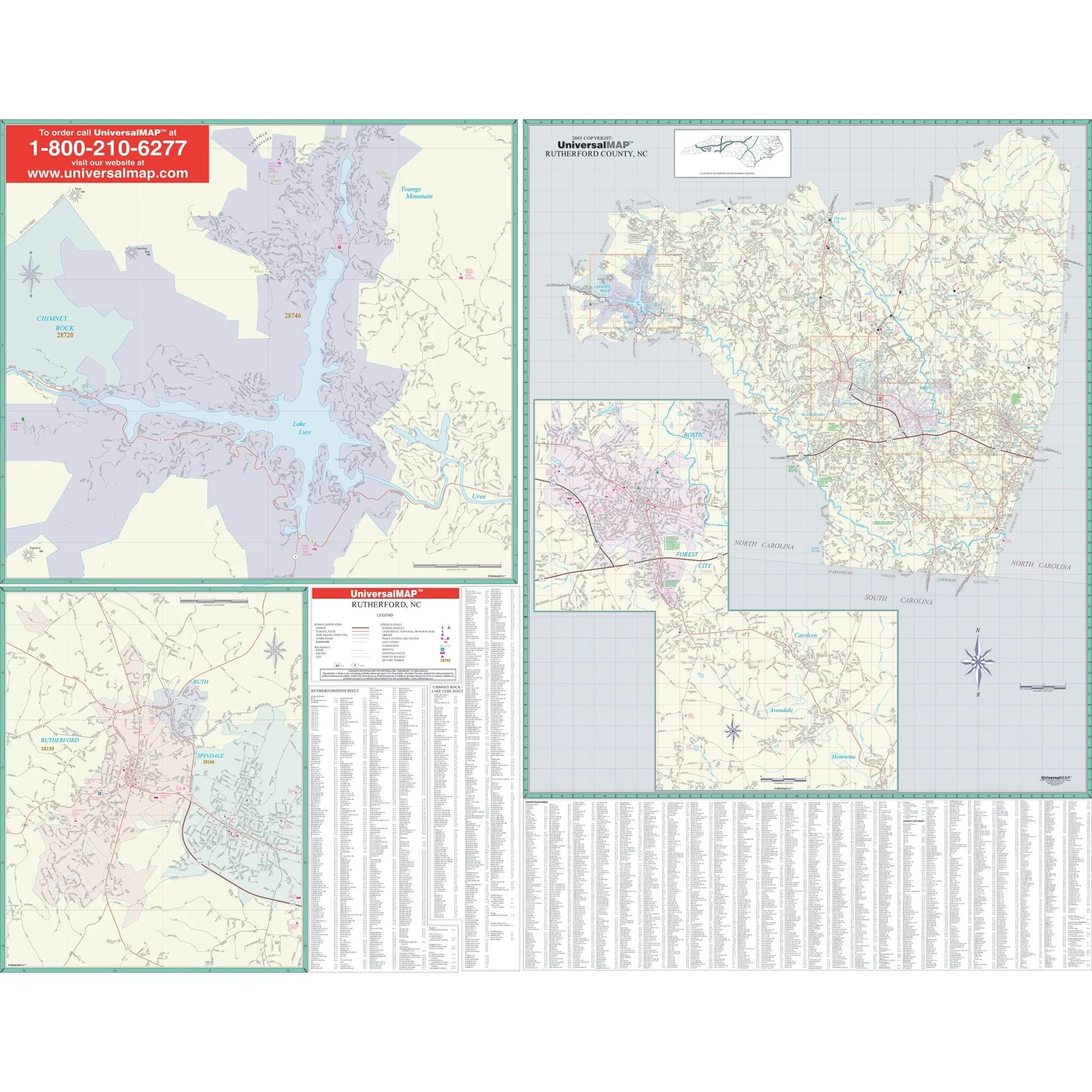
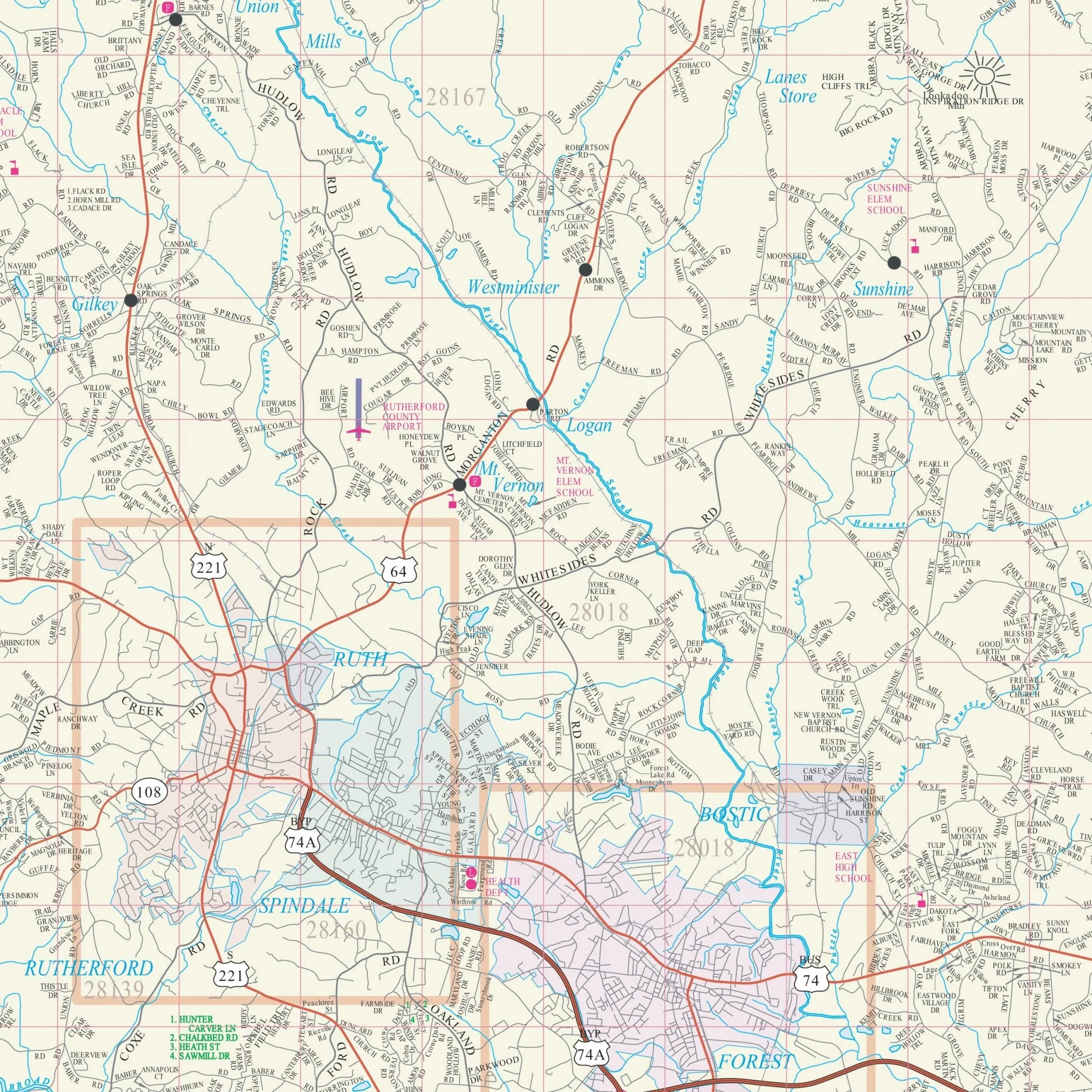
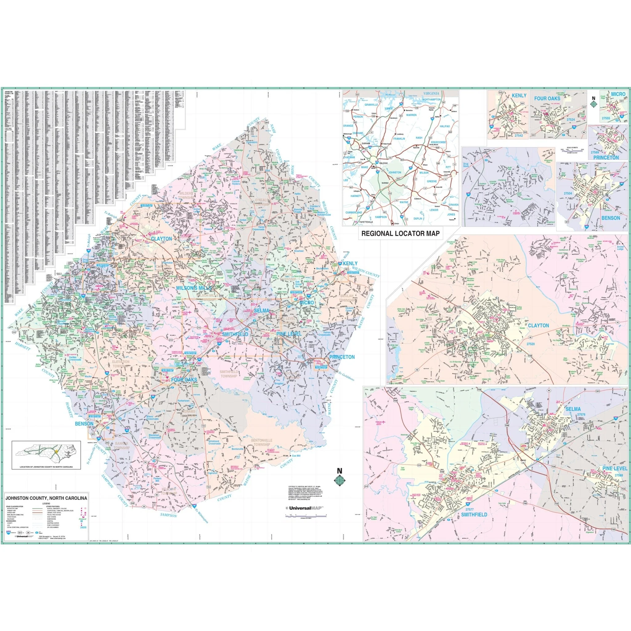
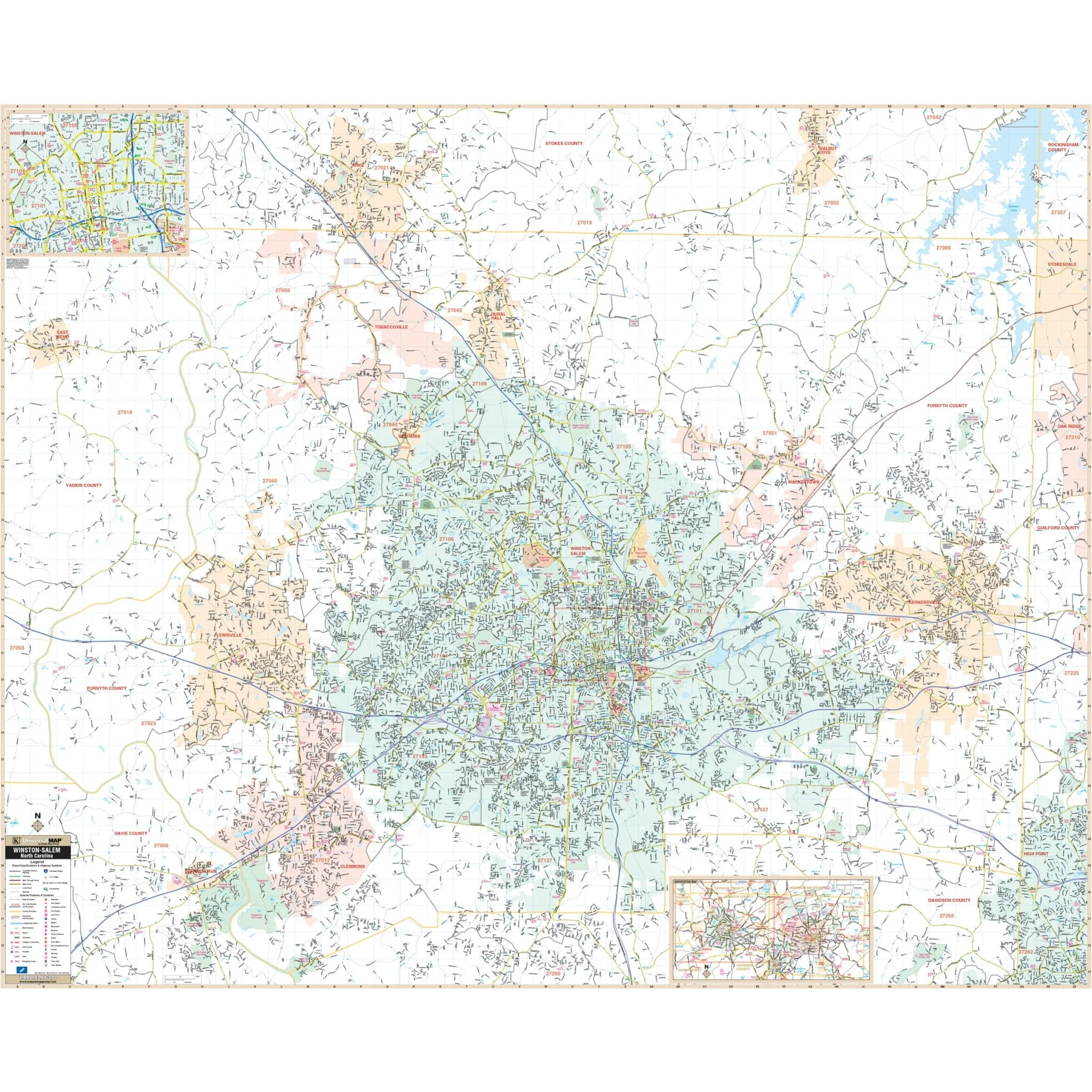
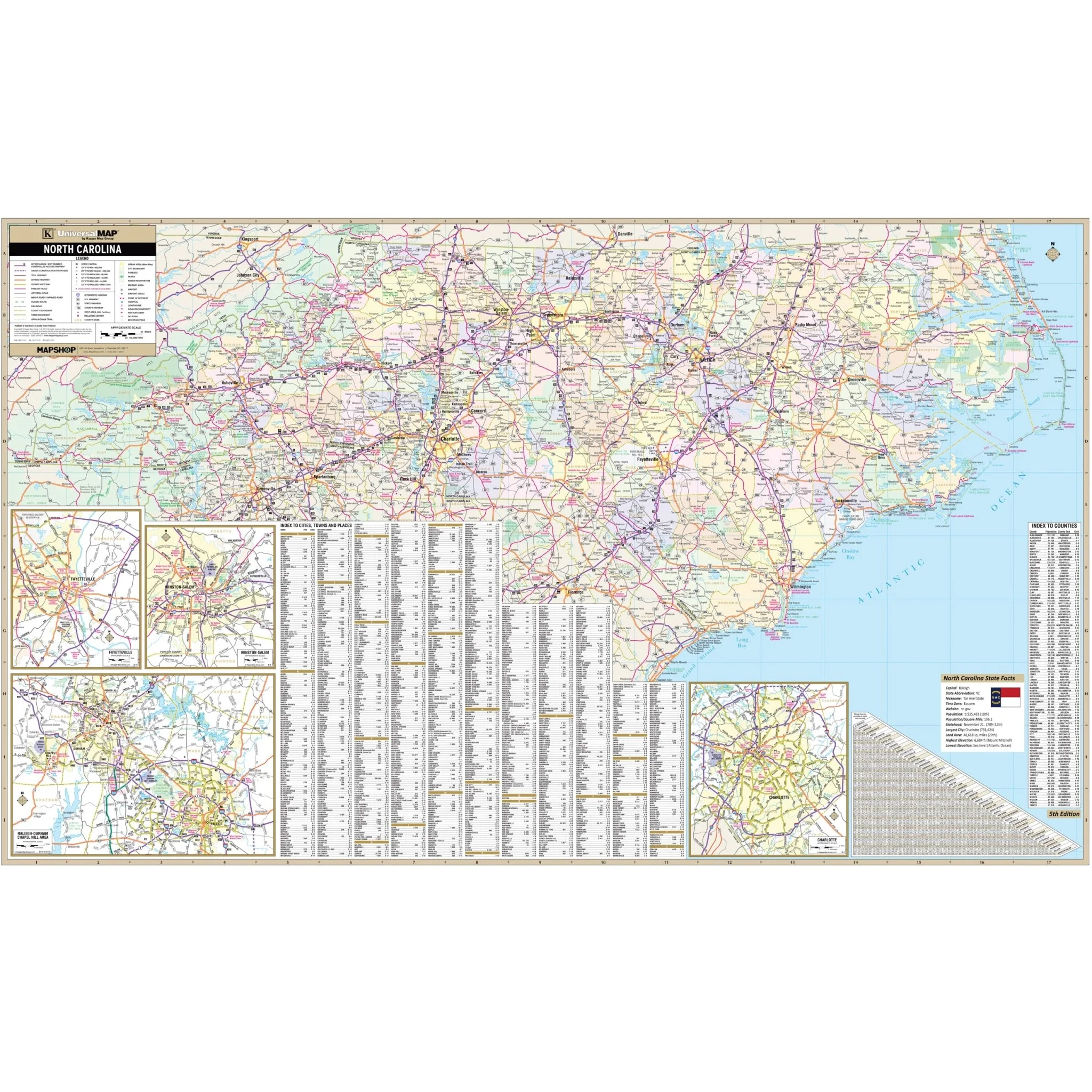
The North Carolina State Wall Map by Kappa Map Group is an expansive and detailed guide, providing cartography at a scale of 1" = 8 miles. This map indexes cities and counties, along with their populations, directly on its face for ease of reference. It features color-coded counties and a mileage chart for estimating distances between major cities. Additionally, the map includes a state facts index and inset maps of key urban areas: Charlotte, Fayetteville, Winston-Salem, and the Raleigh/Durham/Chapel Hill area.
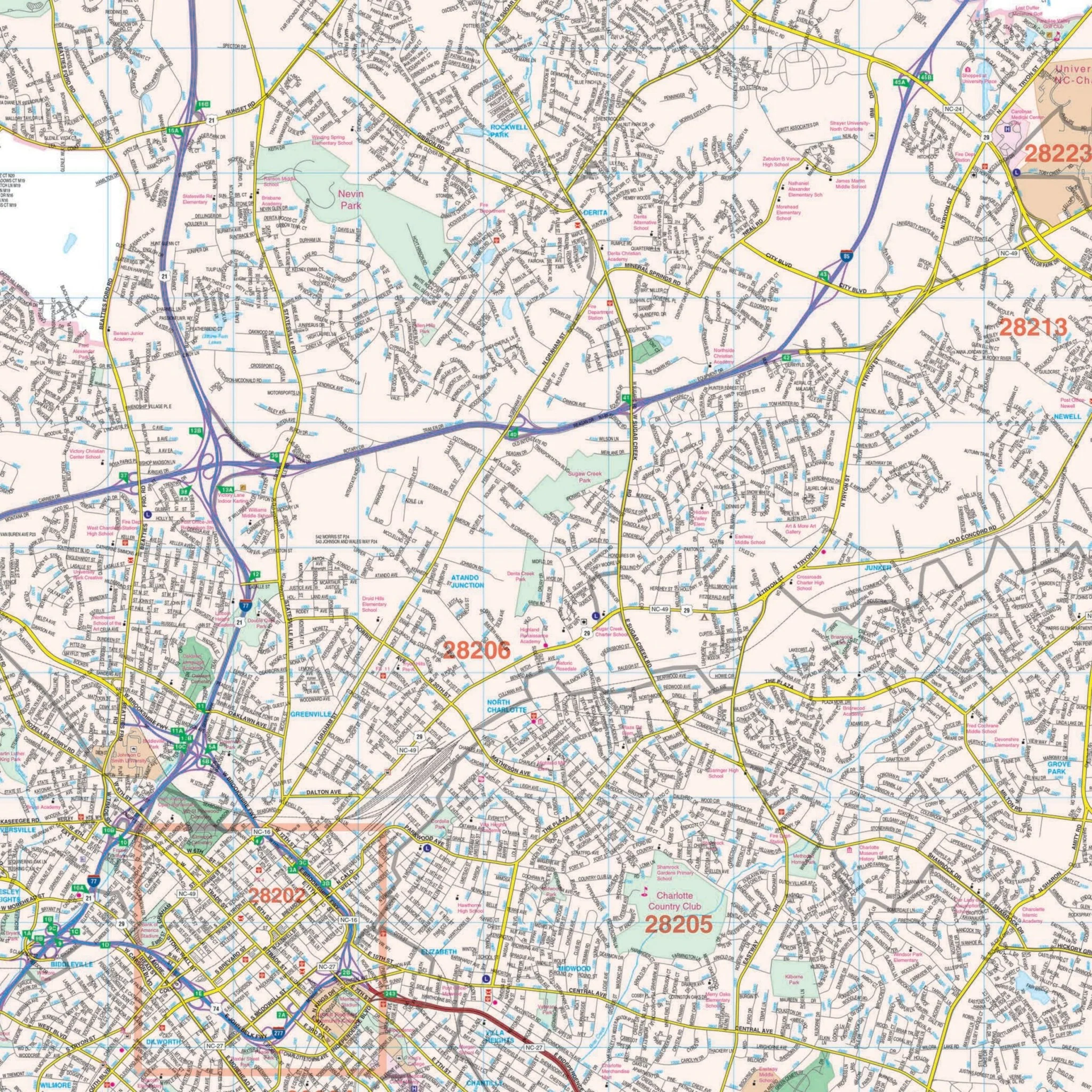
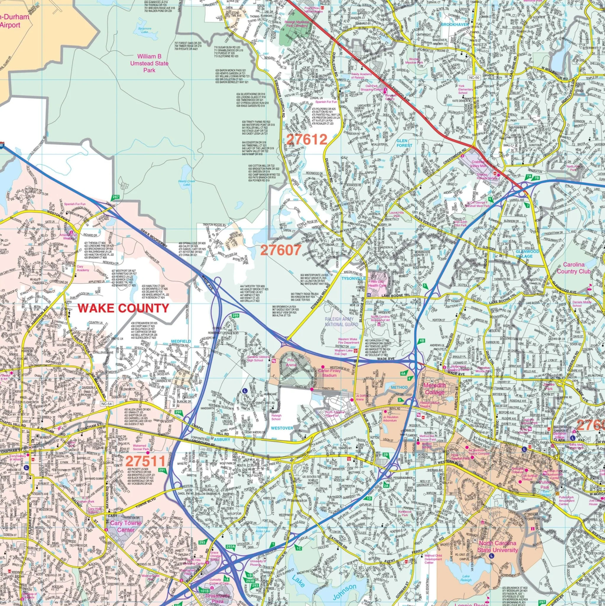
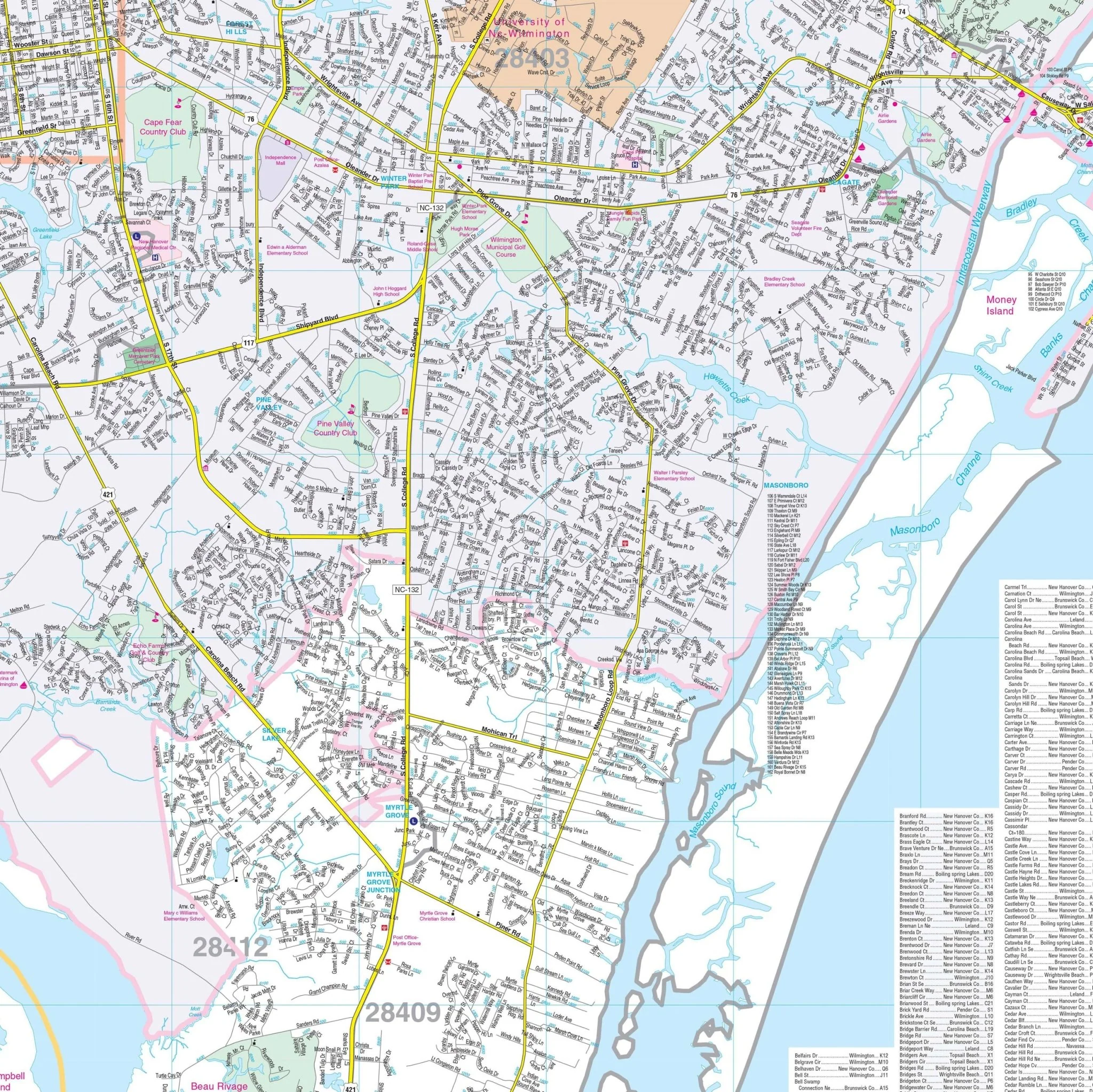
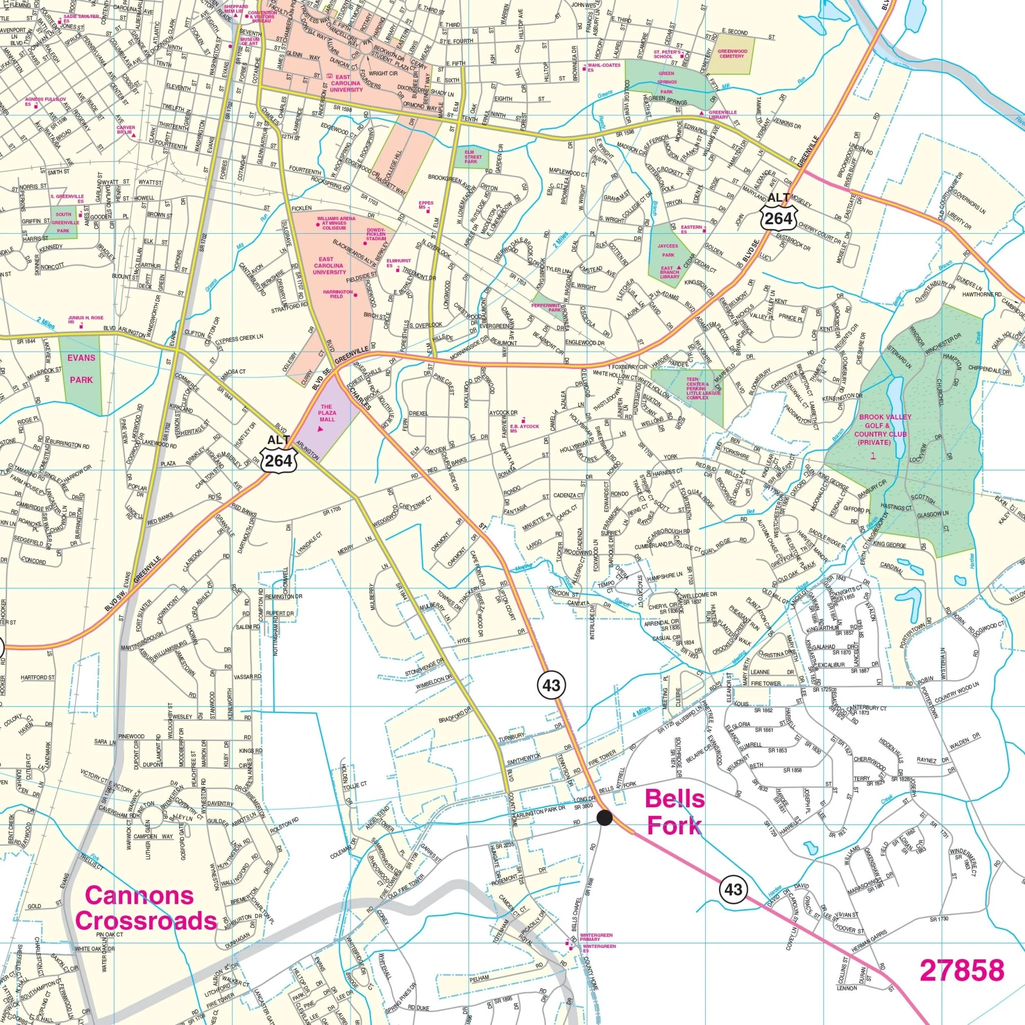
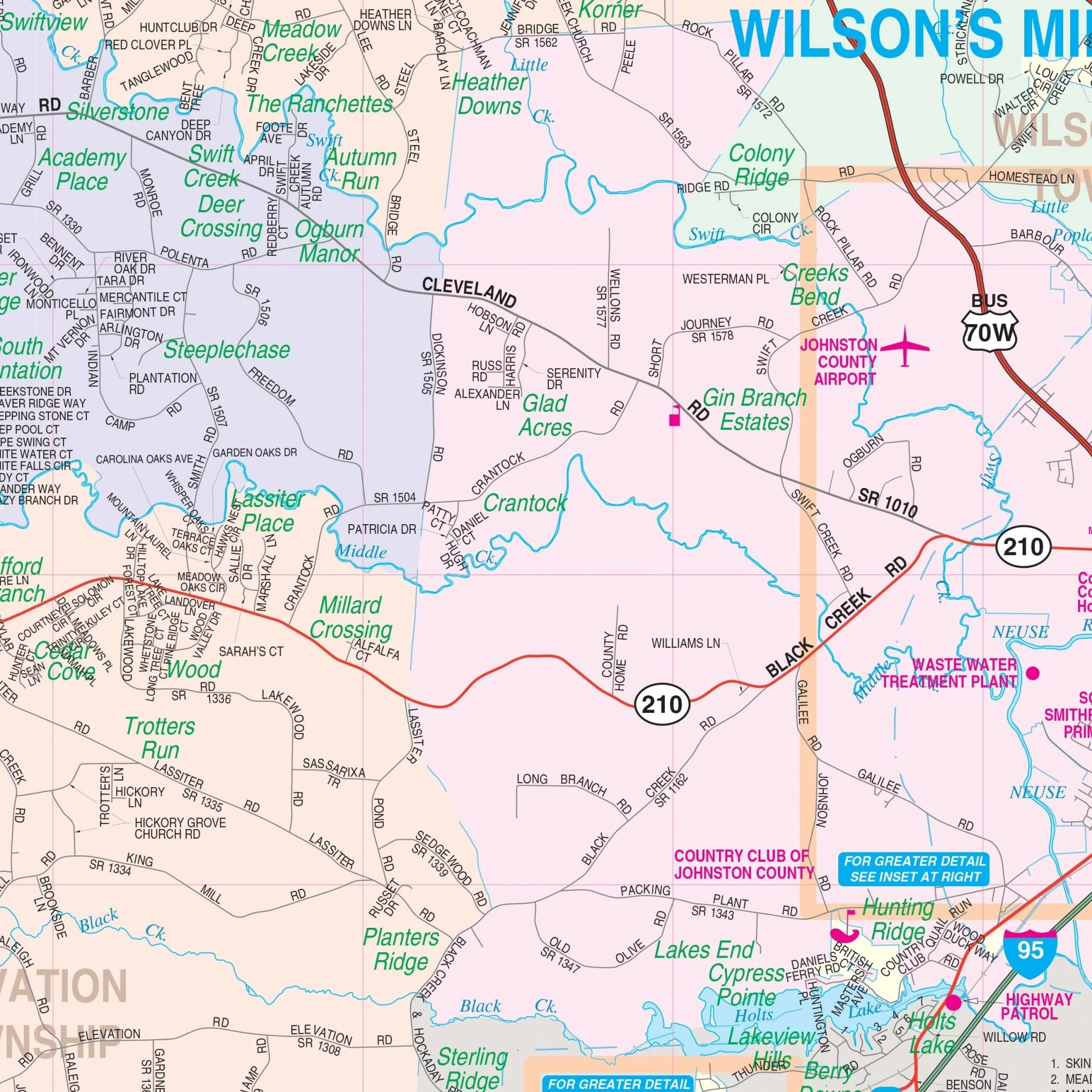
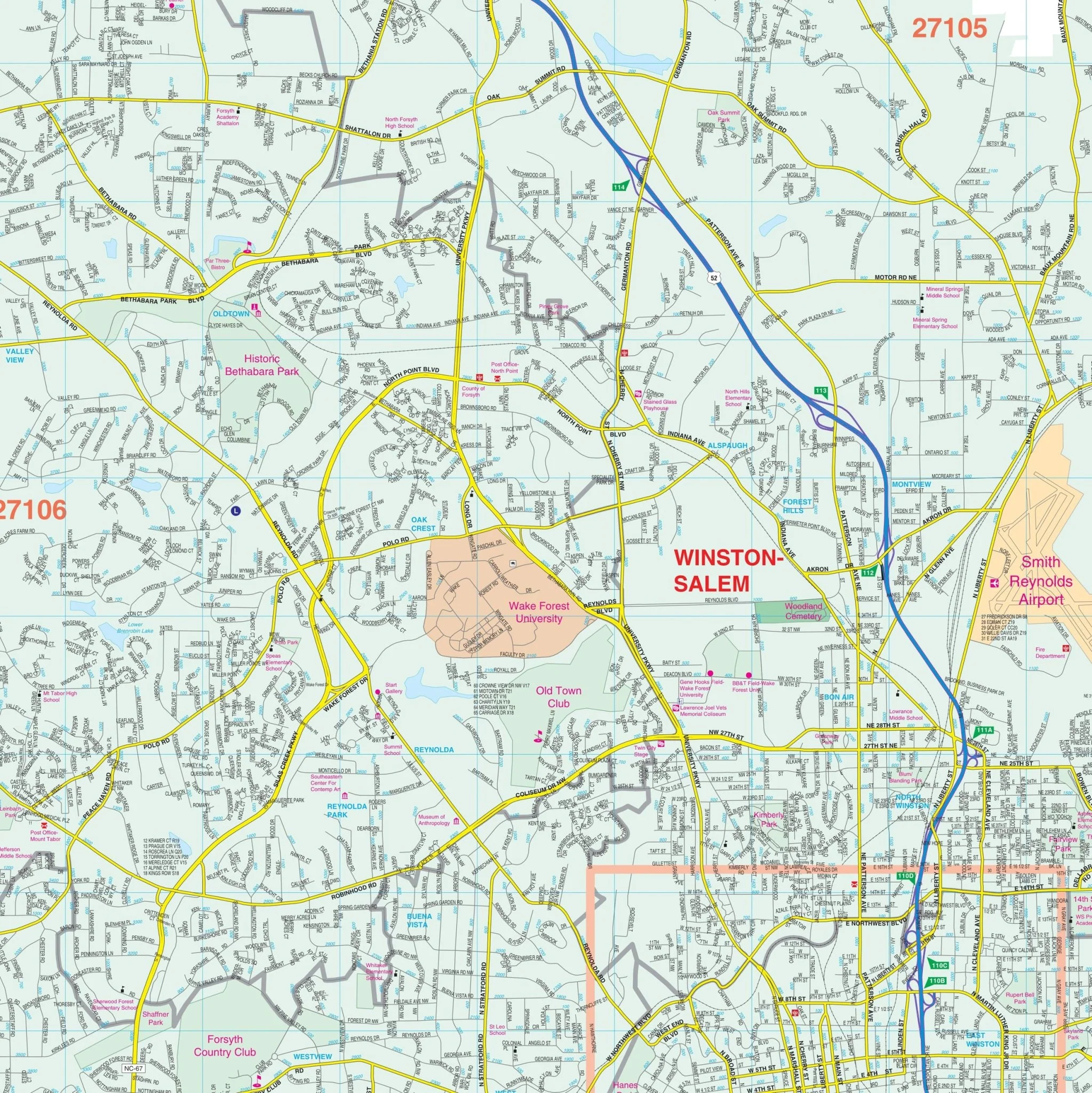
In terms of detail, the map covers all state highways, all federal highways, and secondary roads, offering a comprehensive view of North Carolina's transportation network. It also includes cities and towns, major waterways, major airports, state and national parks, state universities, military installations, wildlife areas, and various points of interest. This map is a valuable tool for anyone needing an in-depth geographical overview of North Carolina, from students and professionals to travelers and local residents.
Size: 67.5" x 42"
Published: 2013
Original: $109.99
-70%$109.99
$33.00Product Information
Product Information
Shipping & Returns
Shipping & Returns
Description
The North Carolina State Wall Map by Kappa Map Group is an expansive and detailed guide, providing cartography at a scale of 1" = 8 miles. This map indexes cities and counties, along with their populations, directly on its face for ease of reference. It features color-coded counties and a mileage chart for estimating distances between major cities. Additionally, the map includes a state facts index and inset maps of key urban areas: Charlotte, Fayetteville, Winston-Salem, and the Raleigh/Durham/Chapel Hill area.
In terms of detail, the map covers all state highways, all federal highways, and secondary roads, offering a comprehensive view of North Carolina's transportation network. It also includes cities and towns, major waterways, major airports, state and national parks, state universities, military installations, wildlife areas, and various points of interest. This map is a valuable tool for anyone needing an in-depth geographical overview of North Carolina, from students and professionals to travelers and local residents.
Size: 67.5" x 42"
Published: 2013