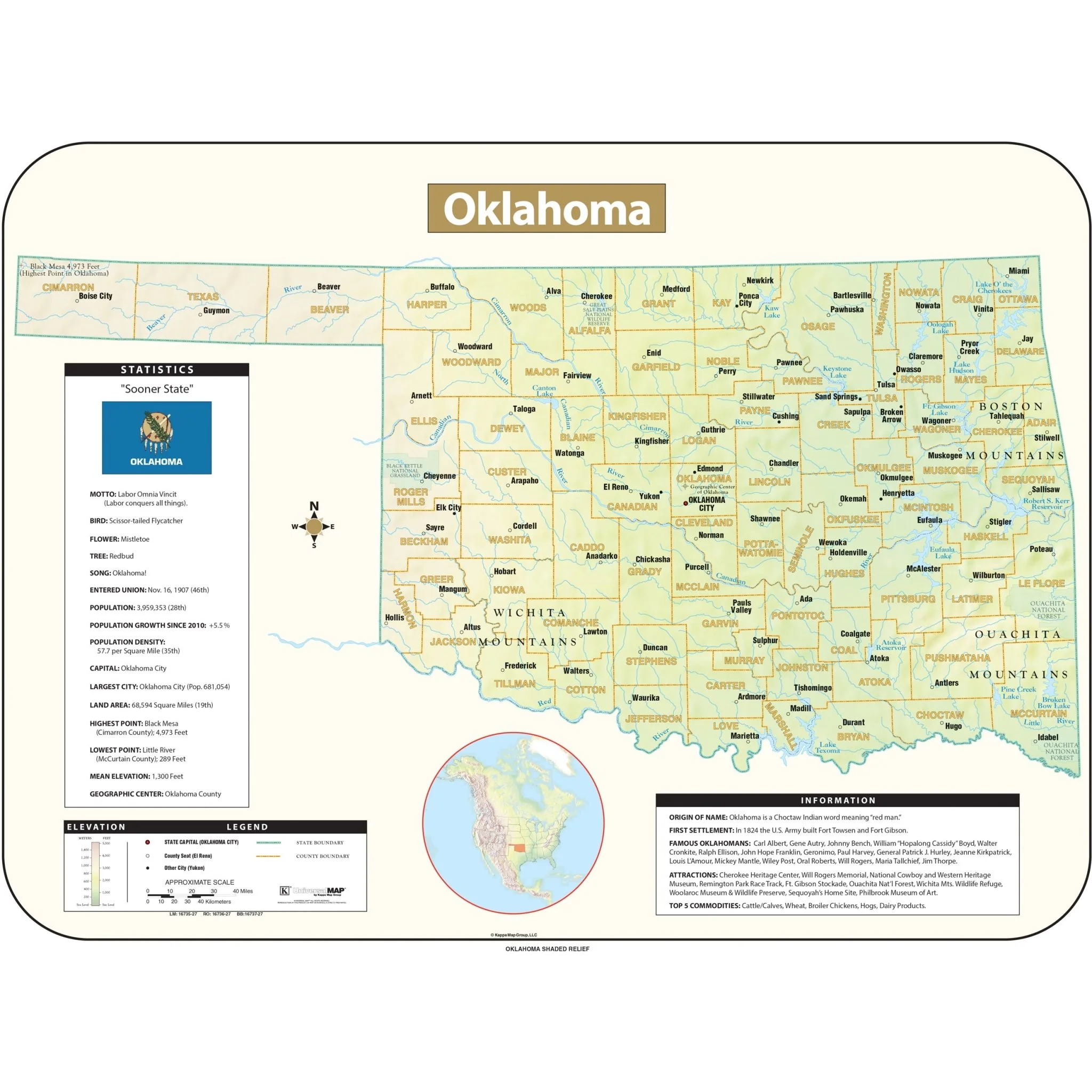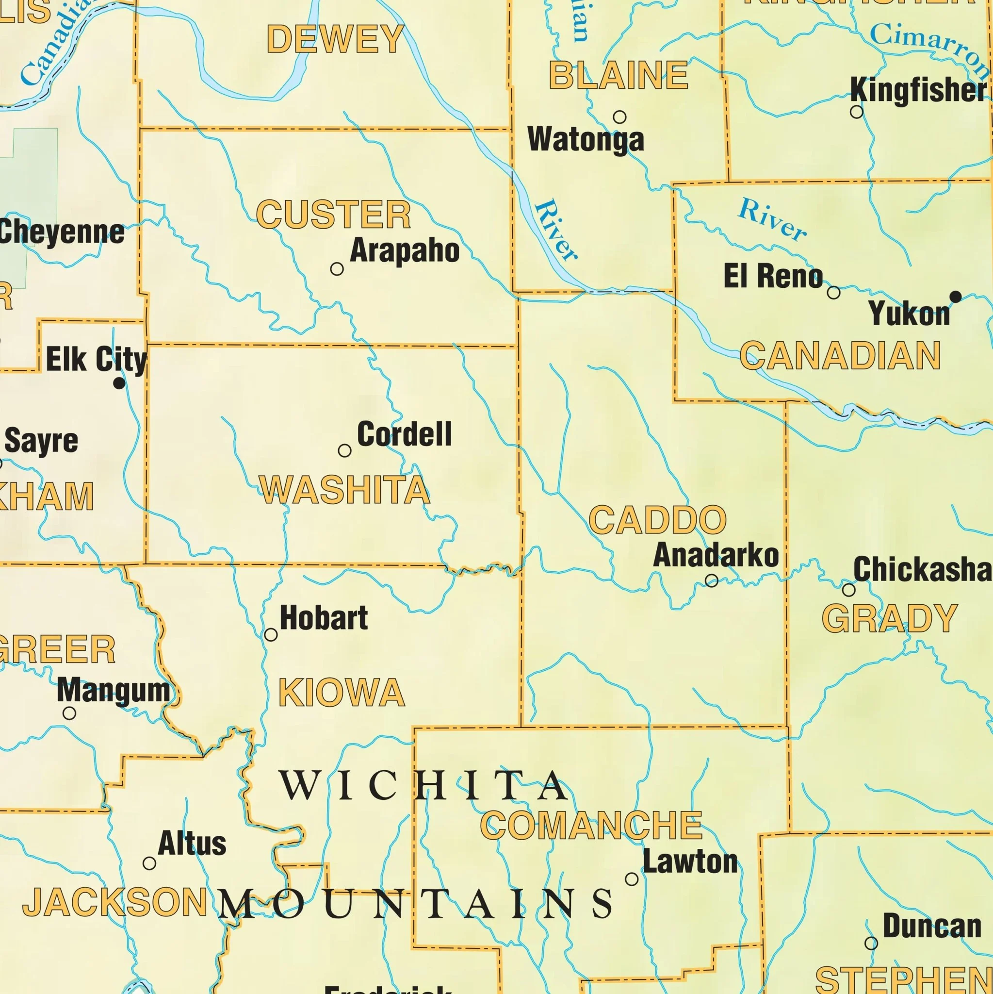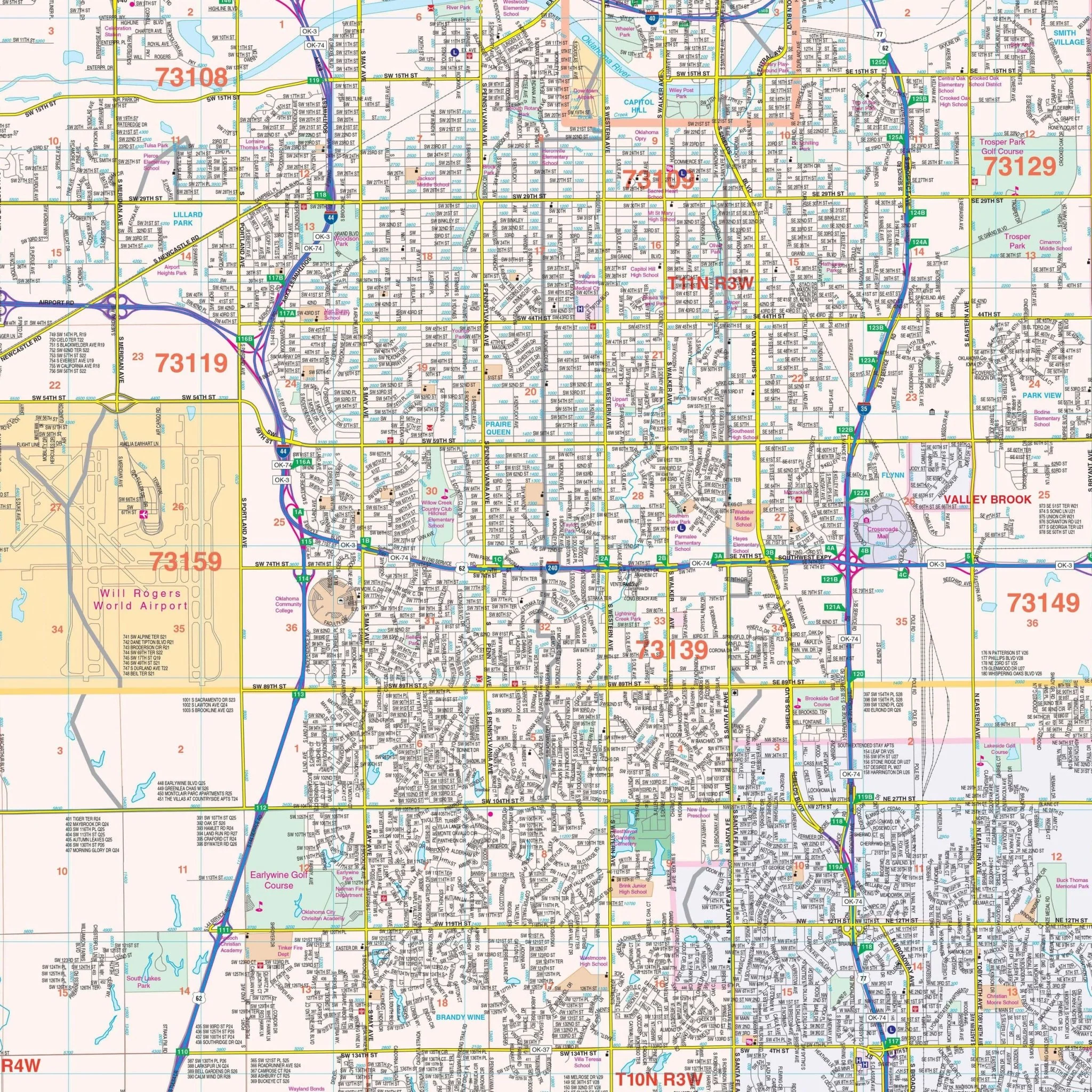


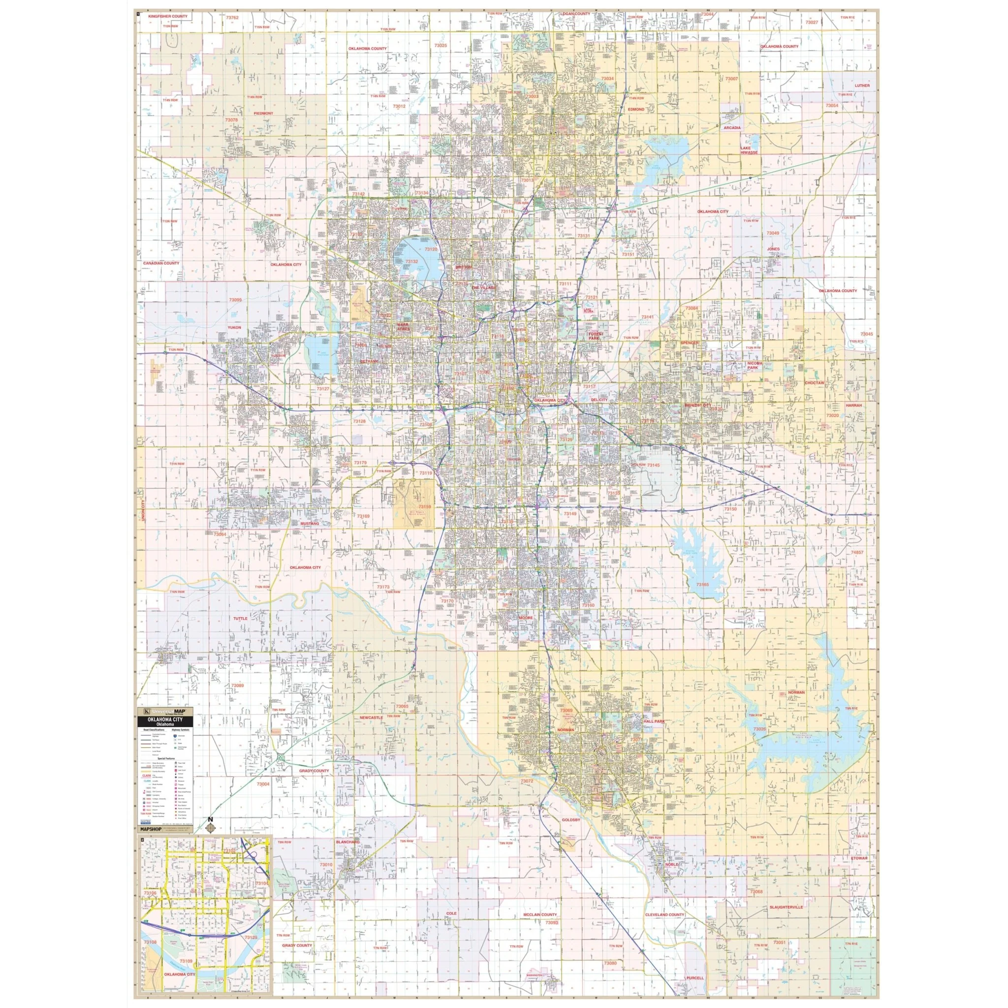


Oklahoma City, OK Wall Map
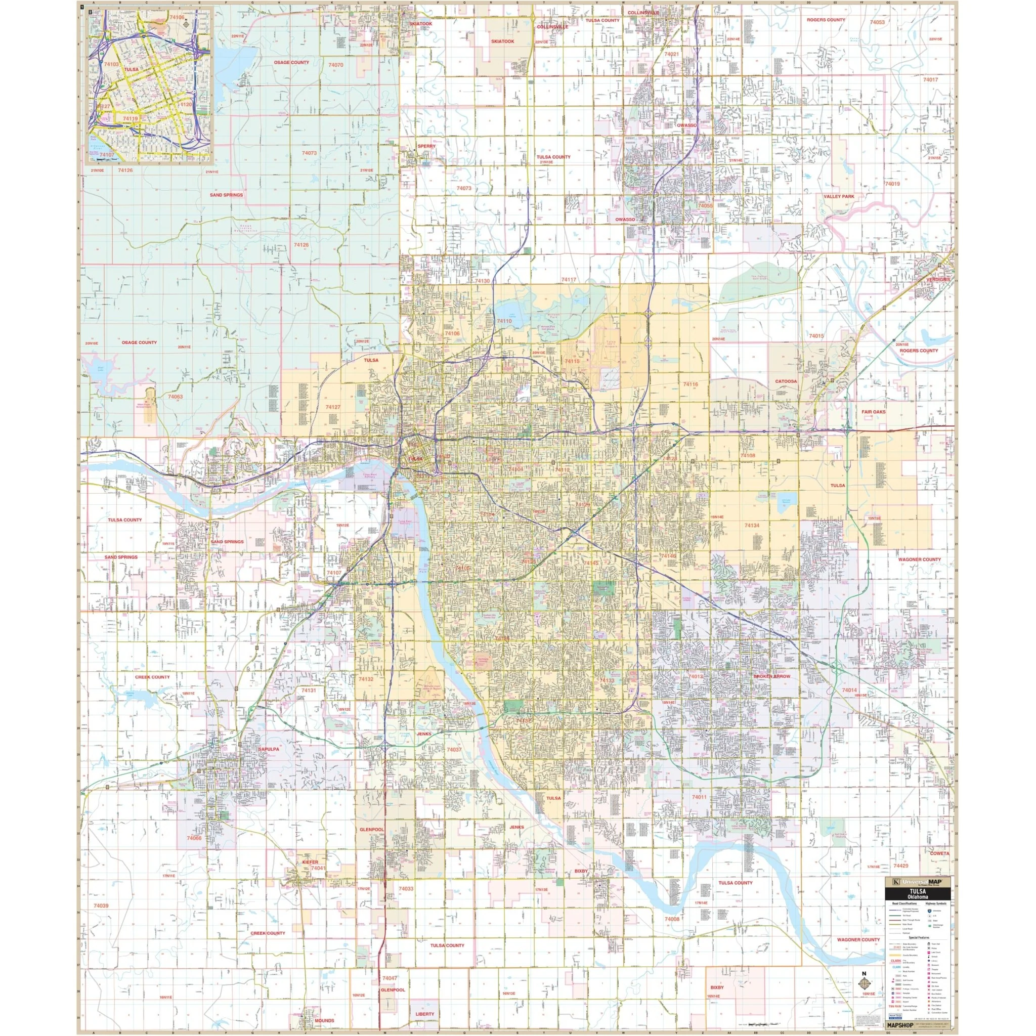
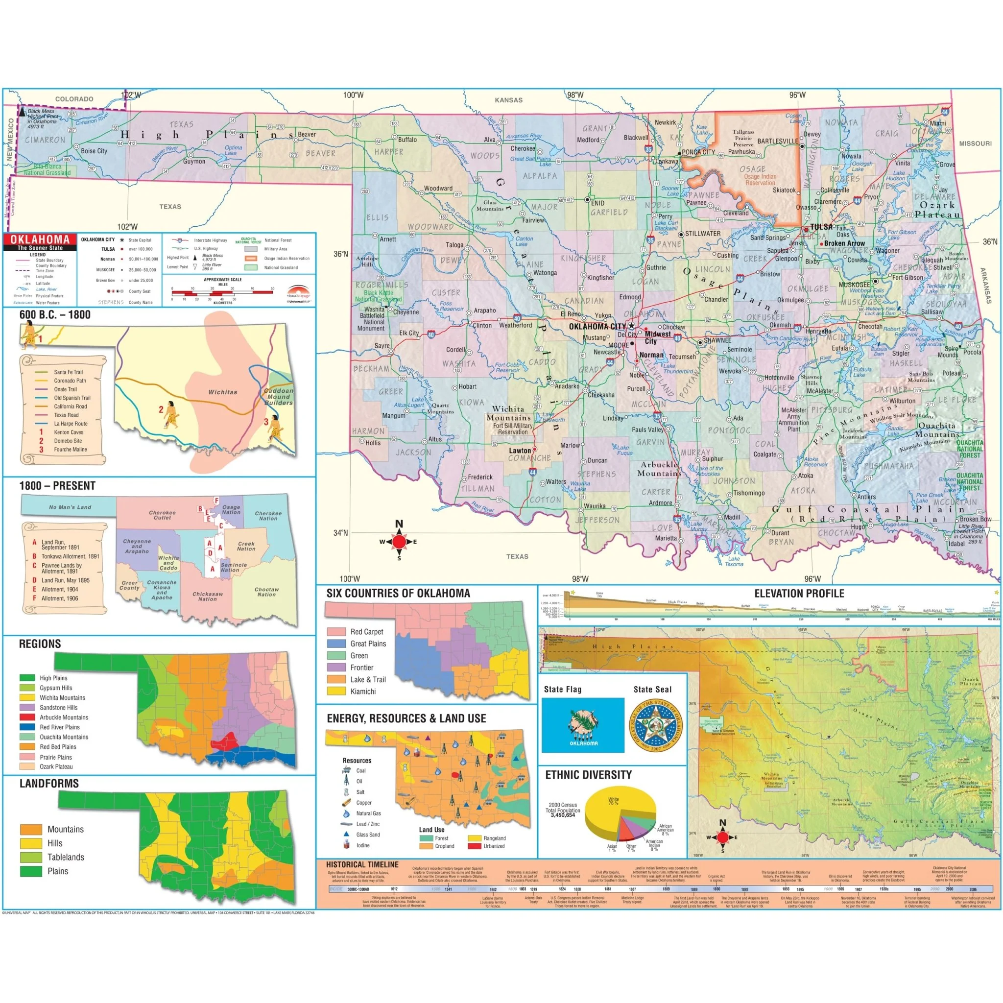
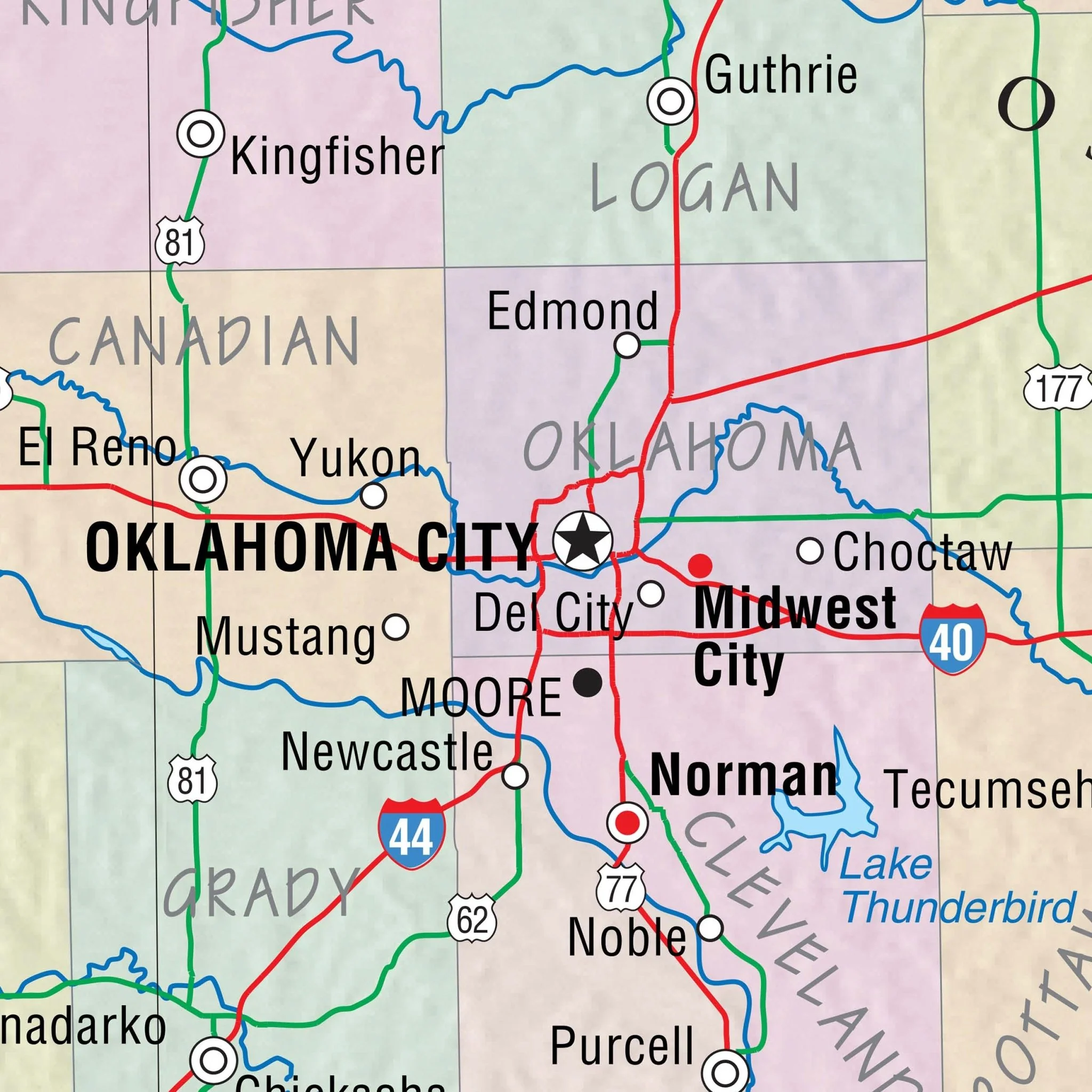
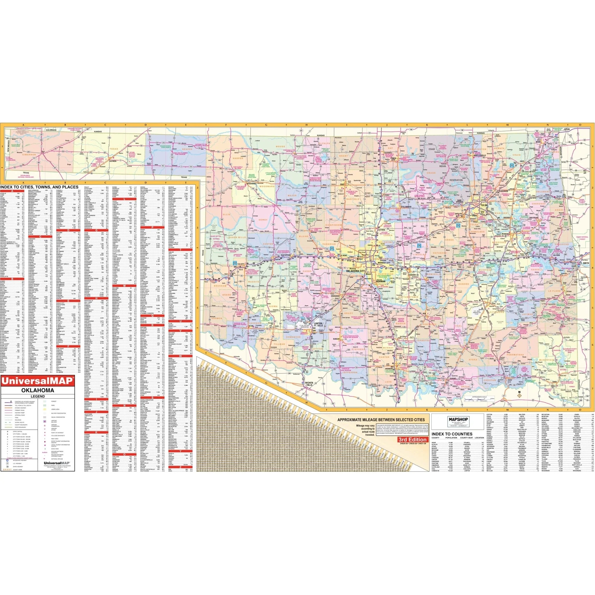
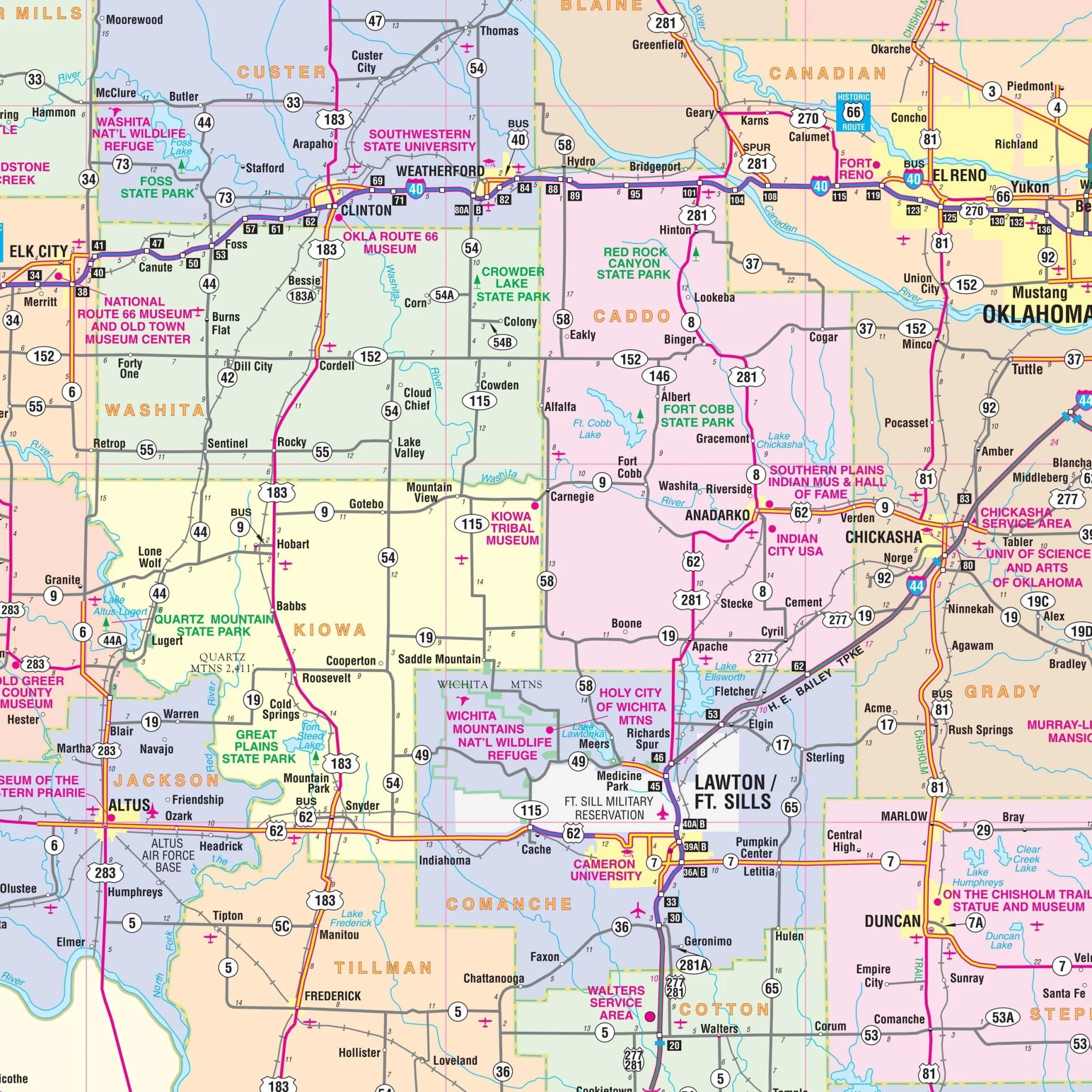
The Oklahoma City, OK Wall Map, with adjacent areas, features complete street detail and includes an inset map of Downtown Oklahoma City. The area of coverage includes the new Crosstown Expressway with the following boundaries:
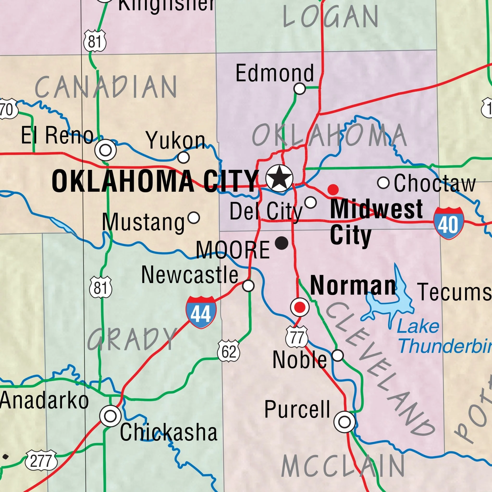
- North: to Logan/Oklahoma County Line, including cities of Edmond and Piedmont
- South: to Cole and Washington
- East: to Choctaw
- West: to Yukon and Tuttle
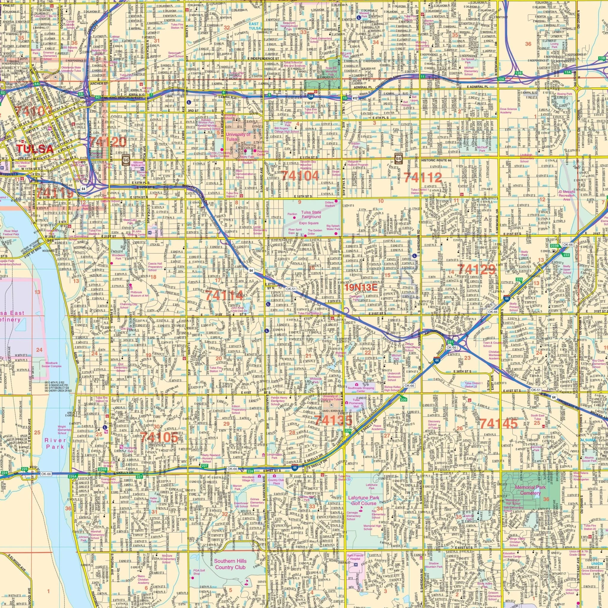
Details on this map encompass all streets, airports, government buildings, post offices, cemeteries, fire and police stations, hospitals, shopping centers, educational institutions, railroads, water features, golf and country clubs, mileage circles, recreational parks, ZIP codes and boundaries, as well as block numbers.
Size: 57" x 75.25"
Published: 2015
Original: $149.99
-70%$149.99
$45.00Product Information
Product Information
Shipping & Returns
Shipping & Returns
Description
The Oklahoma City, OK Wall Map, with adjacent areas, features complete street detail and includes an inset map of Downtown Oklahoma City. The area of coverage includes the new Crosstown Expressway with the following boundaries:
- North: to Logan/Oklahoma County Line, including cities of Edmond and Piedmont
- South: to Cole and Washington
- East: to Choctaw
- West: to Yukon and Tuttle
Details on this map encompass all streets, airports, government buildings, post offices, cemeteries, fire and police stations, hospitals, shopping centers, educational institutions, railroads, water features, golf and country clubs, mileage circles, recreational parks, ZIP codes and boundaries, as well as block numbers.
Size: 57" x 75.25"
Published: 2015