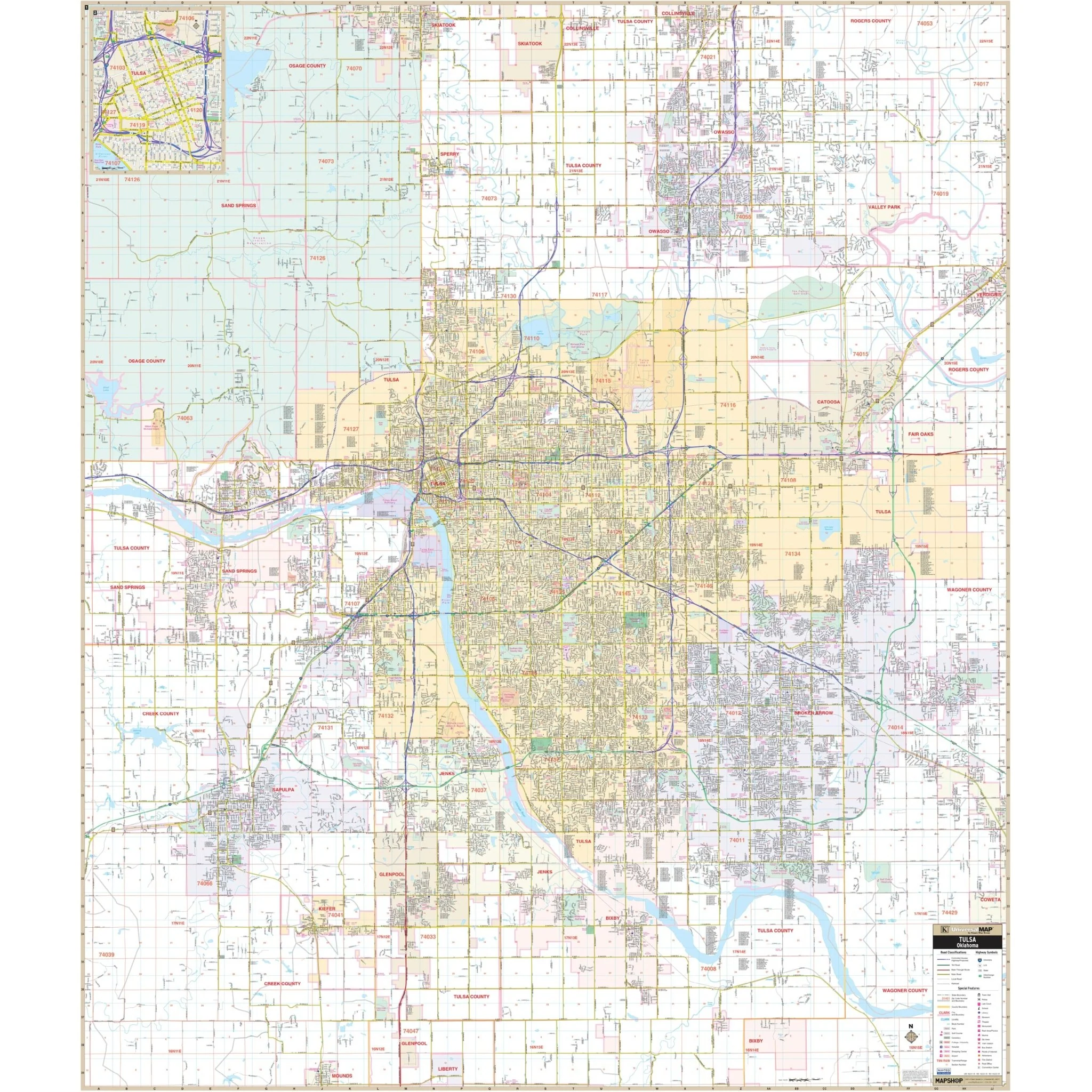
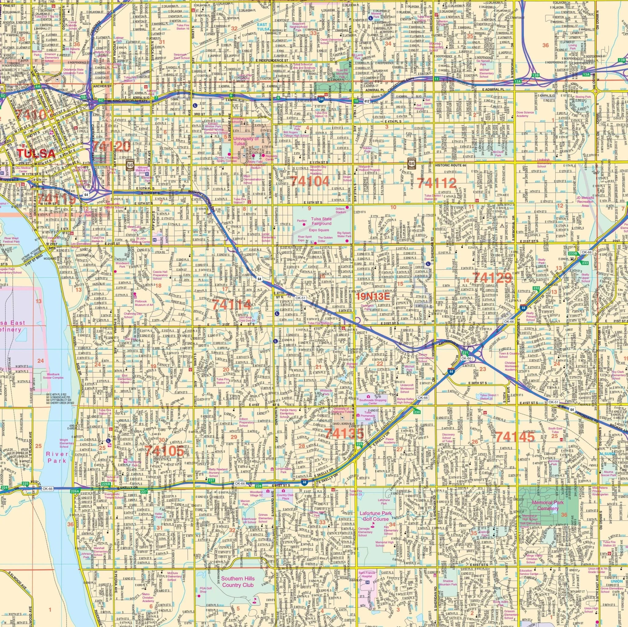


Tulsa, OK Wall Map
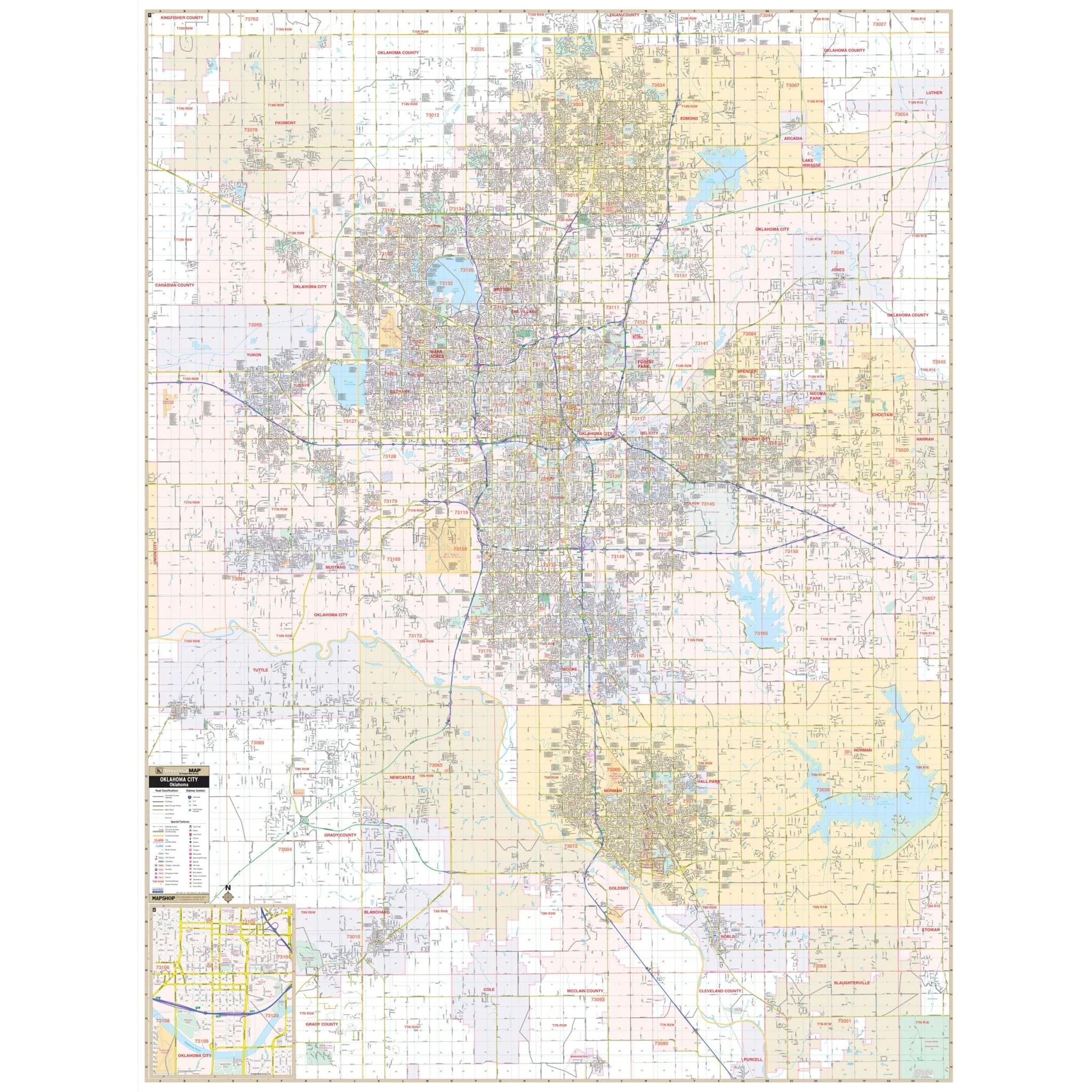
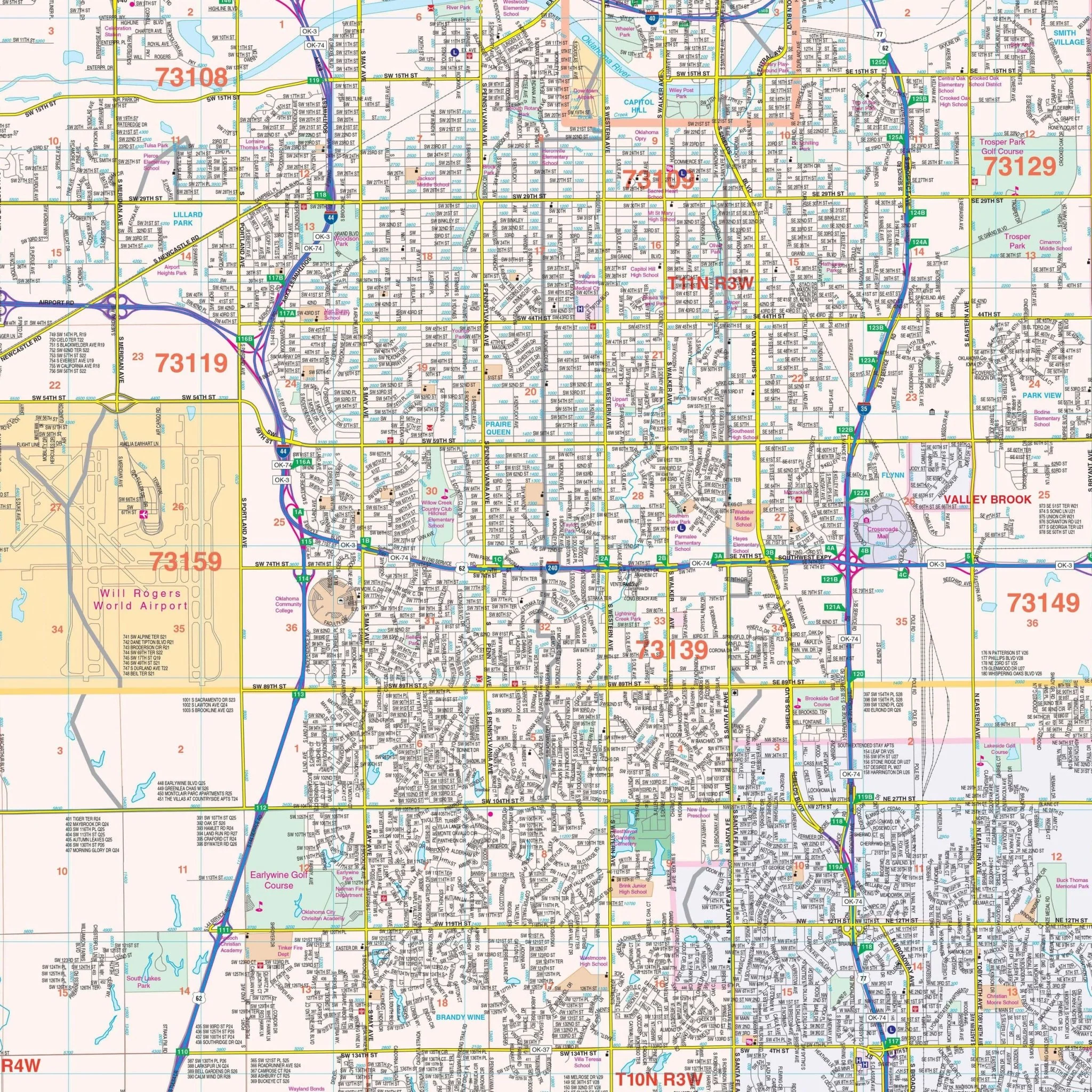
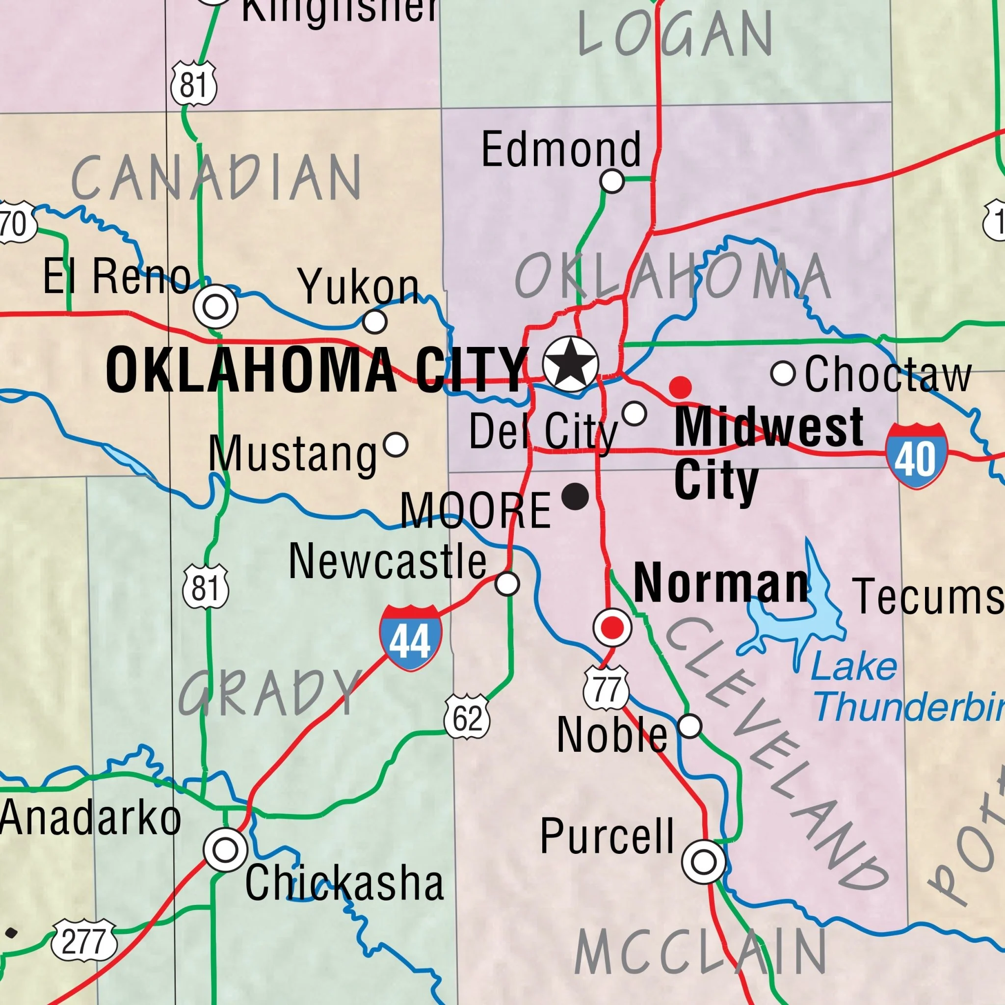
The Tulsa, OK Wall Map, with adjacent areas, provides complete street detail and includes an inset map of Downtown Tulsa. The area of coverage encompasses all of Tulsa, with the following boundaries:
- North: Skiatook and Collinsville
- South: Glenpool and Bixby
- East: Fair Oaks and Broken Arrow
- West: Five (5) miles west of Sand Springs
Details and features on this map include airports, block numbers, cemeteries, city limits (color-coded), educational institutions, fire and police stations, golf and country clubs, government buildings, historic Route 66, hospitals, libraries, points of interest, post offices, railroads, recreational parks, section, township, and range lines, shopping centers, streets and highways, water features, ZIP codes, and boundaries.
Size: 57" x 66.5"
Published: 2015
Original: $149.99
-70%$149.99
$45.00Product Information
Product Information
Shipping & Returns
Shipping & Returns
Description
The Tulsa, OK Wall Map, with adjacent areas, provides complete street detail and includes an inset map of Downtown Tulsa. The area of coverage encompasses all of Tulsa, with the following boundaries:
- North: Skiatook and Collinsville
- South: Glenpool and Bixby
- East: Fair Oaks and Broken Arrow
- West: Five (5) miles west of Sand Springs
Details and features on this map include airports, block numbers, cemeteries, city limits (color-coded), educational institutions, fire and police stations, golf and country clubs, government buildings, historic Route 66, hospitals, libraries, points of interest, post offices, railroads, recreational parks, section, township, and range lines, shopping centers, streets and highways, water features, ZIP codes, and boundaries.
Size: 57" x 66.5"
Published: 2015