


Salt Lake City, UT Wall Map
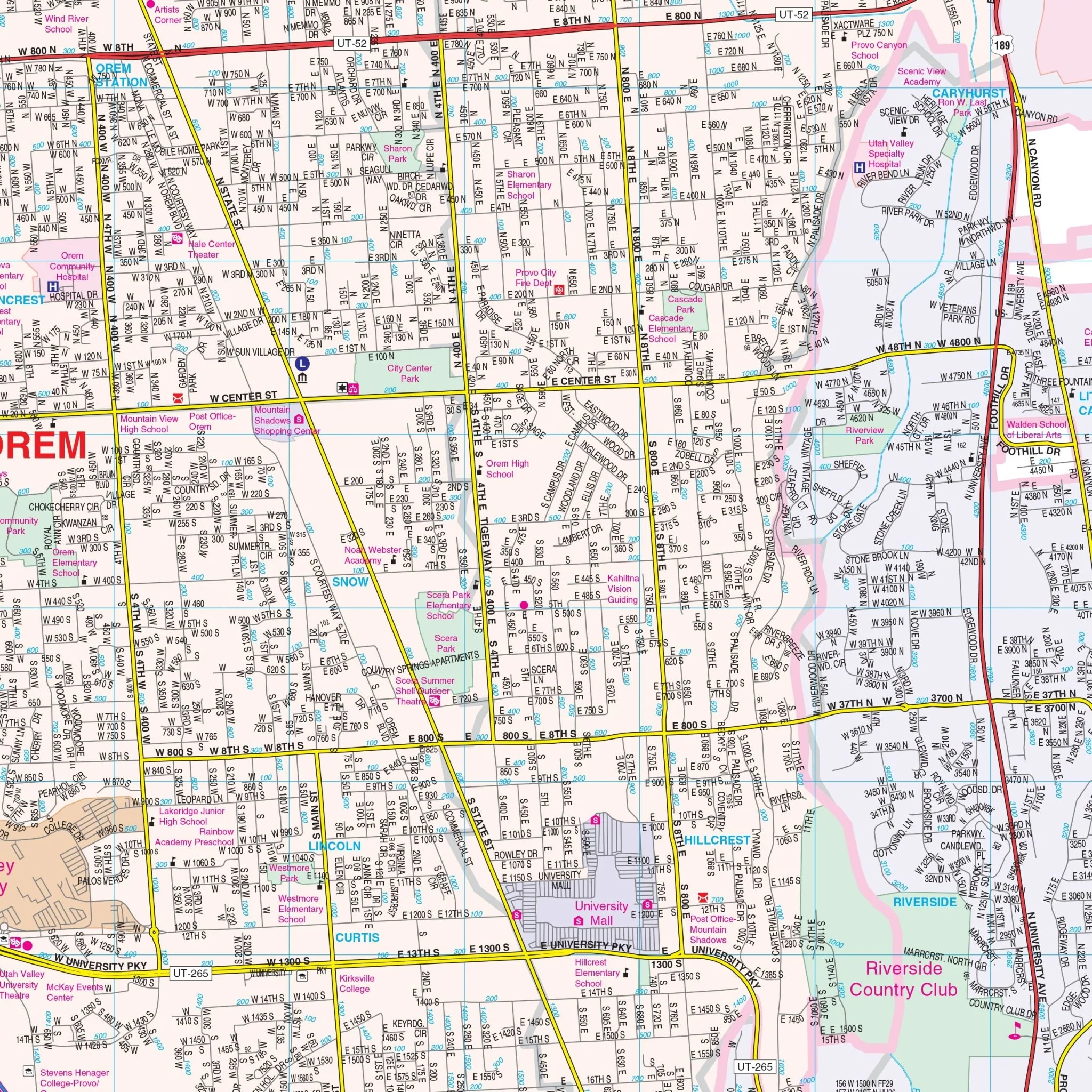
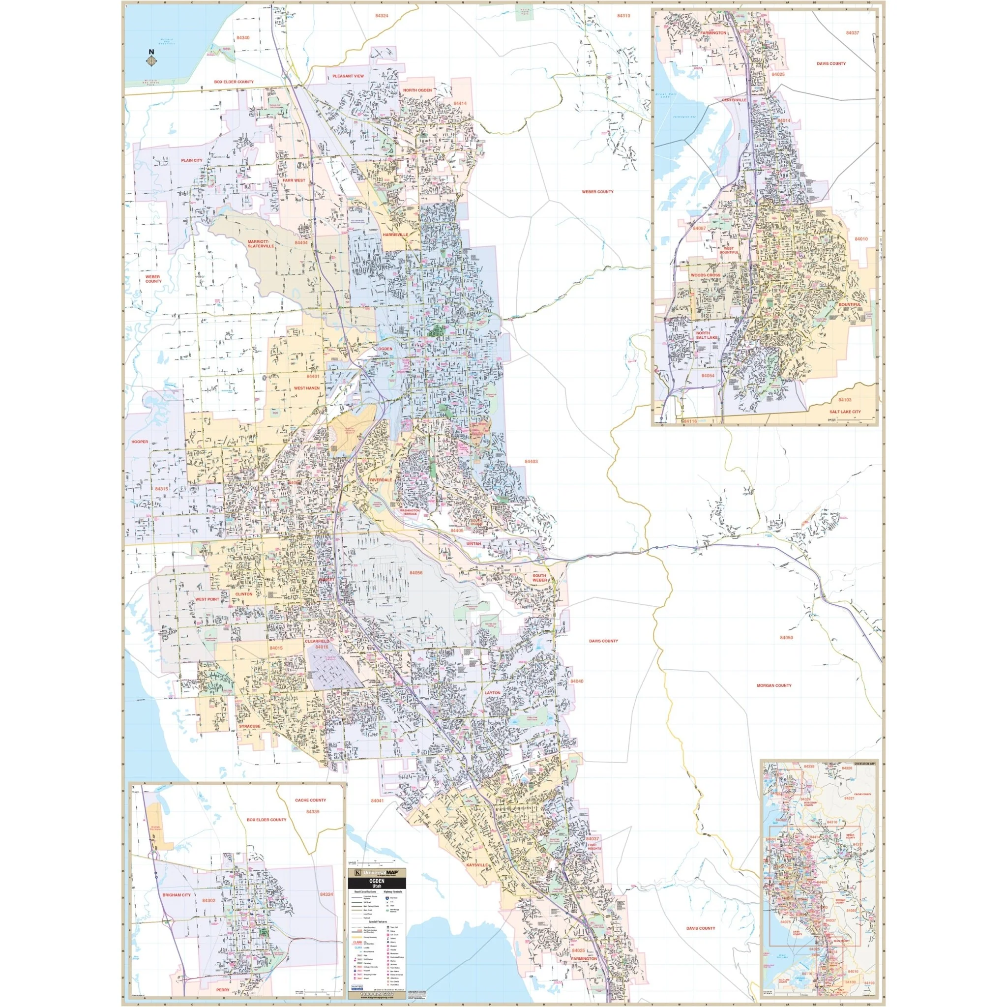
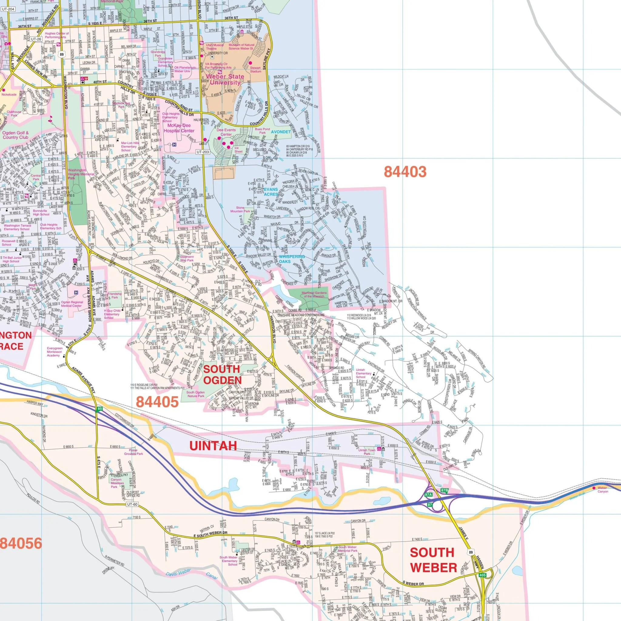
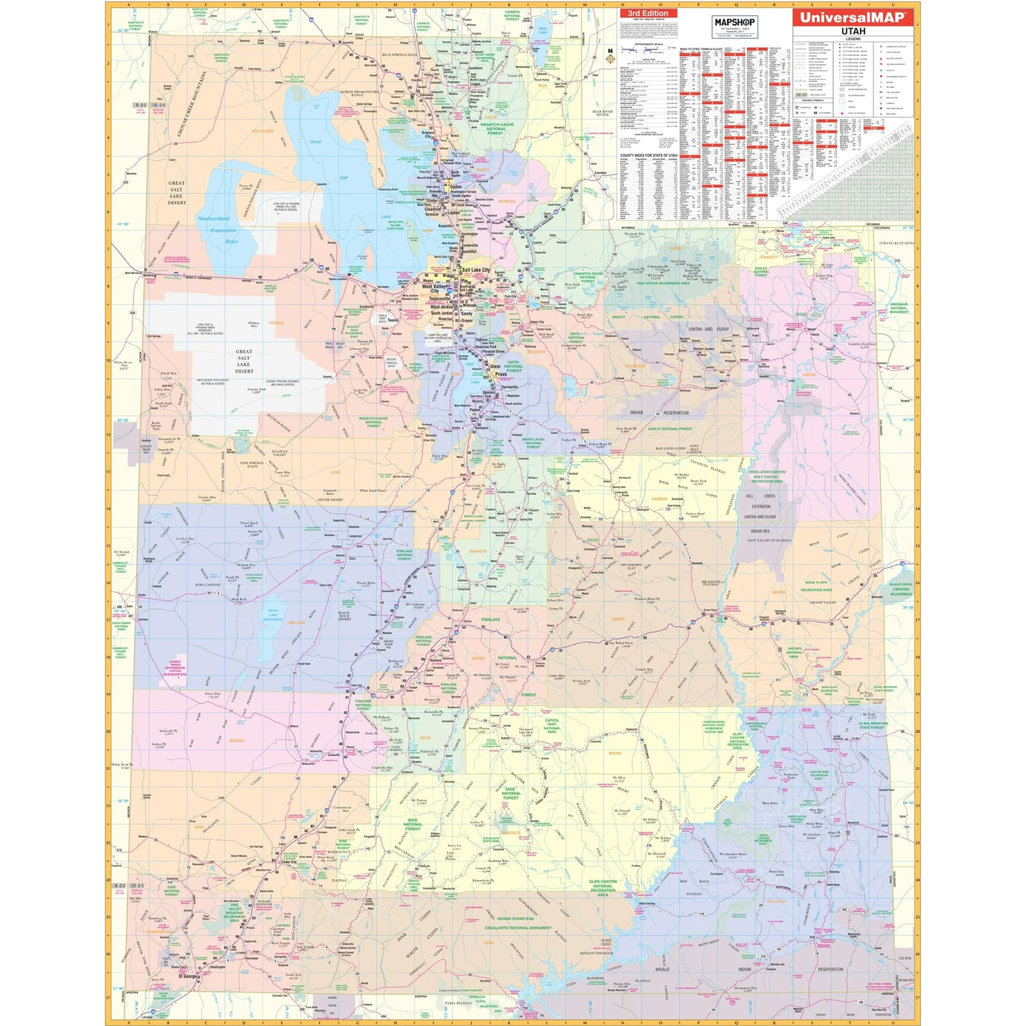
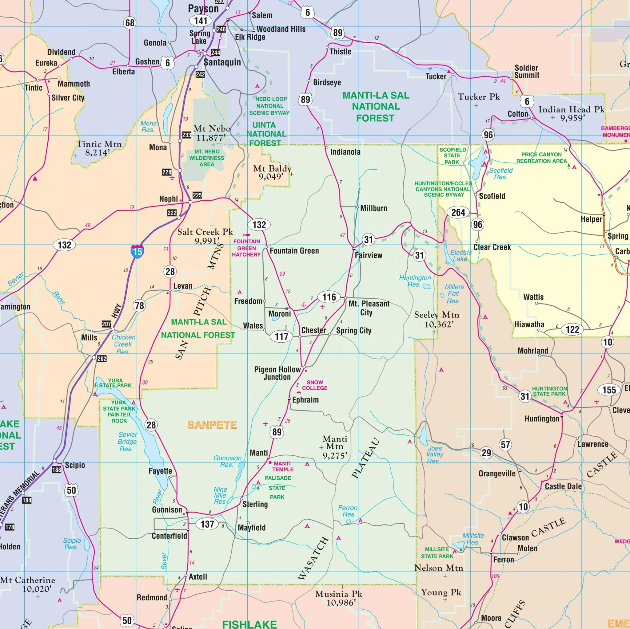
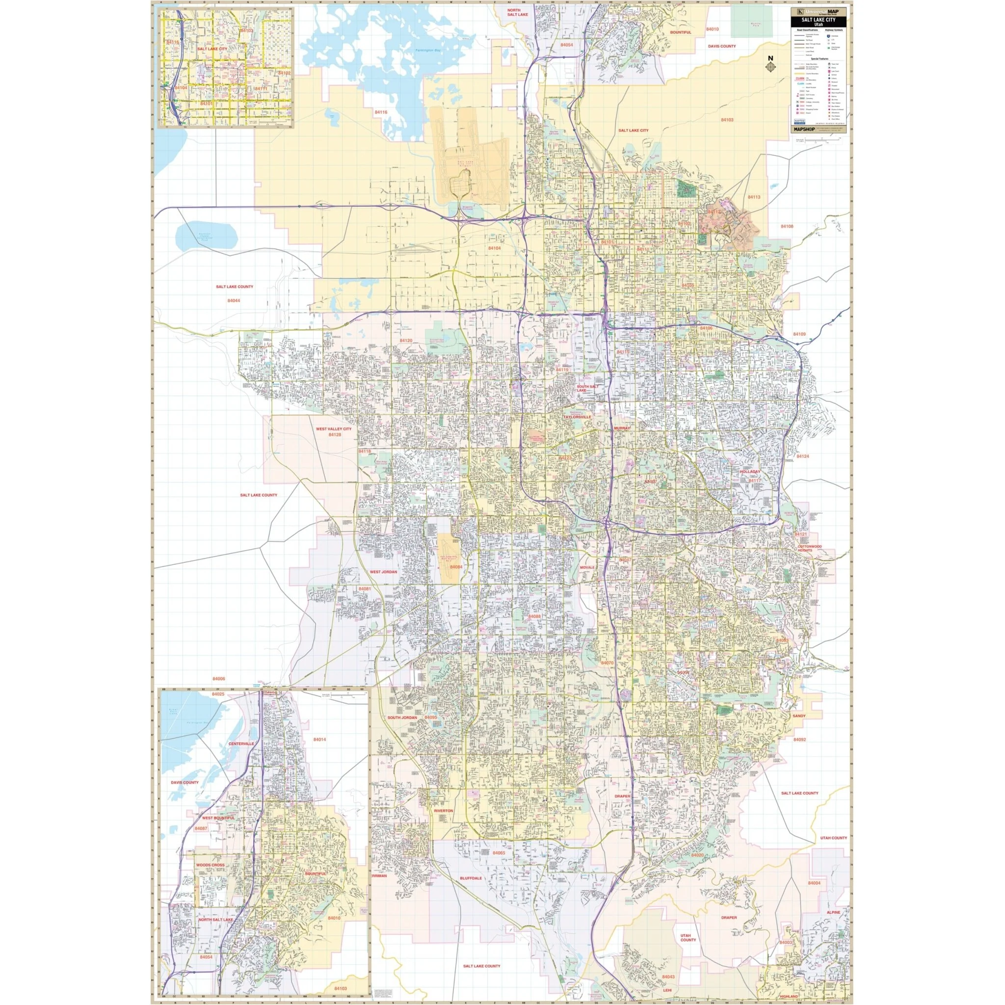
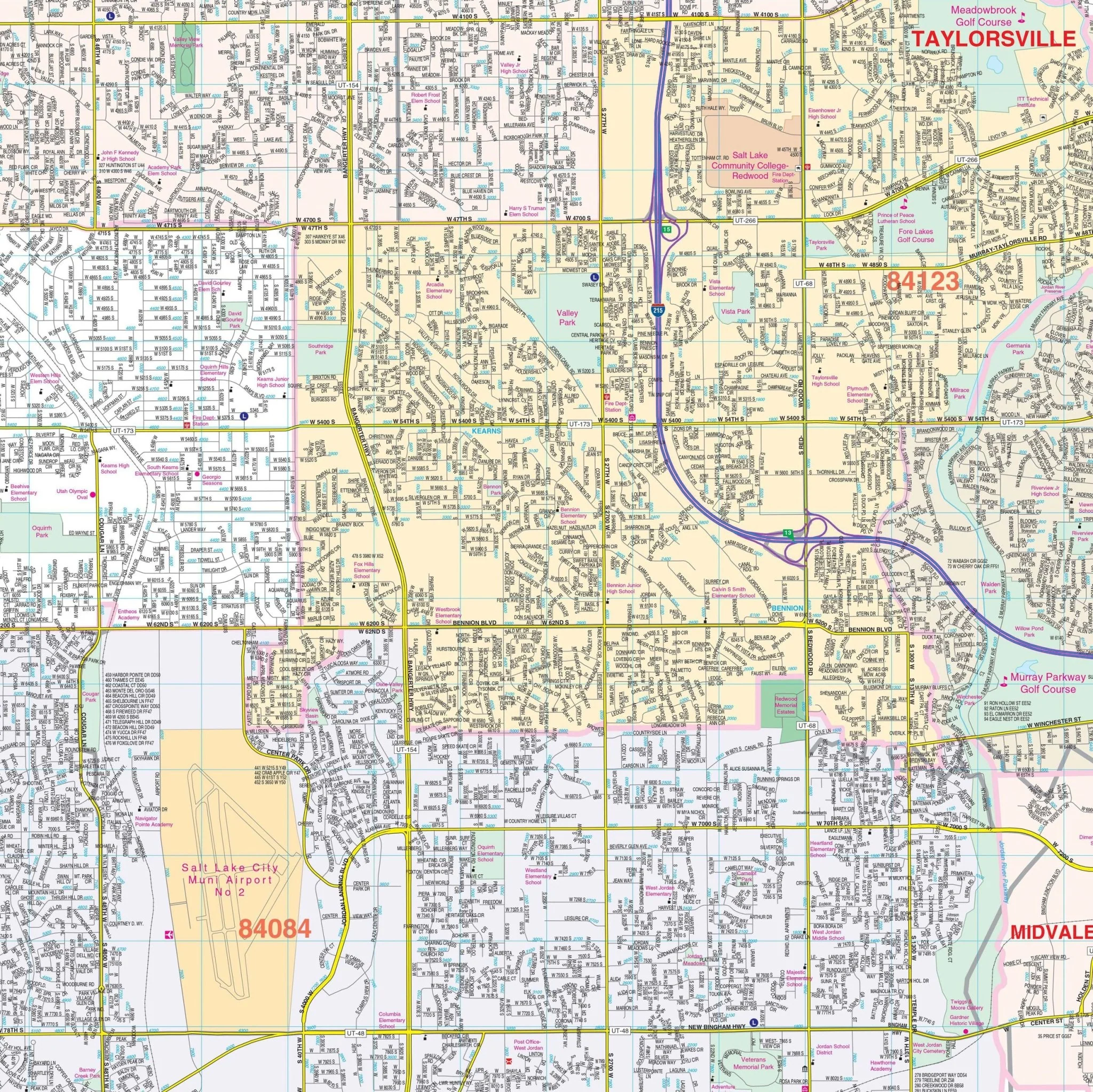
The Salt Lake City, Utah Wall Map by Kappa Map Group provides complete street detail. The area of coverage includes:
- North: Extends to the Salt Lake/Davis County Line
- South: Covers all of the City of Bluffdale
- East: Reaches just past the eastern city limits of the City of Cottonwood Heights
- West: Encompasses all of the Kennecott Copper Cooperation Pond
This map also includes insets of the Centerville, Bountiful, Woods Cross, and North Salt Lake City area, a vicinity map, and a Downtown Salt Lake City map. Special features highlighted on the map include airports, all streets and highways, government buildings, cemeteries, shopping centers, police stations, hospitals, water features, educational institutions, railroads, recreational parks, golf and country clubs, libraries, city limits and annexations, ZIP codes and boundaries, and block numbers.
Size: 54" x 77"
Published: 2015
Original: $149.99
-70%$149.99
$45.00Product Information
Product Information
Shipping & Returns
Shipping & Returns
Description
The Salt Lake City, Utah Wall Map by Kappa Map Group provides complete street detail. The area of coverage includes:
- North: Extends to the Salt Lake/Davis County Line
- South: Covers all of the City of Bluffdale
- East: Reaches just past the eastern city limits of the City of Cottonwood Heights
- West: Encompasses all of the Kennecott Copper Cooperation Pond
This map also includes insets of the Centerville, Bountiful, Woods Cross, and North Salt Lake City area, a vicinity map, and a Downtown Salt Lake City map. Special features highlighted on the map include airports, all streets and highways, government buildings, cemeteries, shopping centers, police stations, hospitals, water features, educational institutions, railroads, recreational parks, golf and country clubs, libraries, city limits and annexations, ZIP codes and boundaries, and block numbers.
Size: 54" x 77"
Published: 2015