


Canada Primary Wall Map
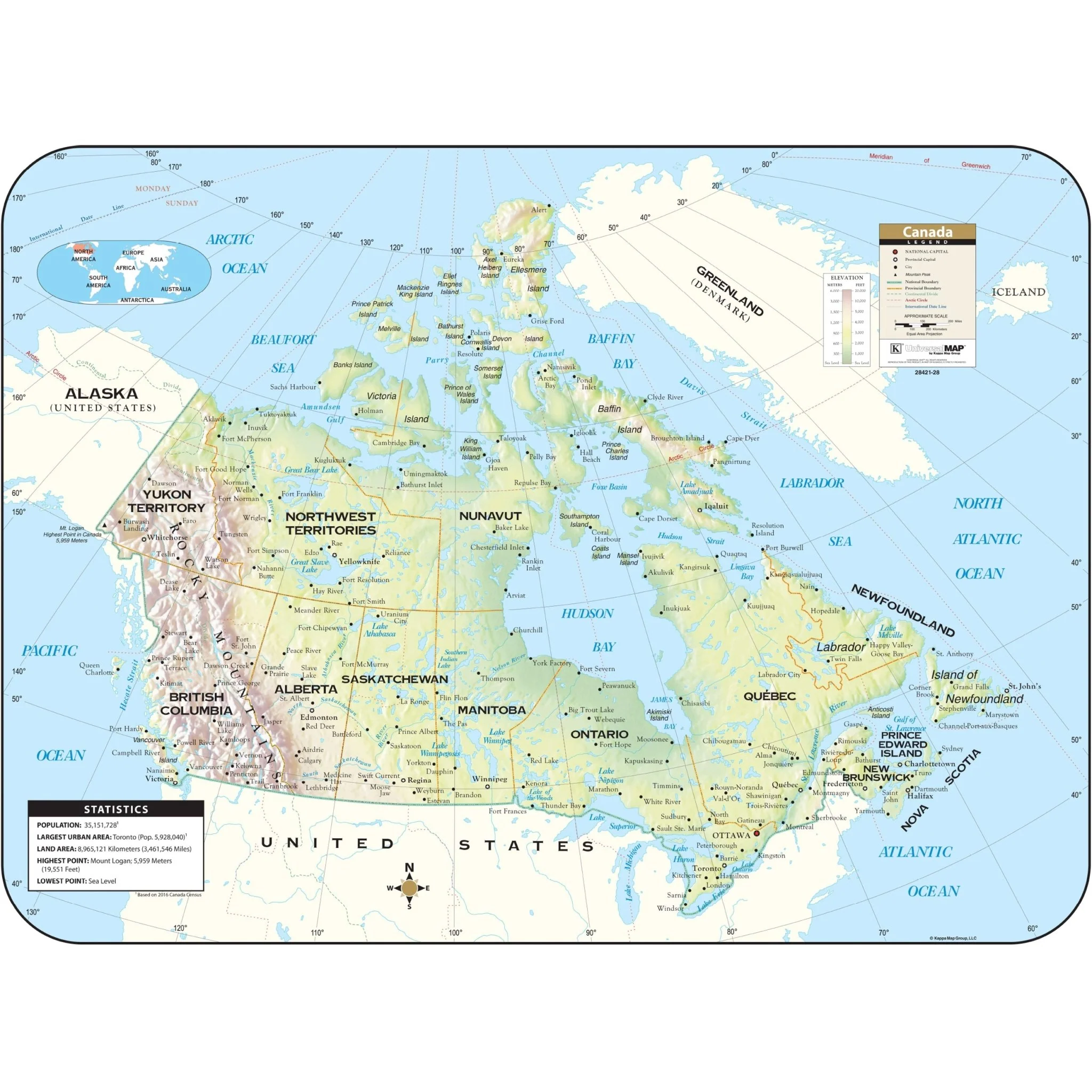
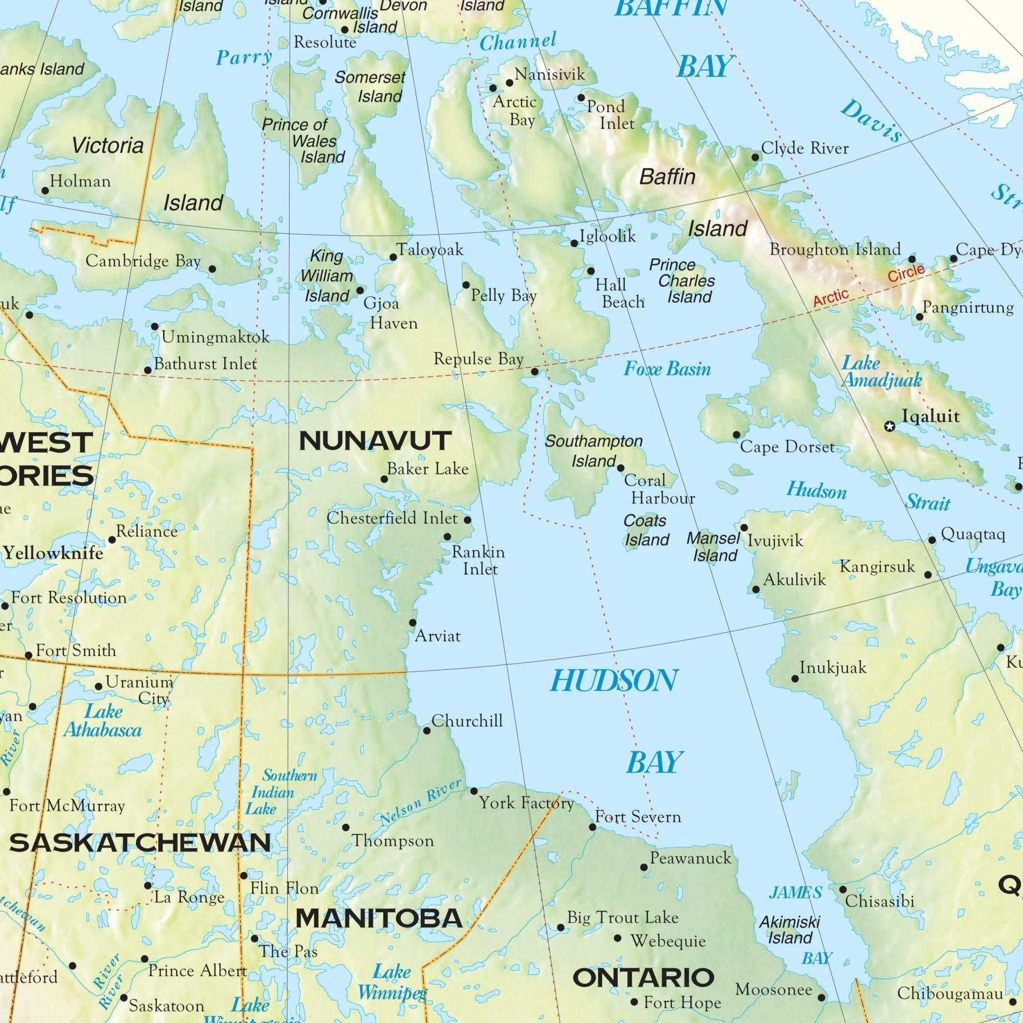
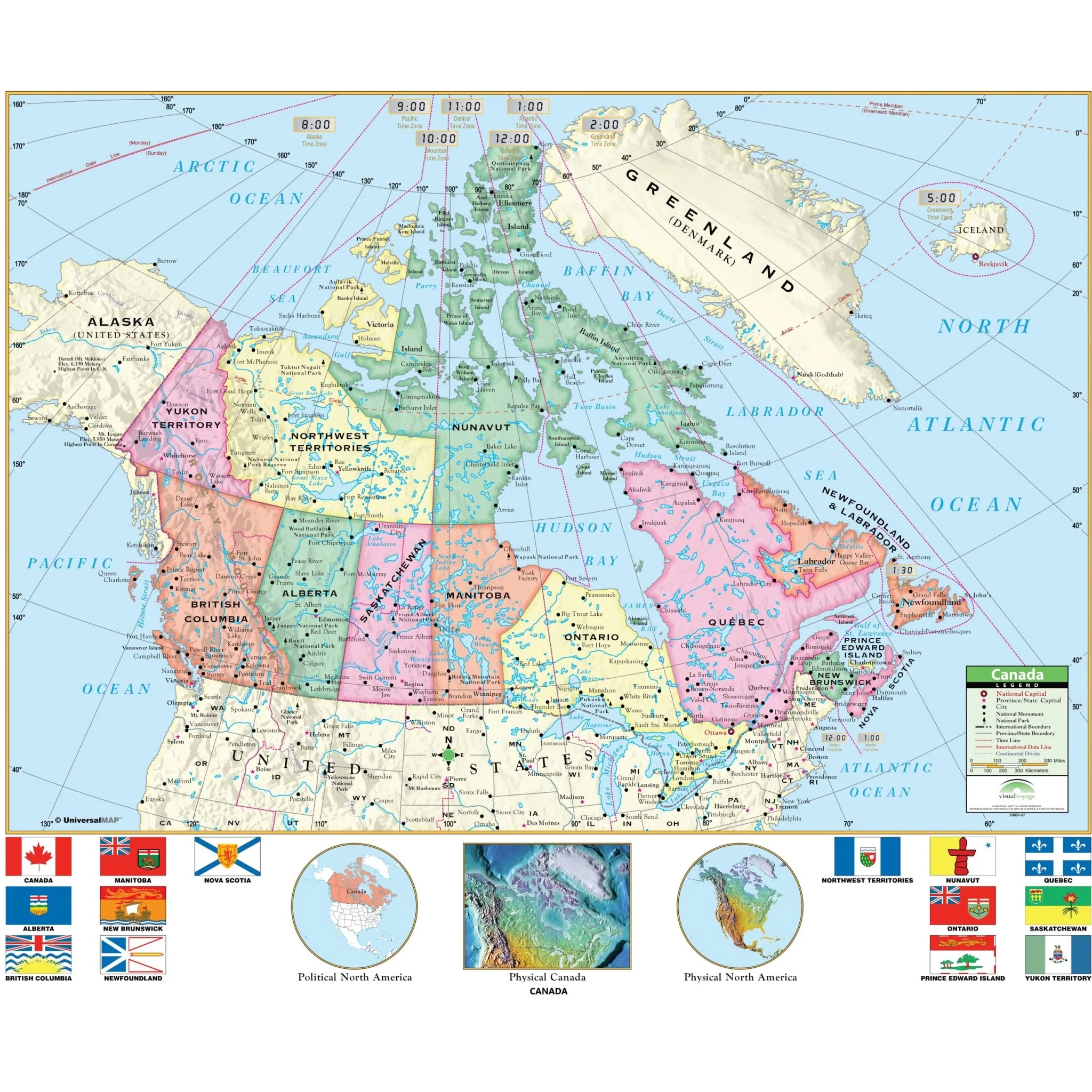
The Canada Primary Wall Map by Kappa Map Group is an engaging educational tool that prominently displays the flags of Canada's provinces, along with helpful North America inset maps. These vibrant, multi-colored classroom wall maps are designed to assist students in identifying political boundaries and national capitals. The map also employs shaded relief to provide a clear depiction of physical landforms.
Target Grade Range: K through 3
Sizes: 54" x 69" | 42" x 53.7"
Published: 2000
Original: $99.99
-70%$99.99
$30.00Product Information
Product Information
Shipping & Returns
Shipping & Returns
Description
The Canada Primary Wall Map by Kappa Map Group is an engaging educational tool that prominently displays the flags of Canada's provinces, along with helpful North America inset maps. These vibrant, multi-colored classroom wall maps are designed to assist students in identifying political boundaries and national capitals. The map also employs shaded relief to provide a clear depiction of physical landforms.
Target Grade Range: K through 3
Sizes: 54" x 69" | 42" x 53.7"
Published: 2000