Canada Wall Map
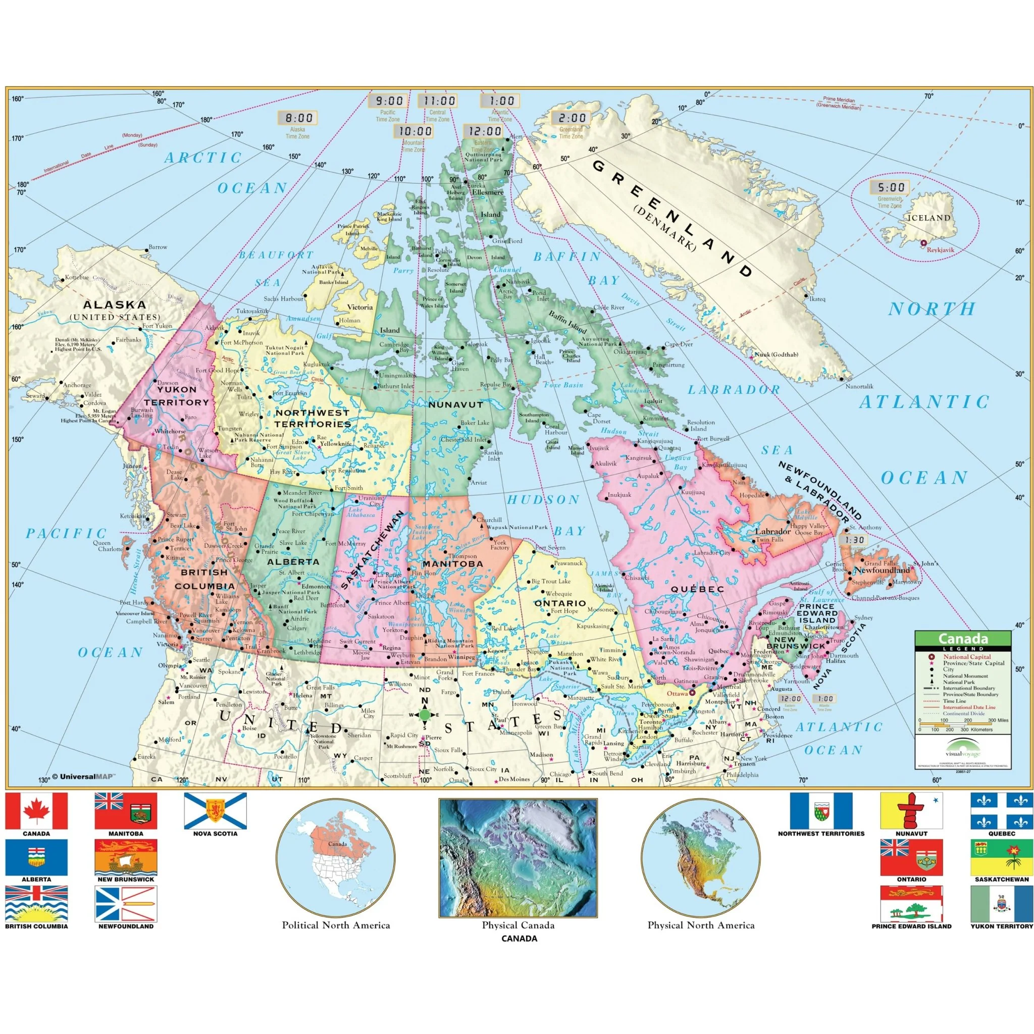
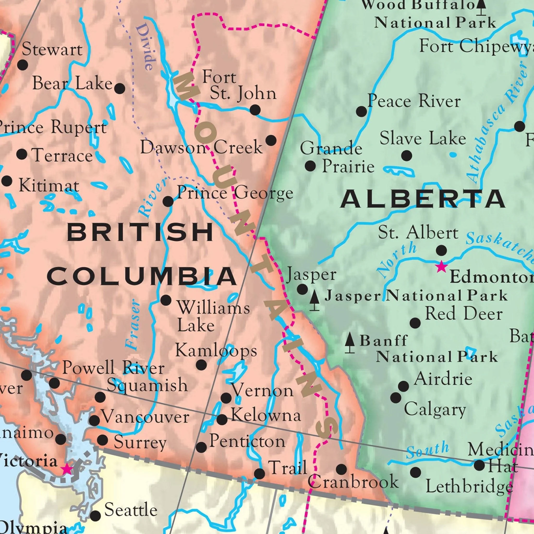
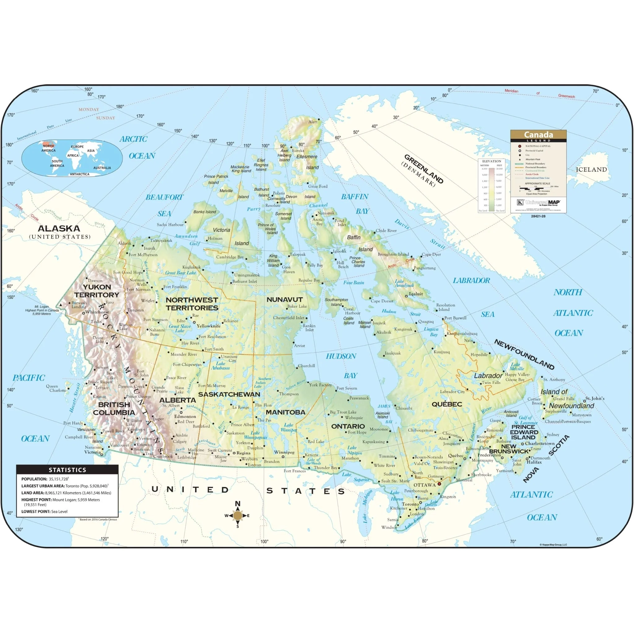
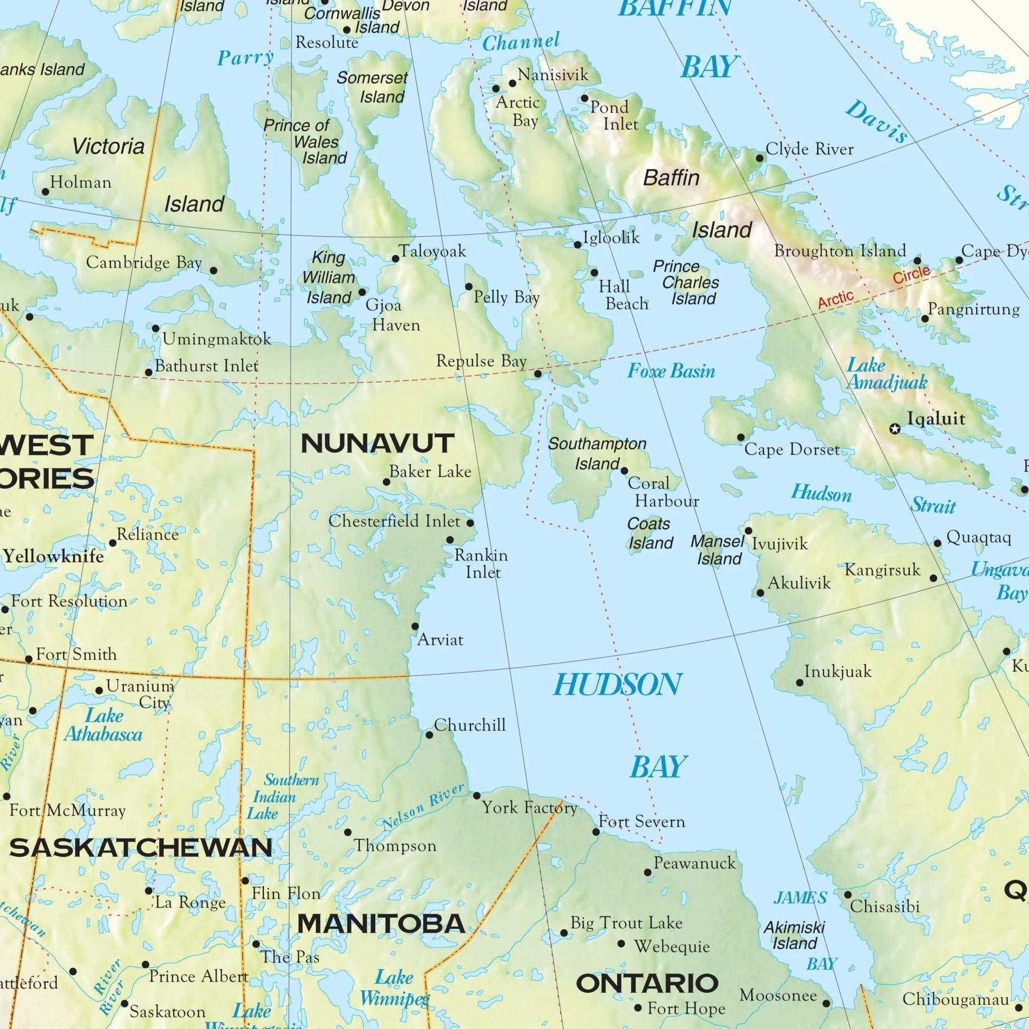
This Wall Map of Canada by Kappa Map Group is a comprehensive resource packed with a myriad of special features and essential data. It showcases all provincial highways, major waterways, military installations, state parks, towns, cities, the Trans-Canada Highway, and time zones. The map employs color-coding to highlight Canada's provinces and also includes significant cities in the United States, such as New York City, Cleveland, Chicago, Minneapolis/St. Paul, Bismarck, Salem (OR), and Helena (MT). In addition, it features insets of South Central Canada to provide a closer look at that region's details. For added convenience, the map is indexed on its face, making it easy to locate and reference key information.
Sizes: 74" x 50" | 62" x 42"
Published: 2003
Original: $109.99
-70%$109.99
$33.00Product Information
Product Information
Shipping & Returns
Shipping & Returns
Description
This Wall Map of Canada by Kappa Map Group is a comprehensive resource packed with a myriad of special features and essential data. It showcases all provincial highways, major waterways, military installations, state parks, towns, cities, the Trans-Canada Highway, and time zones. The map employs color-coding to highlight Canada's provinces and also includes significant cities in the United States, such as New York City, Cleveland, Chicago, Minneapolis/St. Paul, Bismarck, Salem (OR), and Helena (MT). In addition, it features insets of South Central Canada to provide a closer look at that region's details. For added convenience, the map is indexed on its face, making it easy to locate and reference key information.
Sizes: 74" x 50" | 62" x 42"
Published: 2003