


Central America Shaded Relief Wall Map
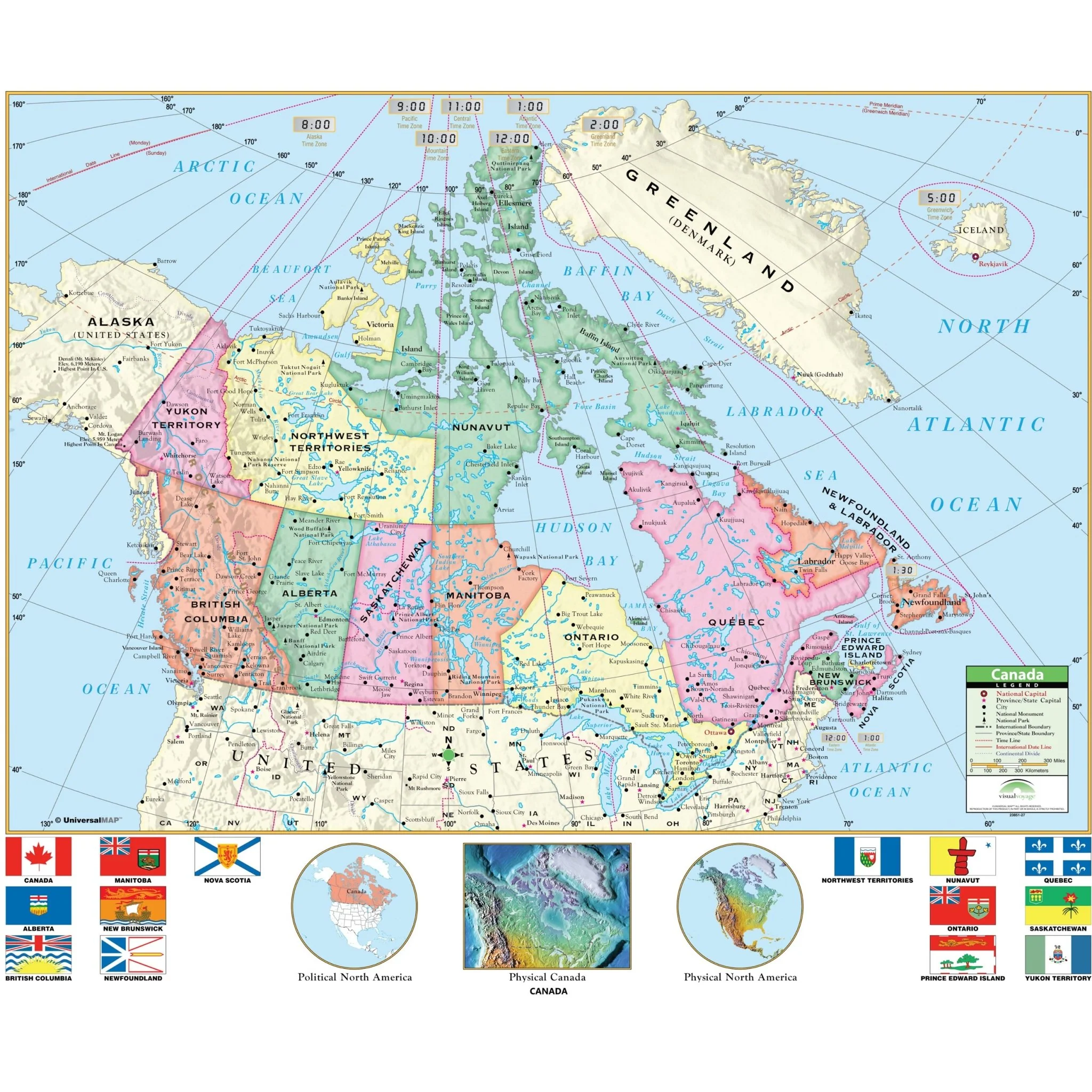
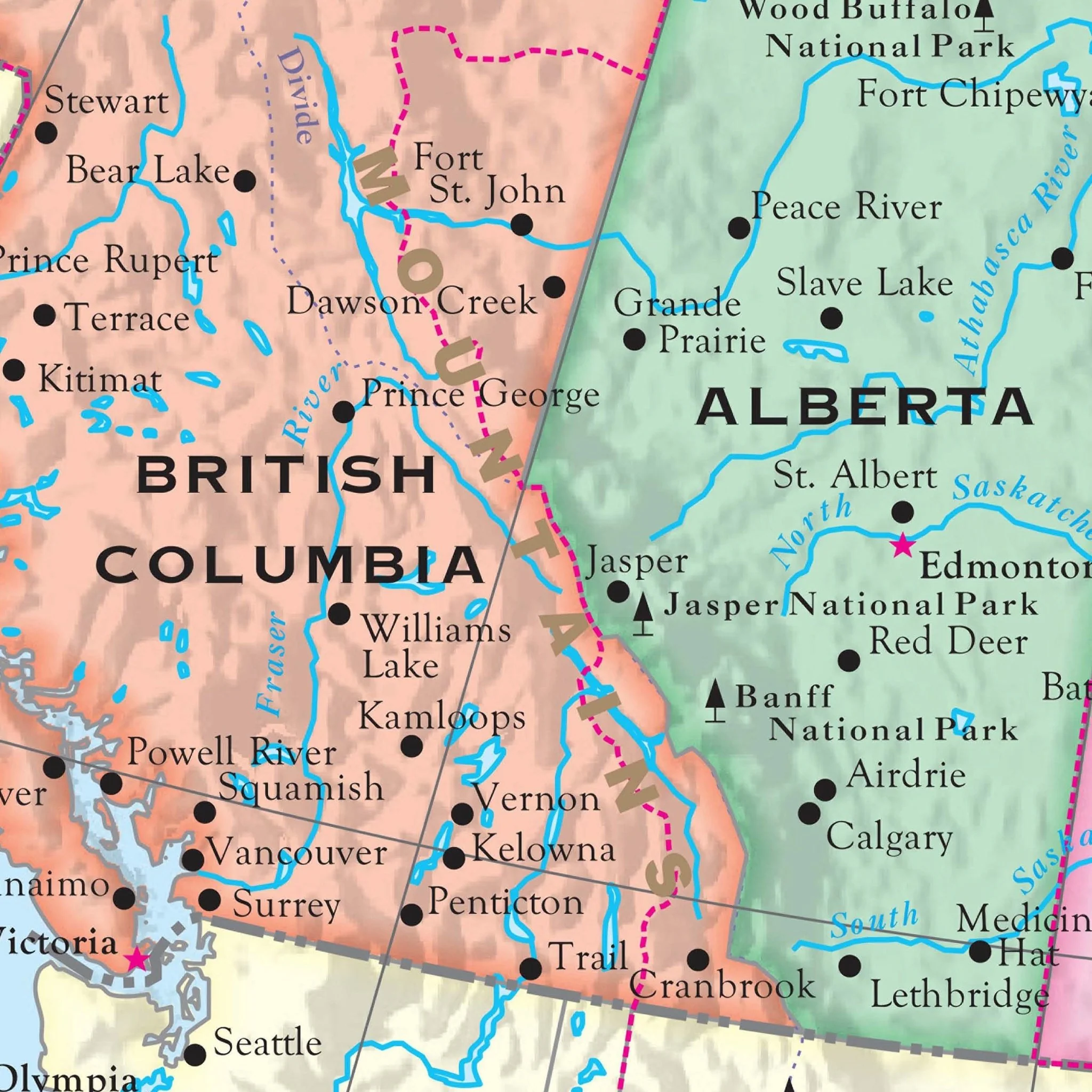
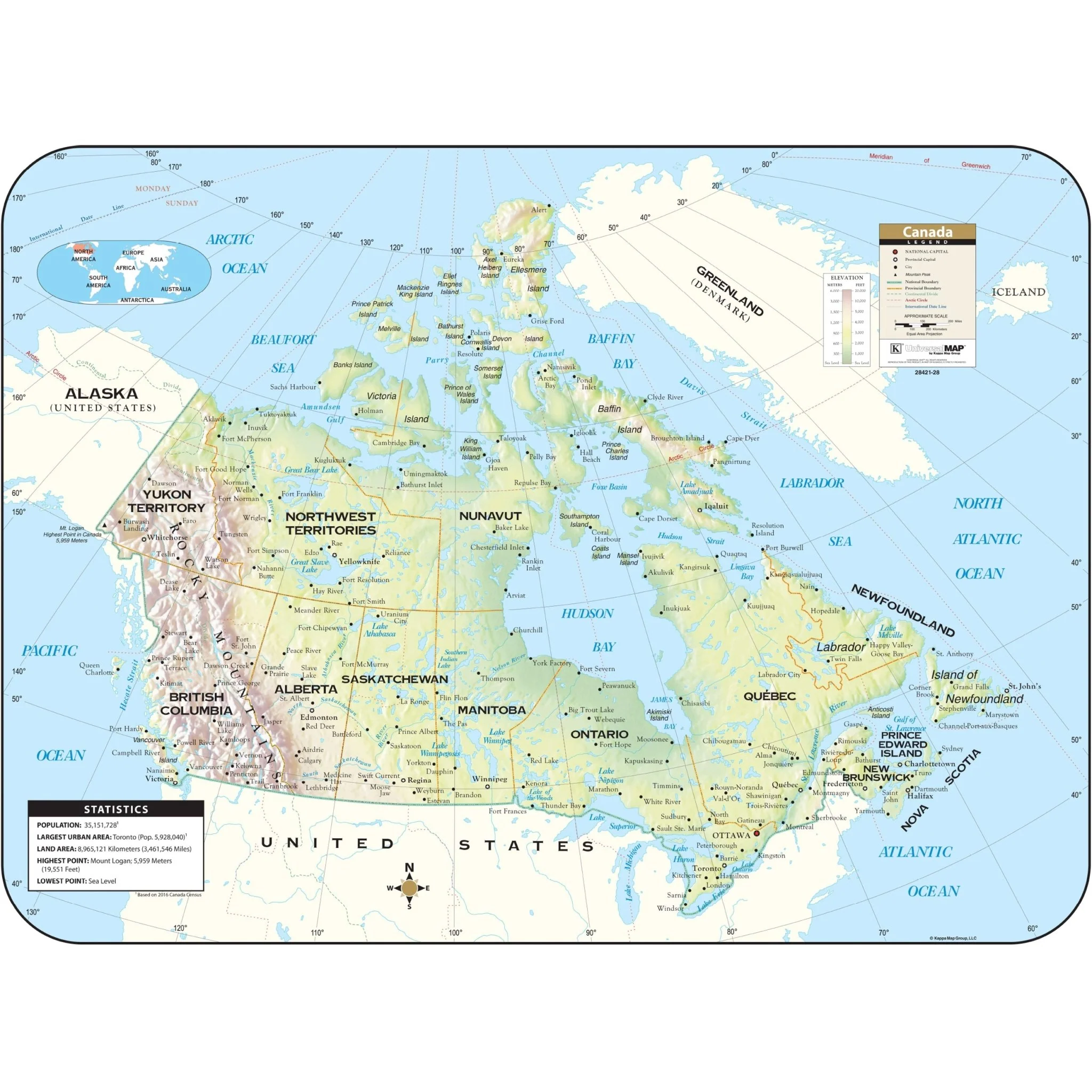
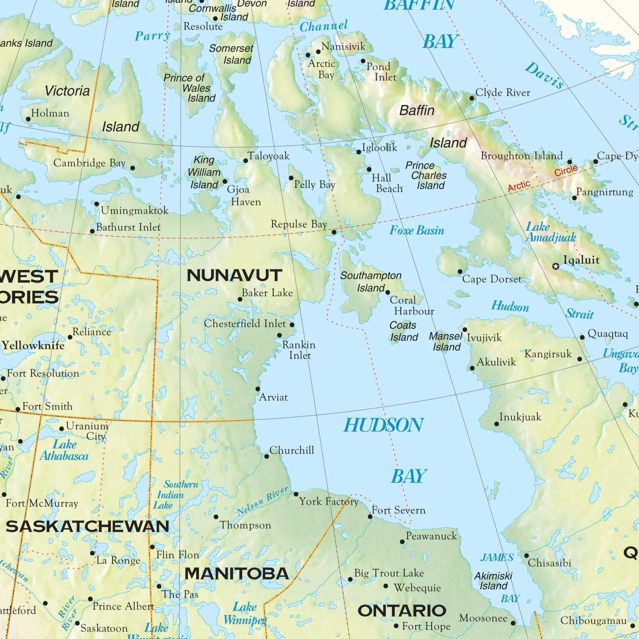
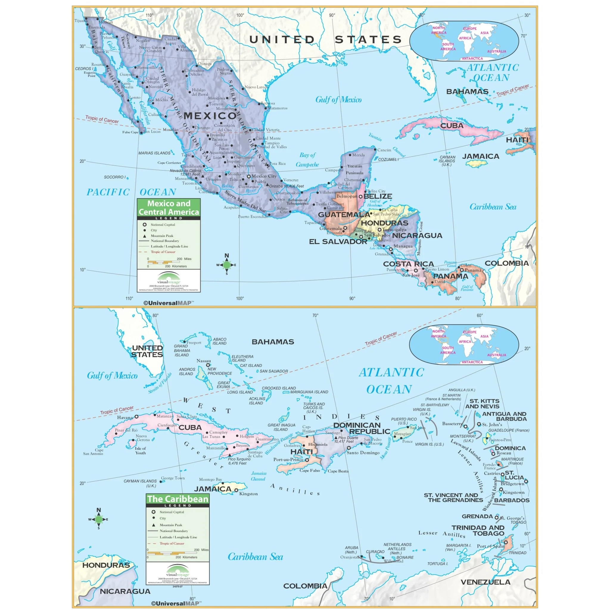
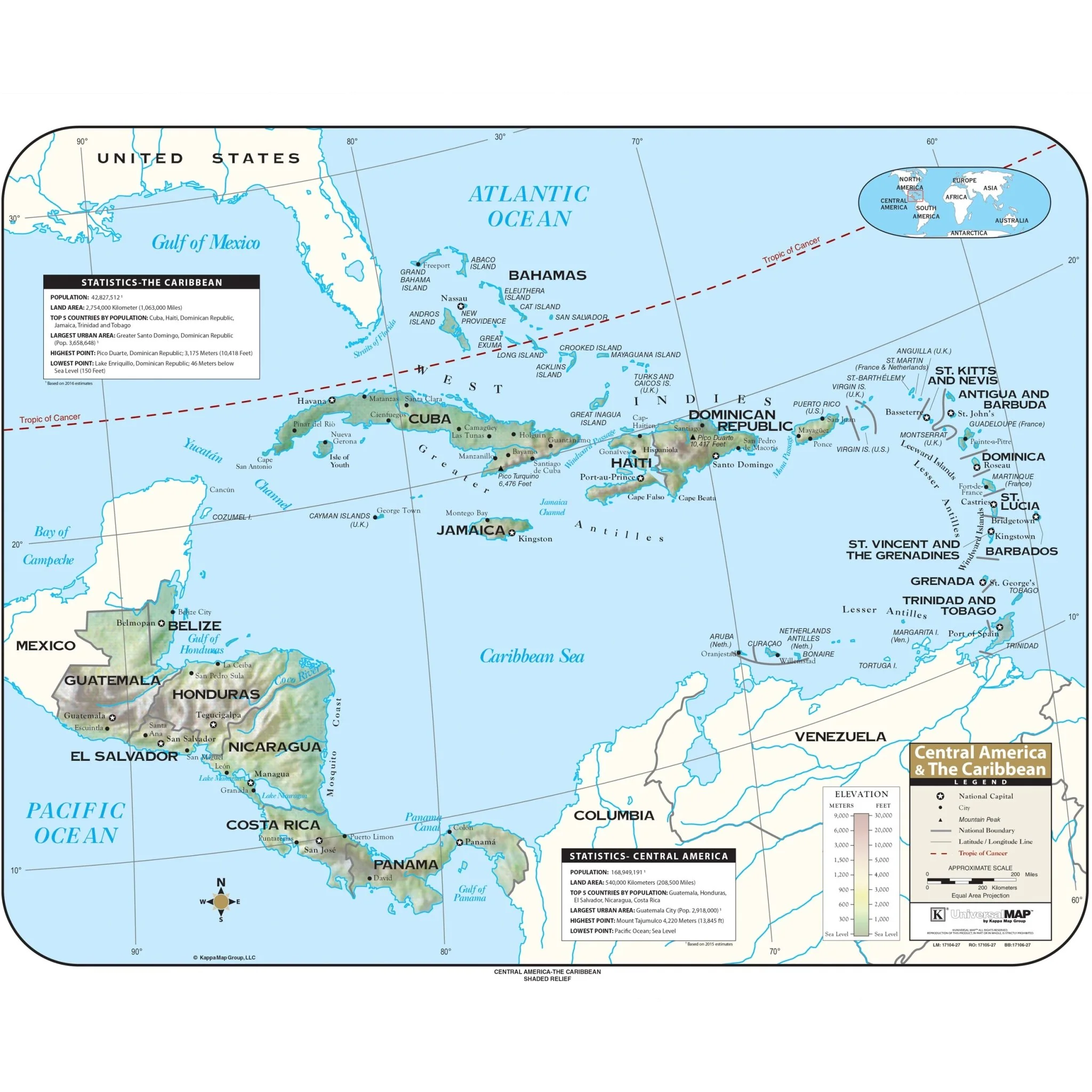
The Central America Shaded Relief Topographical Wall Map by Kappa Map Group is a comprehensive resource, offering valuable details such as an elevation scale measured in both meters and feet, a distance scale presented in miles and kilometers, national boundaries, capital cities, major urban centers, prominent mountain peaks, precise latitude and longitude lines, and the clear demarcation of the Tropic of Cancer.
Sizes: 63" x 50" | 53" x 42" | 38" x 30"
Published: 2016
Original: $89.99
-70%$89.99
$27.00Product Information
Product Information
Shipping & Returns
Shipping & Returns
Description
The Central America Shaded Relief Topographical Wall Map by Kappa Map Group is a comprehensive resource, offering valuable details such as an elevation scale measured in both meters and feet, a distance scale presented in miles and kilometers, national boundaries, capital cities, major urban centers, prominent mountain peaks, precise latitude and longitude lines, and the clear demarcation of the Tropic of Cancer.
Sizes: 63" x 50" | 53" x 42" | 38" x 30"
Published: 2016