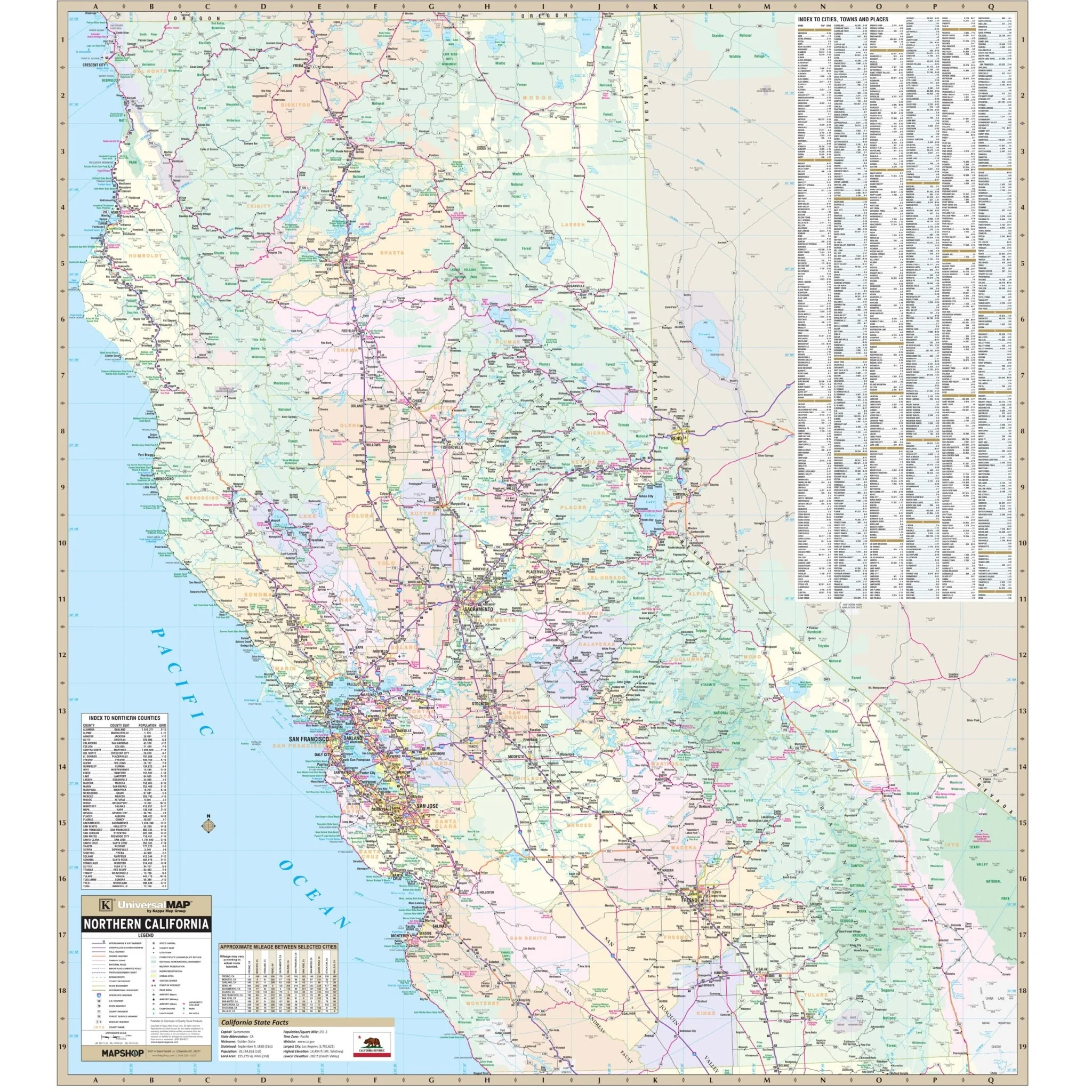


North Central California Regional Wall Map
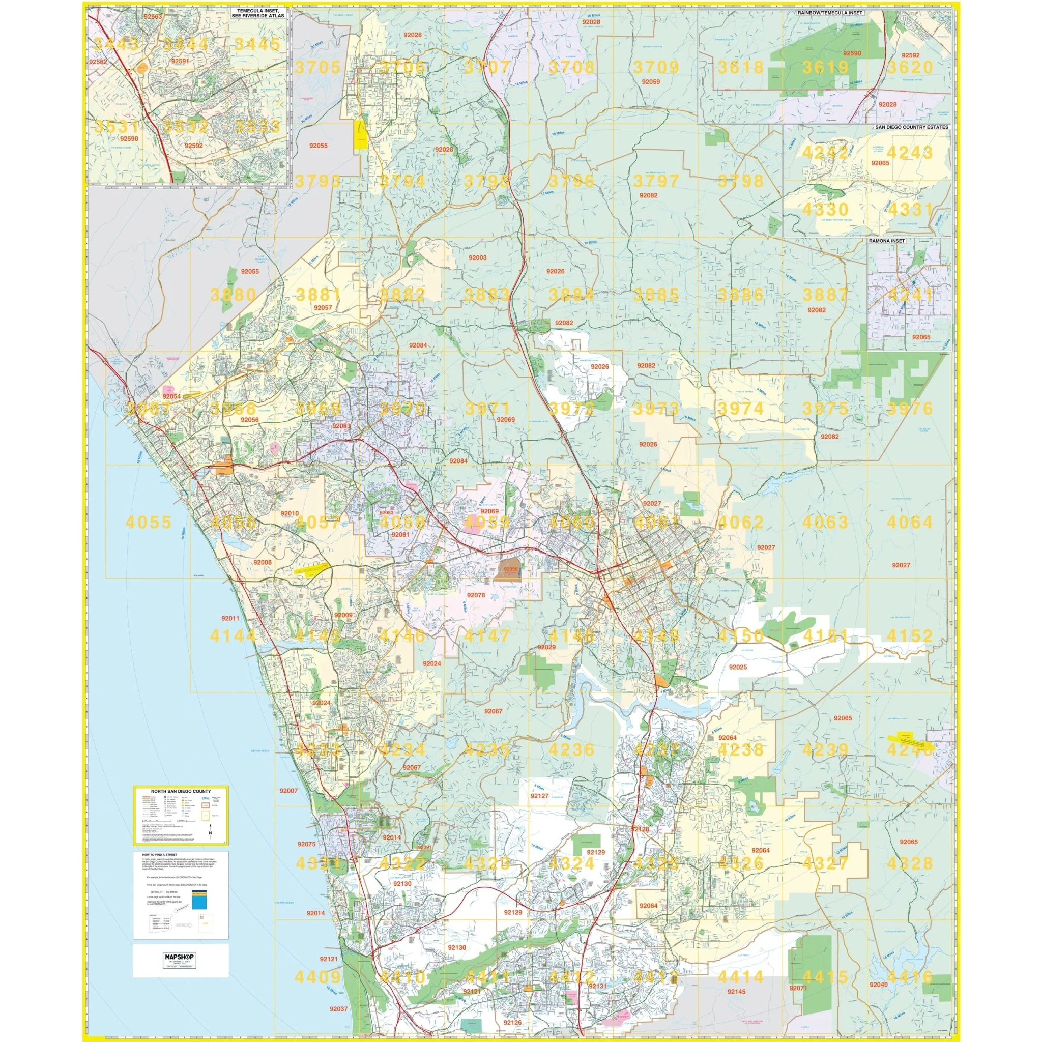
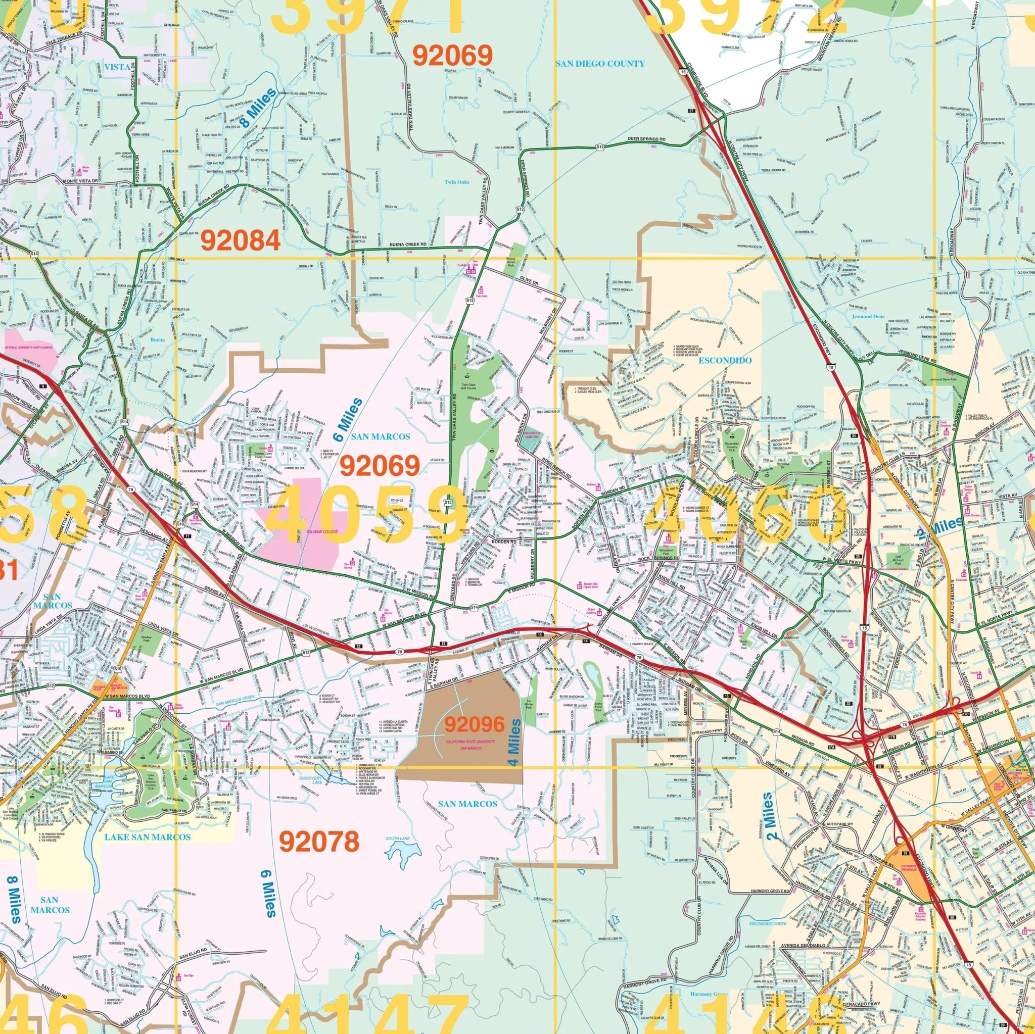
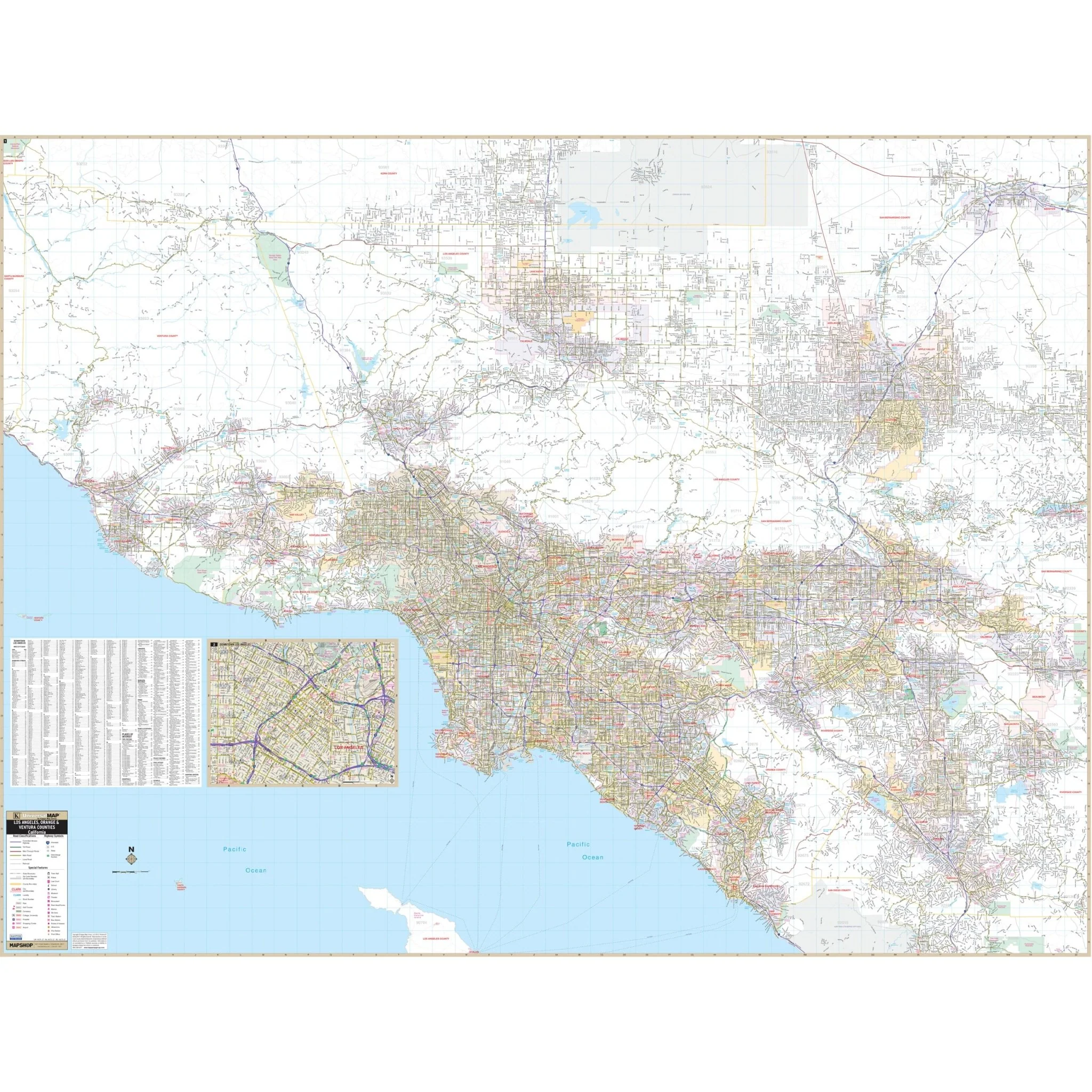
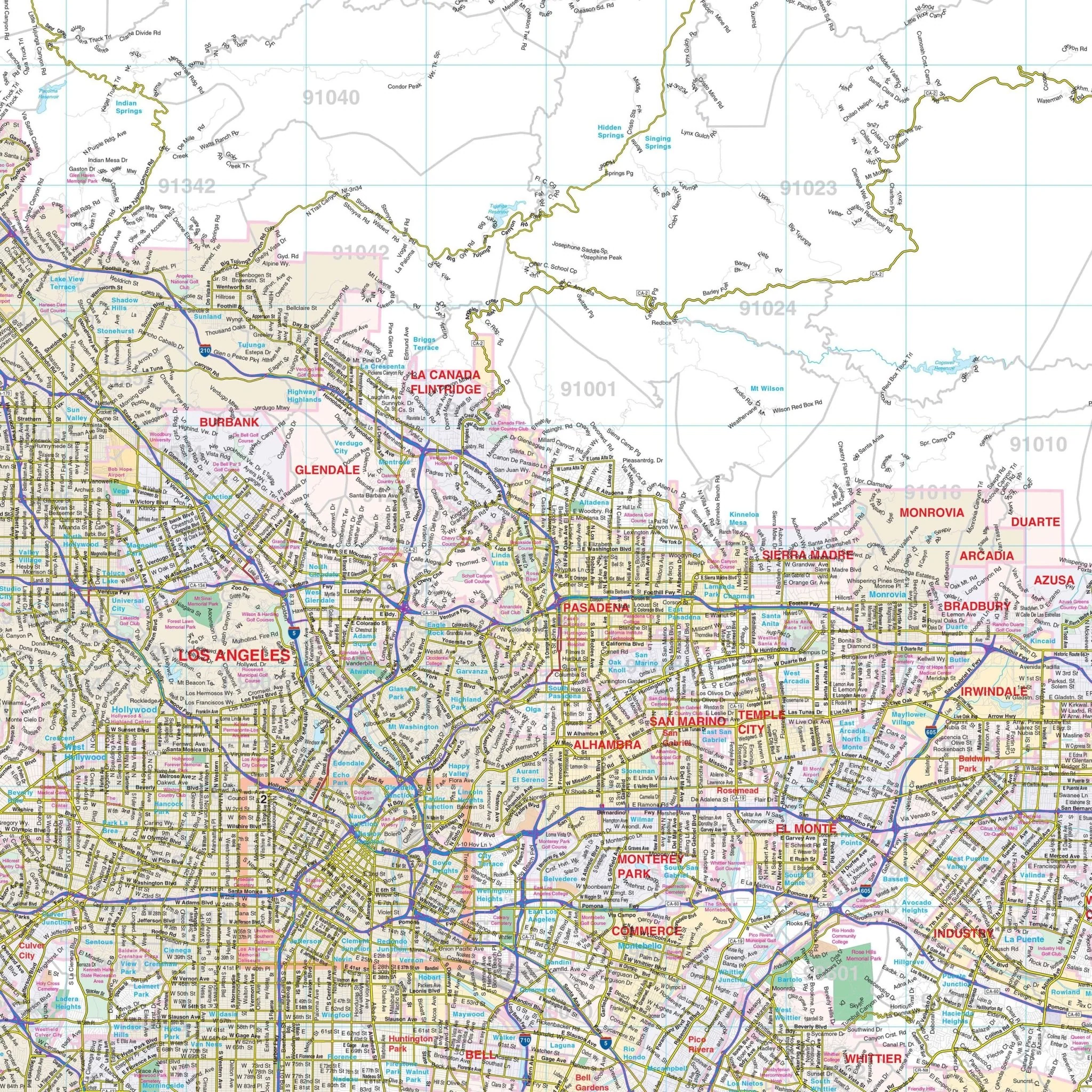
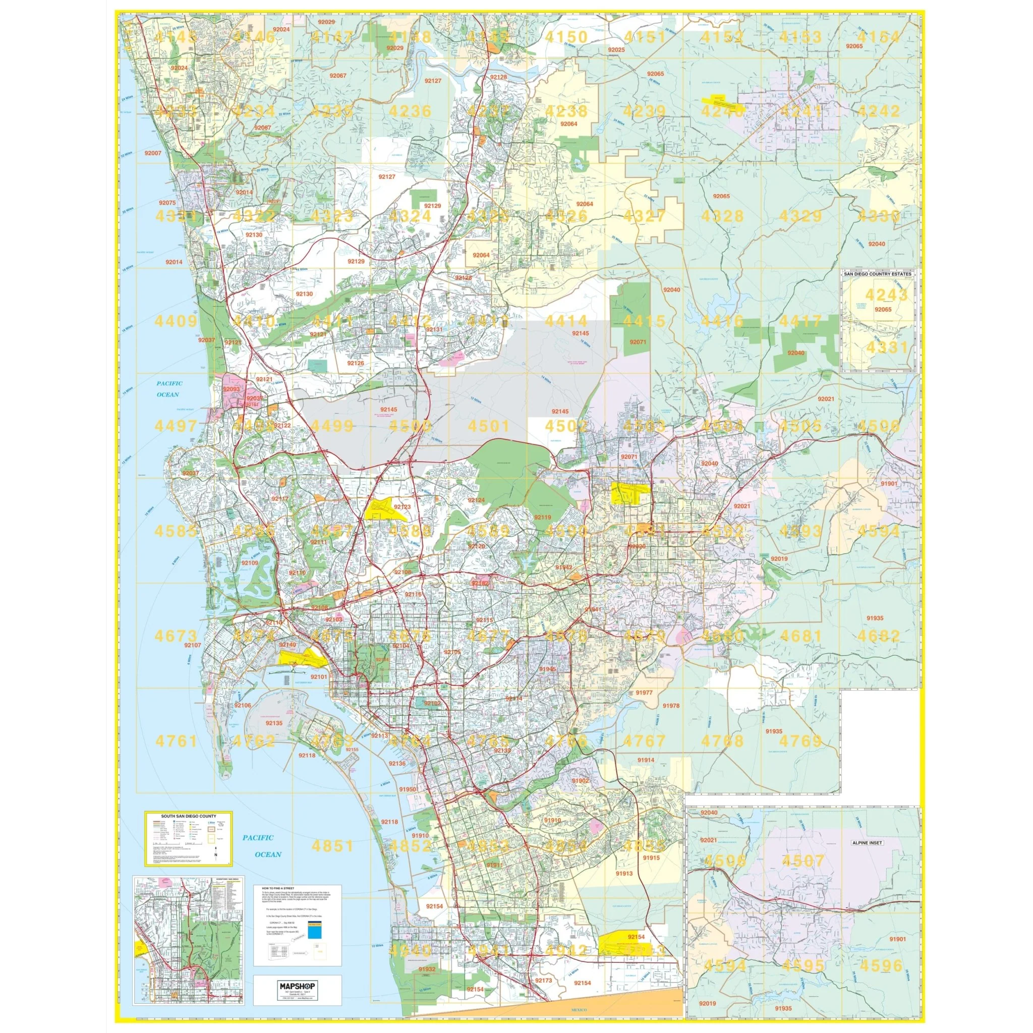
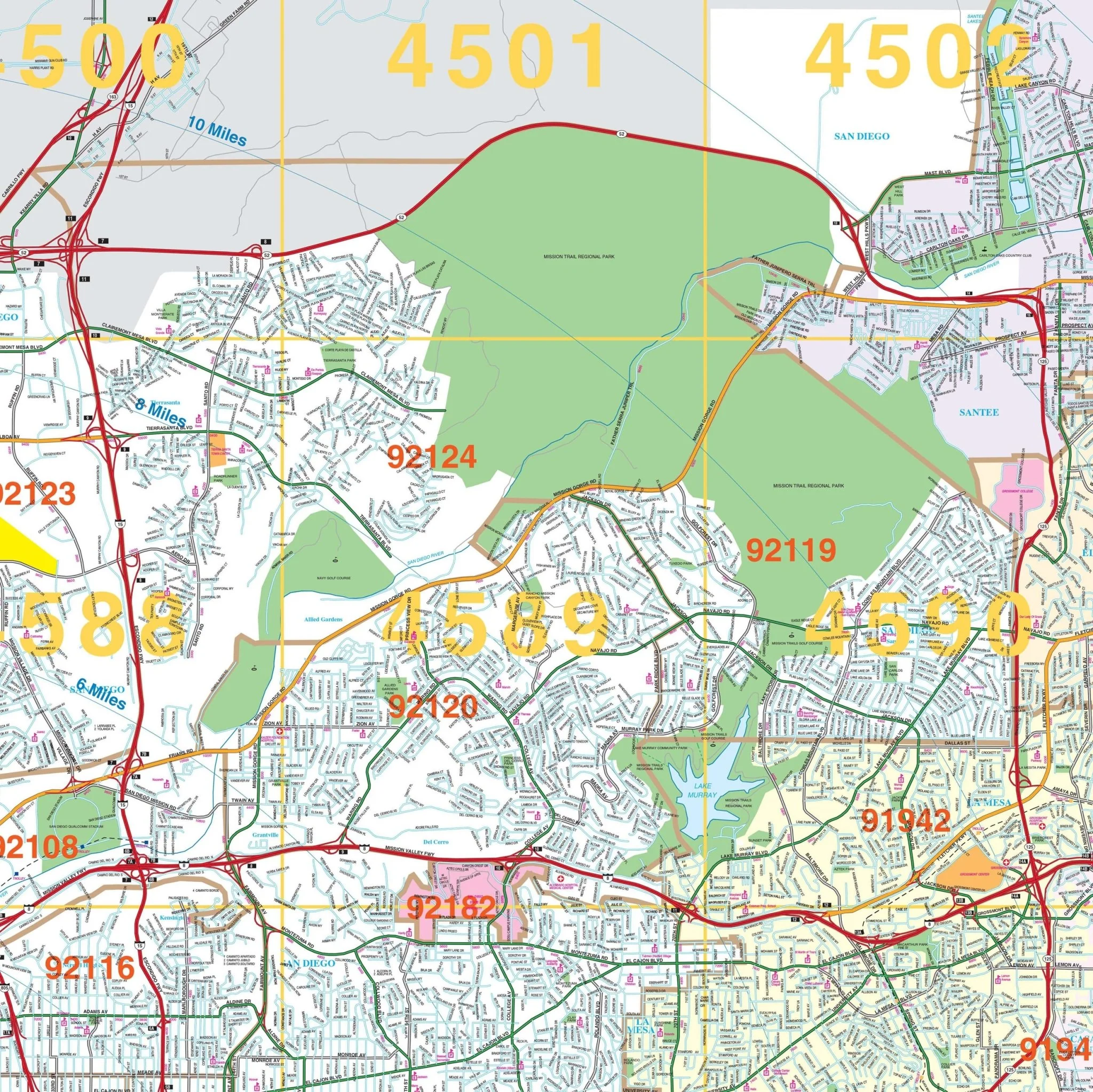
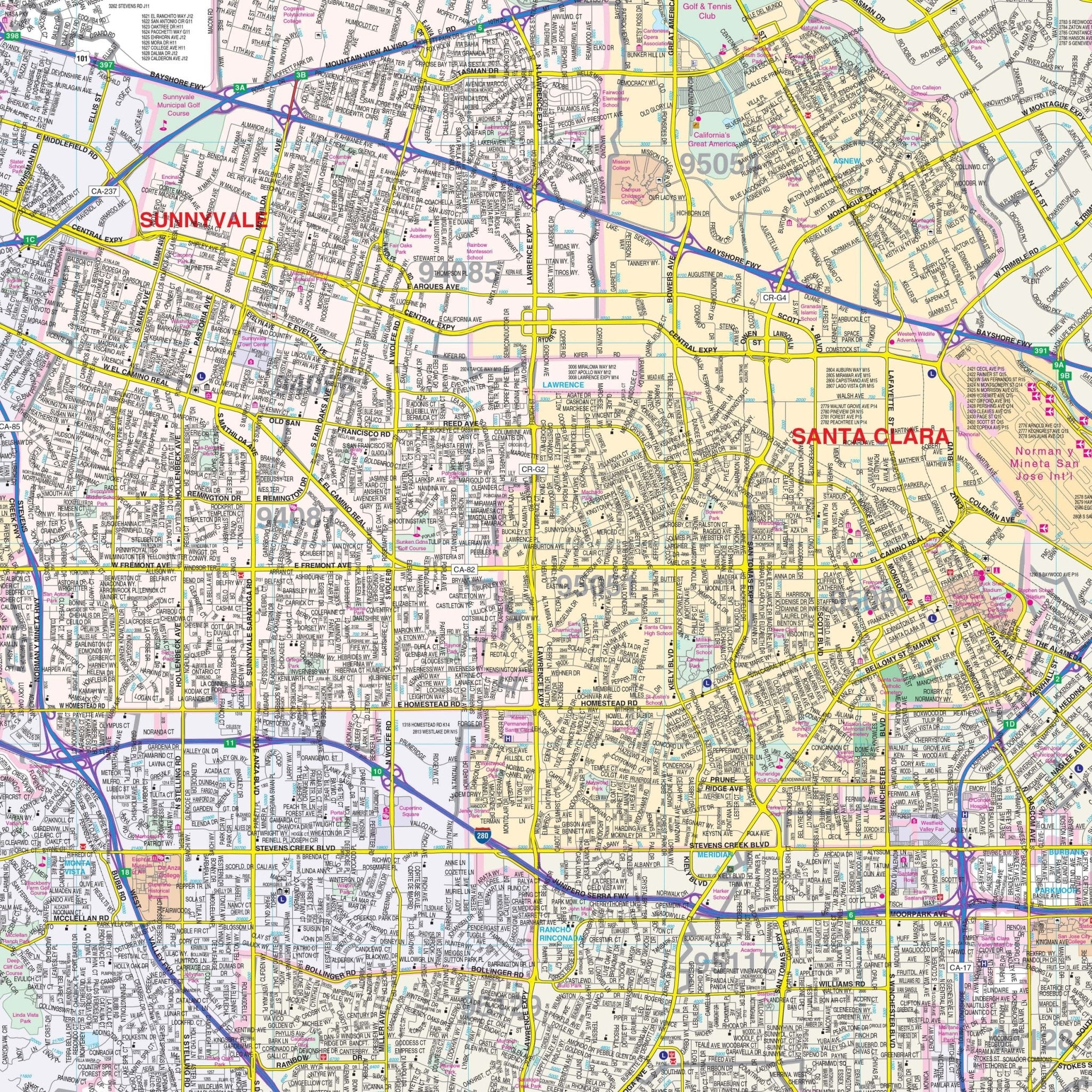
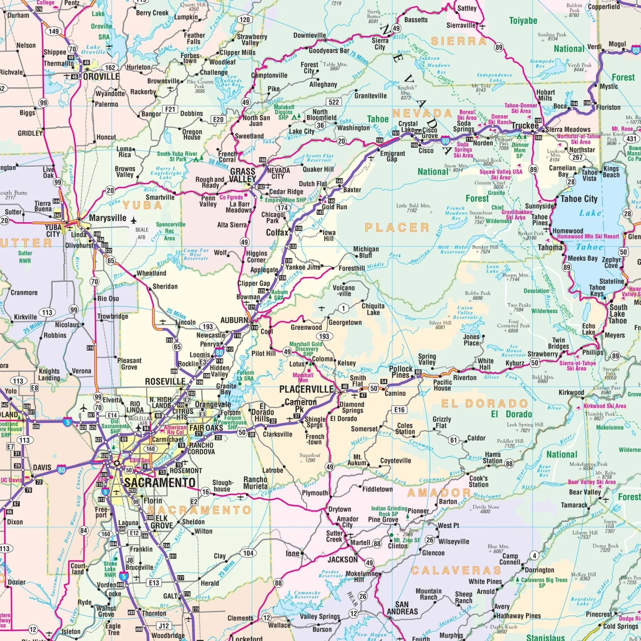
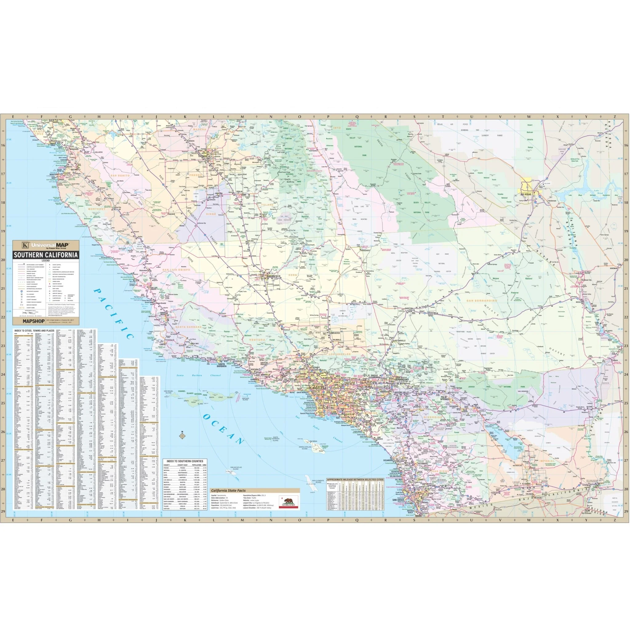
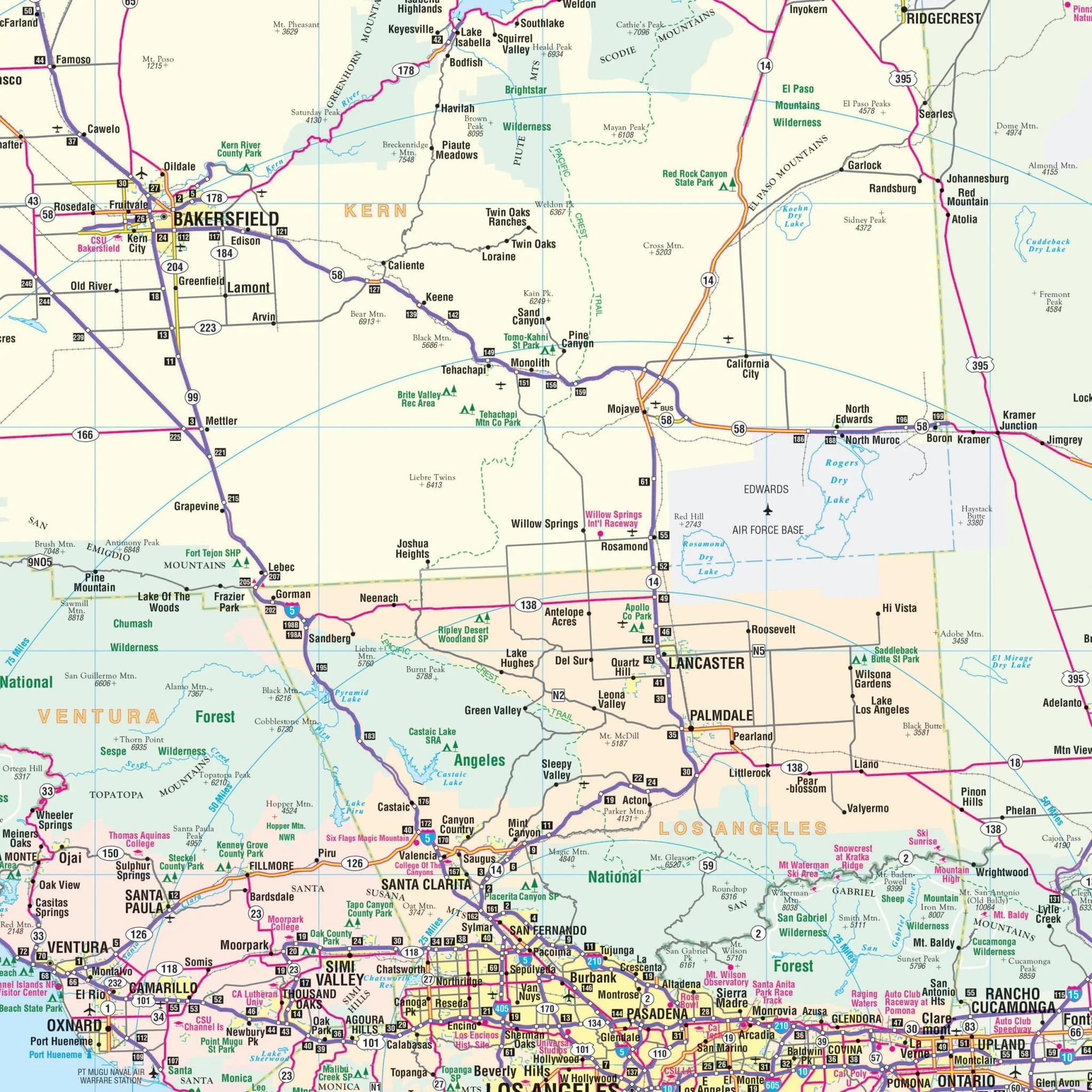
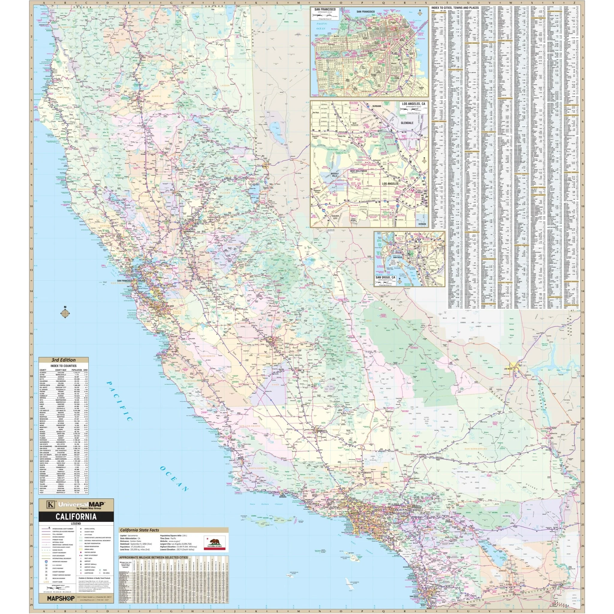
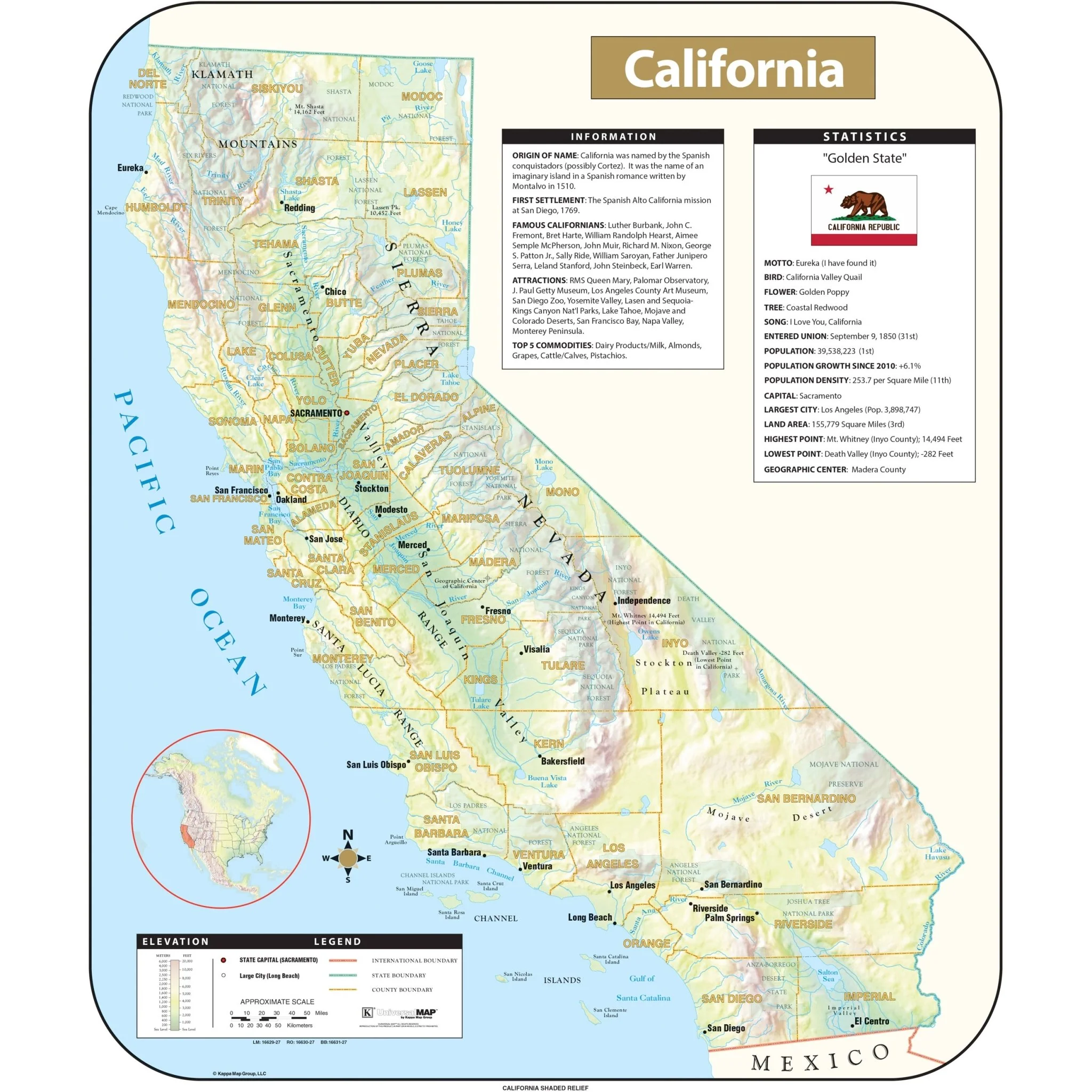
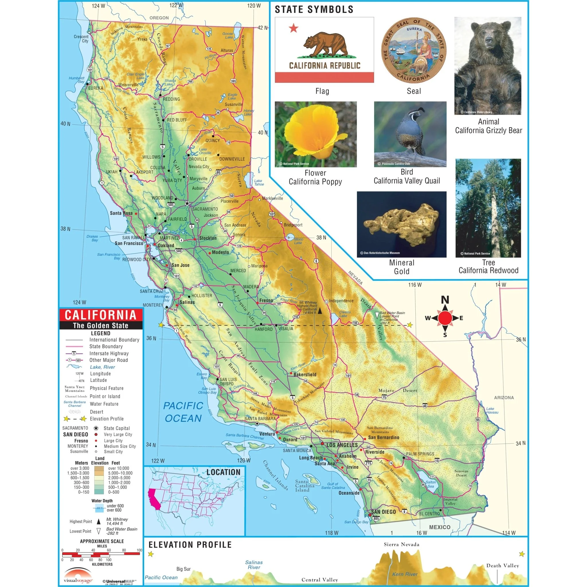
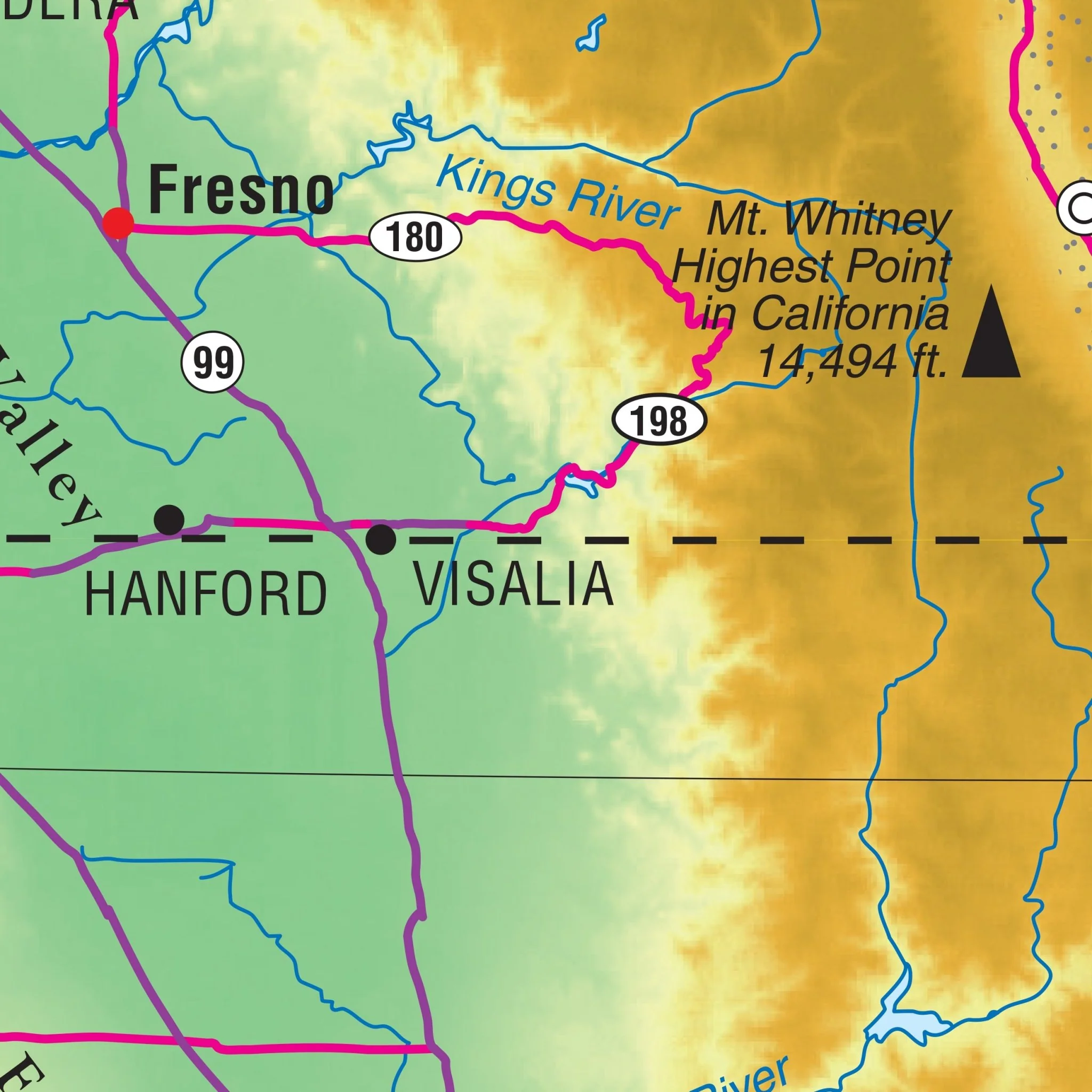
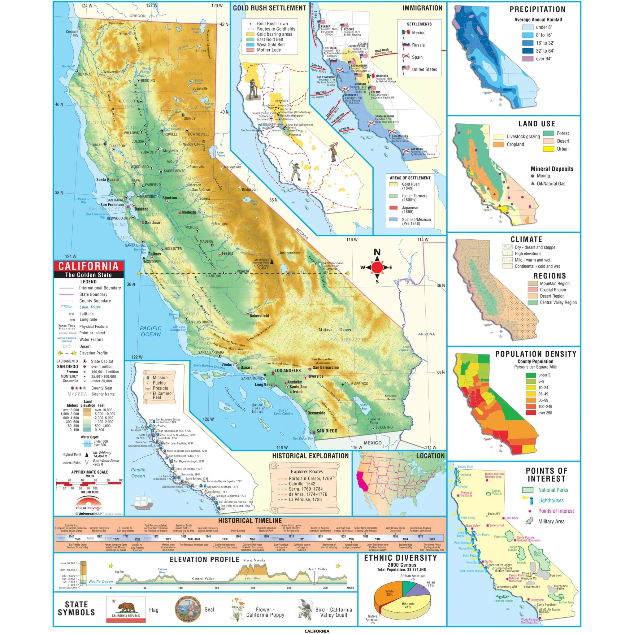
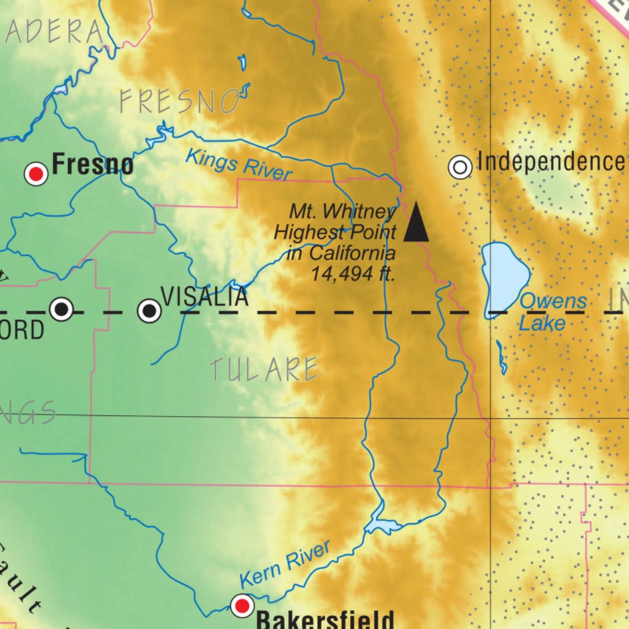
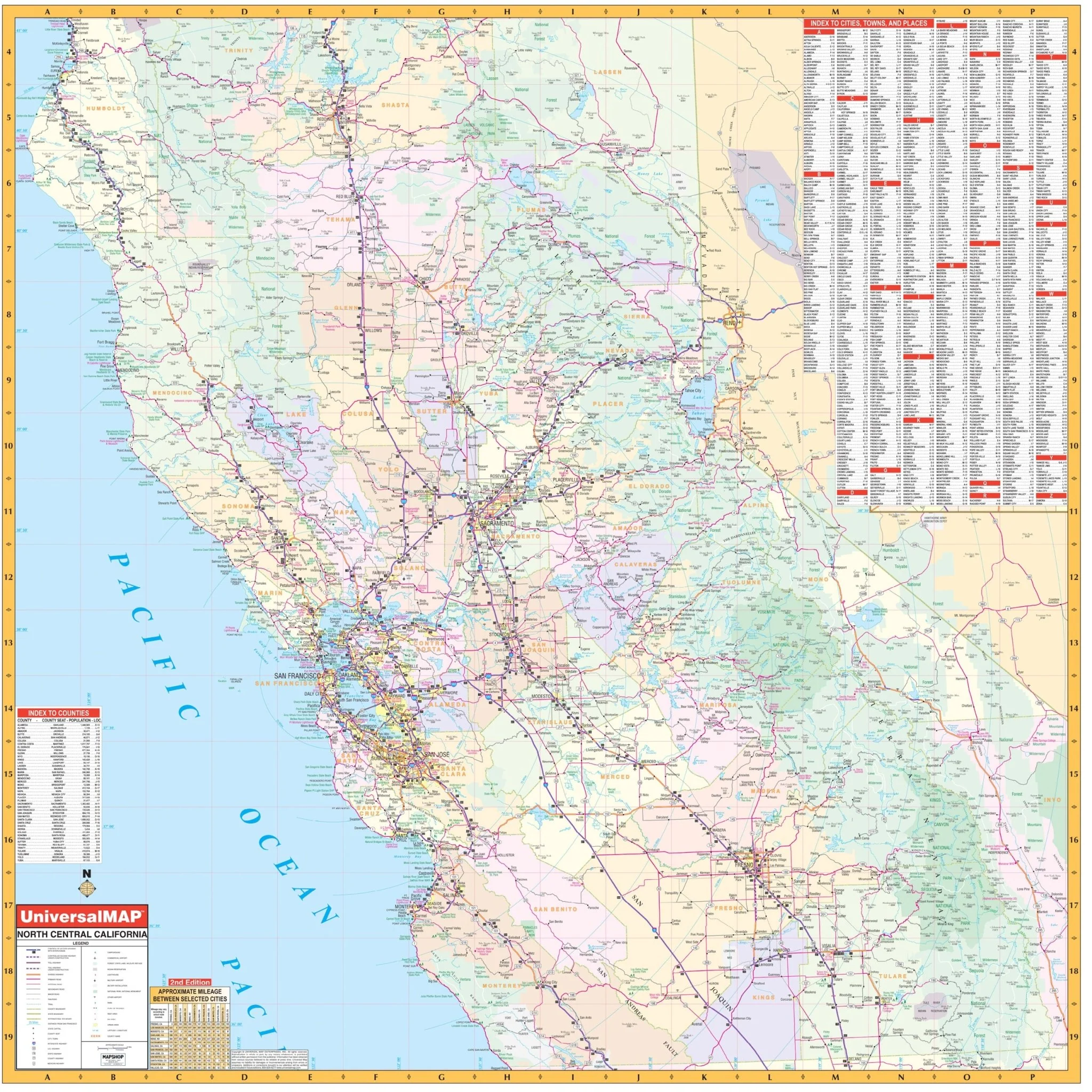
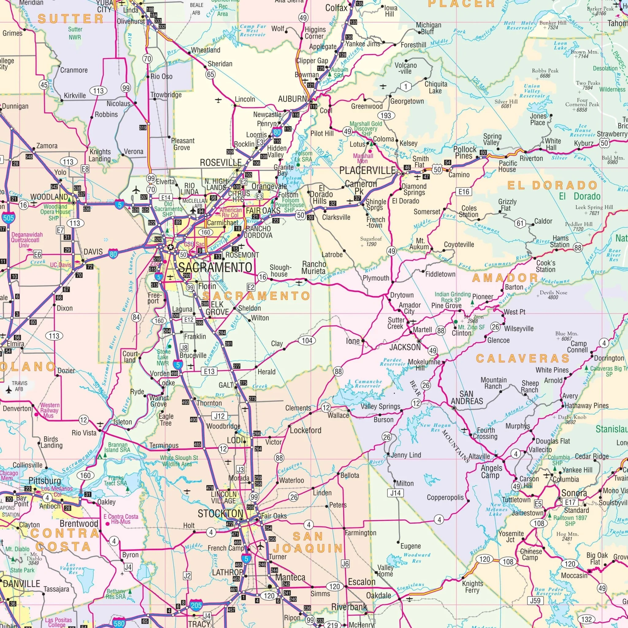
This North Central California Regional Wall Map by Kappa Map Group is an extensive and detailed reference tool that is ideal for businesses, education, or just enhancing your geographical knowledge. The map covers a wide area, highlighting the diversity and intricacy of North Central California's topography, road systems, and political boundaries.
- North: Extending all the way to Redding in Shasta County.
- South: Including the entirety of Monterey, Kings, and Tulare Counties.
- East: Reaching as far as the Nevada State line, even including Reno.
- West: Extending to the beautiful Pacific Ocean.
The map's extensive coverage area includes major cities, highways, waterways, and geographical features, providing a comprehensive view of the region. Colored in a range of soft hues, the map is designed for easy reading and comprehension, distinguishing between urban and rural areas, bodies of water, national parks, and reserves. One of the map's standout features is its grid overlay, which allows for easy location referencing and navigation. Along the sides, you will find a detailed index listing of cities, making this wall map both a practical tool for route planning and an educational resource for learning about the region's geography and infrastructure.
Size: 54" x 54"
Published: 2001
Original: $139.99
-70%$139.99
$42.00Product Information
Product Information
Shipping & Returns
Shipping & Returns
Description
This North Central California Regional Wall Map by Kappa Map Group is an extensive and detailed reference tool that is ideal for businesses, education, or just enhancing your geographical knowledge. The map covers a wide area, highlighting the diversity and intricacy of North Central California's topography, road systems, and political boundaries.
- North: Extending all the way to Redding in Shasta County.
- South: Including the entirety of Monterey, Kings, and Tulare Counties.
- East: Reaching as far as the Nevada State line, even including Reno.
- West: Extending to the beautiful Pacific Ocean.
The map's extensive coverage area includes major cities, highways, waterways, and geographical features, providing a comprehensive view of the region. Colored in a range of soft hues, the map is designed for easy reading and comprehension, distinguishing between urban and rural areas, bodies of water, national parks, and reserves. One of the map's standout features is its grid overlay, which allows for easy location referencing and navigation. Along the sides, you will find a detailed index listing of cities, making this wall map both a practical tool for route planning and an educational resource for learning about the region's geography and infrastructure.
Size: 54" x 54"
Published: 2001