


Southern California Regional Wall Map
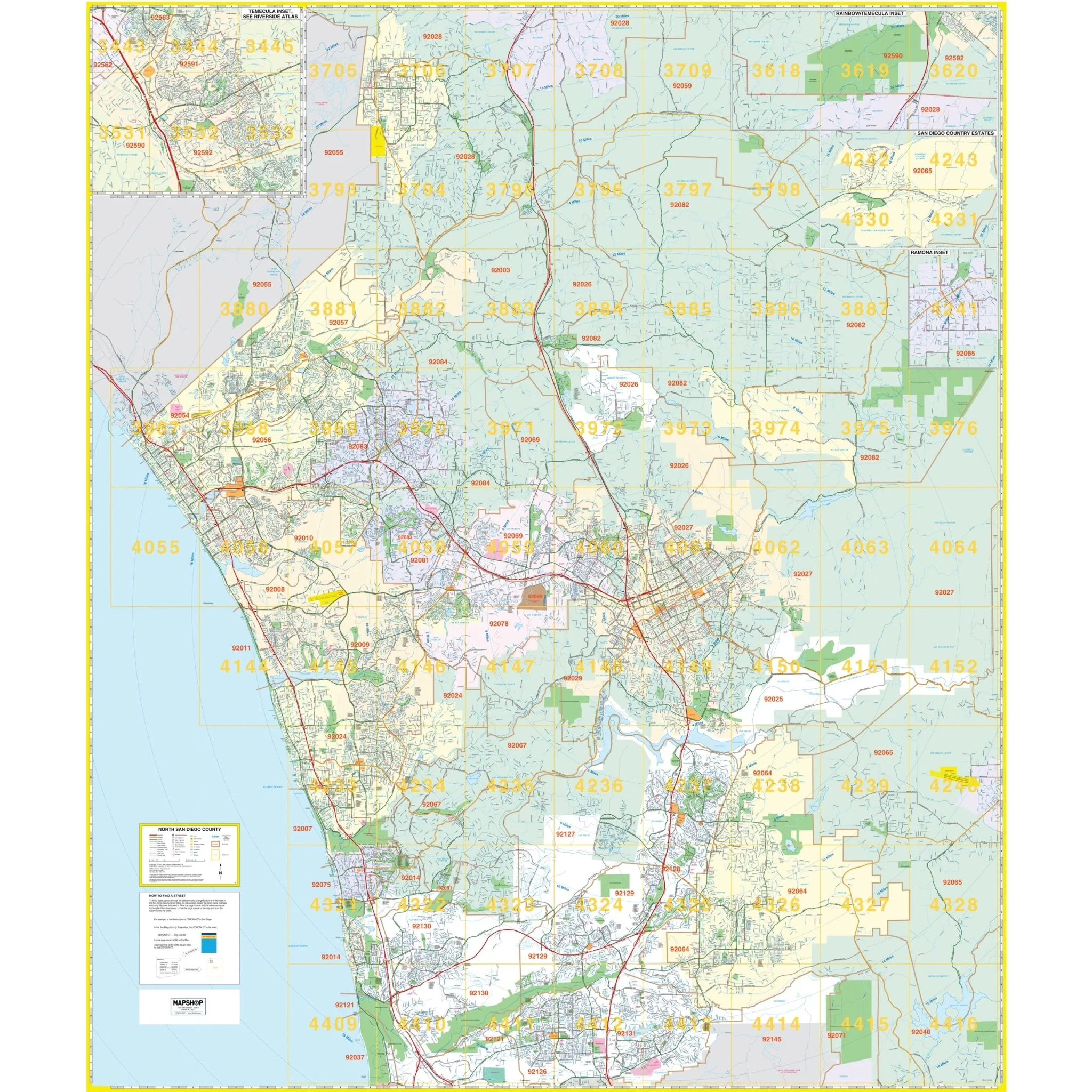
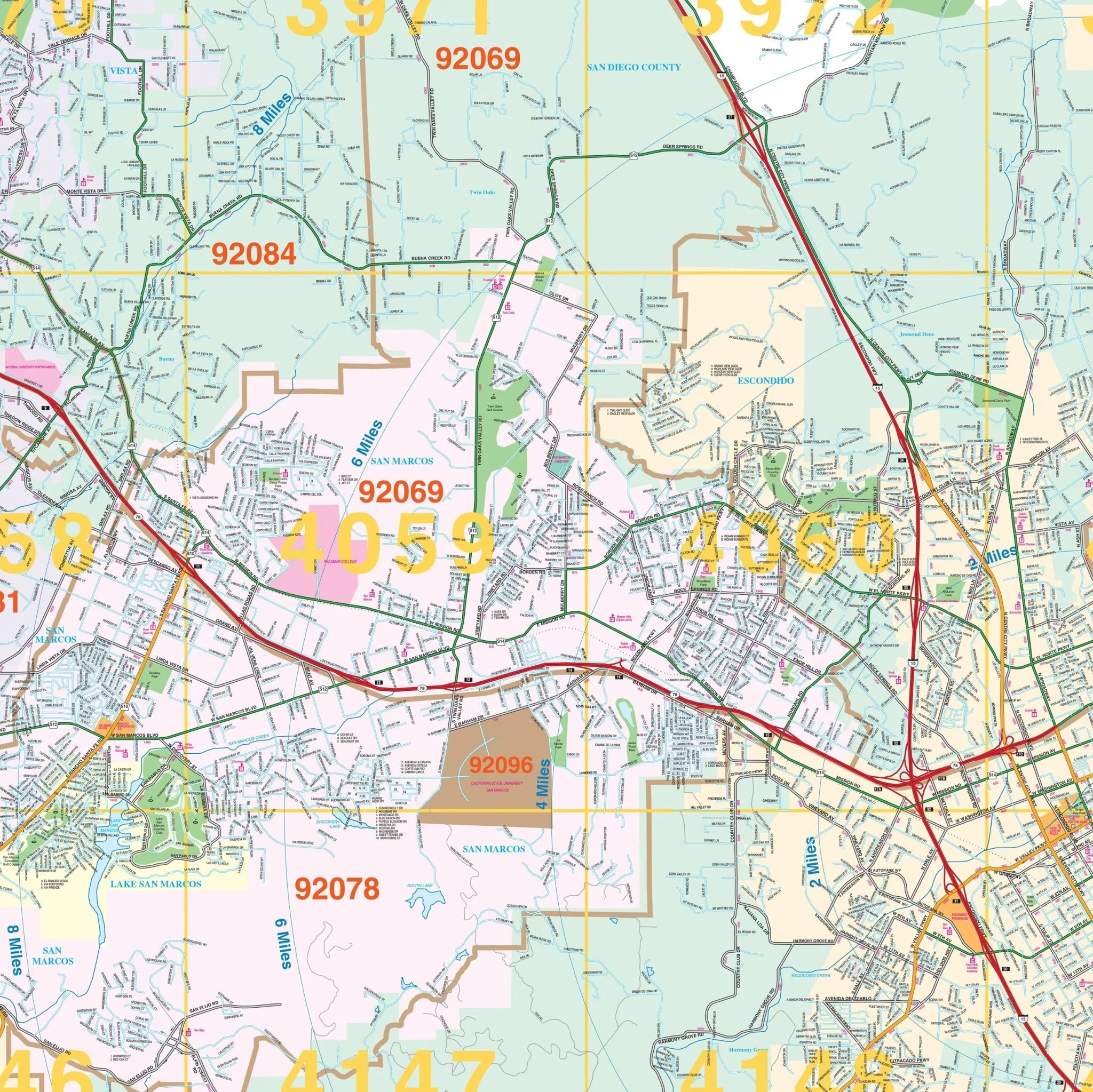
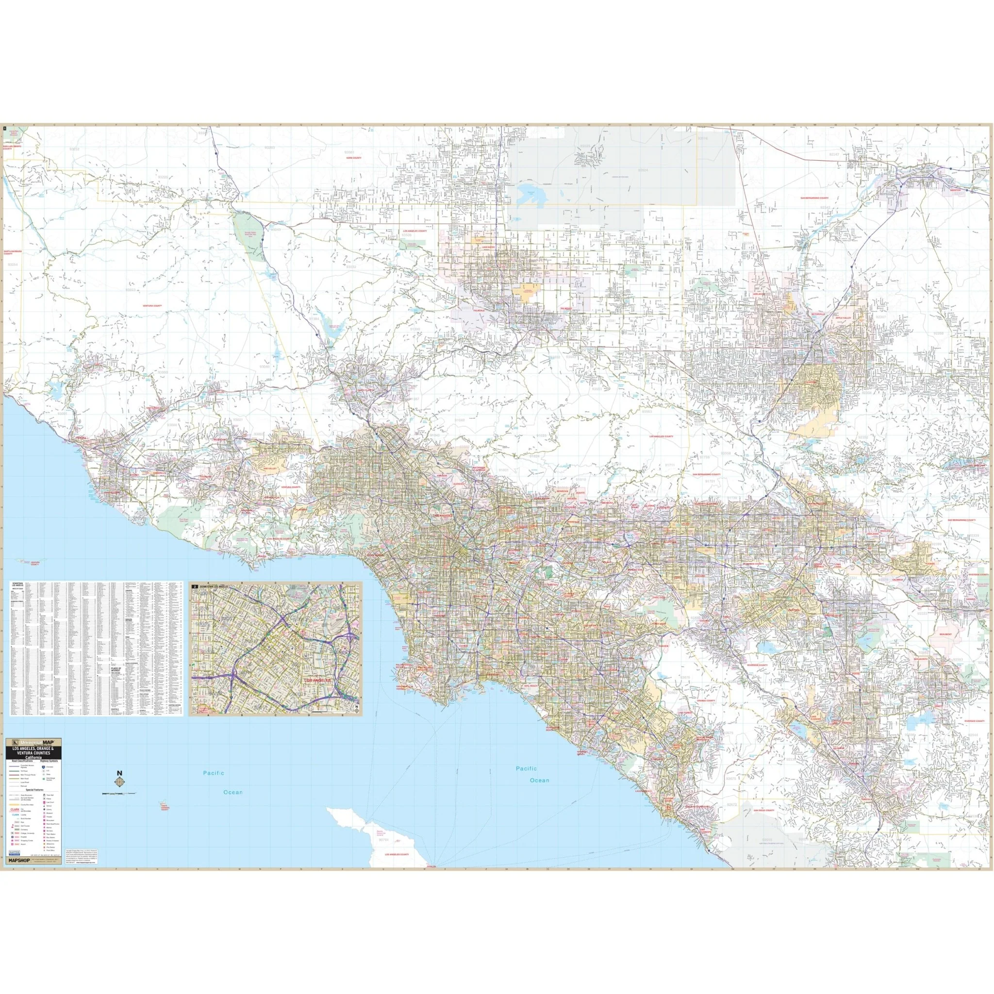
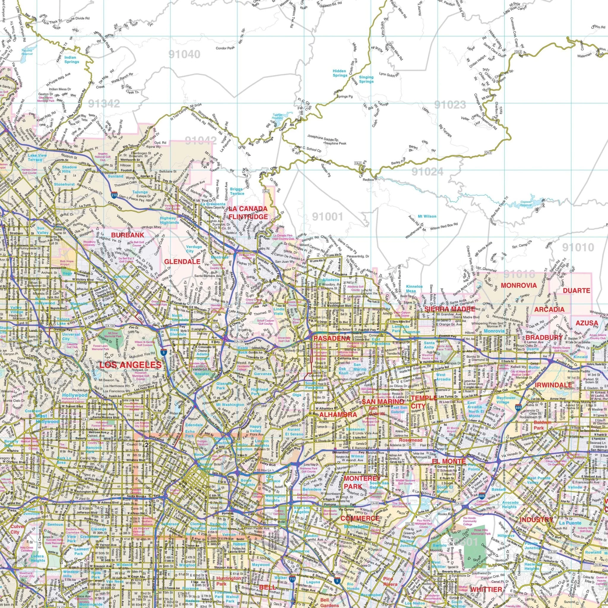
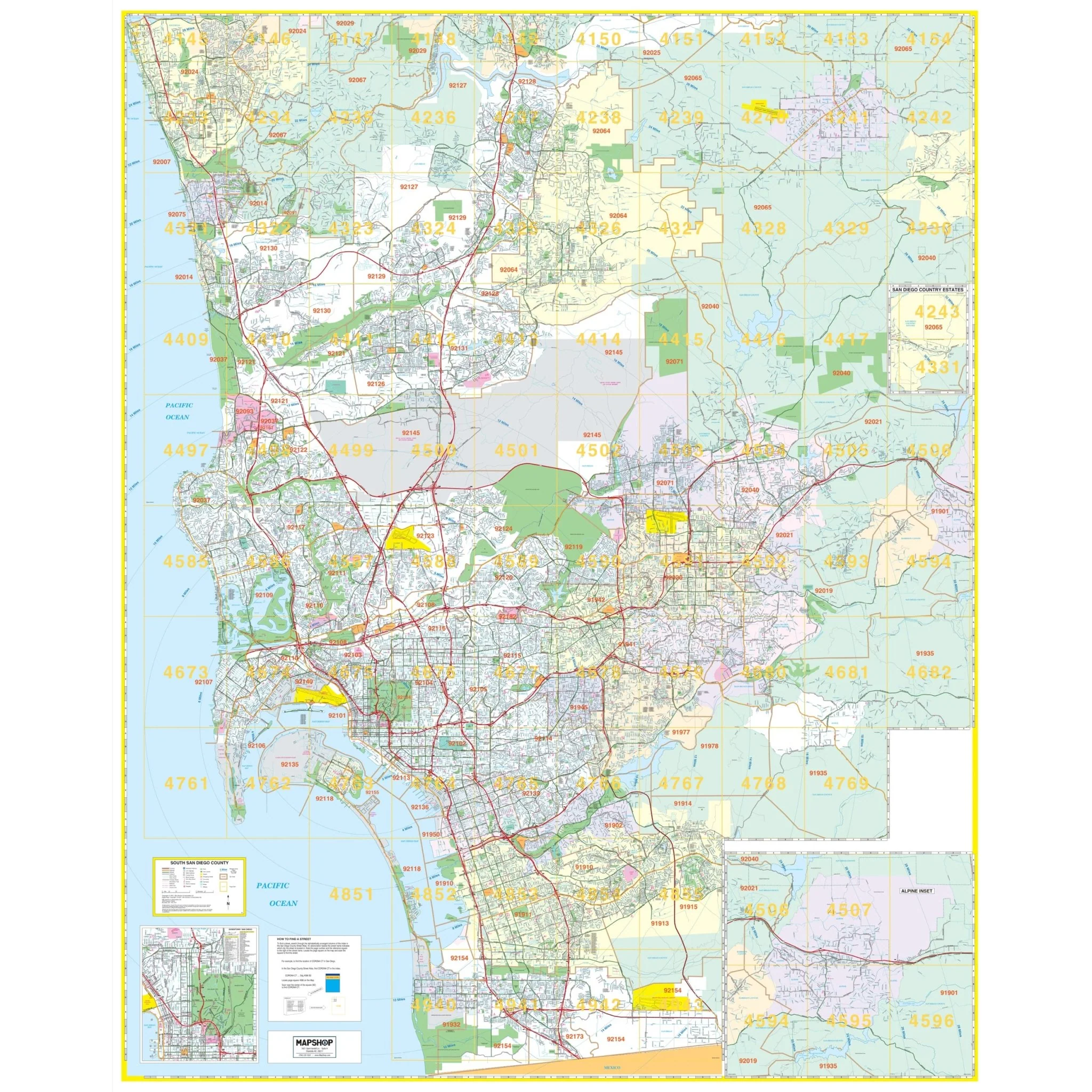
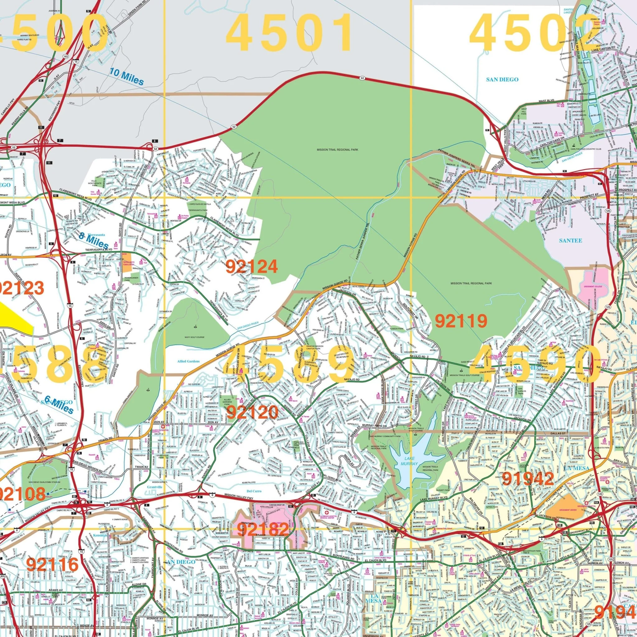
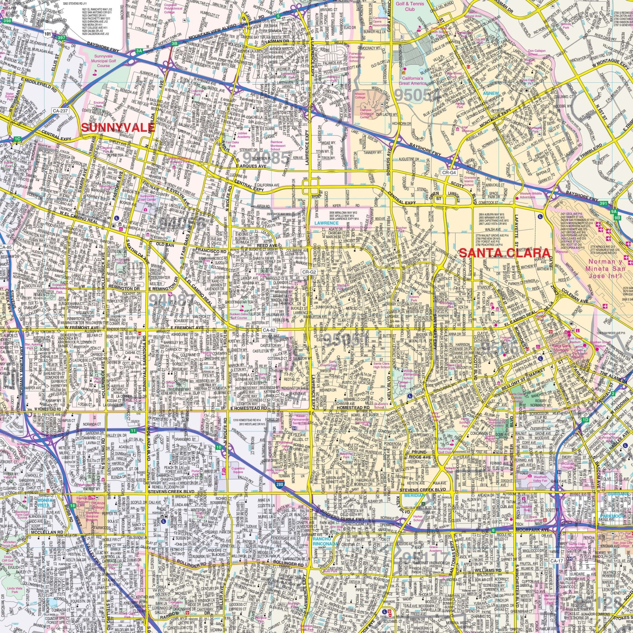
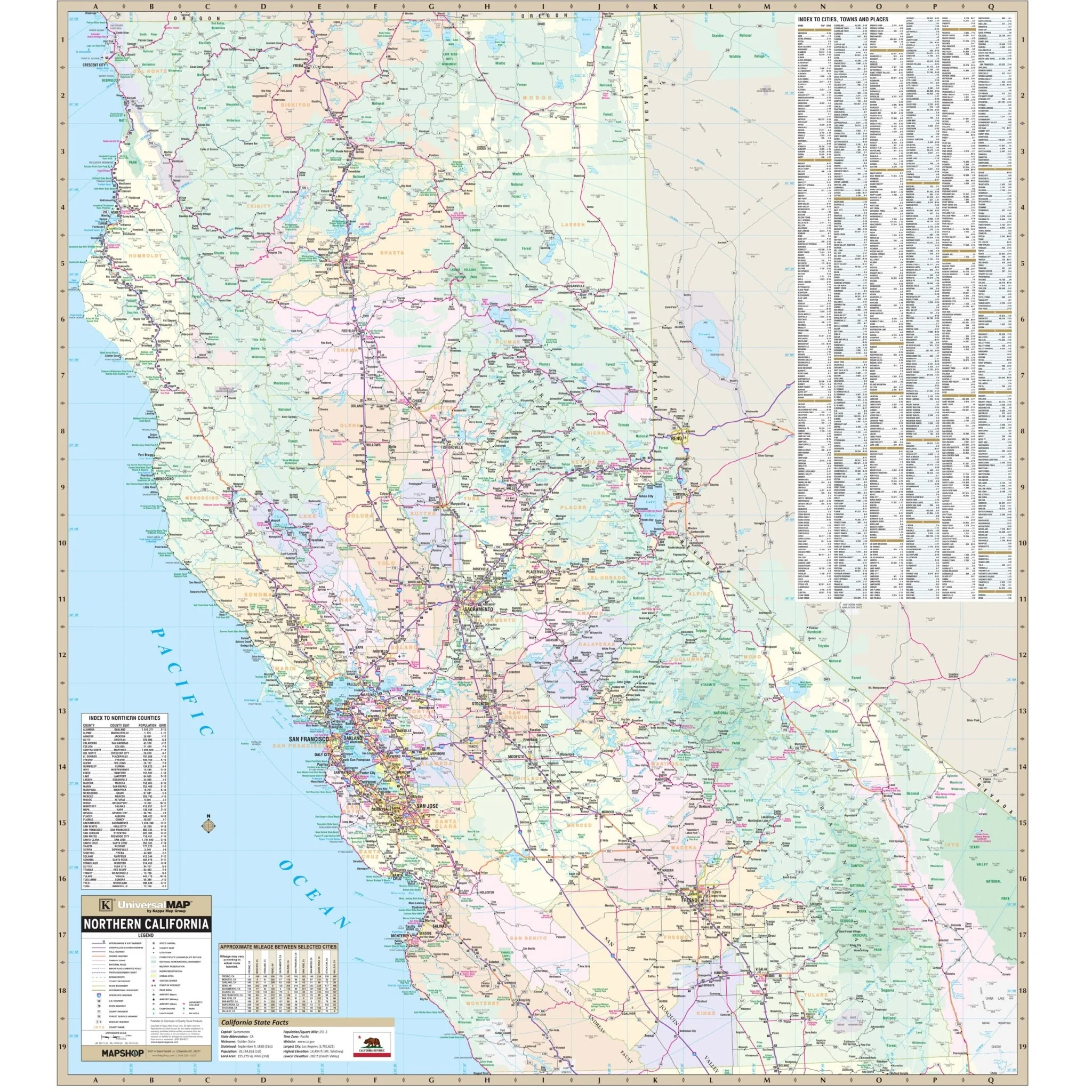
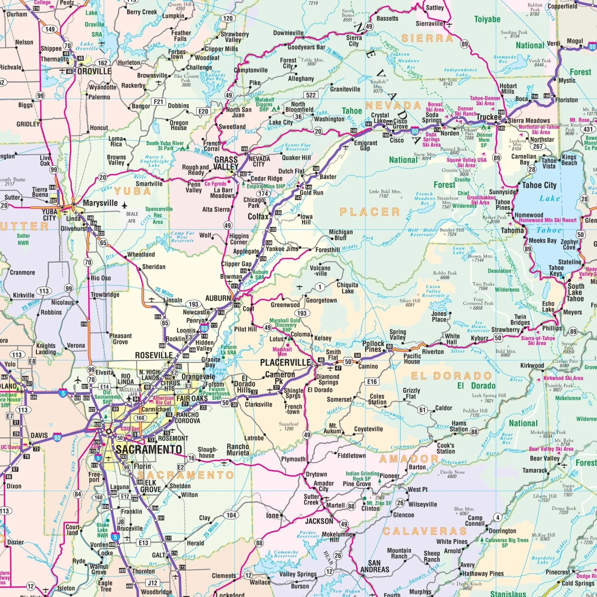
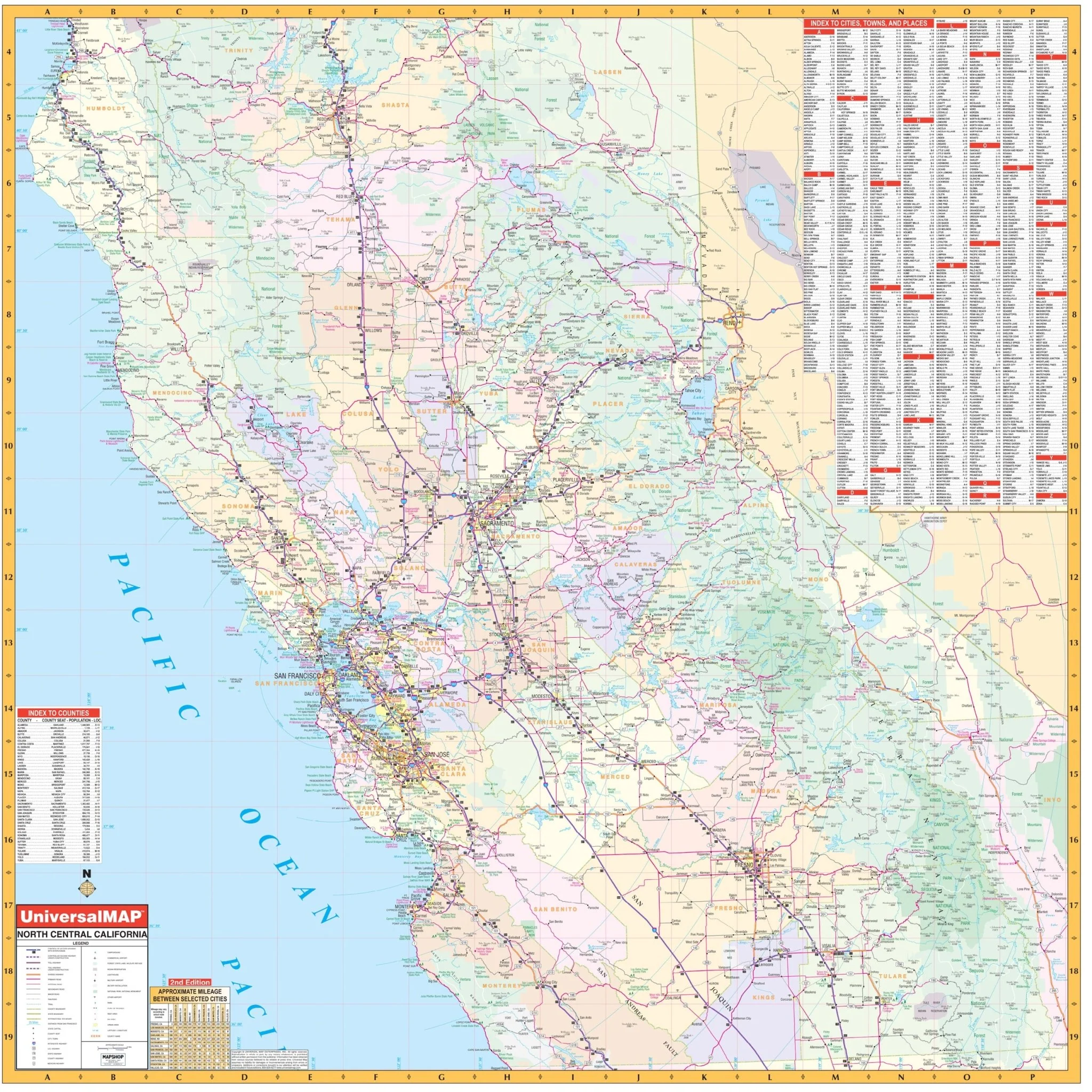
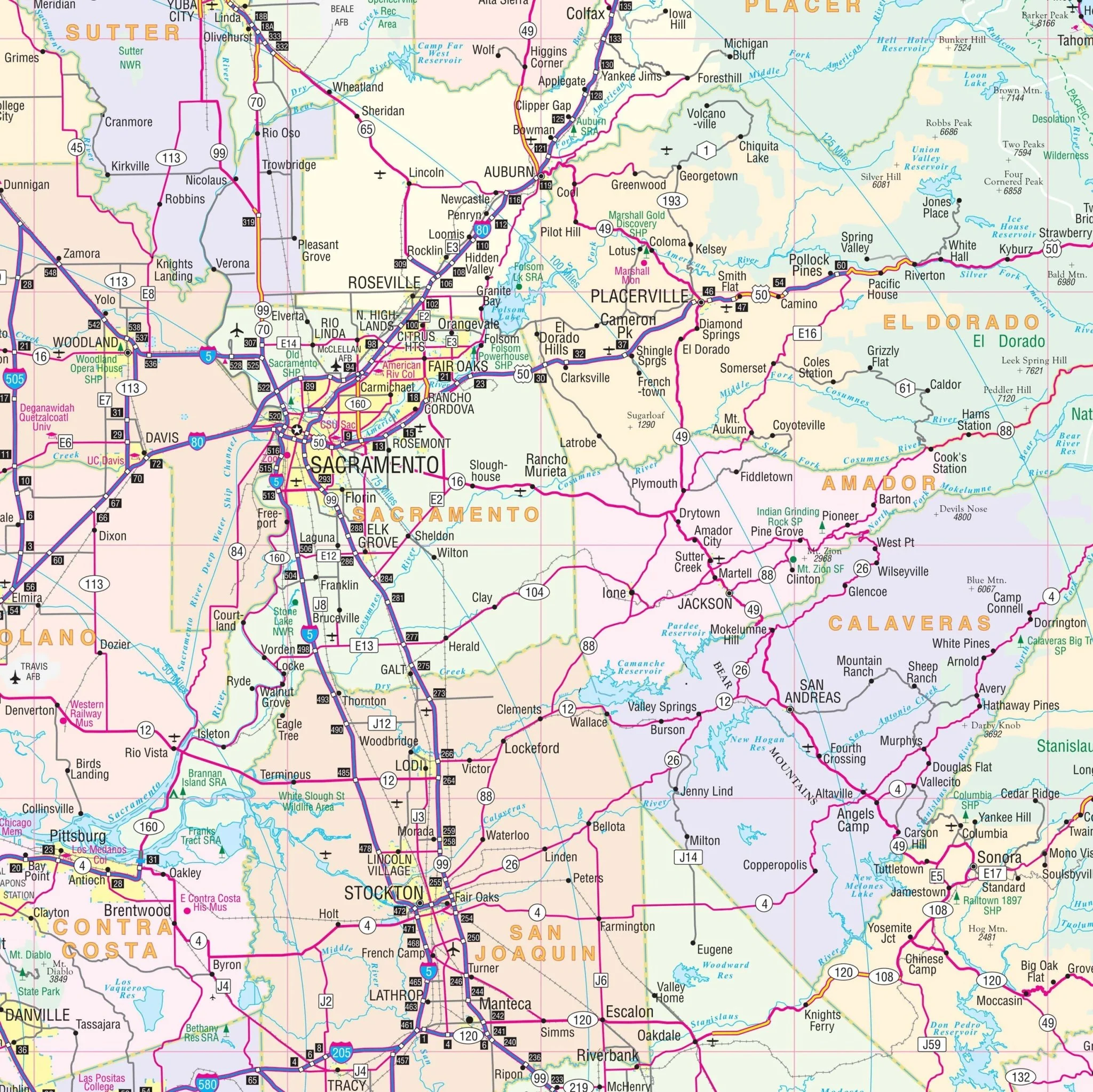
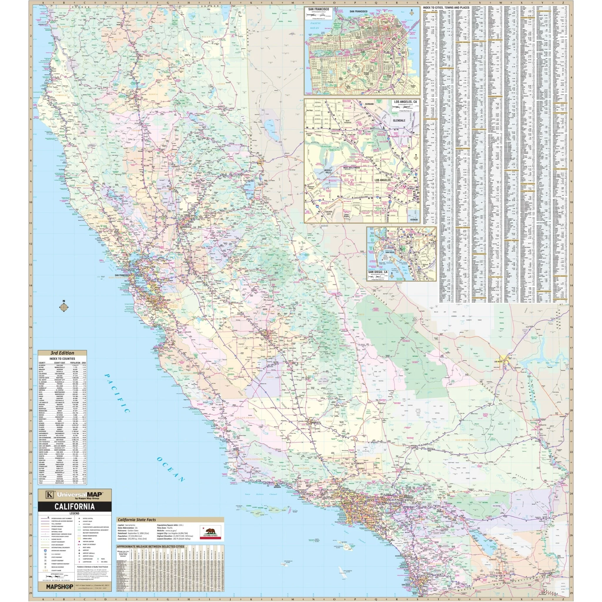
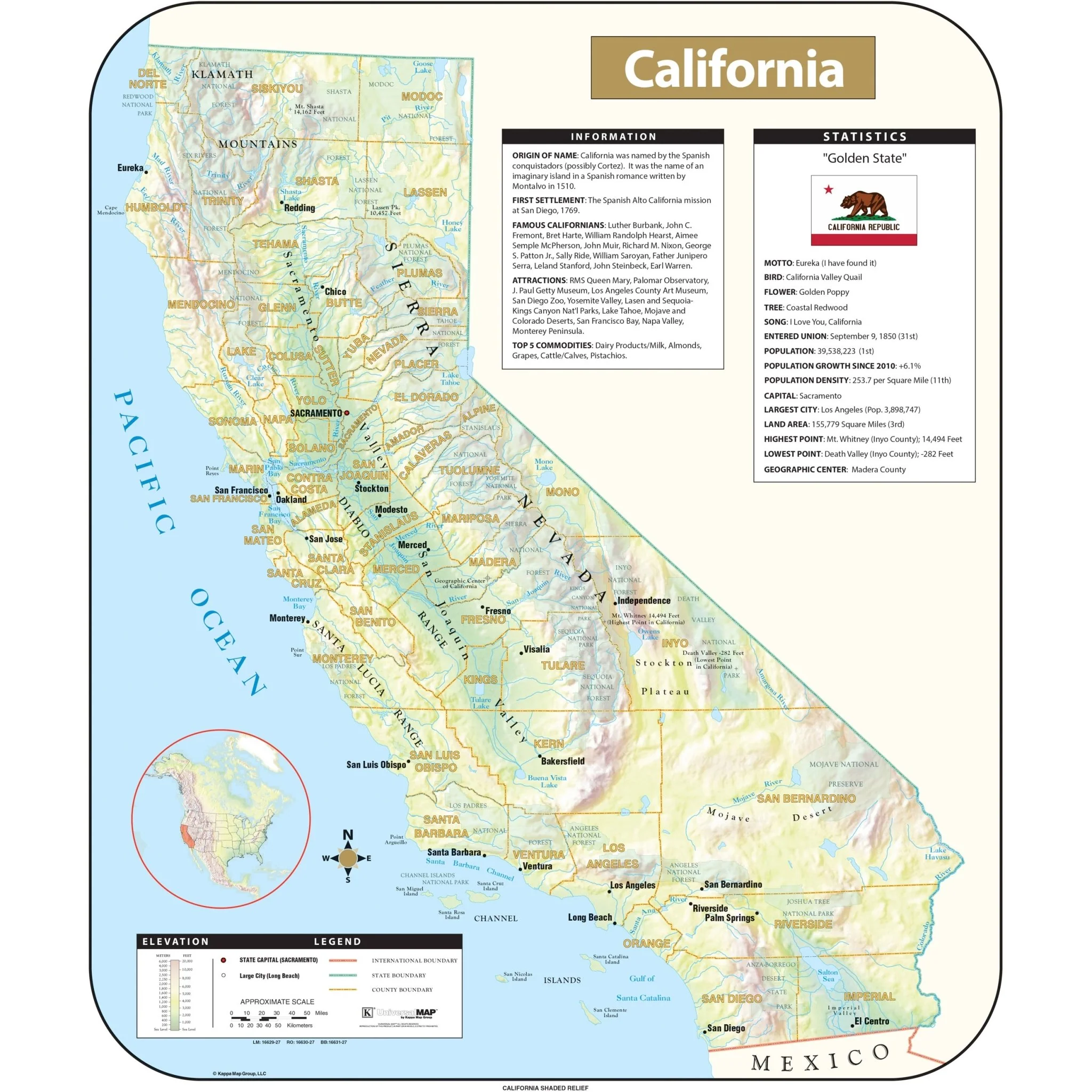
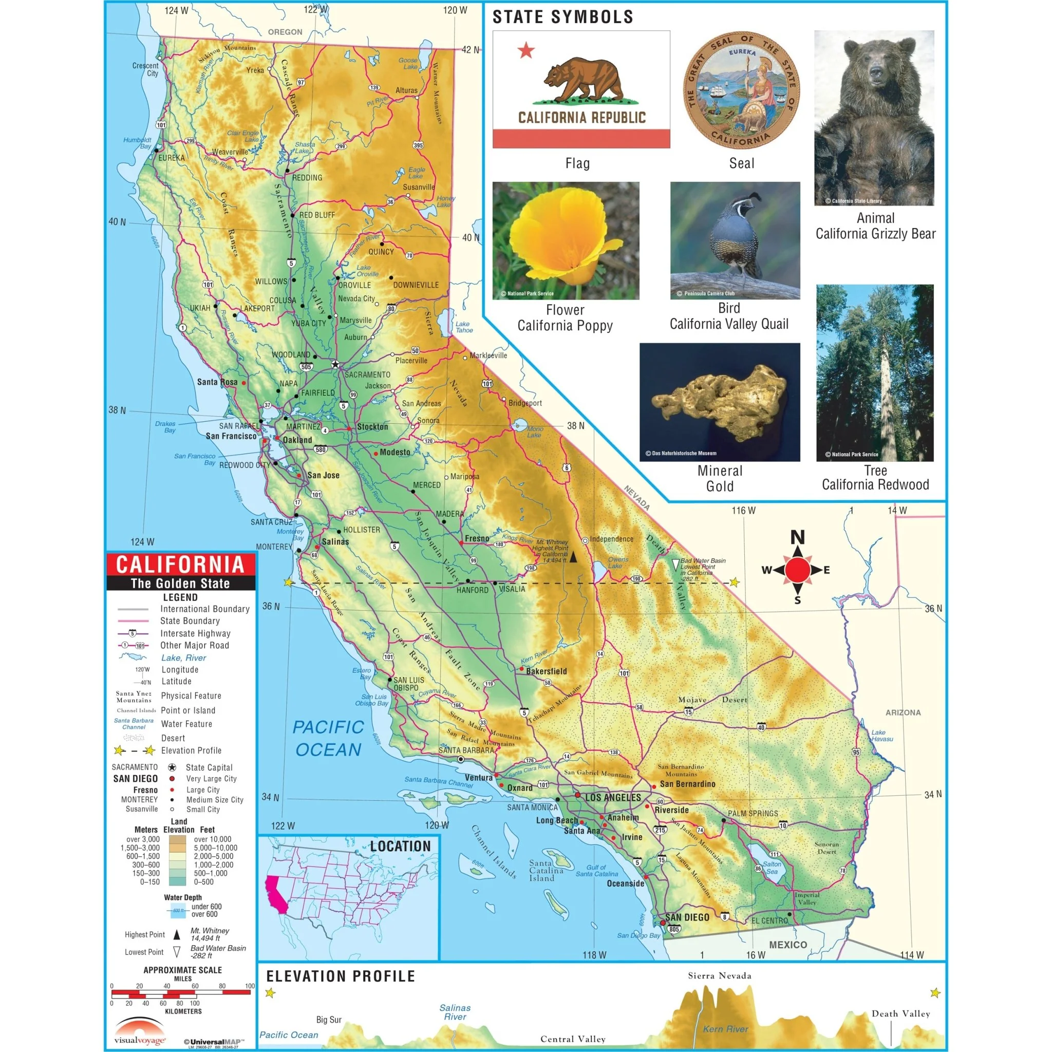
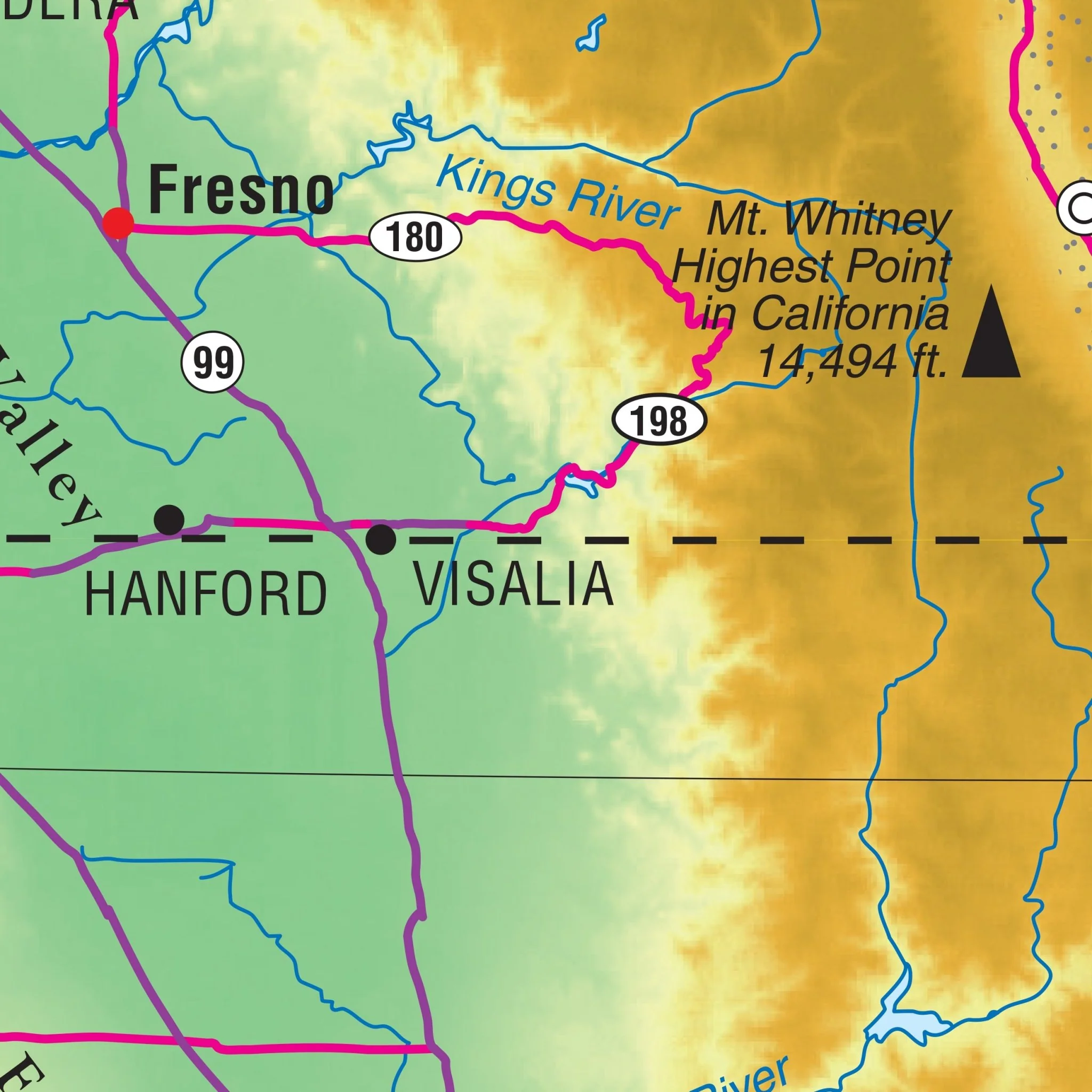
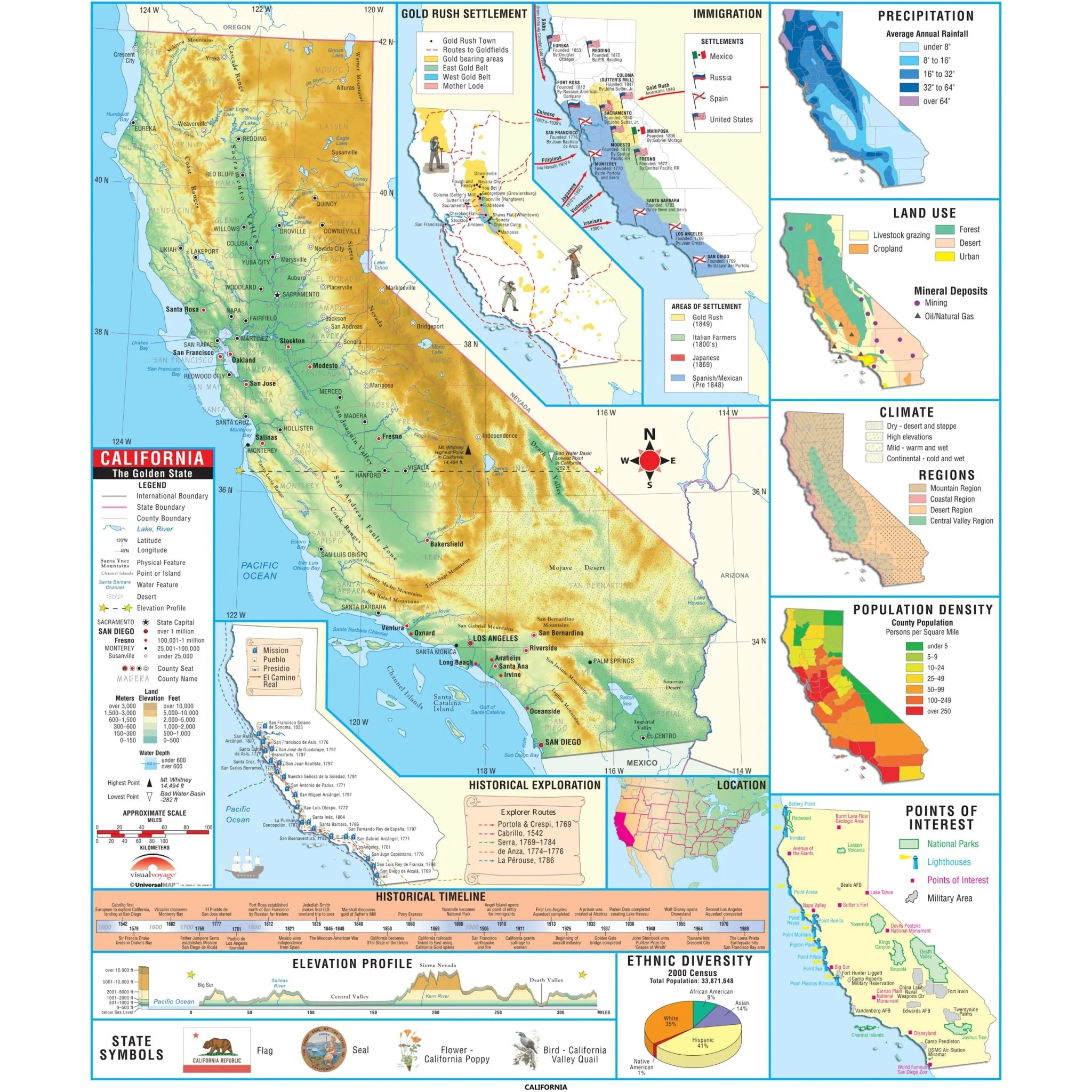
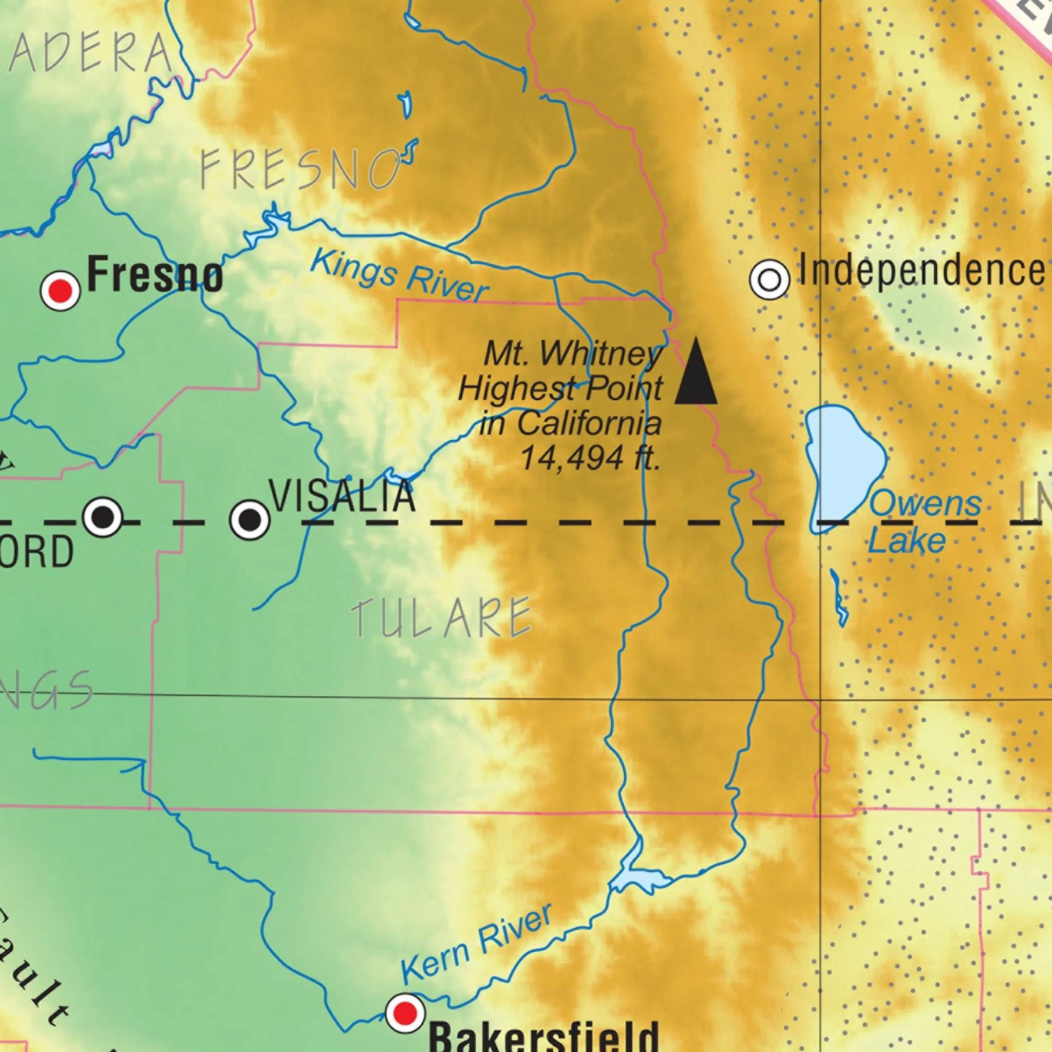
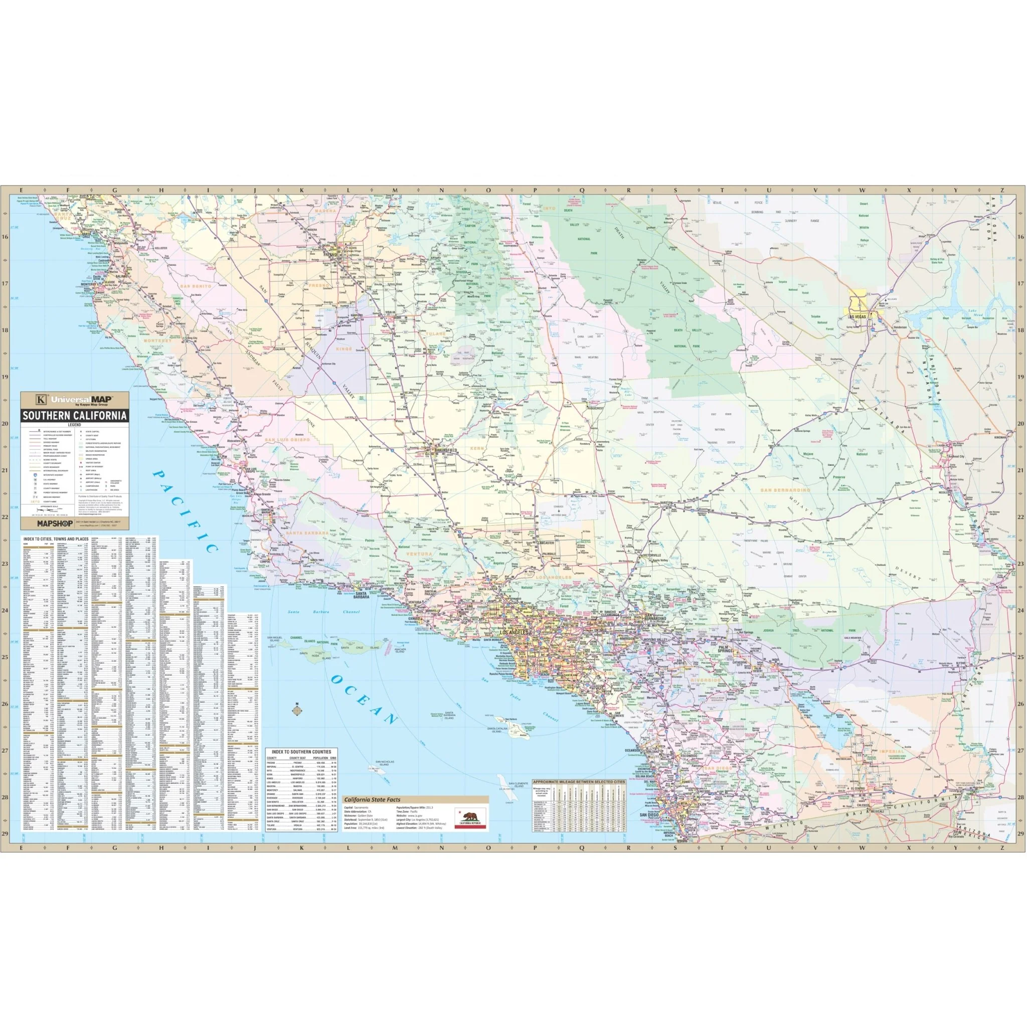
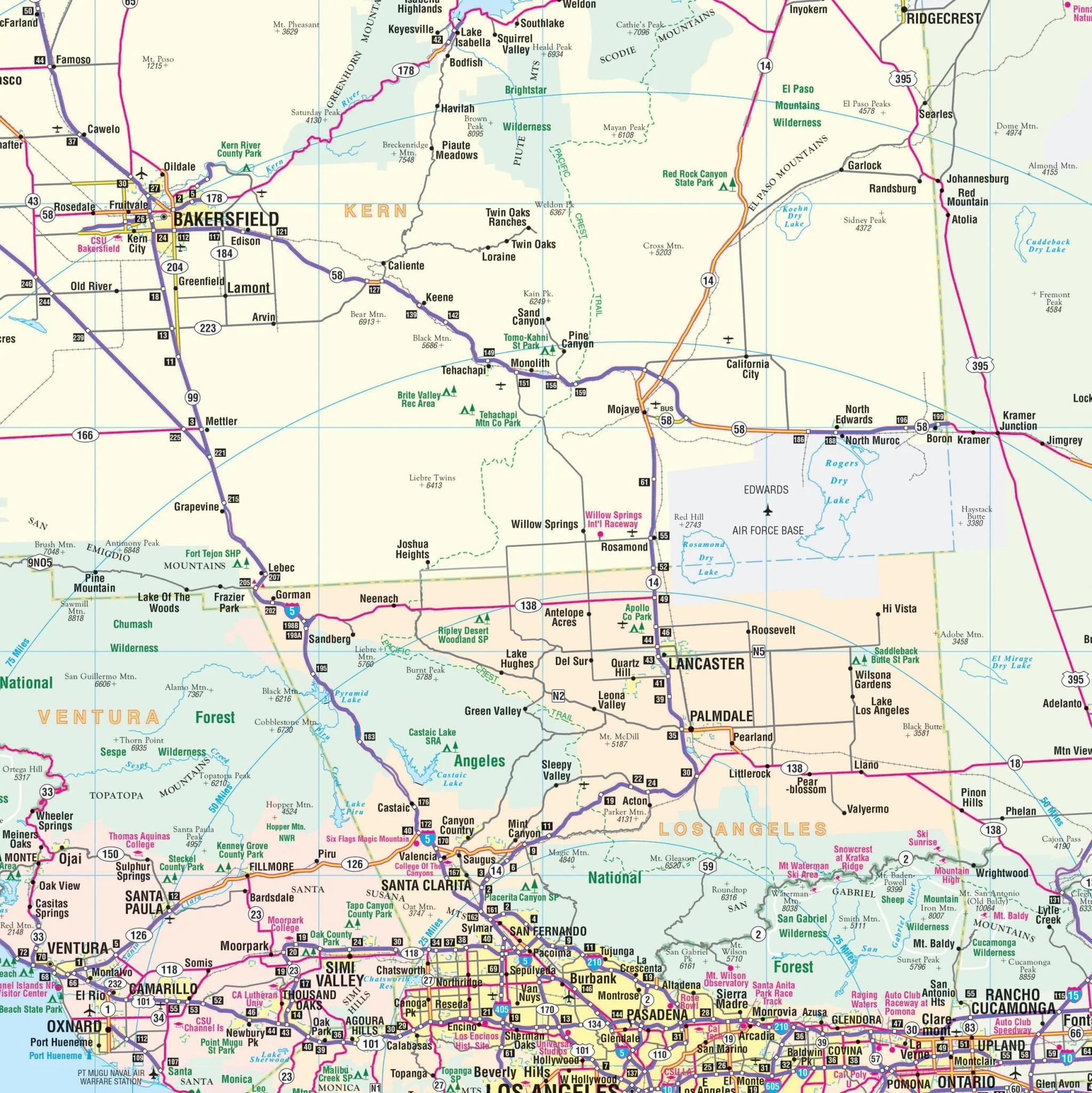
The Southern California Regional Wall Map by Kappa Map Group is a comprehensive and informative wall map ideal for anyone needing an extensive overview of the Southern California region. This map spans from the sun-drenched beaches of San Diego to the sprawling cityscape of Los Angeles and beyond, offering detailed information on road networks, urban infrastructure, and natural landscapes.
- Full Counties: Imperial, Kern, Kings, Los Angeles, Monterey, Orange, Riverside, San Benito, San Bernardino, San Diego, San Luis Obispo, Santa Barbara, Tulare, Ventura.
- Partial Counties: Fresno, Inyo, Madera, Santa Cruz.
It includes an alphanumeric grid and a thorough index, providing an easy reference to find cities, towns, and various points of interest. The use of varied colors enhances the distinction between urban districts, parks, forests, and water bodies, ensuring that the map is as useful as it is visually appealing. This map is a perfect tool for educational settings, businesses, and travelers seeking to navigate or learn more about the vibrant and diverse Southern California area.
Size: 63" x 42"
Published: 2016
Original: $109.99
-70%$109.99
$33.00Product Information
Product Information
Shipping & Returns
Shipping & Returns
Description
The Southern California Regional Wall Map by Kappa Map Group is a comprehensive and informative wall map ideal for anyone needing an extensive overview of the Southern California region. This map spans from the sun-drenched beaches of San Diego to the sprawling cityscape of Los Angeles and beyond, offering detailed information on road networks, urban infrastructure, and natural landscapes.
- Full Counties: Imperial, Kern, Kings, Los Angeles, Monterey, Orange, Riverside, San Benito, San Bernardino, San Diego, San Luis Obispo, Santa Barbara, Tulare, Ventura.
- Partial Counties: Fresno, Inyo, Madera, Santa Cruz.
It includes an alphanumeric grid and a thorough index, providing an easy reference to find cities, towns, and various points of interest. The use of varied colors enhances the distinction between urban districts, parks, forests, and water bodies, ensuring that the map is as useful as it is visually appealing. This map is a perfect tool for educational settings, businesses, and travelers seeking to navigate or learn more about the vibrant and diverse Southern California area.
Size: 63" x 42"
Published: 2016