Savannah & Chatham County, GA Wall Map
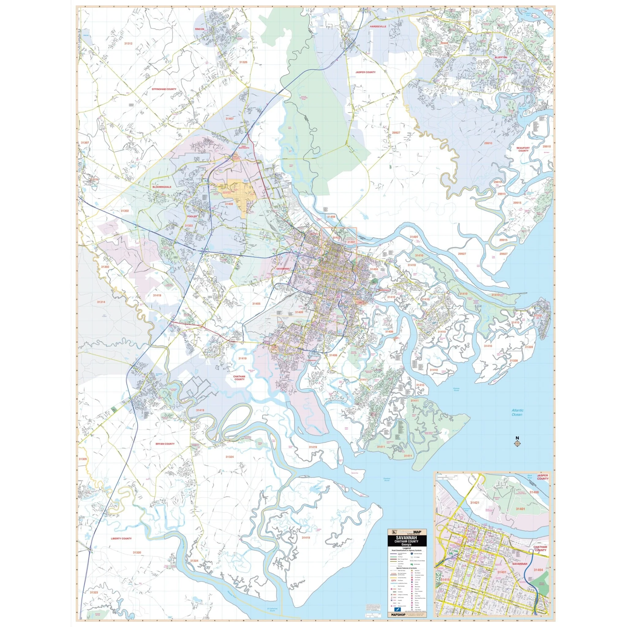
The Savannah & Chatham County, GA Wall Map offers comprehensive coverage of Chatham County, presenting up-to-date cartography that includes newly added streets and recent changes in complete street detail.
The map provides a wealth of information, including details on streets, airports, government buildings, post offices, cemeteries, fire and police stations, hospitals, shopping centers, educational institutions, railroads, water features, golf and country clubs, mileage circles, recreational parks, ZIP codes and boundaries, as well as block numbers.
Size: 57" x 72.5"
Published: 2002
Original: $149.99
-70%$149.99
$45.00Product Information
Product Information
Shipping & Returns
Shipping & Returns
Description
The Savannah & Chatham County, GA Wall Map offers comprehensive coverage of Chatham County, presenting up-to-date cartography that includes newly added streets and recent changes in complete street detail.
The map provides a wealth of information, including details on streets, airports, government buildings, post offices, cemeteries, fire and police stations, hospitals, shopping centers, educational institutions, railroads, water features, golf and country clubs, mileage circles, recreational parks, ZIP codes and boundaries, as well as block numbers.
Size: 57" x 72.5"
Published: 2002