


Georgia State Wall Map
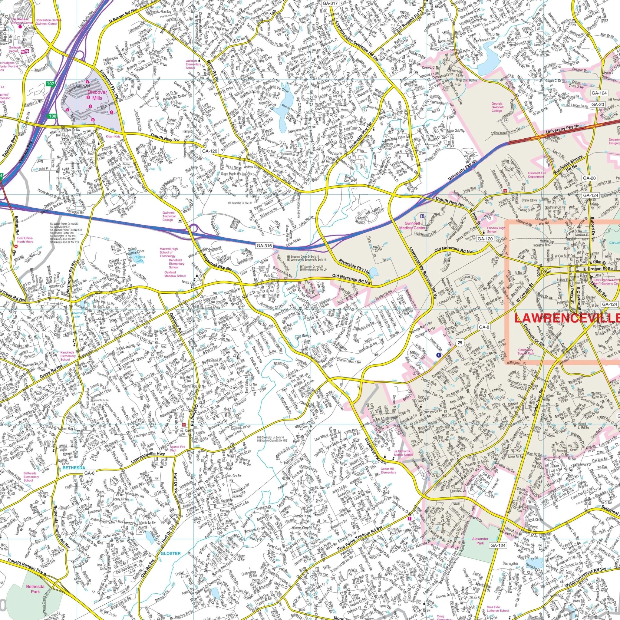
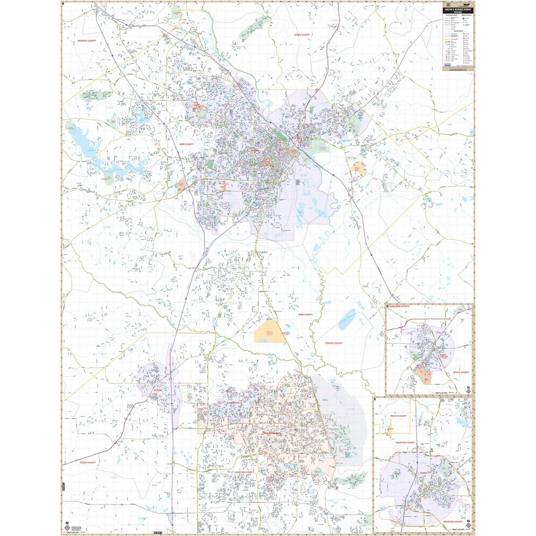
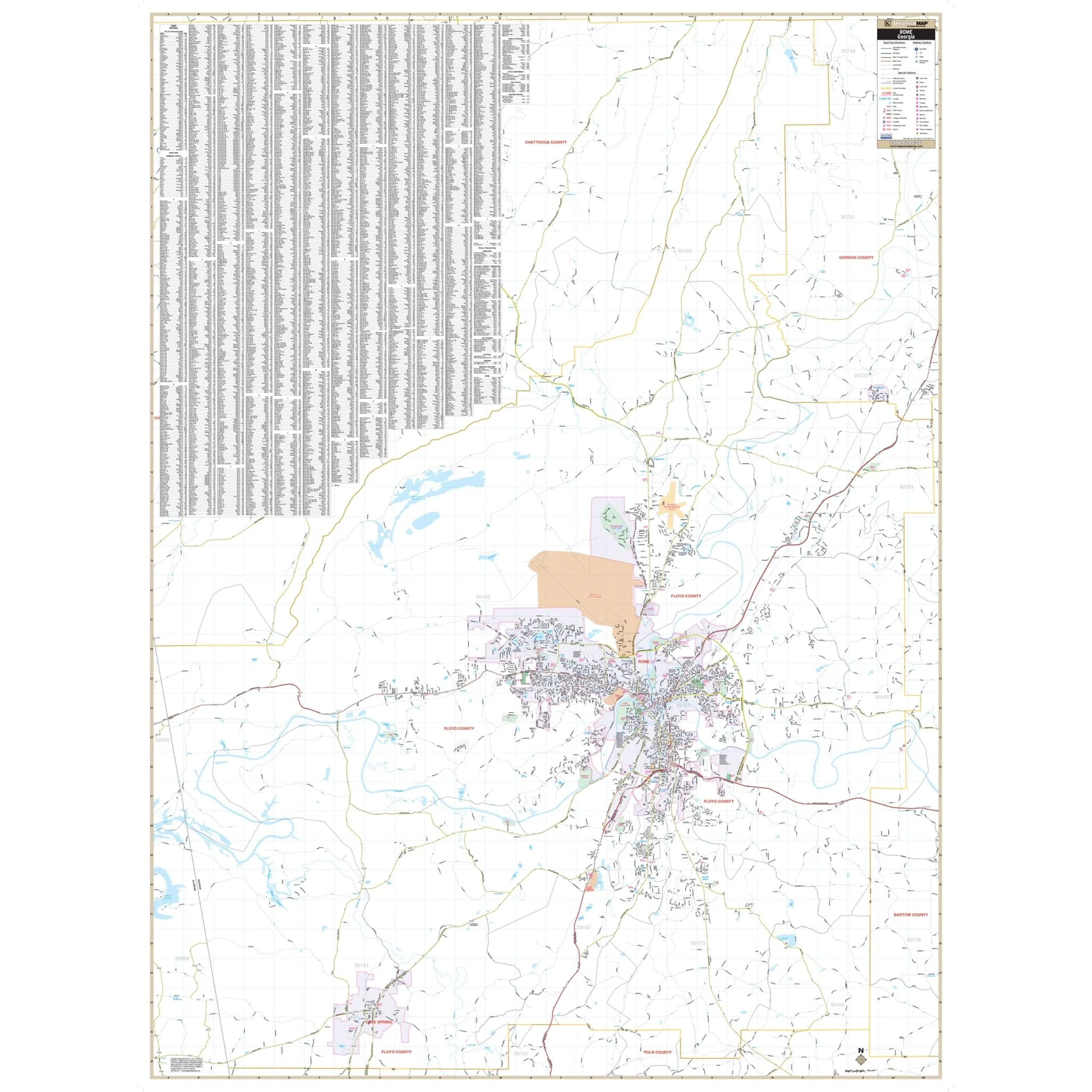
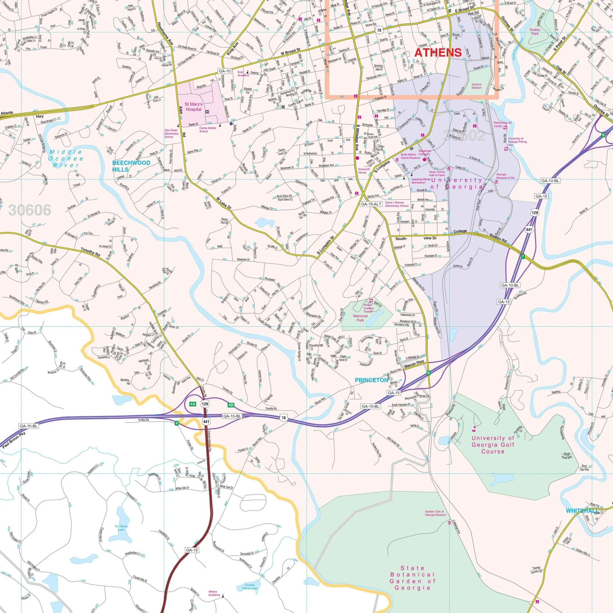
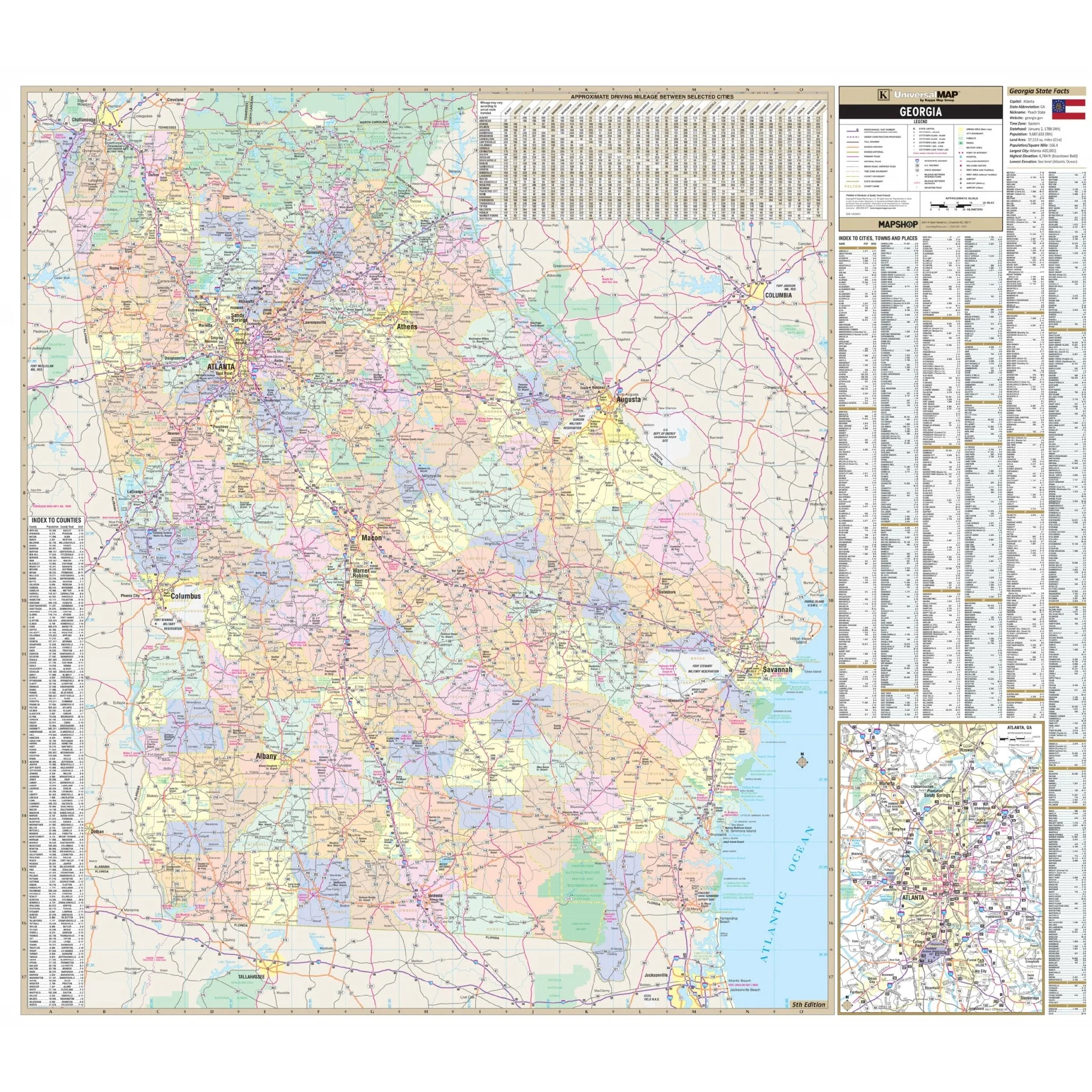
The Georgia State Wall Map from Kappa Map Group is a valuable geographical resource. This map includes color-coded counties and a mileage chart between major cities, along with Georgia State Facts for added context.
Key details featured on the map encompass streets, airports, government buildings, post offices, cemeteries, fire and police stations, hospitals, shopping centers, educational institutions, railroads, water features, golf and country clubs, mileage circles, recreational parks, ZIP codes and their boundaries, as well as block numbers. This comprehensive map is designed to provide a wealth of geographic information about Georgia.
Size: 62" x 54"
Published: 2013
Original: $139.99
-70%$139.99
$42.00Product Information
Product Information
Shipping & Returns
Shipping & Returns
Description
The Georgia State Wall Map from Kappa Map Group is a valuable geographical resource. This map includes color-coded counties and a mileage chart between major cities, along with Georgia State Facts for added context.
Key details featured on the map encompass streets, airports, government buildings, post offices, cemeteries, fire and police stations, hospitals, shopping centers, educational institutions, railroads, water features, golf and country clubs, mileage circles, recreational parks, ZIP codes and their boundaries, as well as block numbers. This comprehensive map is designed to provide a wealth of geographic information about Georgia.
Size: 62" x 54"
Published: 2013