Southern Georgia Regional Wall Map
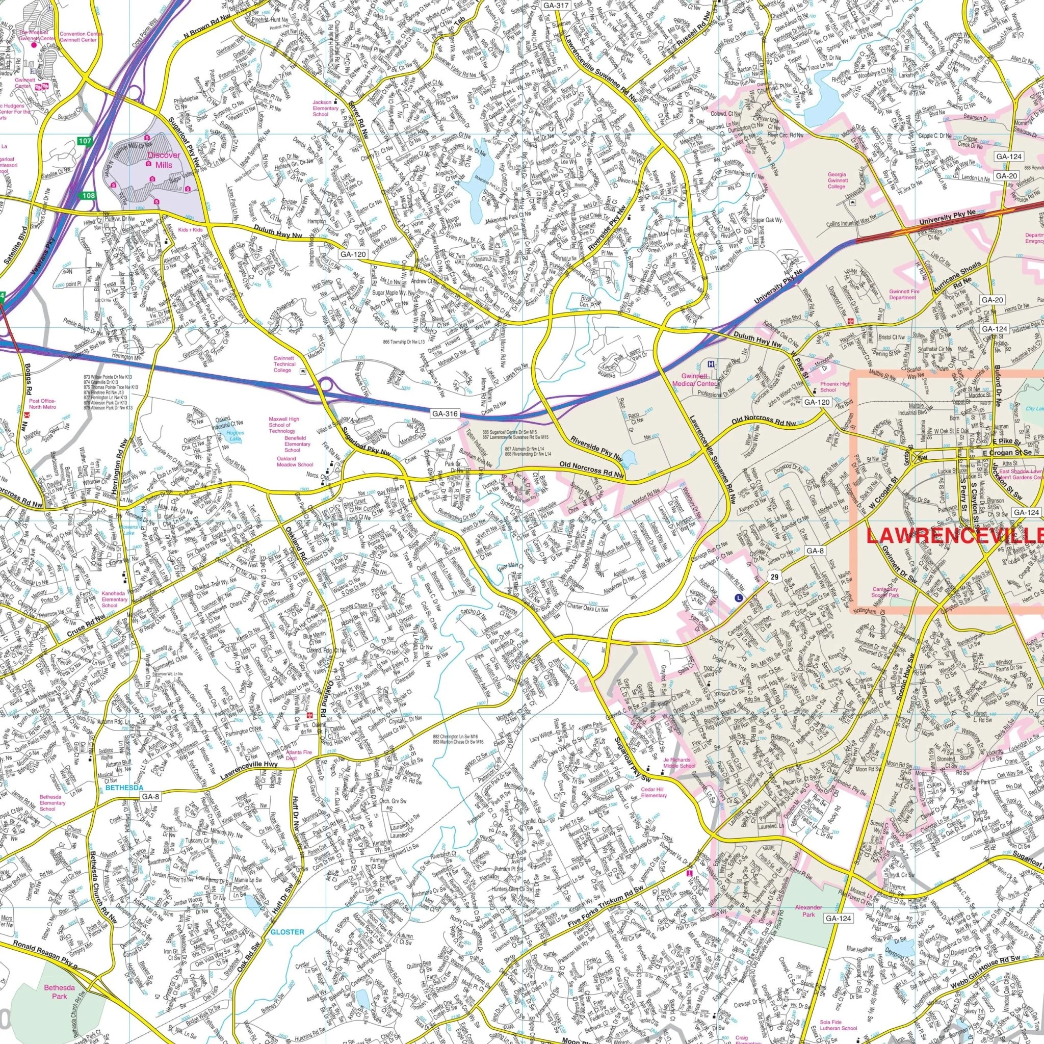
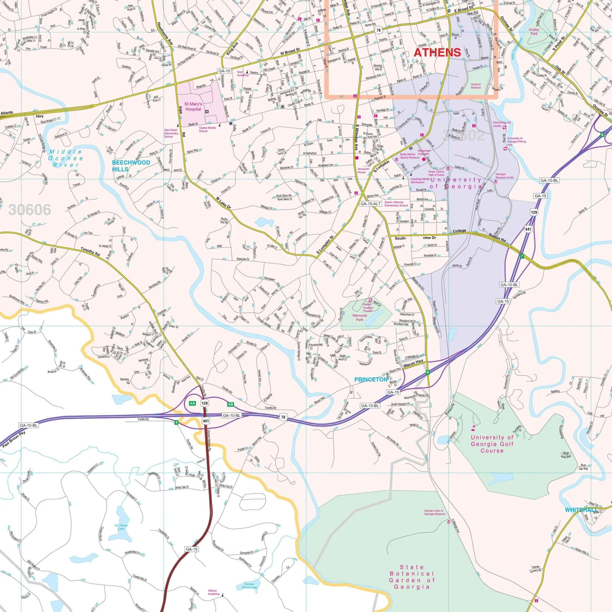
The Southern Georgia Regional Wall Map by Kappa Map Group encompasses a wide area of Southern Georgia, detailing its extensive road networks, including interstate highways, US highways, and local roads, as well as the outline of counties and their subdivisions. The map extends to the borders with Alabama on the west and Florida to the south, capturing the geographical diversity of the region. Coverage includes the following area:
- North: to Quitman, Lee, Crisp, Wilcox, and Jeff Davis Counties
- Northeast: to Chatham, Effingham, Bulloch, and Candler Counties
- South: to Florida State line
- East: to the Atlantic Ocean
- West: to the Alabama State line
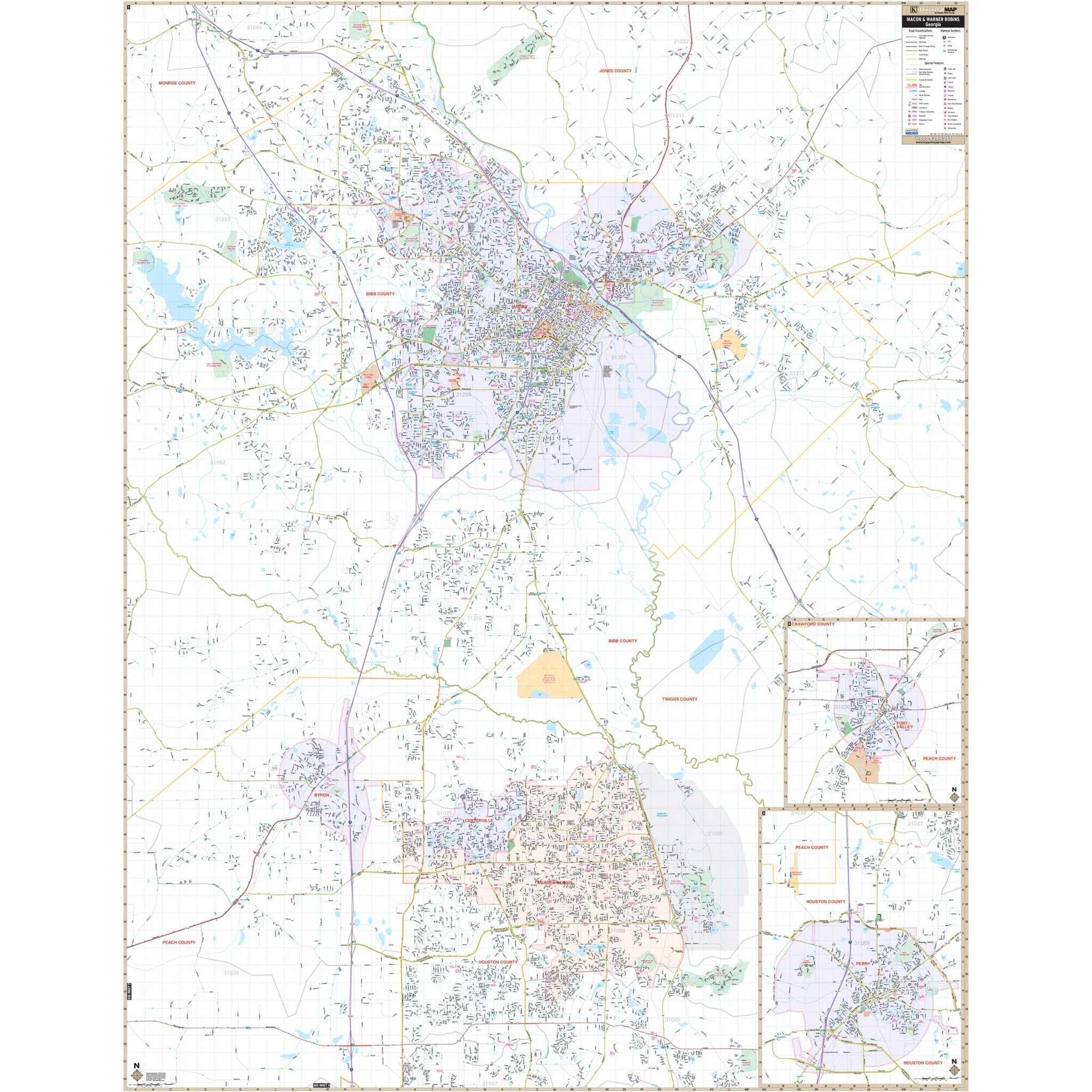
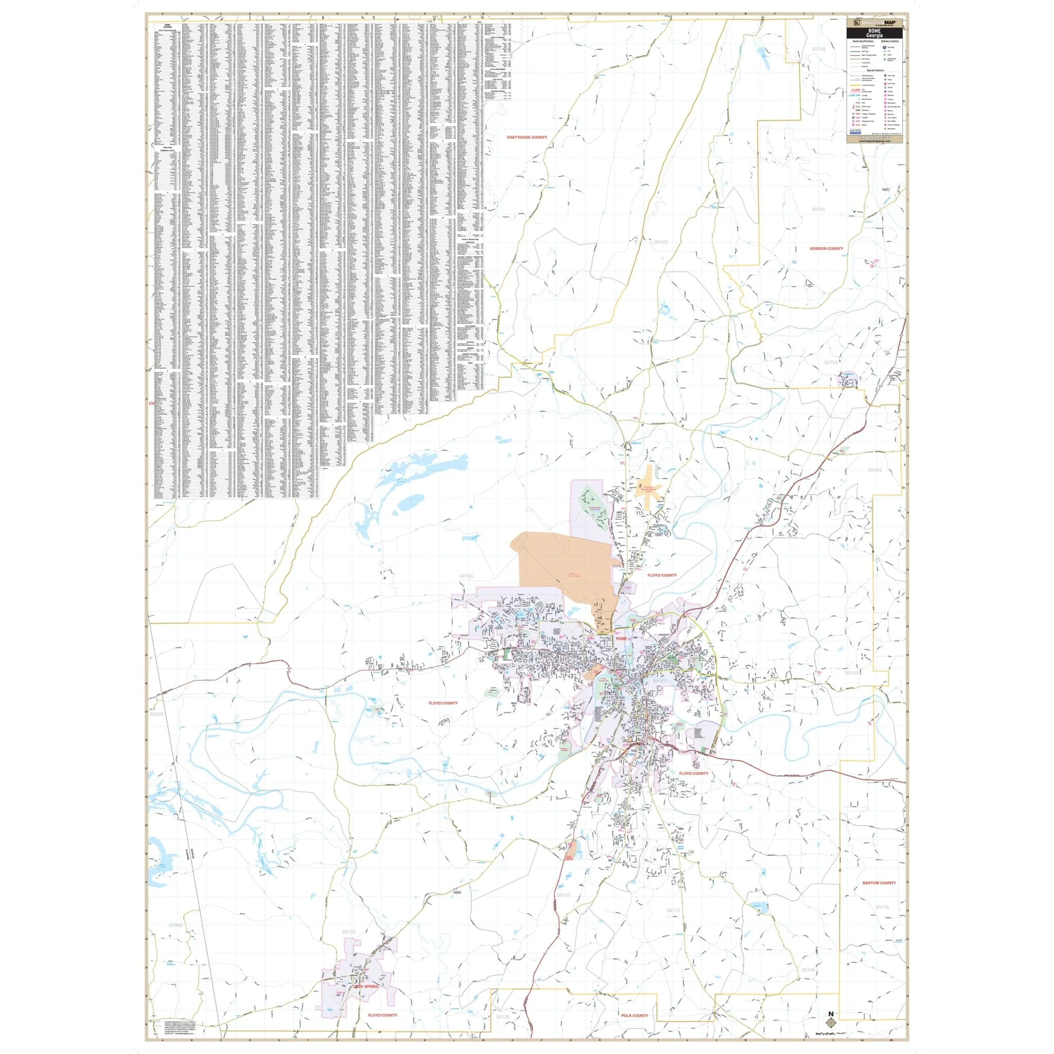
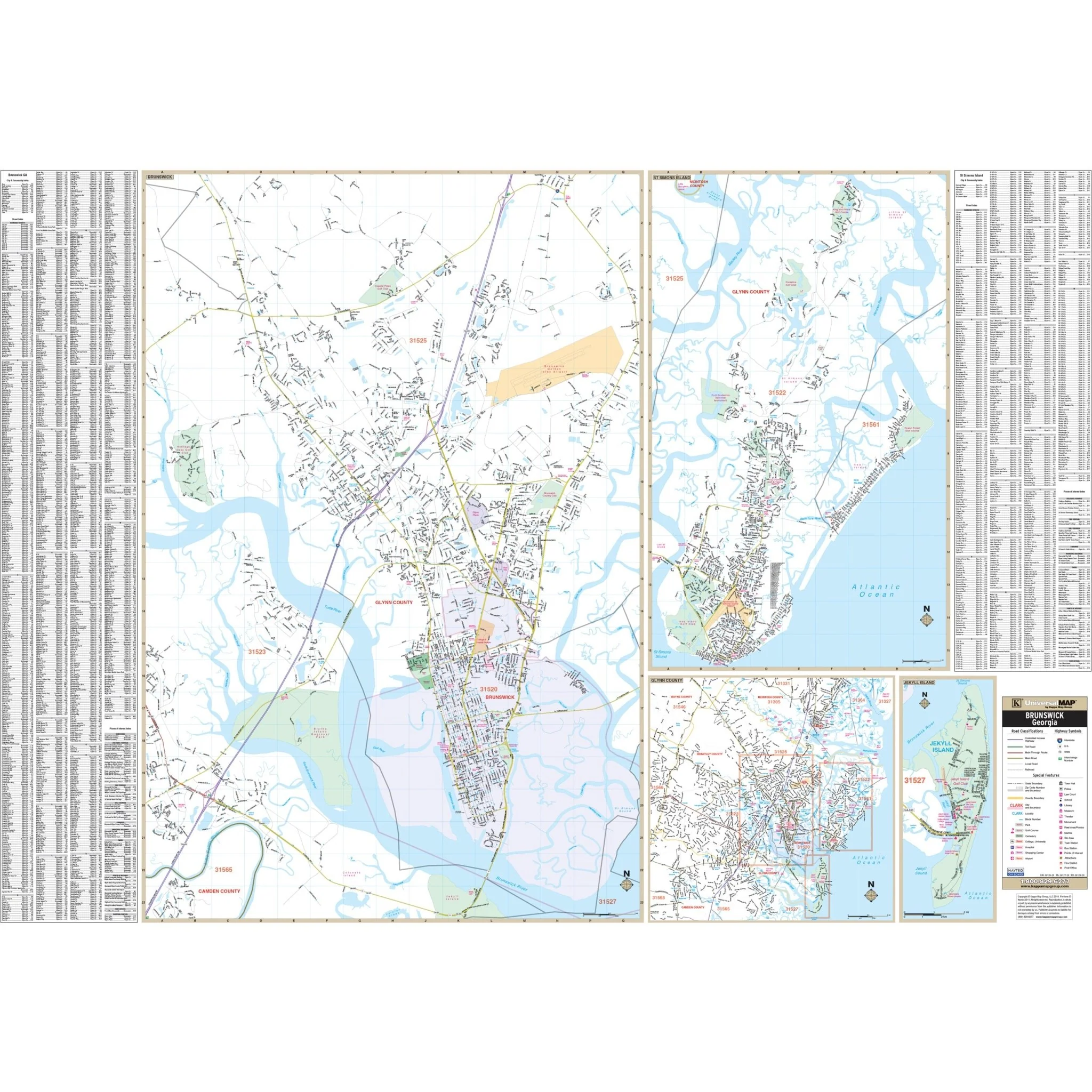
On the top left, an index lists the names of towns and places, structured to correspond with the map's grid system for easy reference. Along the bottom, there is a mileage chart and a county index that offers a quick lookup for distances between cities and county locations on the map. To the right, a hurricane tracking chart is provided, an essential feature for an area affected by seasonal tropical weather.
Additionally, the map includes insets of specific areas, giving a closer view of key locations. This map is a practical tool for anyone who needs to navigate or familiarize themselves with the Southern Georgia region, whether for personal, educational, or professional purposes.
Size: 52.5" x 33.6"
Published: 2002
Original: $99.99
-70%$99.99
$30.00Product Information
Product Information
Shipping & Returns
Shipping & Returns
Description
The Southern Georgia Regional Wall Map by Kappa Map Group encompasses a wide area of Southern Georgia, detailing its extensive road networks, including interstate highways, US highways, and local roads, as well as the outline of counties and their subdivisions. The map extends to the borders with Alabama on the west and Florida to the south, capturing the geographical diversity of the region. Coverage includes the following area:
- North: to Quitman, Lee, Crisp, Wilcox, and Jeff Davis Counties
- Northeast: to Chatham, Effingham, Bulloch, and Candler Counties
- South: to Florida State line
- East: to the Atlantic Ocean
- West: to the Alabama State line
On the top left, an index lists the names of towns and places, structured to correspond with the map's grid system for easy reference. Along the bottom, there is a mileage chart and a county index that offers a quick lookup for distances between cities and county locations on the map. To the right, a hurricane tracking chart is provided, an essential feature for an area affected by seasonal tropical weather.
Additionally, the map includes insets of specific areas, giving a closer view of key locations. This map is a practical tool for anyone who needs to navigate or familiarize themselves with the Southern Georgia region, whether for personal, educational, or professional purposes.
Size: 52.5" x 33.6"
Published: 2002