


United States Interstate Wall Map
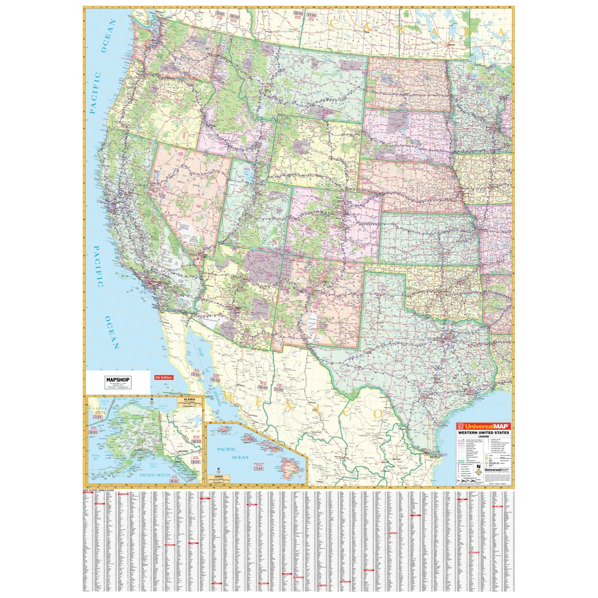
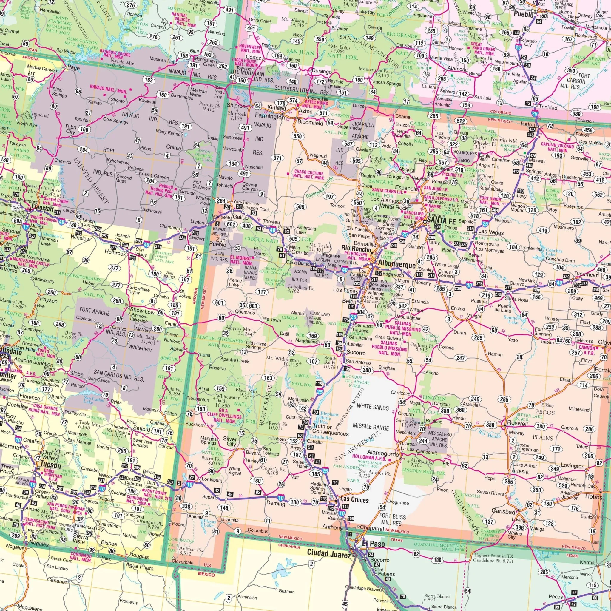
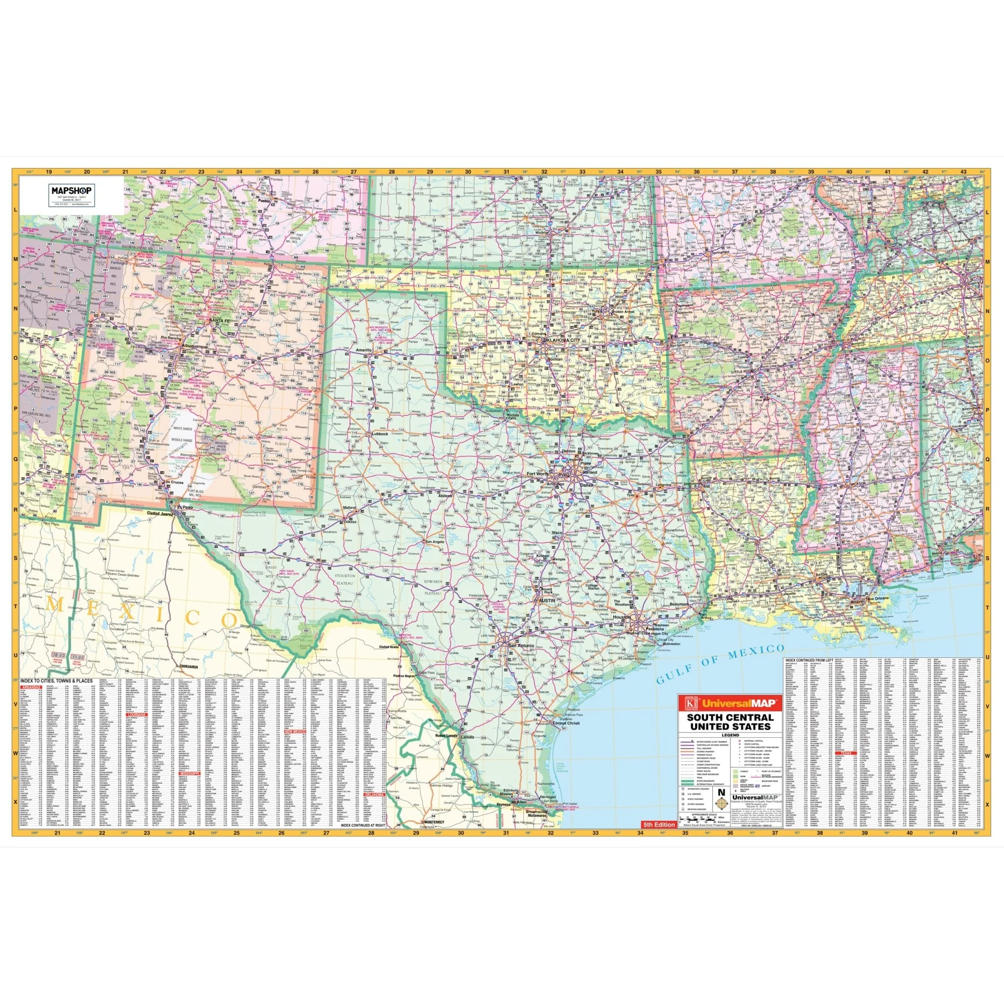
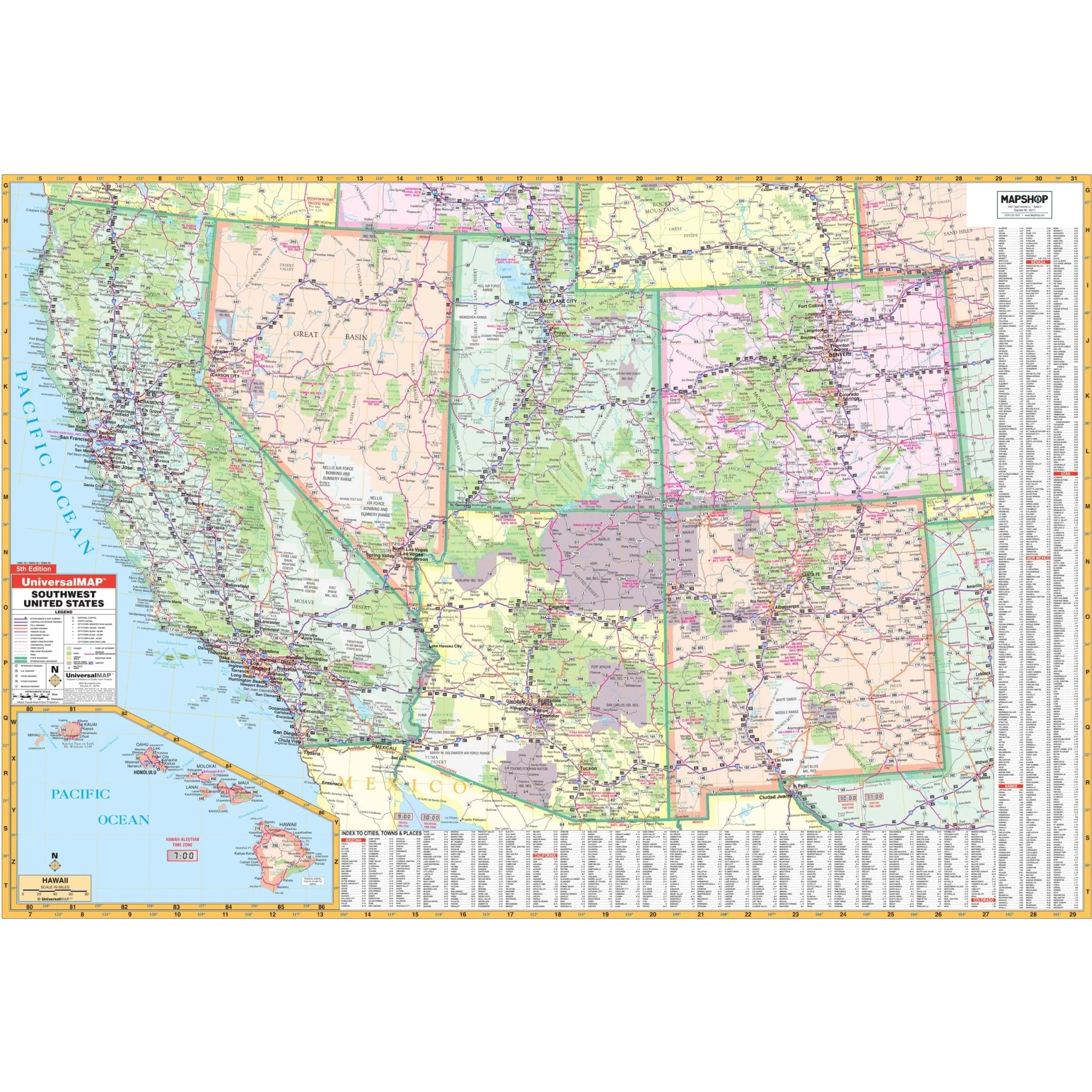
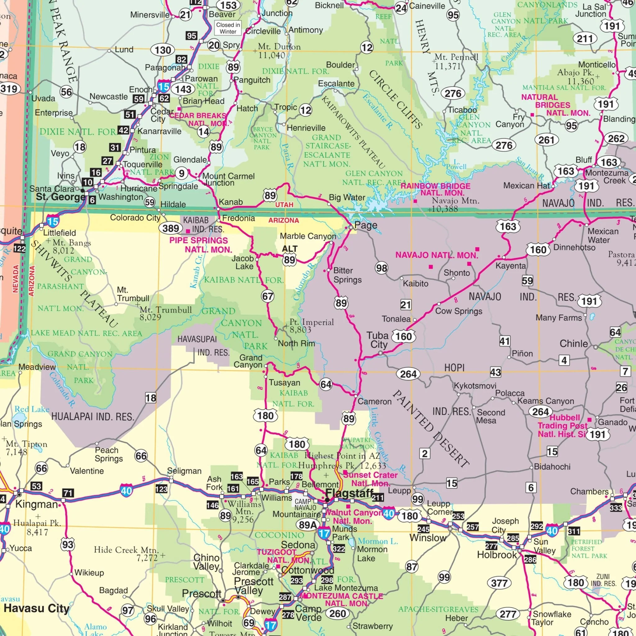
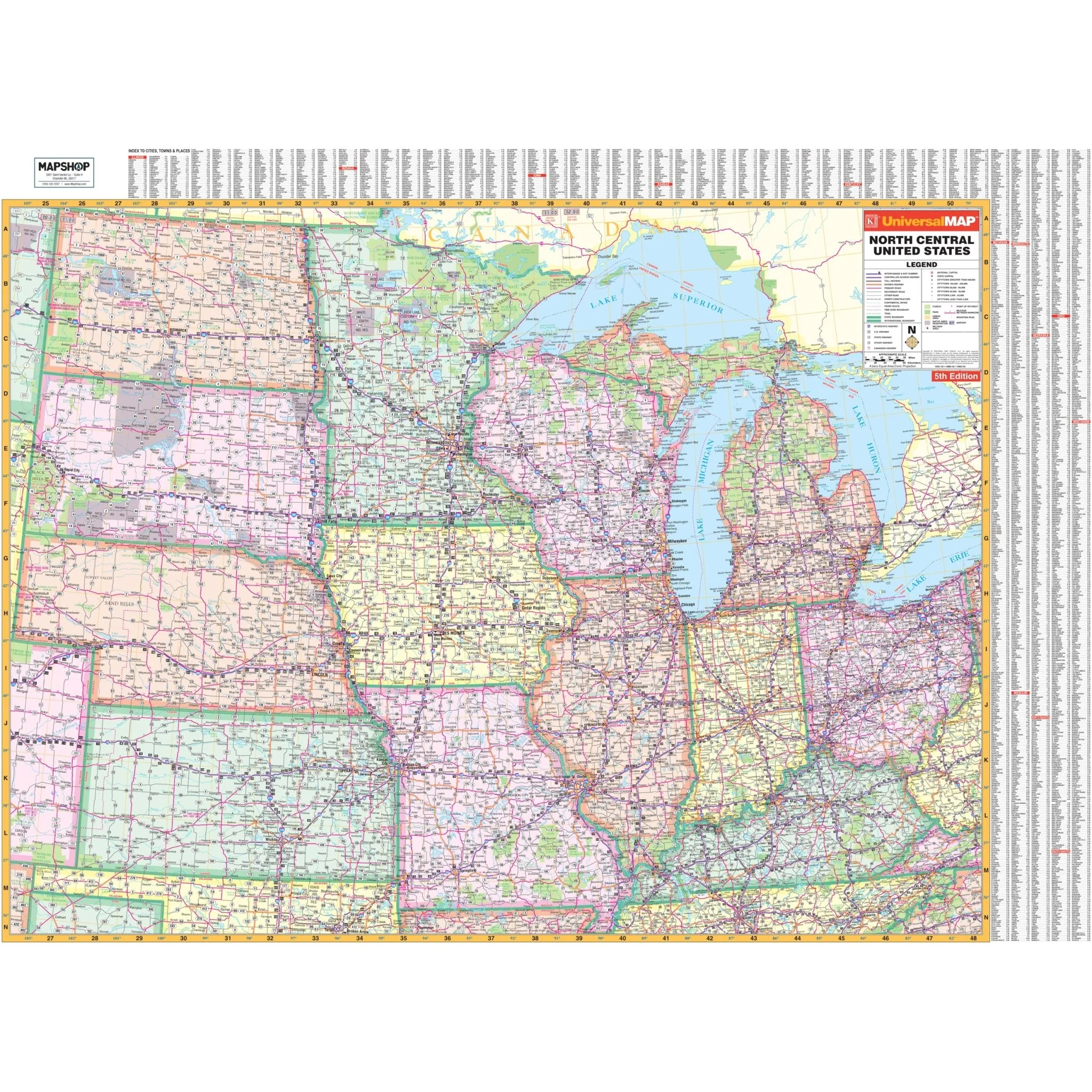
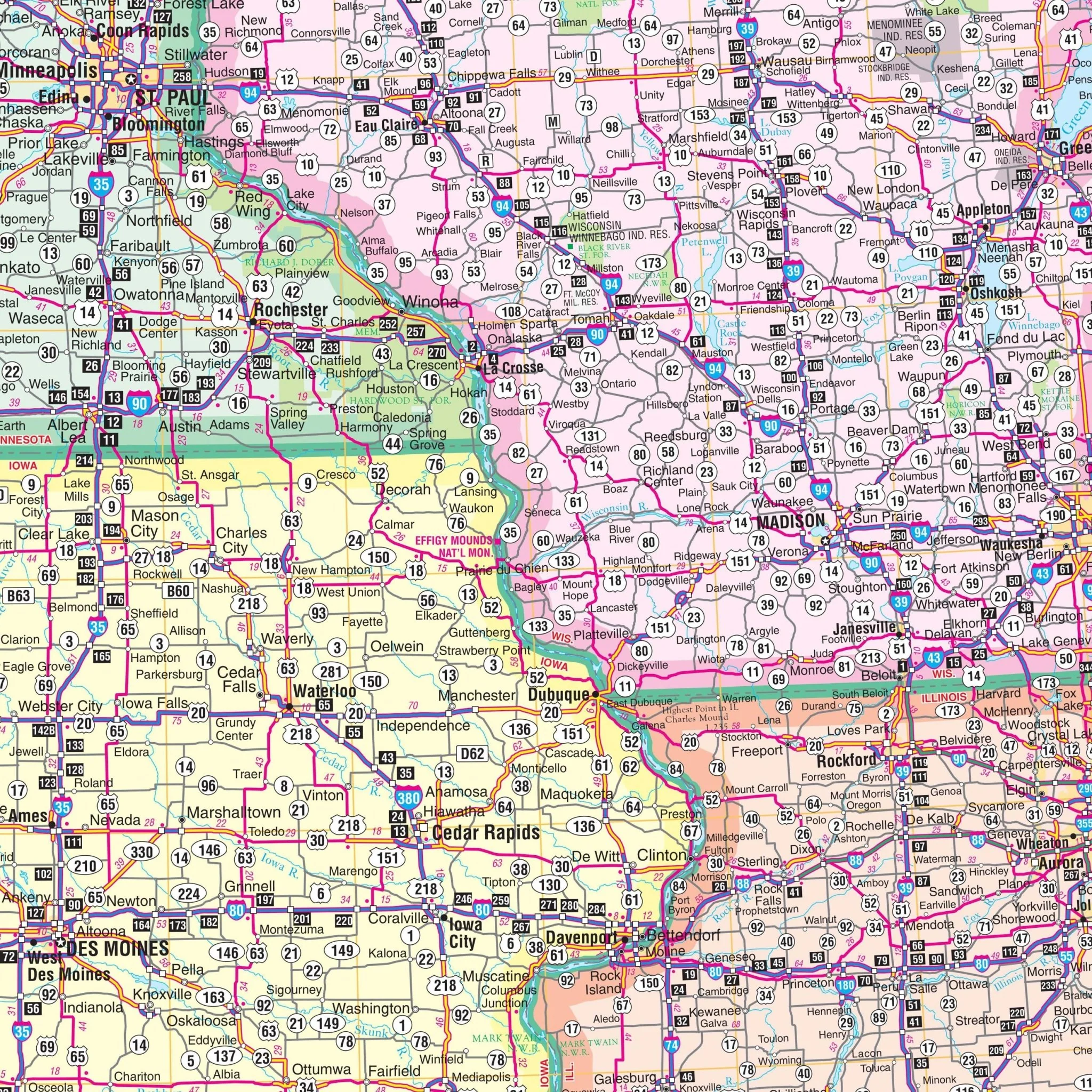
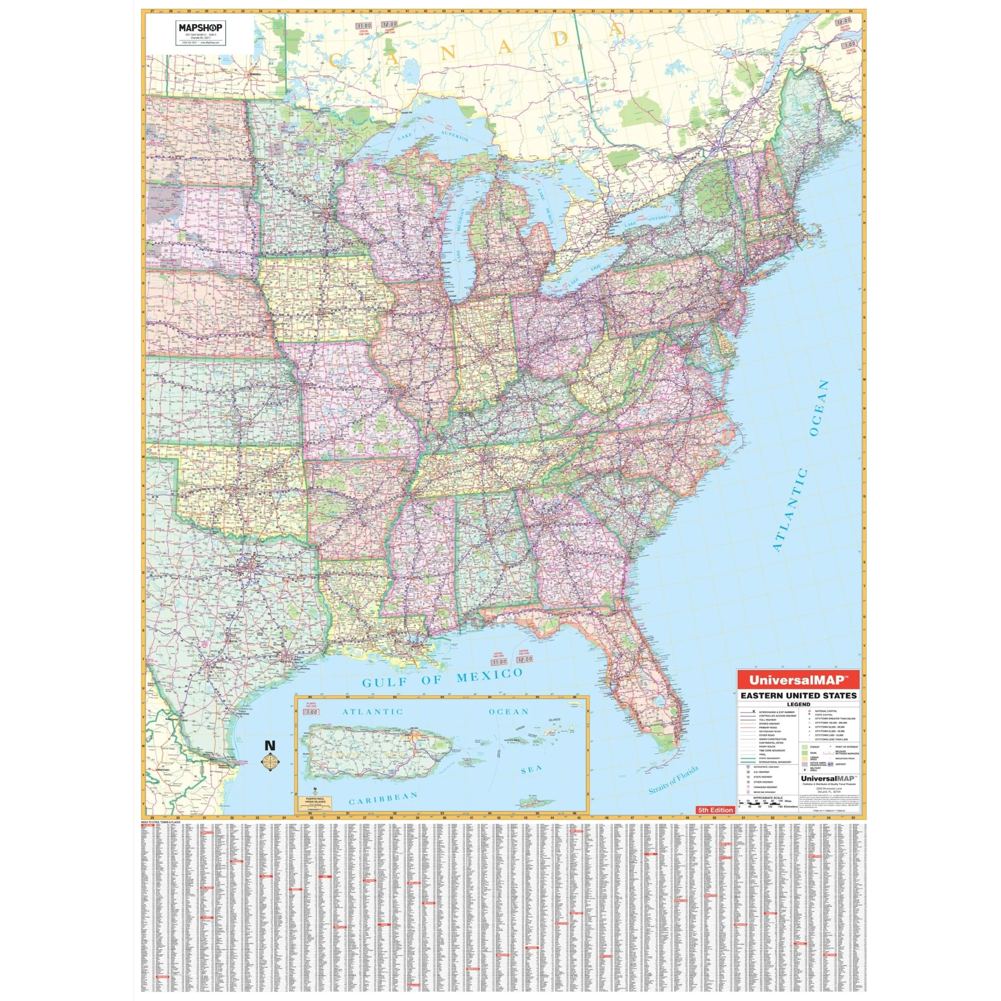
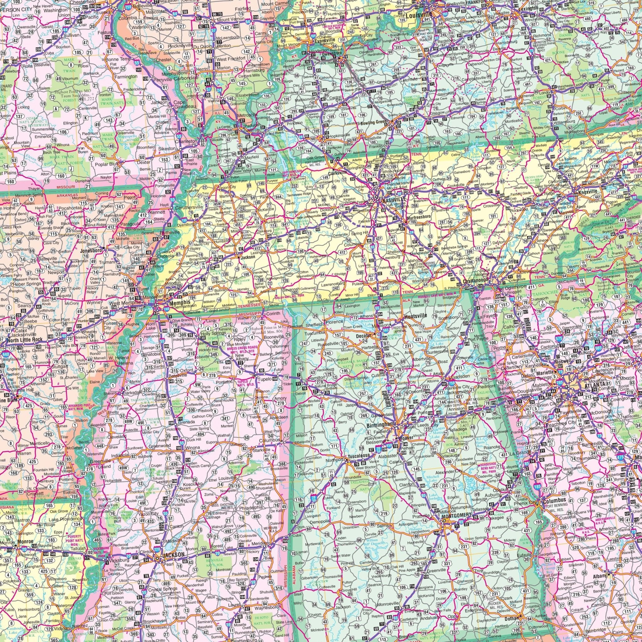
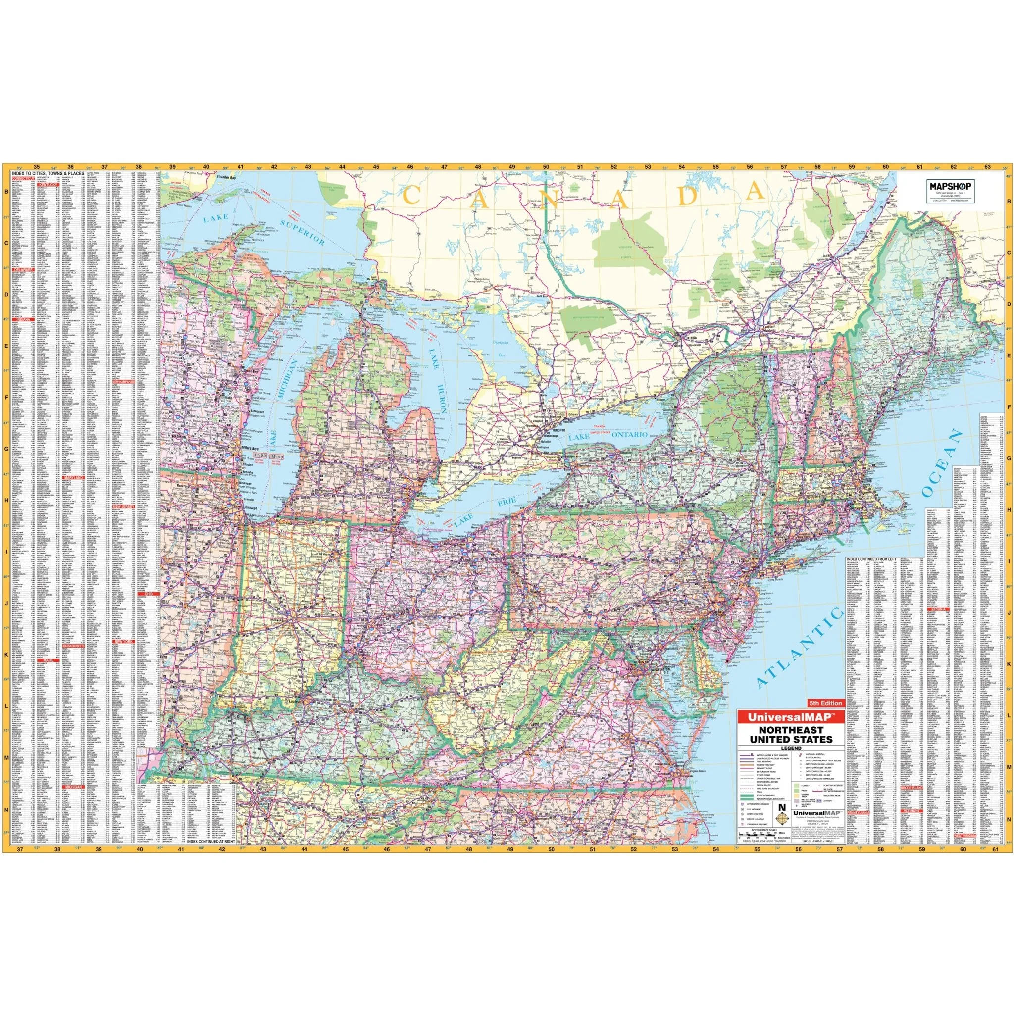
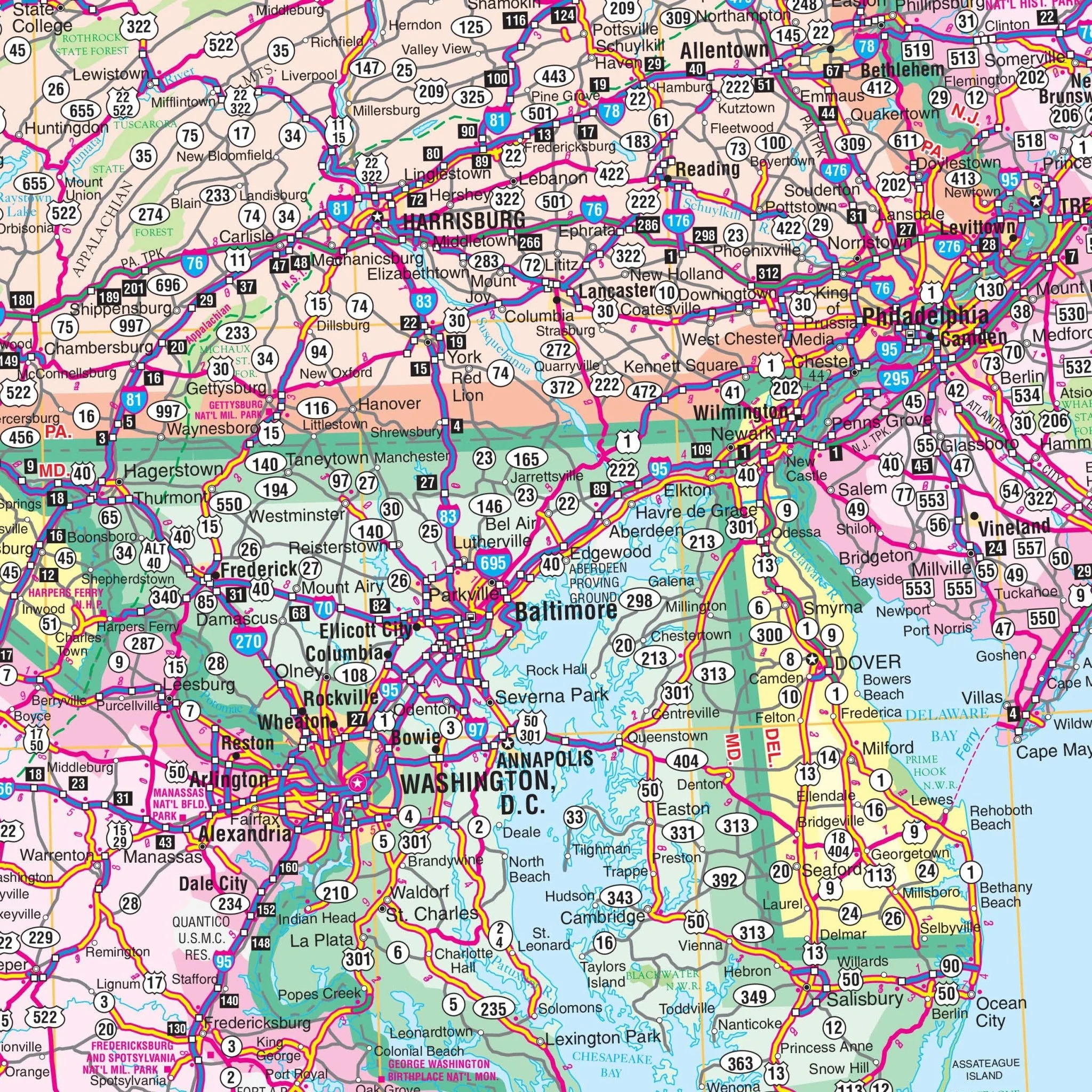
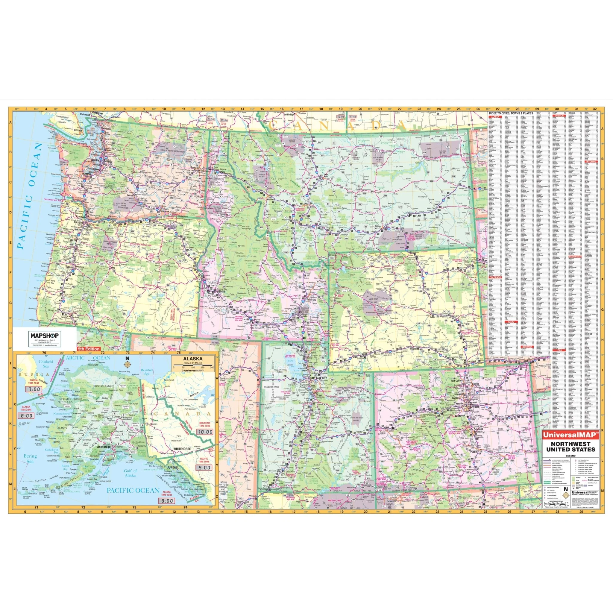
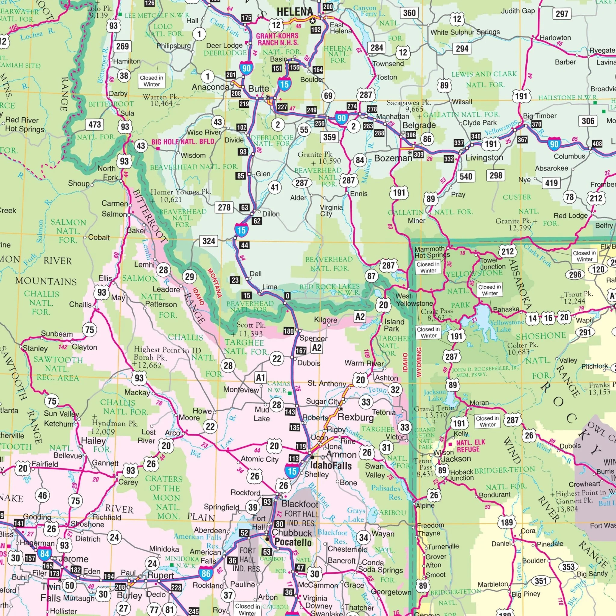
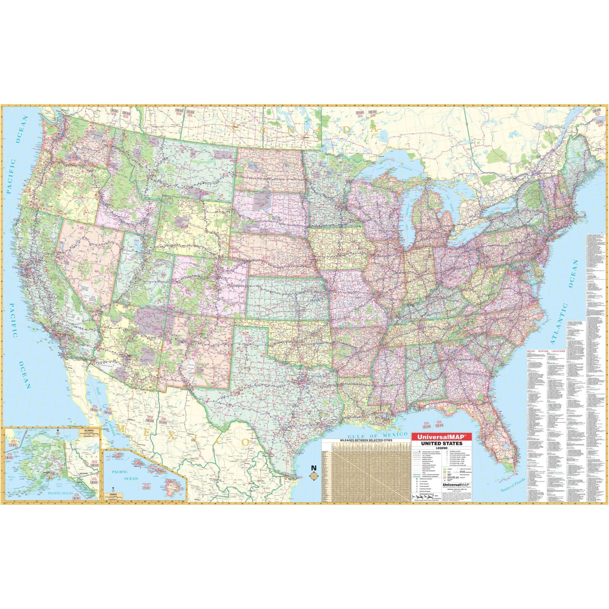
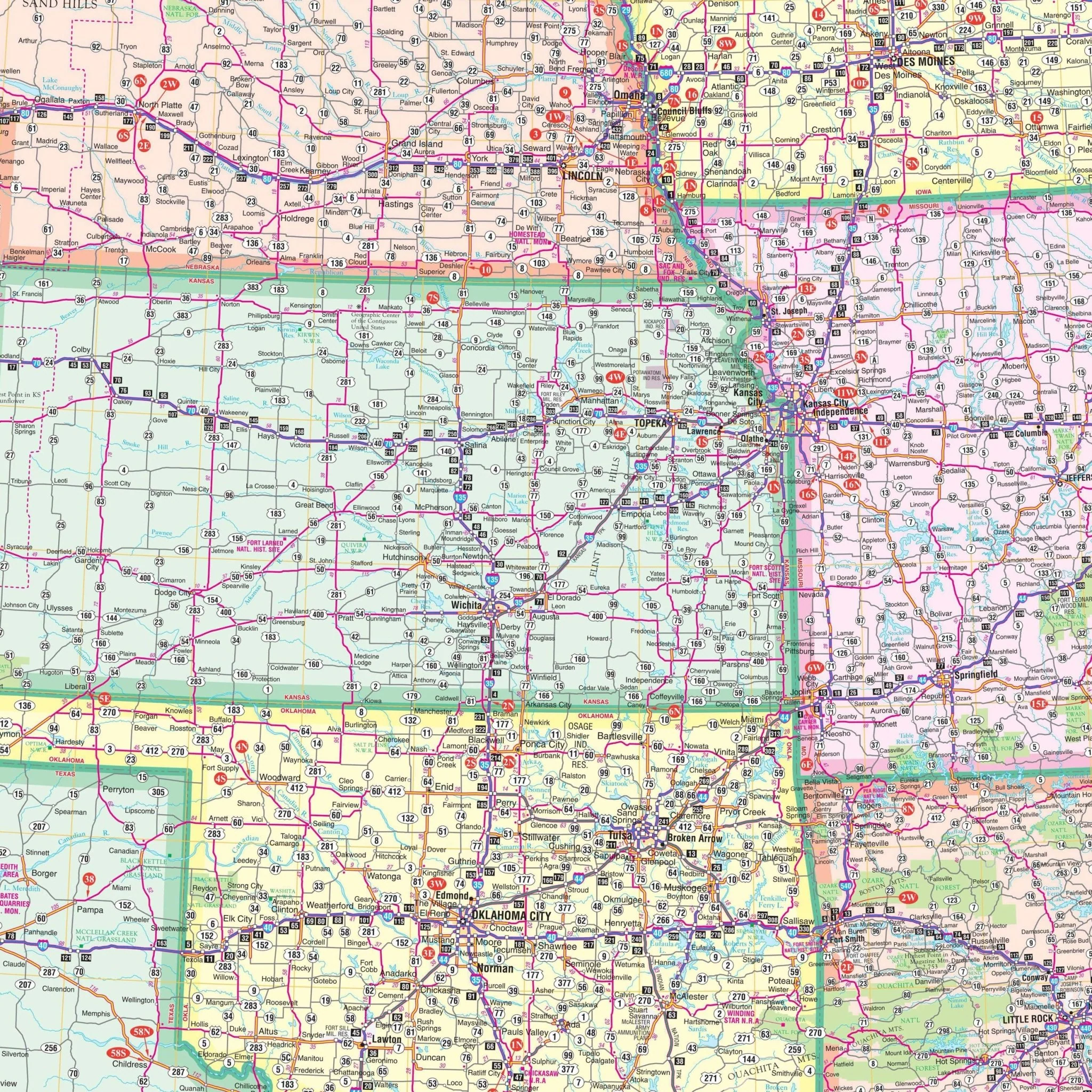
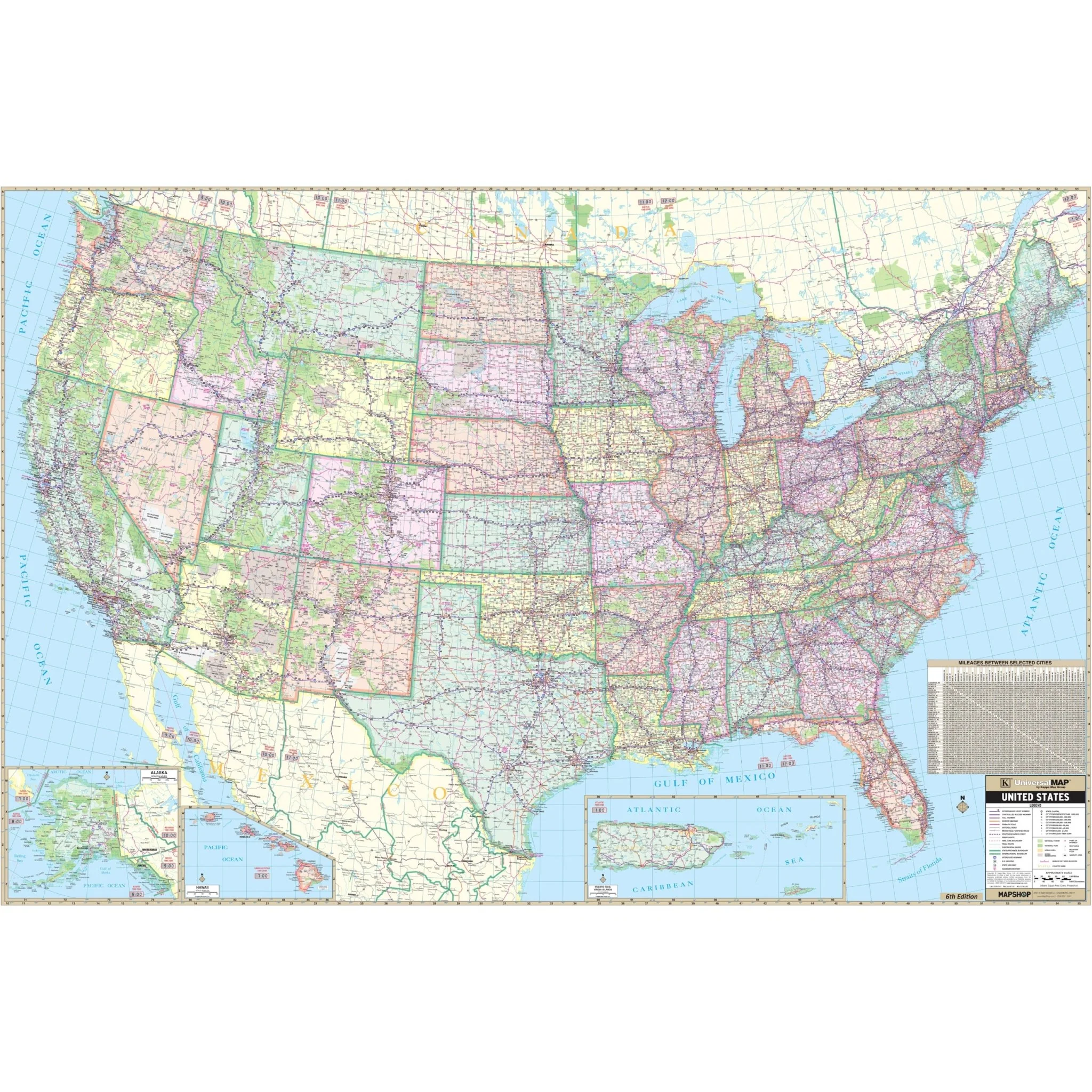
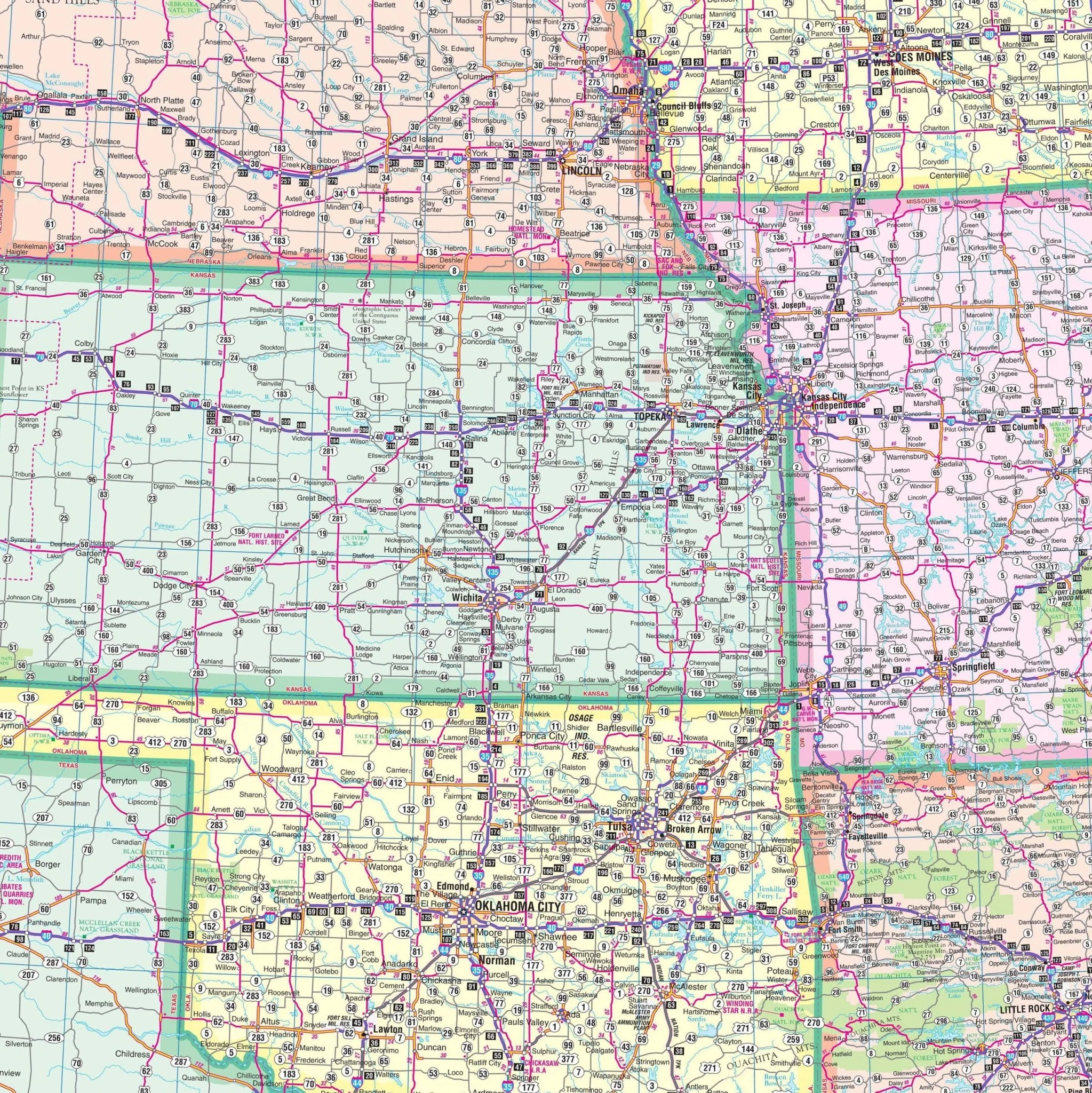
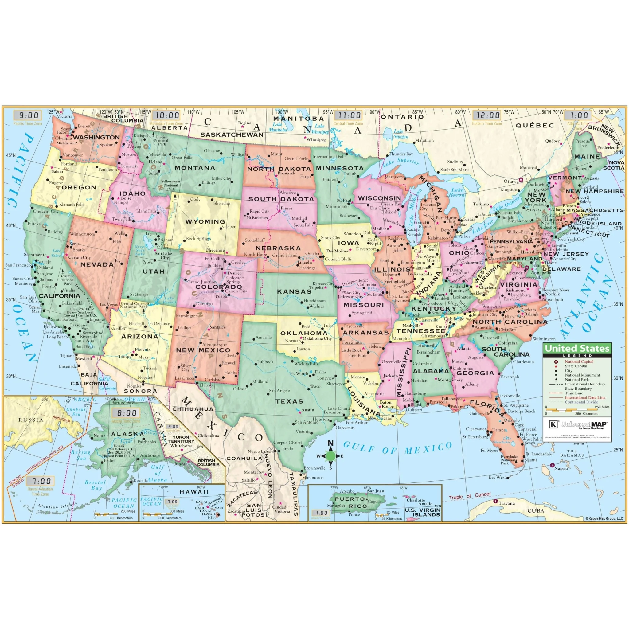
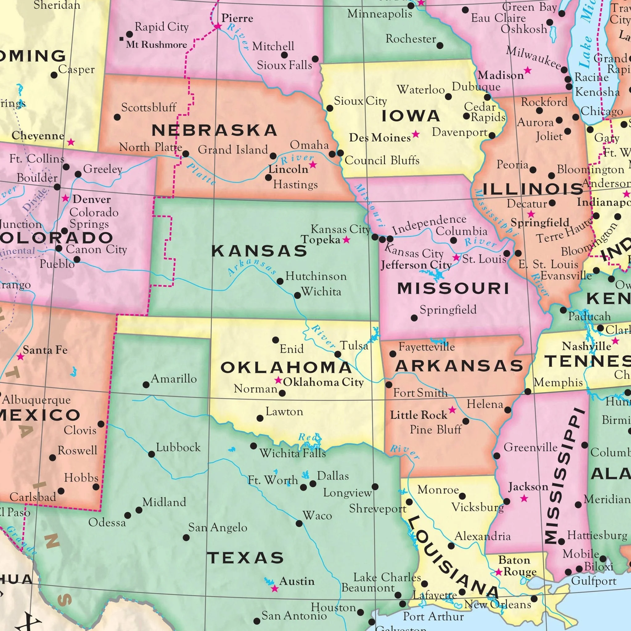
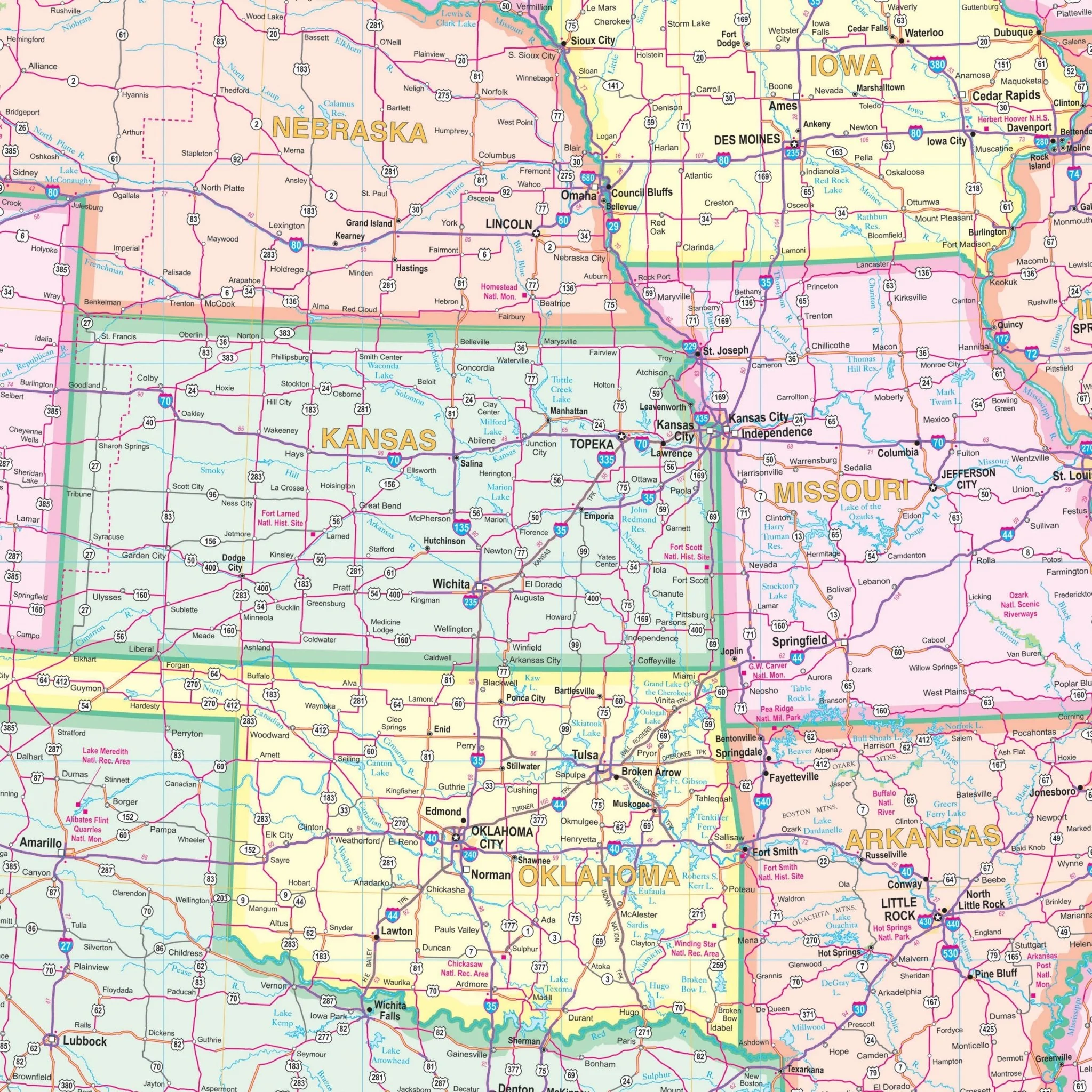
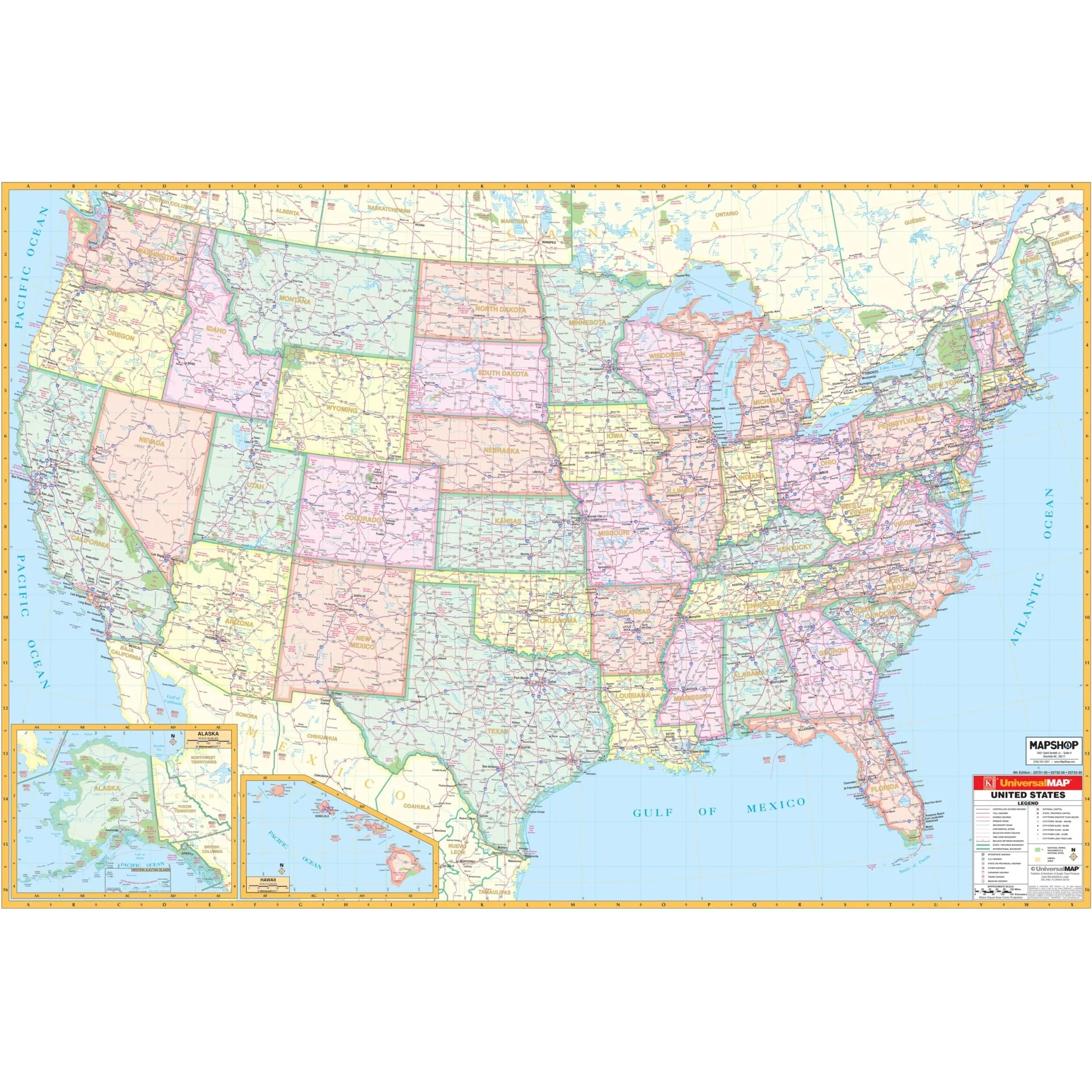
The United States Interstate Wall Map from Kappa Map Group is a comprehensive and detailed guide to the country’s expansive geography and infrastructure. With inset maps of Alaska and Hawaii, this map extends beyond the continental boundaries to provide a full picture of the U.S. territories.
Rendered at a practical scale where 1 inch equates to approximately 50 miles, the map allows for easy visual navigation across vast distances. It is an invaluable reference tool for educators, travelers, and professionals alike.
Key Features: - A clear, detailed representation of state and interstate highways, as well as freeways for travel planning. - Geographic elements such as rivers, lakes, national forests, and prominent mountain ranges are carefully plotted. - Urban and rural areas are indicated, with a range of cities and towns marked for easy identification. - Important national monuments and historical sites are highlighted, offering cultural context and reference points. - Precise demarcations of state lines, time zones, as well as longitude and latitude lines provide a frame for understanding the geography. - A color-coding system differentiates each state for quick visual location.
Whether for educational purposes, route planning, or as a decorative and informative piece for office or home, the United States Wall Map is designed to meet a variety of needs with its attention to detail and clarity.
Size: 62" x 42"
Published: 2009
Original: $109.99
-70%$109.99
$33.00Product Information
Product Information
Shipping & Returns
Shipping & Returns
Description
The United States Interstate Wall Map from Kappa Map Group is a comprehensive and detailed guide to the country’s expansive geography and infrastructure. With inset maps of Alaska and Hawaii, this map extends beyond the continental boundaries to provide a full picture of the U.S. territories.
Rendered at a practical scale where 1 inch equates to approximately 50 miles, the map allows for easy visual navigation across vast distances. It is an invaluable reference tool for educators, travelers, and professionals alike.
Key Features: - A clear, detailed representation of state and interstate highways, as well as freeways for travel planning. - Geographic elements such as rivers, lakes, national forests, and prominent mountain ranges are carefully plotted. - Urban and rural areas are indicated, with a range of cities and towns marked for easy identification. - Important national monuments and historical sites are highlighted, offering cultural context and reference points. - Precise demarcations of state lines, time zones, as well as longitude and latitude lines provide a frame for understanding the geography. - A color-coding system differentiates each state for quick visual location.
Whether for educational purposes, route planning, or as a decorative and informative piece for office or home, the United States Wall Map is designed to meet a variety of needs with its attention to detail and clarity.
Size: 62" x 42"
Published: 2009