


United States Wall Map
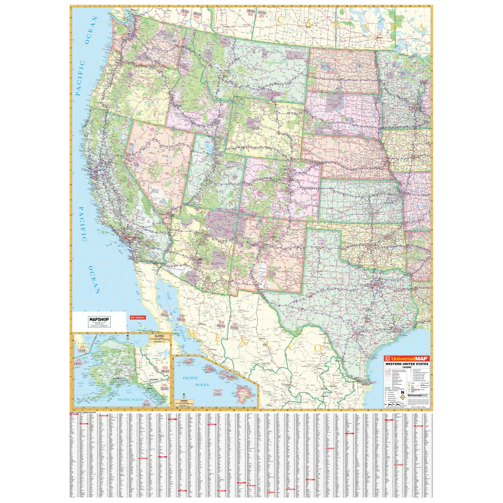
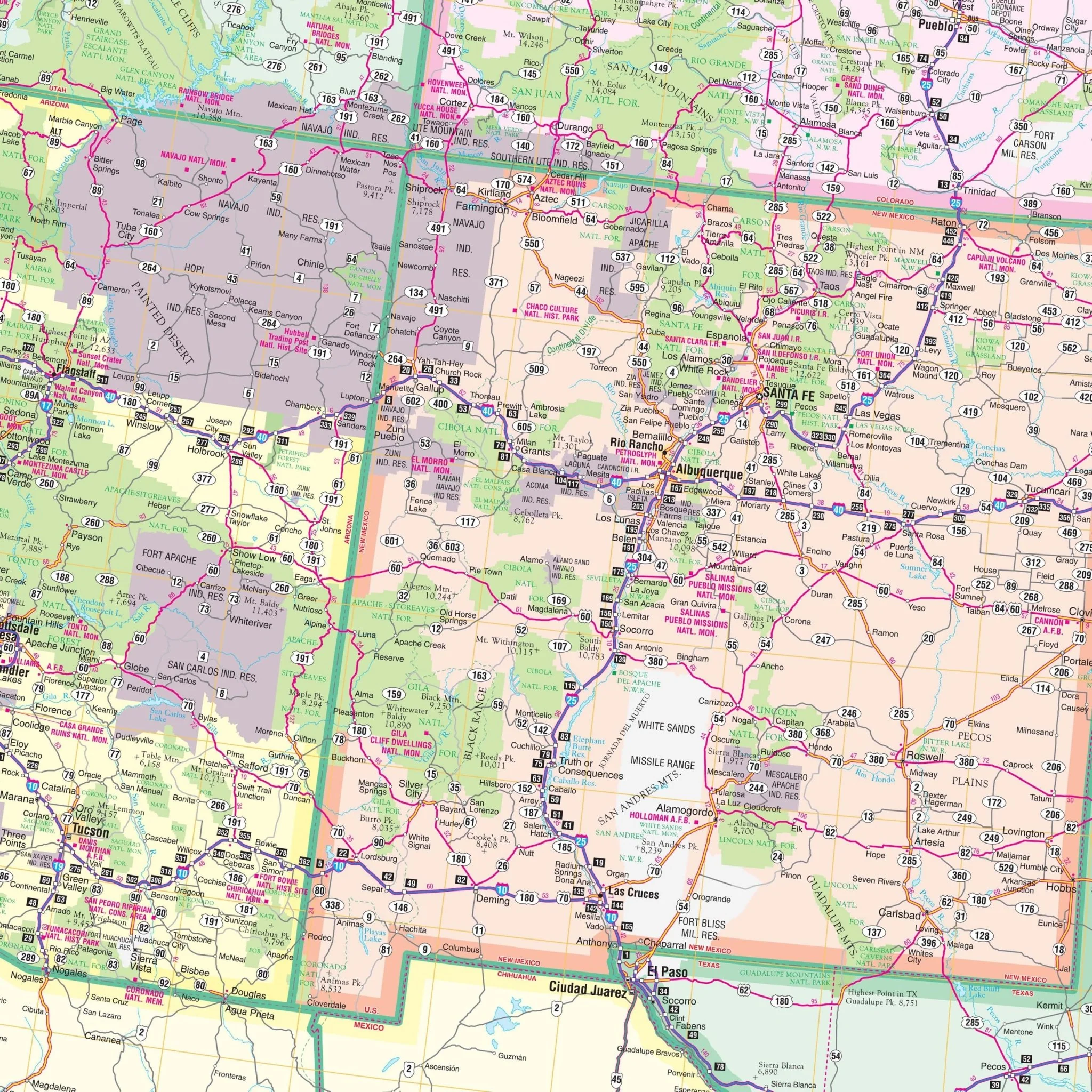
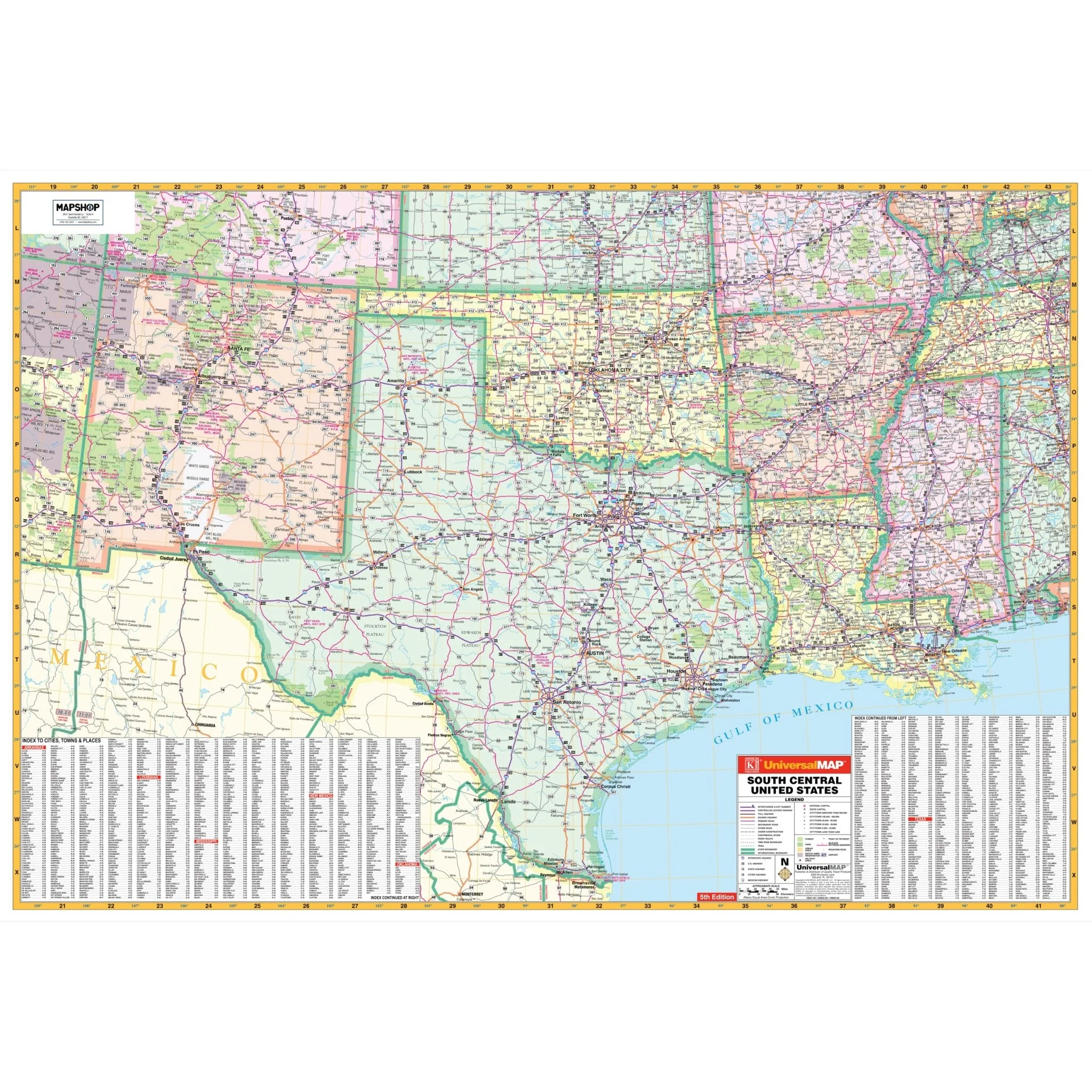
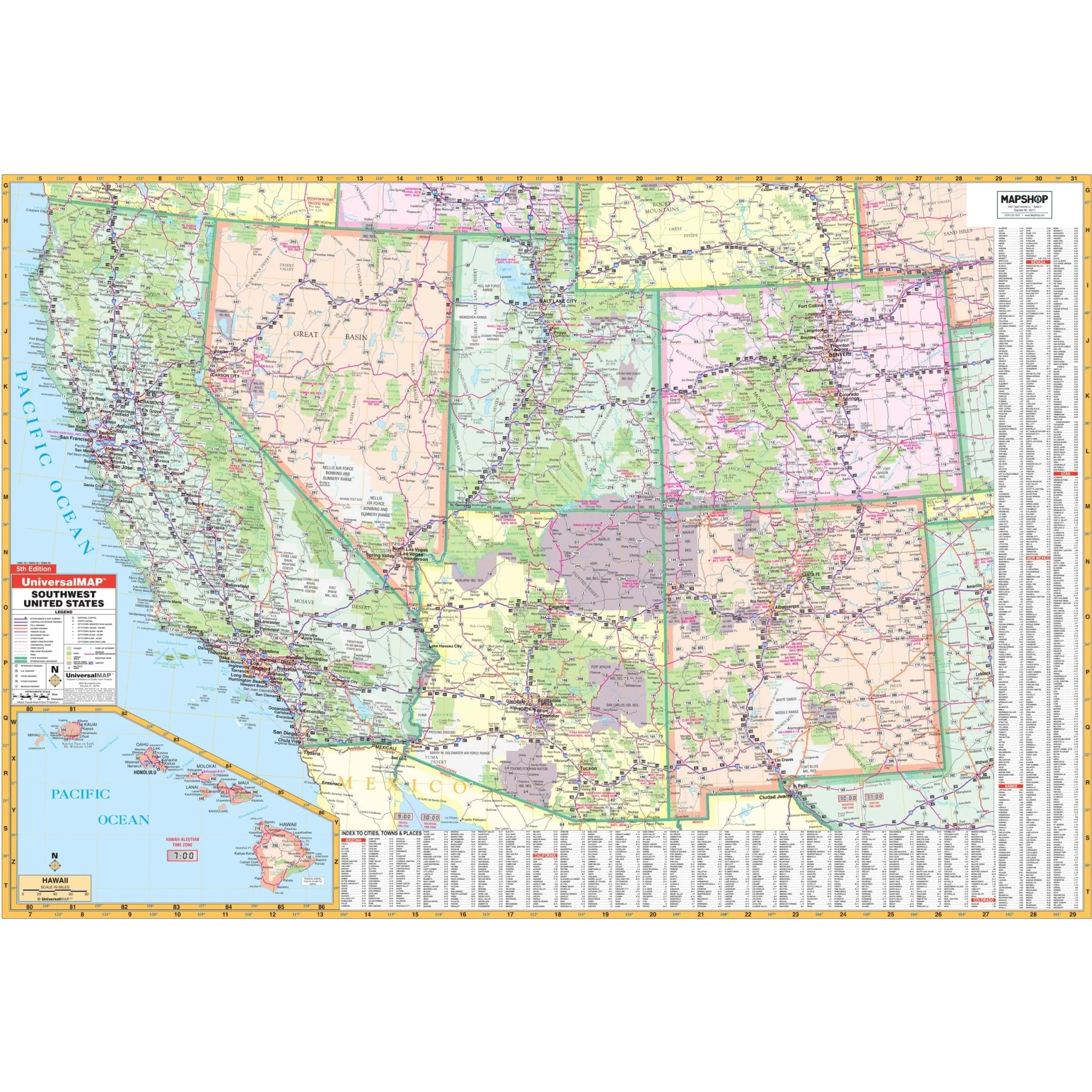
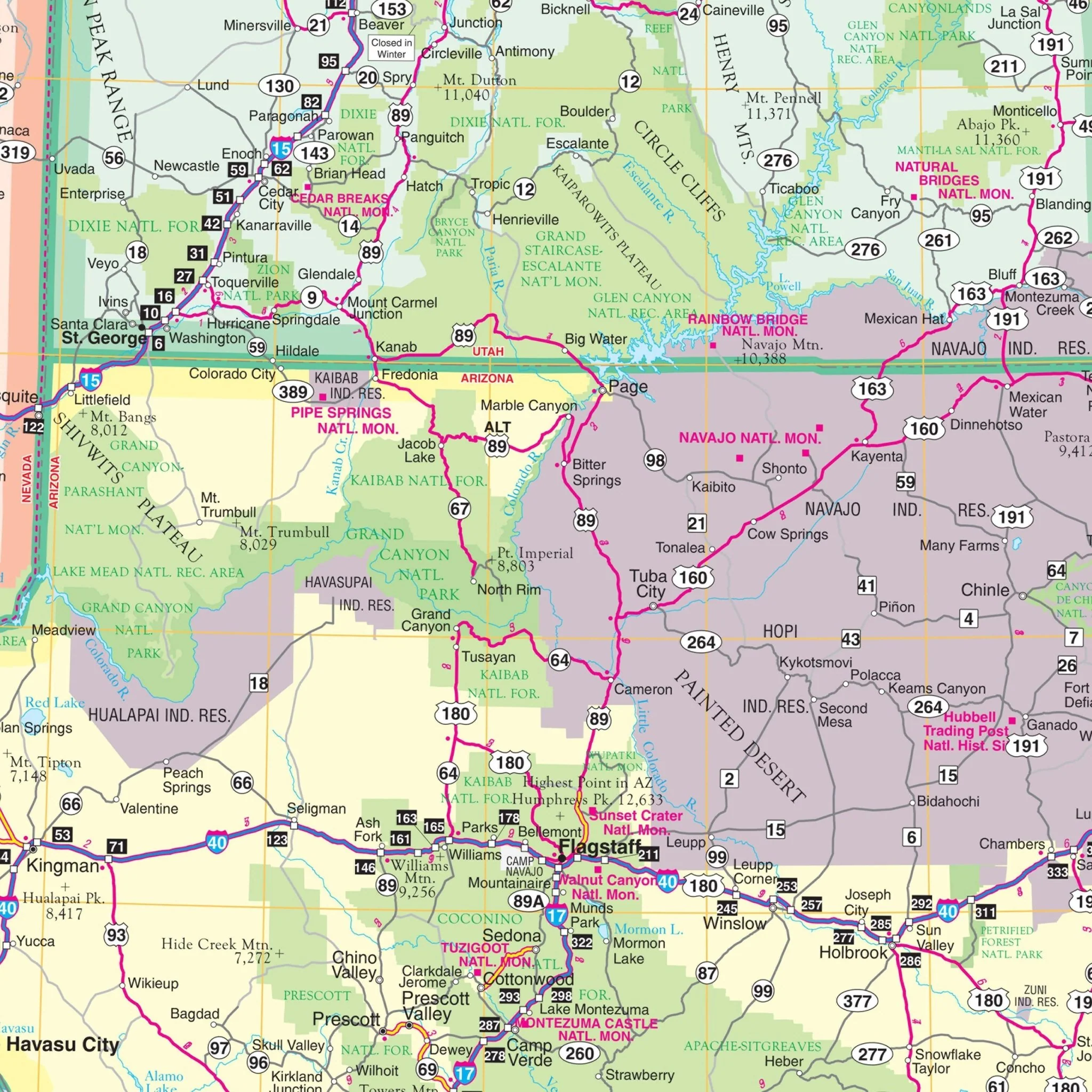
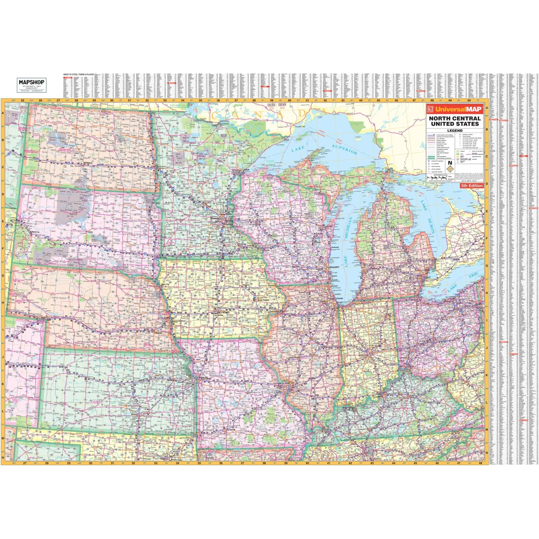
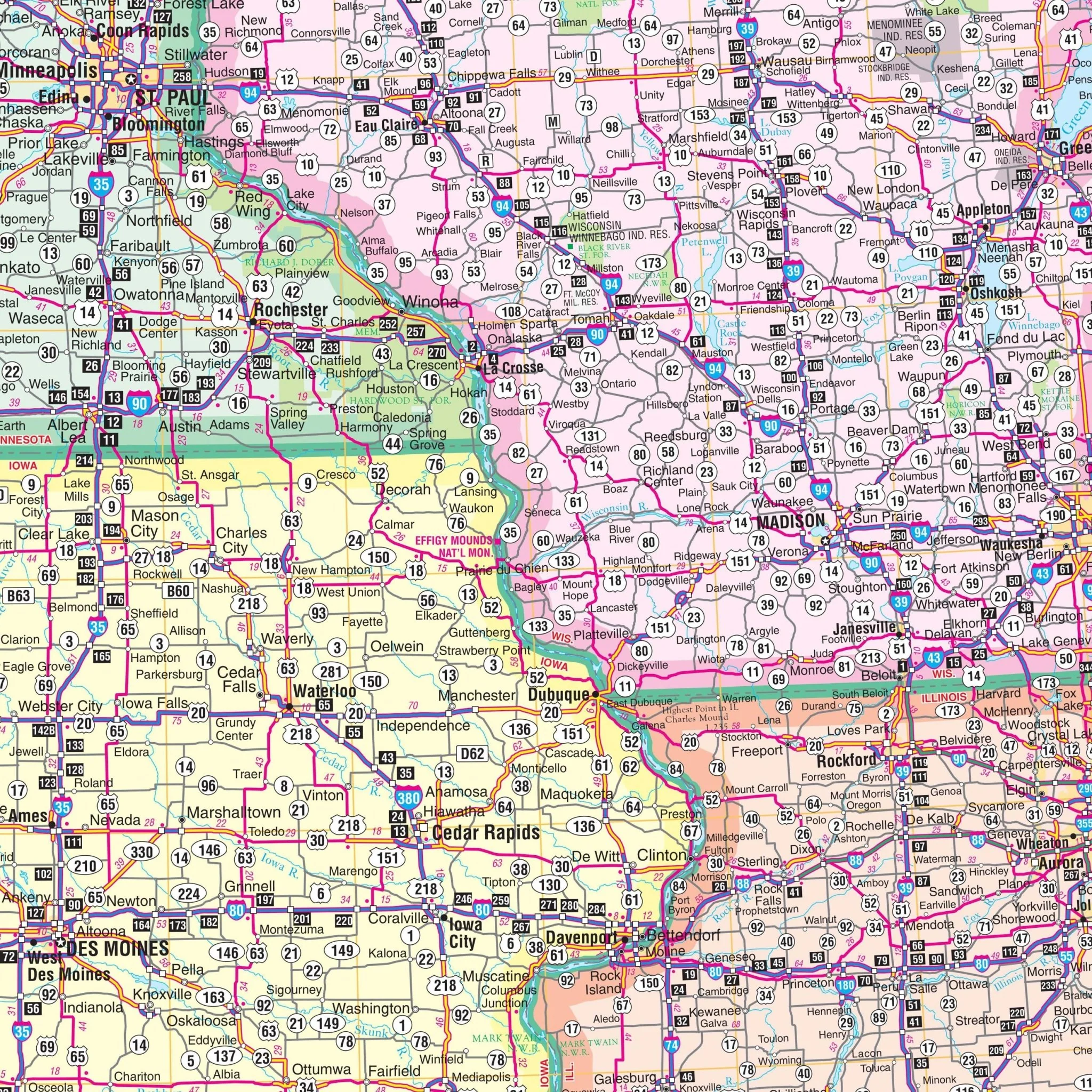
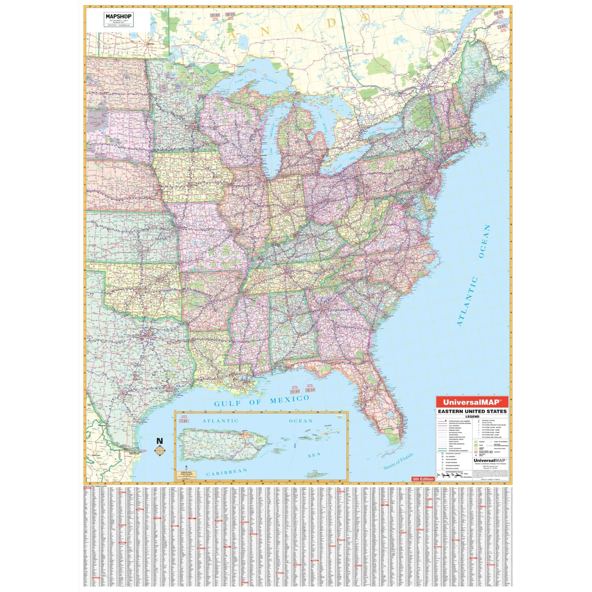
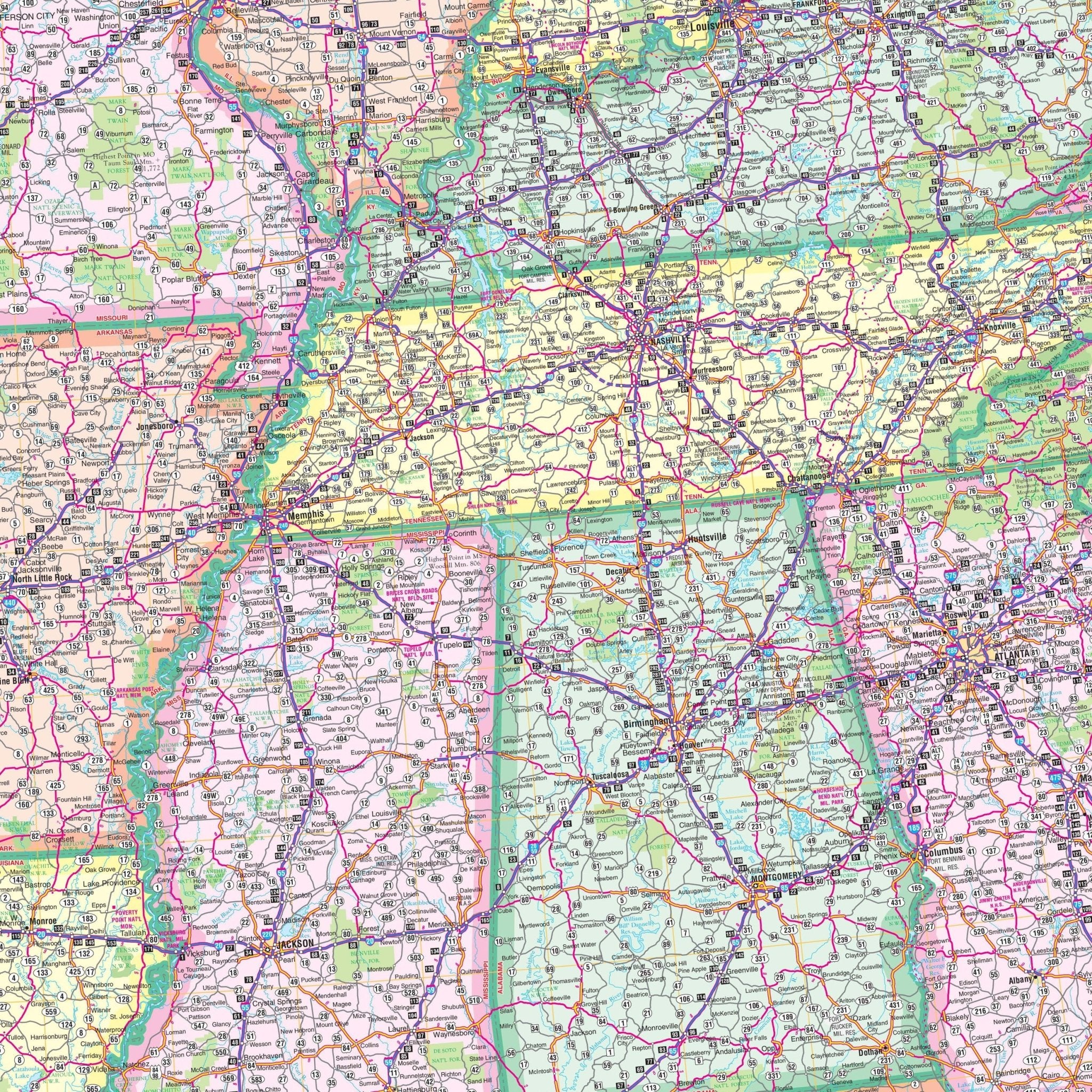
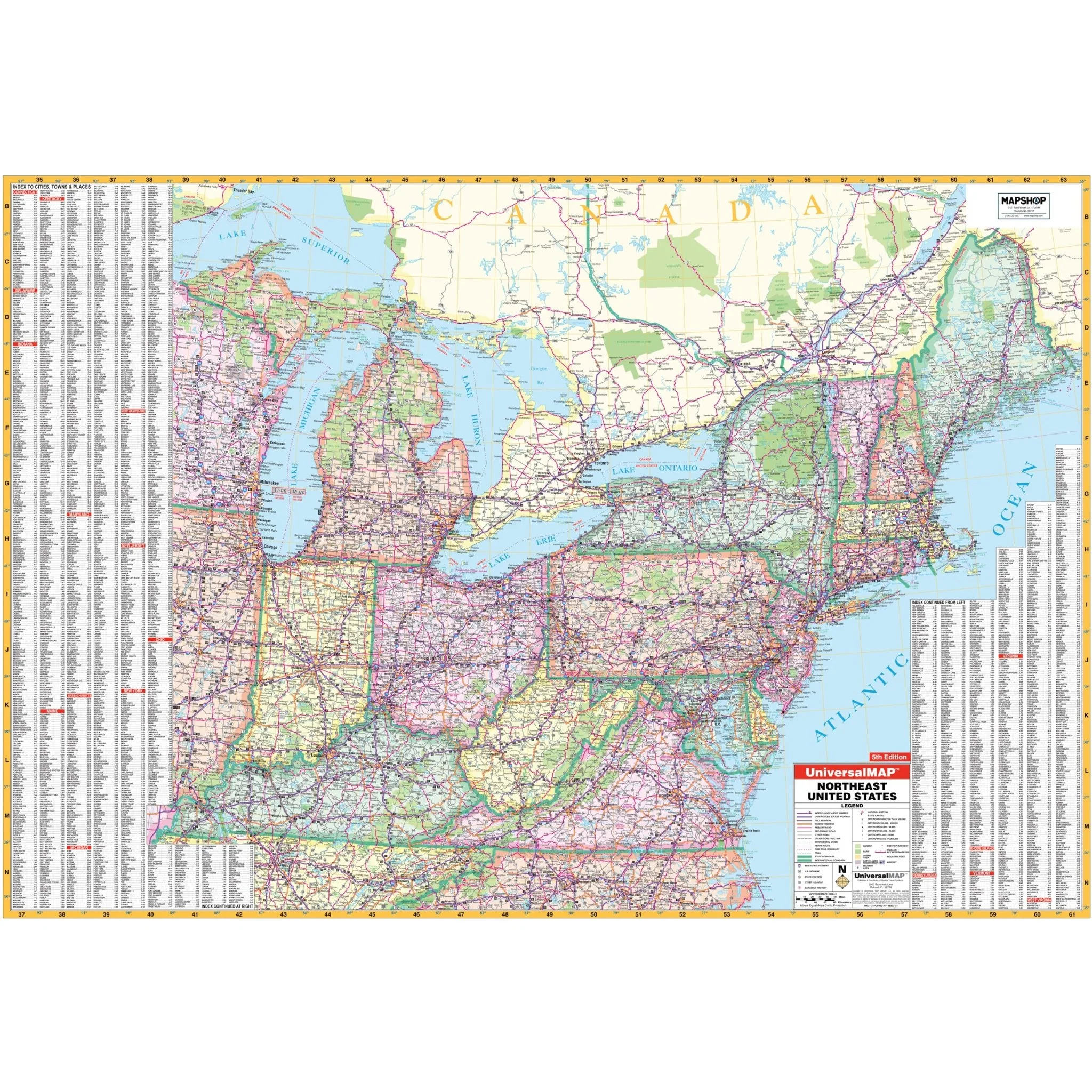
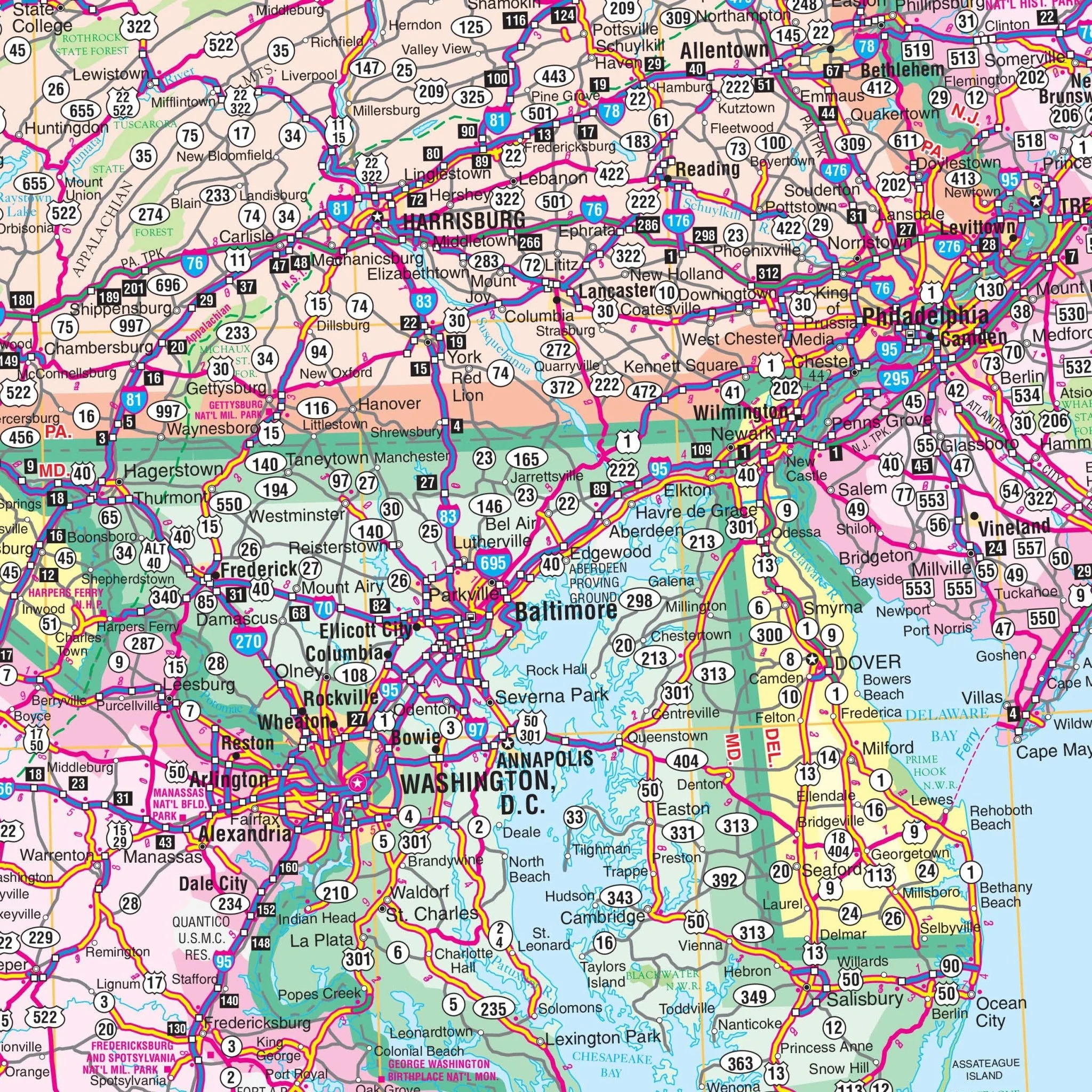
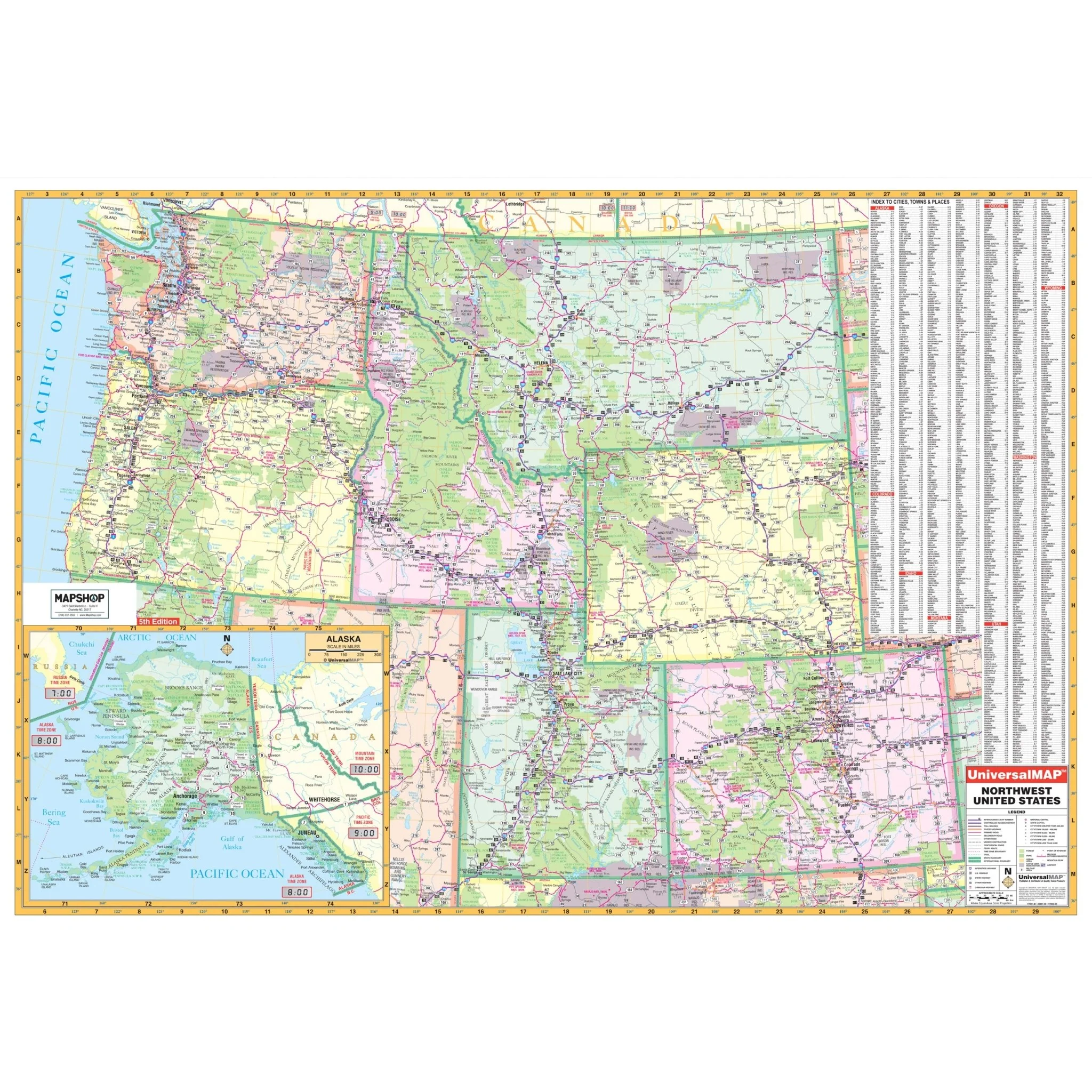
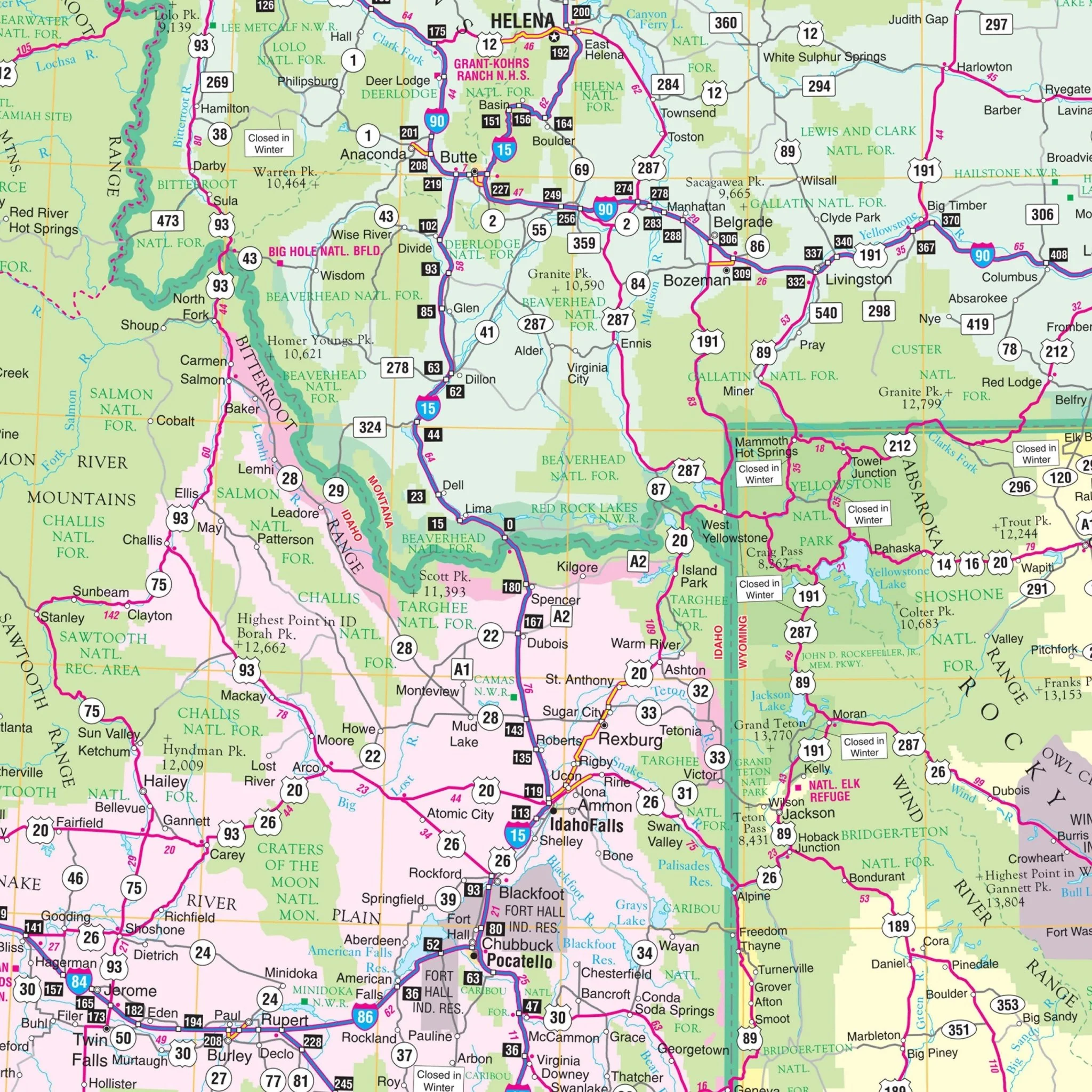
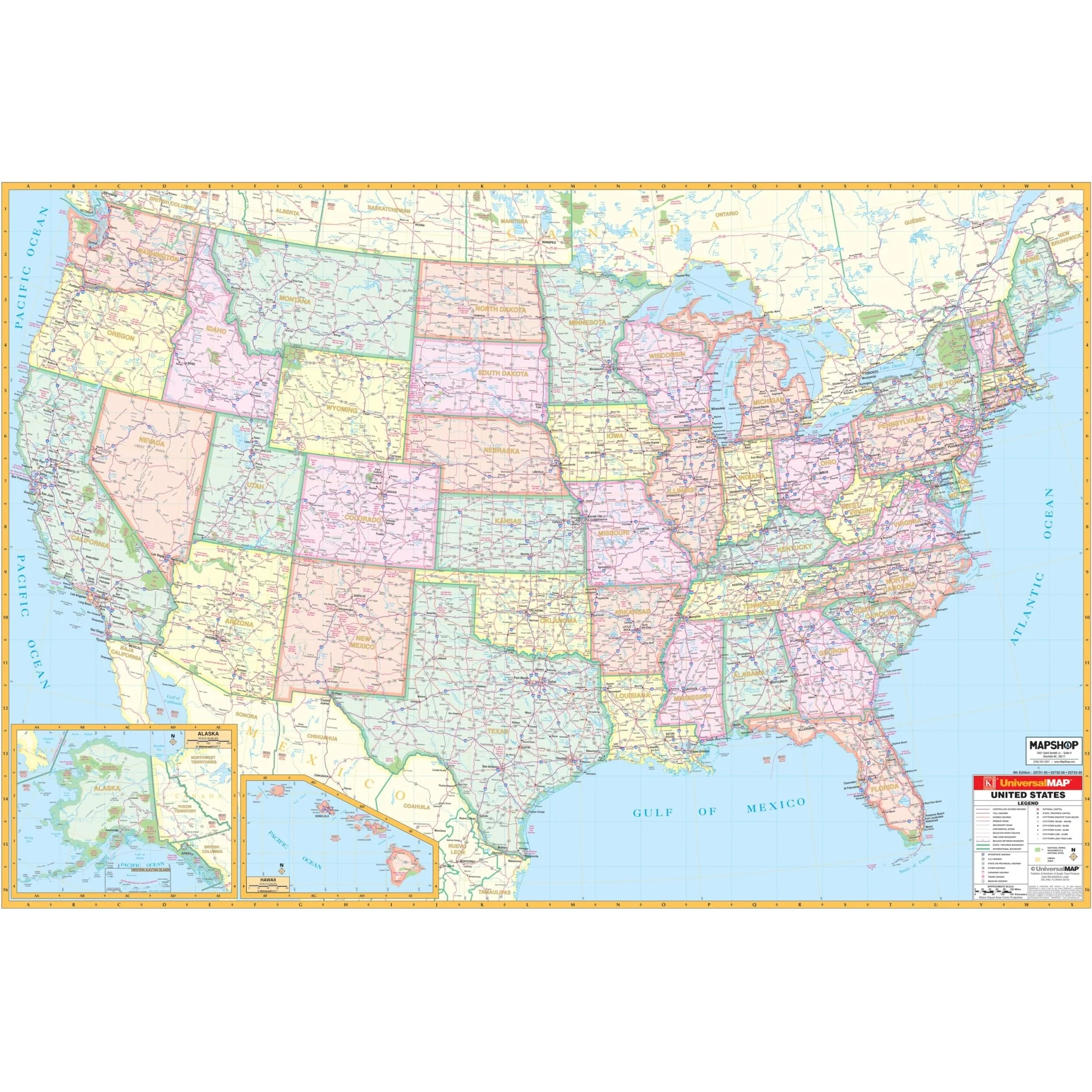
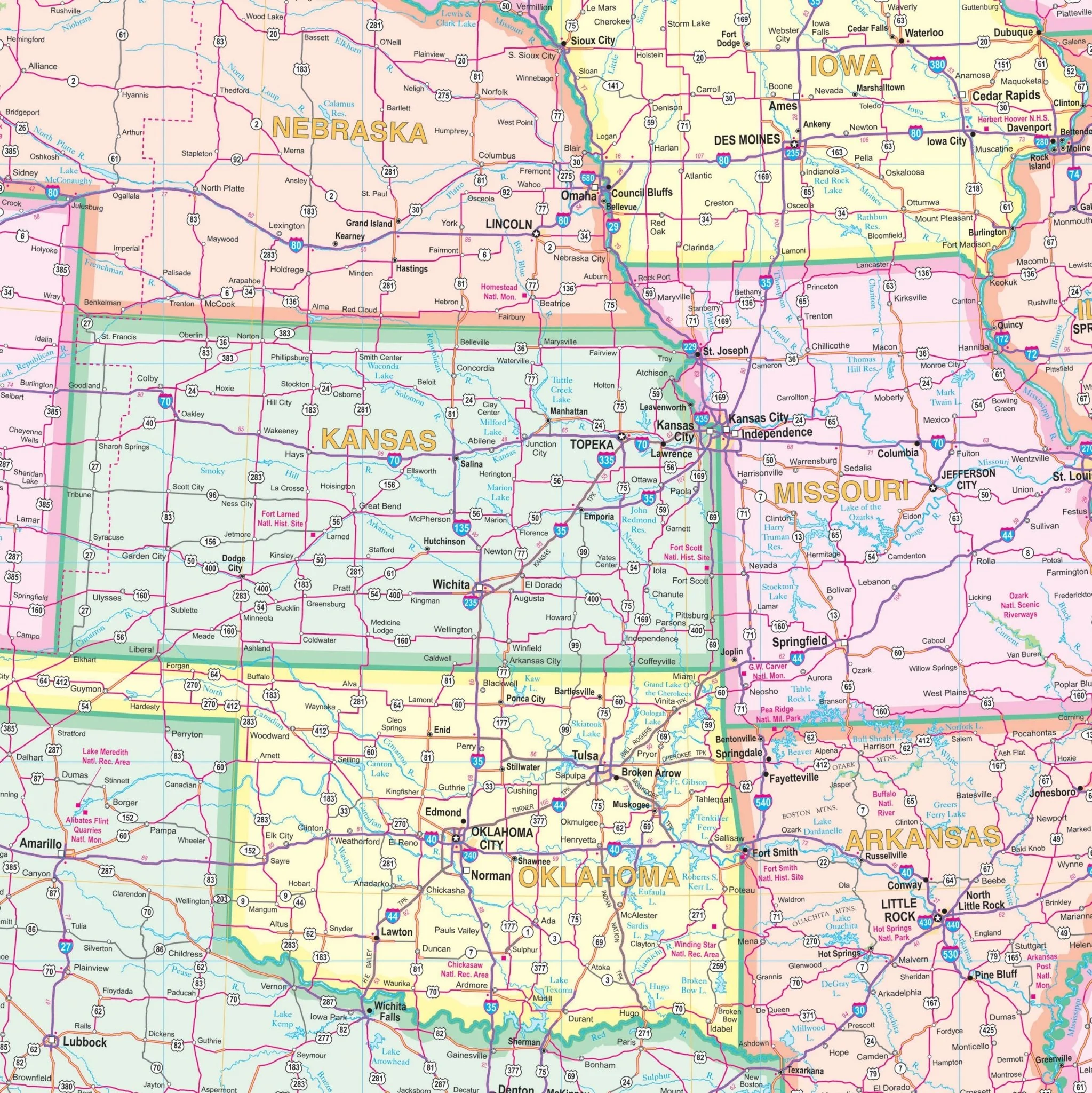
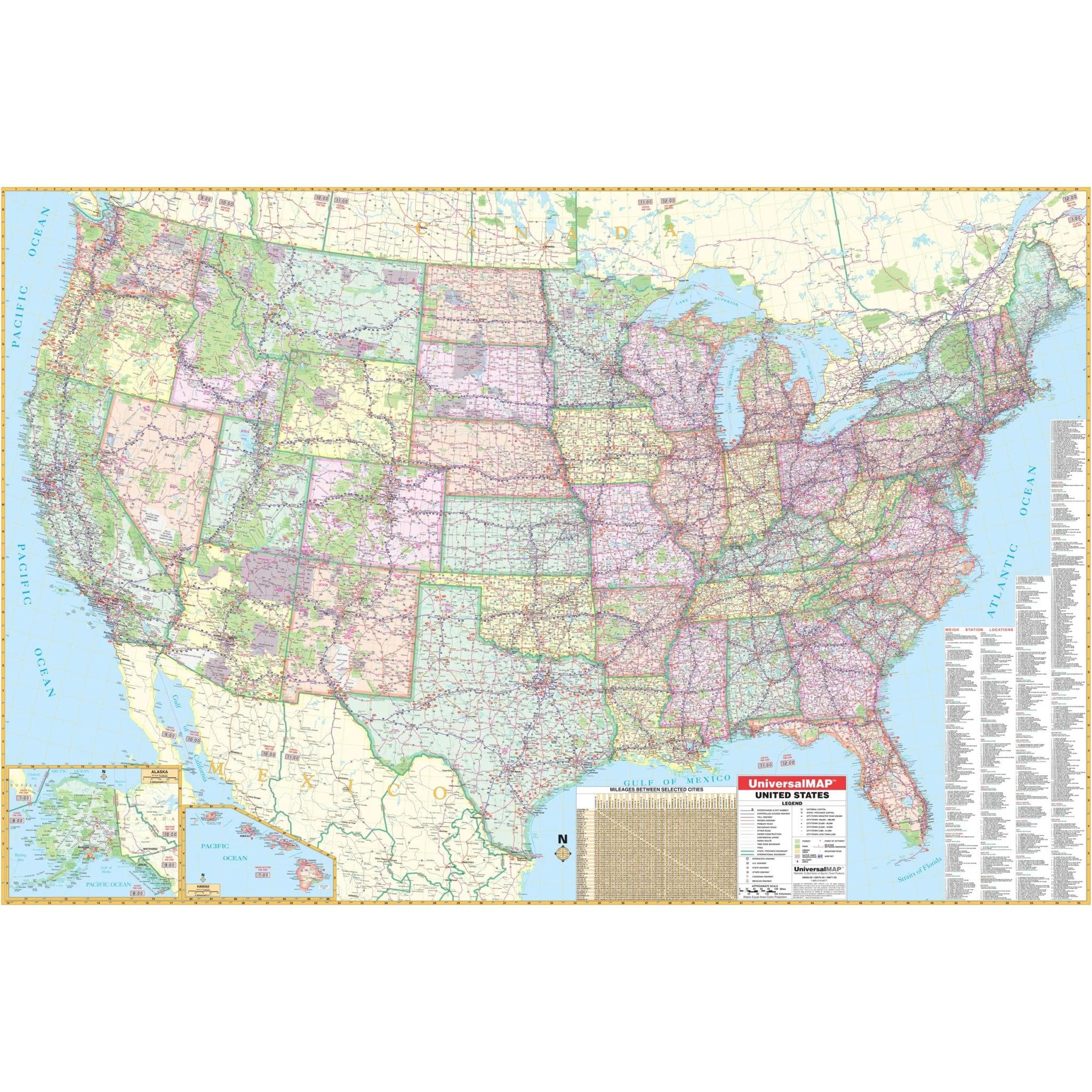
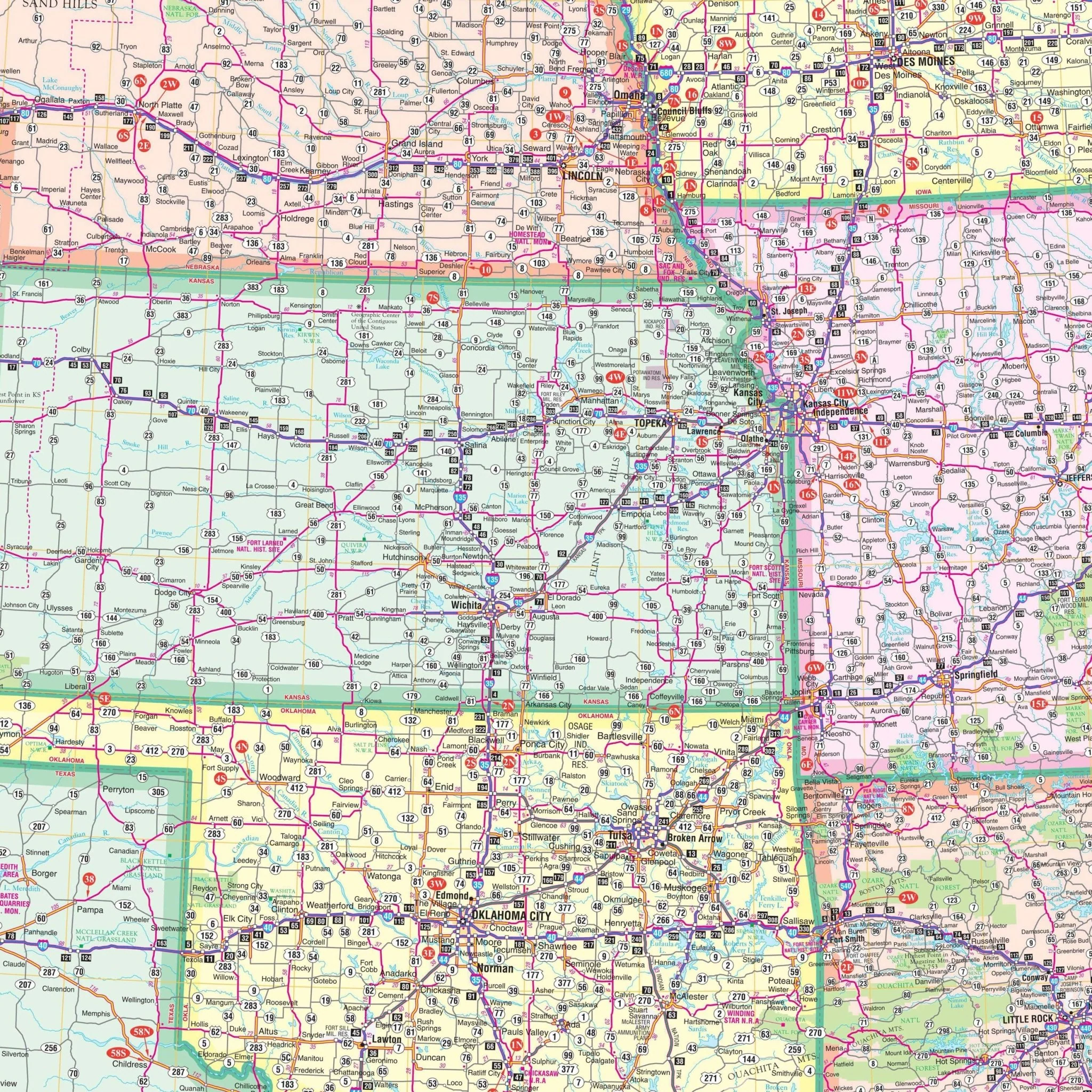
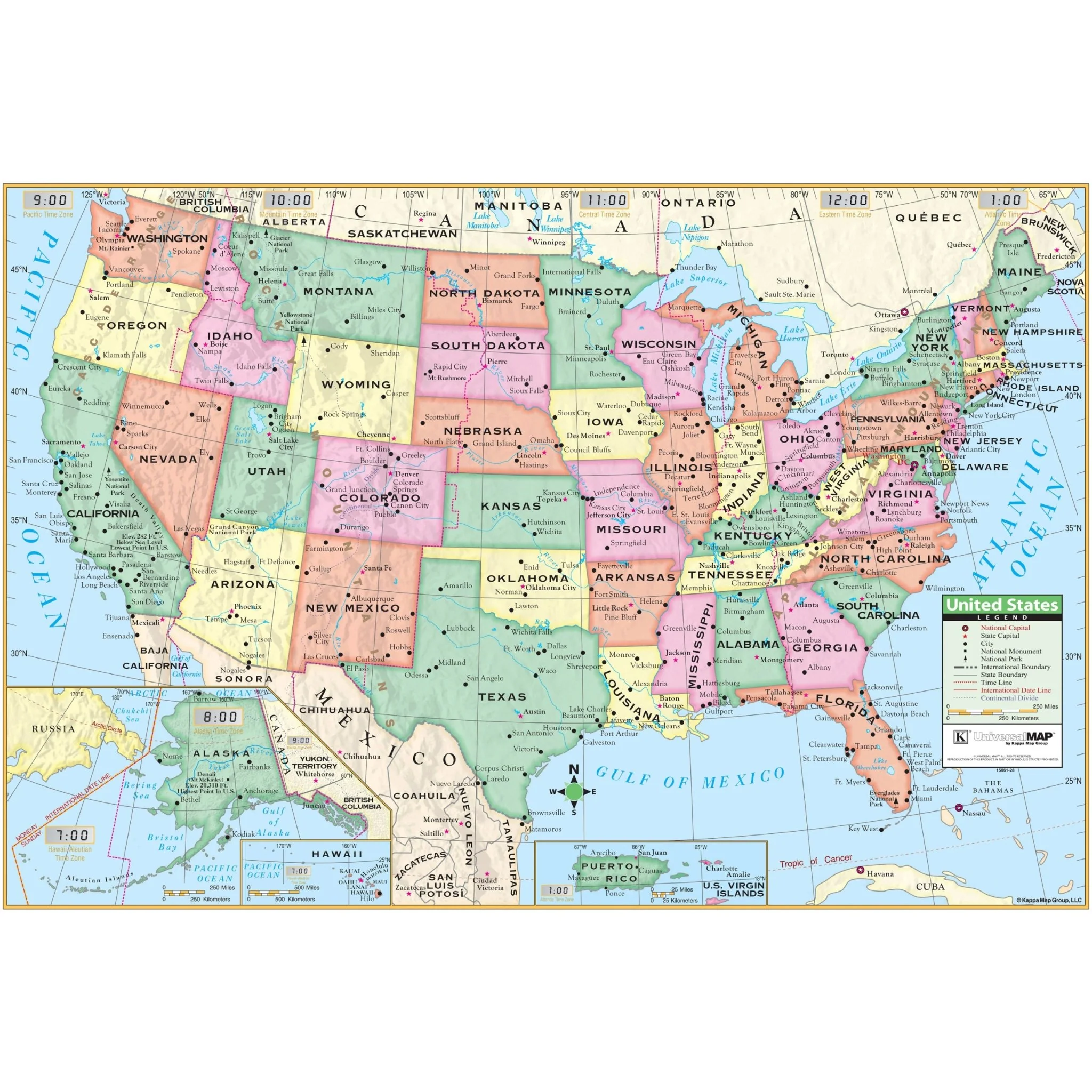
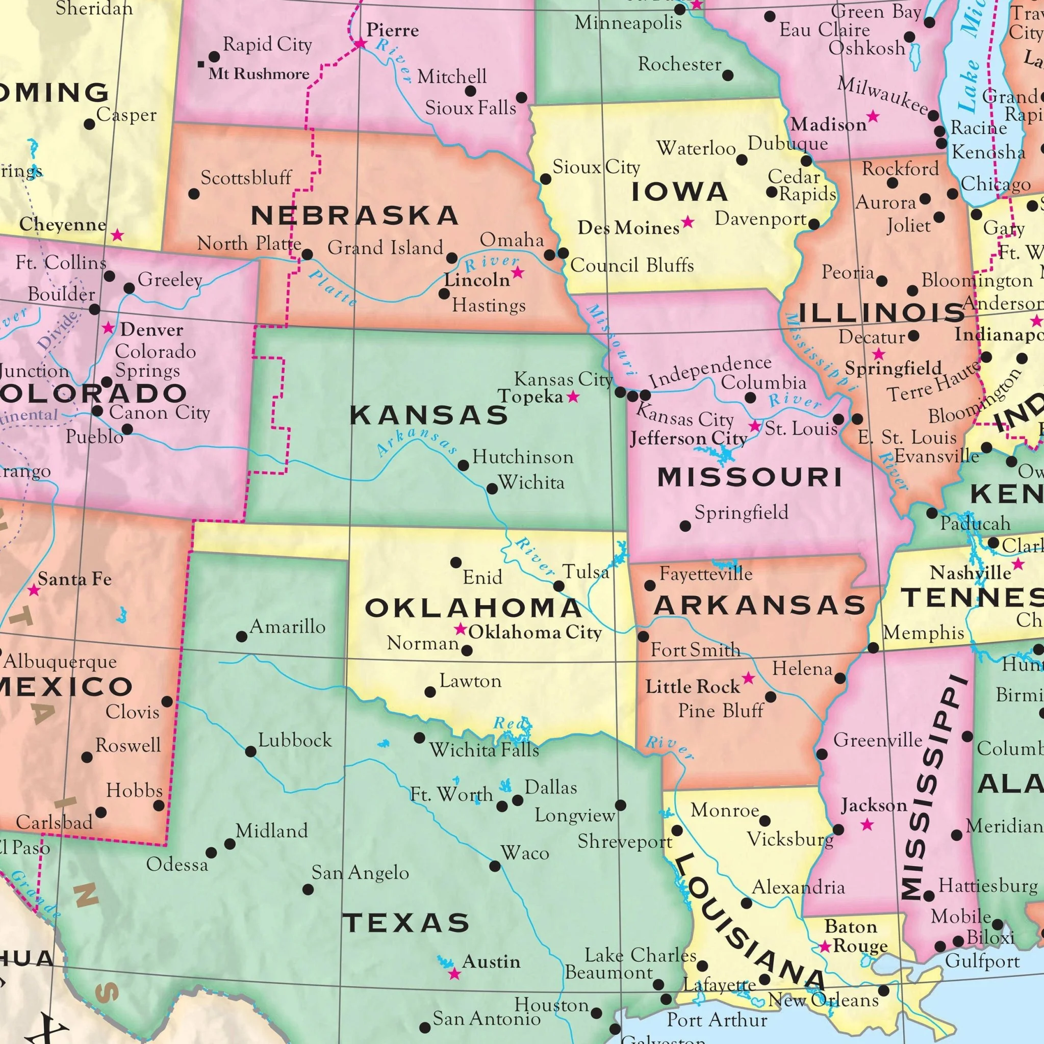
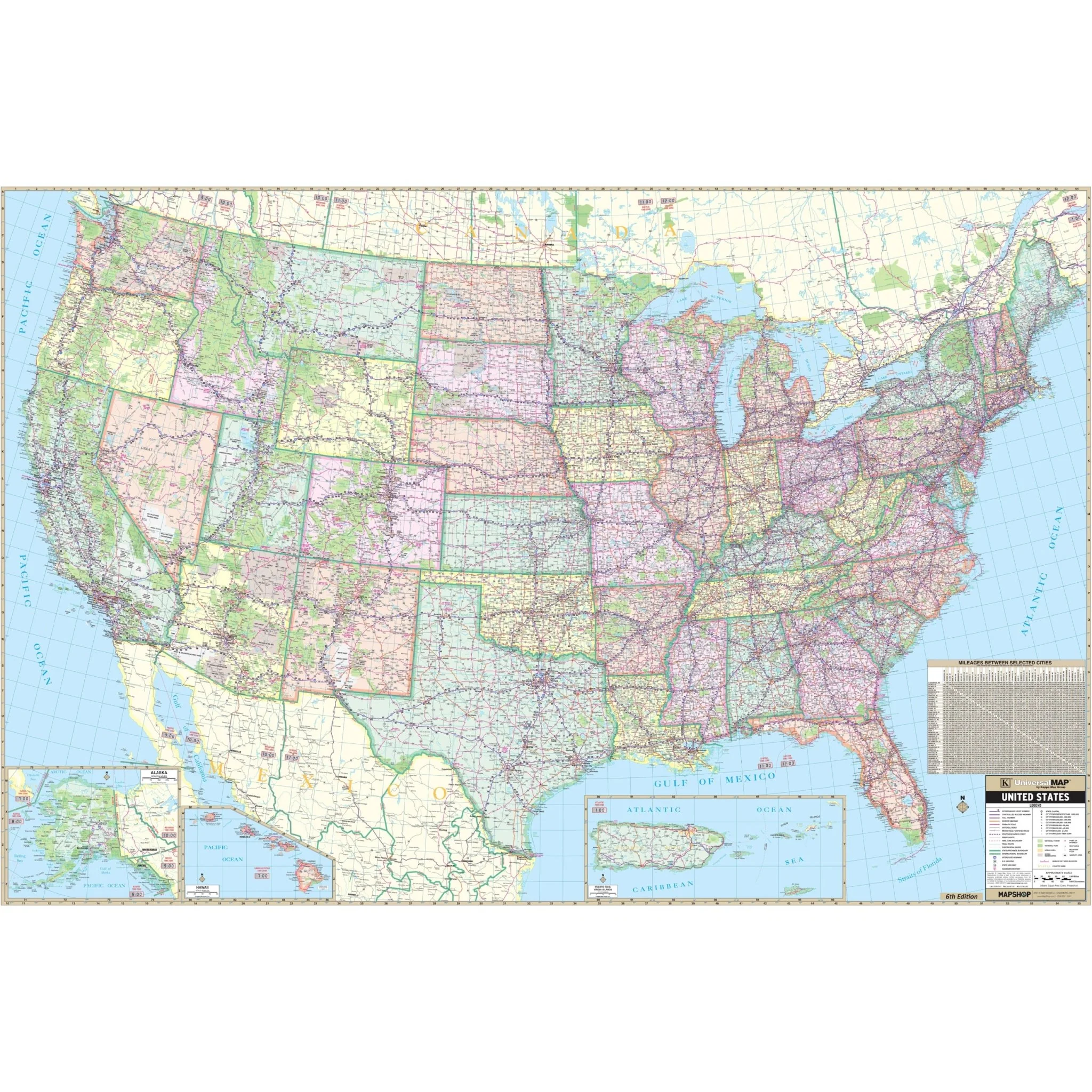
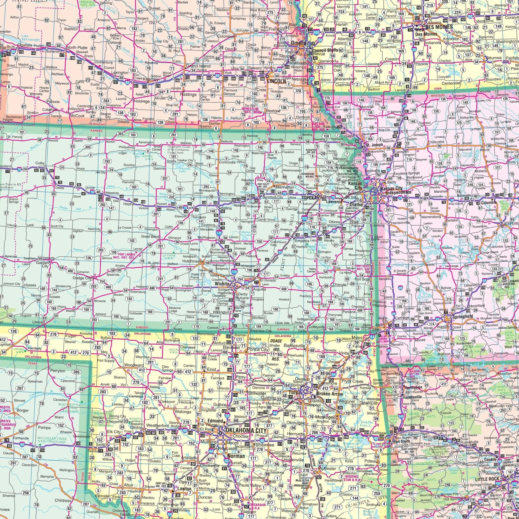
The United States Wall Map, brought to you by Kappa Map Group, stands out with its vivid, contrasting hues that crisply demarcate state and regional boundaries. With a generous scale of 1 inch to approximately 40 miles, this large-scale map offers a clear visualization of the nation’s layout.
This map's extensive detailing includes: - A broad spectrum of cities and towns for comprehensive urban understanding. - A network of freeways with interchange and exit numbers for precise travel planning. - Interstate highways clearly marked for efficient cross-country navigation. - Accurate longitude and latitude markers for geographical orientation. - The geography of mountain ranges, rivers, and lakes illustrated for natural exploration. - Coverage of national forests for environmental insights. - State highways and state lines integrated for local travel routes. - Time zone demarcations for scheduling and coordination across regions. - Insets that provide detailed views of Alaska, Hawaii, and Puerto Rico. - A color-coded representation of each state for immediate recognition. - A mileage chart to calculate distances between major urban centers.
Ideal for educational, professional, or personal use.
Size: 77" x 51"
Published: 2013
Original: $149.99
-70%$149.99
$45.00Product Information
Product Information
Shipping & Returns
Shipping & Returns
Description
The United States Wall Map, brought to you by Kappa Map Group, stands out with its vivid, contrasting hues that crisply demarcate state and regional boundaries. With a generous scale of 1 inch to approximately 40 miles, this large-scale map offers a clear visualization of the nation’s layout.
This map's extensive detailing includes: - A broad spectrum of cities and towns for comprehensive urban understanding. - A network of freeways with interchange and exit numbers for precise travel planning. - Interstate highways clearly marked for efficient cross-country navigation. - Accurate longitude and latitude markers for geographical orientation. - The geography of mountain ranges, rivers, and lakes illustrated for natural exploration. - Coverage of national forests for environmental insights. - State highways and state lines integrated for local travel routes. - Time zone demarcations for scheduling and coordination across regions. - Insets that provide detailed views of Alaska, Hawaii, and Puerto Rico. - A color-coded representation of each state for immediate recognition. - A mileage chart to calculate distances between major urban centers.
Ideal for educational, professional, or personal use.
Size: 77" x 51"
Published: 2013